Key:light_source
Jump to navigation
Jump to search
 |
| Description |
|---|
| A light emitting object. |
| Group: man made |
| Used on these elements |
| Useful combination |
|
| Status: de facto |
| Tools for this tag |
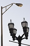
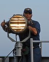
The key light_source=* is used to map a light emitting object. It is more generic than highway=street_lamp.
Values
Typical values could be:
Additional tags
support=*– Type of support/mount or positioning for the light source.light:method=*– Which light generation method/technology is used (values as forlamp_type=*, e.gelectric,led,fluorescent).light:colour=*– Colour of the emitted light, e.g.5000 K,white,orange,560 nm.light:lit=*– Time of day the light is turned on or method by which it is turned on (values as forlit=*, e.g.24/7,dusk-dawn,20:00-08:00,automatic).light:tilt=*– Angle of inclination of a directed light source. The range of this value is from-90(pointing downwards), through0(pointing horizontally), to90(pointing upwards).light:direction=*– In which (map) direction does a directed light source emit most of its light? Use an angle or a cardinal direction as a value (e.g.45,270,NE,W).light:shape=*– What kind of shape does the light source have? This determines the way the light is distributed. Typical values are:light:count=*– How many light sources are there (on a lamp pole, for example)? The default value is 1. With LED lamps: do not count the individual diodes!operator=*– The operator of a light source.manufacturer=*– The manufacturer of a light source.model=*– The model name / model number of a light source.ref=*– If the light source has a reference number.
See also
- Proposed_features/Key:light_source
highway=street_lamp– A lamp for lighting a street.


