OpenHistoricalMap/Projects/United States/Time zone boundaries
This project has added complete coverage of time zone boundaries to OpenHistoricalMap, with coverage of every official time zone boundary change since the United States adopted a nationwide system of definite time zone boundaries on January 1, 1919. These boundaries are not to be confused with data on the standard time observed by each region, which is much more complex and not as well suited to OpenHistoricalMap's data model.
Chronologies
- Atlantic Time Zone
- Eastern Time Zone
- Central Time Zone
- Mountain Time Zone
- Pacific Time Zone
- Alaska Time Zone
- Hawaii–Aleutian Time Zone
- Samoa Time Zone
- Chamorro Time Zone
Visualizations
- Interactive query in Overpass turbo
- Interactive query color-coding boundaries by age in Overpass Ultra
- Animation in five-year increments
Background
Unlike many countries, the United States observes standard time according to a system of time zone limits that are defined in a similar manner as administrative boundaries. These boundaries usually align with state and county lines but occasionally depart from them, so that a time zone is a geographic construct requiring the use of a map. The boundaries have changed numerous times since 1919 and presently are based in part on historical features such as survey lines and abandoned railways,[1] making them an ideal subject for OpenHistoricalMap.
As a side benefit, the boundaries extend into the waters surrounding each state, up to the legal limit of each state. This will help us patch up the state boundaries imported from the Newberry Library dataset, which incorrectly hug the coastline and omit entire states and territories.
Sources
This project will mostly rely on works by the United States Department of Transportation, which are in the public domain under federal law:
- Time Zones (Map). Washington, D.C.: Bureau of Transportation Statistics. November 16, 2023 [October 4, 2019]. Present-day time zone boundary geometries apparently largely based on TIGER county boundaries. Due to this apparent origin, the dataset contains some errors when compared to a closer reading of relevant regulations:
In Franklin County, Florida, Forbes Island is shown within Central Time Zone, but it was moved to the Eastern Time Zone in 1972 shortly after it was transferred from Gulf County to Franklin County. [1][2]- In Michigan within Green Bay, a portion of the Eastern–Central Time Zone boundary that follows the eastern boundary of Menominee County is shown following a line 13 1⁄3 miles (21.5 km) to the east.
- Fort Pierre, South Dakota, is bisected by the Central–Mountain Time Zone boundary, even though 49 CFR 71.7(g) places the city entirely in the Mountain Time Zone.
- Standard Time in the United States: A History of Standard and Daylight Saving Time in the United States and an Analysis of the Related Laws. Washington, D.C.: United States Department of Transportation. 1970 – via Google Books. A history of the national system of time zone boundaries from 1919 to 1970, including a table of boundary changes citing Interstate Commerce Commission reports (1919–1967) and notices issued by the Department of Transportation in the Federal Register (1967–1970). While relatively few volumes of ICC reports have been digitized in whole, individual ICC reports and orders can be found within issues of the Federal Register that have been digitized.
- Time Zone Proceedings. Washington, D.C.: United States Department of Transportation. January 24, 2024. Retrieved March 7, 2024. A summary of time zone boundary changes from 1999 to present.
- "Standard time zone boundaries". Code of Federal Regulations. Washington, D.C.: National Archives and Records Administration and United States Government Publishing Office. March 11, 2024. 49 CFR 71. The current federal regulations pertaining to time zone boundaries, annotated with changes since 1970 citing the Federal Register.
- "Interstate Commerce Commission Reports". HathiTrust. Full text of reports through 1937.
- tz-segments.gpkg, courtesy of the Bureau of Transportation Statistics. Annotates each segment of each time zone boundary with a citation to a particular clause in 49 CFR 71.
For the period between March 30, 1924, and April 3, 1927, when the boundary between the Eastern and Central Time Zones incorporated the Columbus, Ohio, city limits by reference, we can use the following work as a reference:
- "Corporate Boundary Annexations" (Map). GIS Open Data Columbus. Columbus, Ohio: City of Columbus. September 1, 2020. Retrieved March 23, 2024.
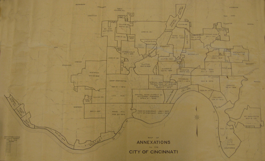
For the period between April 3, 1927, and September 27, 1936, when the boundary between the Eastern and Central Time Zones incorporated the Cincinnati city limits by reference, we can use the following works as references:
- "Cincinnati (City) Annexations". Newsdex. Cincinnati: Cincinnati and Hamilton County Public Library. Retrieved March 20, 2024.
- Map of Annexations to the City of Cincinnati (Map). Cincinnati Department of Public Works, Division of Highways. 1944 [April 4, 1935]. Published without copyright notice or registration. Reproduced in "Historic Annexations". Plan Cincinnati (PDF). Cincinnati City Planning Commission. November 21, 2012. p. 20. Also reproduced in Muller, Paul (November 9, 2014). Timeline of Cincinnati’s Growth by Annexation. Retrieved March 20, 2024 – via Vimeo.
- Water Lines, Survey Easements, and Annexations (PDF). Cincinnati: Hamilton County Recorder's Office. June 29, 1988. pp. 5–13. Retrieved March 23, 2024.
Prior art
- Evan Siroky's OpenStreetMap-based Timezone Boundary Builder maps the IANA tz database time zones, which reflect historical boundaries since mid 1970 per RFC 6557 (BCP 175).
- The website "Hoosiers for Eastern Time" includes a compilation of historical regulations affecting the boundary between the Eastern and Central Time Zones, illustrated by screenshots of the boundaries mapped in Google Earth.
- EmperorTigerstar (October 18, 2022). The History of Time Zones in North America: Every Year. Retrieved April 23, 2024 – via YouTube. North American time zones animated on a yearly interval since the railroads instituted railroad time in 1883.
Editorial considerations
Most sources available on the Internet, including the tz database and OpenStreetMap, model time zones as something akin to annexation boundaries: if one time zone loses territory to another, that territory is carved out as a separate "time zone". Yet these sources generally do not account for changes in the administrative boundaries from which the time zone boundaries are derived, so an OSM-based map is insufficient to reliably determine historical standard time observance in some locations. By contrast, OpenHistoricalMap represents boundary changes as a time series of coherent boundaries overlapping each other, each representing the whole territory during a given time period. The resolved boundaries will facilitate point-in-time visualizations, while an all-time overview would require some postprocessing.
Additionally, tz and OSM conflate changes in daylight saving time (DST) observance with time zone changes. However, the area in which DST is observed does not really constitute a kind of boundary per se; it is an attribute of another administrative boundary or, in some cases, an organization such as a railroad or park operator. Therefore, this project will ignore local and state DST observance. A data consumer that wishes to determine DST observance will need to consult an external database, such as Wikidata. Conversely, the focus on observed time causes the tz database to ignore many well-documented time zone boundary changes because communities along the boundaries reportedly already observed de facto times consistent with the boundary to which they were being moved – usually the reason for moving the boundary, after all. Although OHM would strive to map a de facto boundary in addition to a de jure one in case of a dispute, these are not disputes about where a boundary runs, only at most a dispute about where it ought to run.
The tz database aims to cover changes since the Unix epoch of January 1, 1970, ignoring any earlier changes except occasionally as supplementary data. Nevertheless, there are some omissions even given this limited scope. For example, the eastern fourth of Kearny County, Kansas, corresponding to Unified School District No. 216, was moved to the Central Time Zone in March 1970; it would be another 20 years before the rest of Kearny County would follow it to the Central Time Zone. [2][3] This should in theory result in two separate "time zone" entries for "America/Lakin" and "America/Deerfield", but as of March 2024, these entries have not yet been added to the tz database. [4] OHM will include changes all the way back to 1919. To the extent that any portion of a boundary is defined vaguely in the regulations, the boundary relation will include a way tagged with indeterminate=yesindefinite=yes or a note=*.
Process
Bulk import
The first step will be to transform the USDOT time zone dataset into OSM format:
- Download the entire FeatureServer using QGIS.
- Export the layer as a GeoJSON file.
- Import the GeoJSON file into OpenJUMP.
- Convert the layer into a planar graph.
- Export the edges as a GeoJSON file.
- Import the GeoJSON file into JOSM.
- Remove all the tags from the 191 ways.
- Clean up some artifacts originating from the dataset, such as a 280-by-1 1⁄2-foot (85.34 m × 0.46 m) hole in the Central Time Zone on the Nebraska–South Dakota line.
- Manually create nine boundary relations and add the ways to them.
- Manually create nine chronology relations and add the boundaries to them.
- Split ways at state and county boundaries according to the TIGER boundary layer, in order to avoid overlong ways.
- Conflate overland boundary ways with existing county boundary ways from the Newberry import and merge in newly created ways over water.
The dataset's attributes will be transformed as follows:
| USDOT | OHM |
|---|---|
source=https://geodata.bts.gov/datasets/usdot::time-zones/
|
| USDOT | OHM |
|---|---|
type=boundary
| |
boundary=timezone
| |
start_date=2007-11-04start_date:edtf=2007-11-04T02:00-05:00source:start_date=https://www.transportation.gov/sites/dot.gov/files/docs/IN%20Knox%20Daviess%20Martin%20Pike%20Dubois%20Counties.pdf
| |
source=https://geodata.bts.gov/datasets/usdot::time-zones/
| |
Zone: Eastern |
name=Eastern Time Zonename:en=Eastern Time Zonewikipedia=en:Eastern Time Zonewikidata=Q941023
|
UTC: -05:00 |
utc=-05:00
|
This tagging scheme conforms to the tagging scheme used in OSM. However, this import will not set the timezone=* key, because tz database entries are orthogonal to the actual time zones we are mapping.
Post-import cleanup
After uploading, the next step will be to manually extend existing state and county boundaries to include the newly imported boundaries over water. This will need to be a manual step post-upload because the existing data is too messy to conflate automatically, with state boundaries that generally don't already connect to county boundaries and generally have less accurate geometries anyways. There is too high a risk of edit conflicts if we attempt to conflate existing features as part of a bulk nationwide upload. In the Atlantic, Pacific, and Gulf of Mexico, the generally 3-nautical-mile (5.6 km; 3.5 mi) boundaries will be conflated with new copies of each state boundary dating from the signing of the Submerged Lands Act on May 22, 1953.[3][4] The seaward boundaries in the DOT dataset are likely just approximations; later, we can conflate them with the MarineCadastre.gov dataset.[5]
Further mapping
After conflation is done, the final step will be to work backwards from the present to 1919 based on the Federal Register notices and ICC reports listed in the sources, creating additional copies of each boundary as necessary.
Participants
Please add your wiki and/or OHM user name to this list if you are interested in contributing to the project:
Progress
 Import USDOT dataset of current time zone boundaries
- Conflate with county boundaries over land
- Conflate with county boundaries over water
- Conflate with state boundaries over water
- Work backwards to 2000
- Work backwards to 1970
- Work backwards to 1967
- Work backwards to 1919
- Adjust boundaries according to municipal boundaries as specified in 49 CFR 71.5(h), 49 CFR 71.7(g), and 49 CFR 71.9(d)
- Adjust boundaries according to railroad exceptions under ICC administration
- Import the rest of the Columbus city limits beyond the parts that formed the Central–Eastern boundary [5]
Notes and references
- ↑ "DOT Can Improve Processes for Evaluating the Impact of Time Zone Changes and Promoting Uniform Time Observance" (PDF). Washington, D.C.: Office of Inspector General for the Department of Transportation. September 20, 2022. p. 22. ST2022037.
- ↑ In correspondence with the Bureau of Transportation Statistics, it became apparent that the transfer of Forbes Island from Gulf County to Franklin County in April 1972 was coincidental and unrelated to the time zone boundary change, and that the BTS dataset is correct in its depiction of this portion of the current boundary.
- ↑ "OCS Lands Act History". Washington, D.C.: Bureau of Ocean Energy Management. Retrieved March 7, 2024.
- ↑ "Submerged Lands Act" (PDF). Washington, D.C.: Bureau of Ocean Energy Management. December 2, 2021. Retrieved March 11, 2024.
- ↑ "Mapping Marine Boundaries and Statutes". MarineCadastre.gov. Washington, D.C.: Bureau of Ocean Energy Management and National Oceanic and Atmospheric Administration. March 1, 2024. Retrieved March 11, 2024.
Further reading
- Nguyễn, Minh (October 18, 2024). OpenHistoricalMap: the most open-ended map in history. NACIS Annual Meeting 2024. Tacoma, Washington: North American Cartographic Information Society.
