Proposal:Surface=laterite/Science
Supporting subpage for Proposal:Surface=laterite. See also: Proposal:Surface=laterite/Data and Proposal:Surface=laterite/Community.
This page contains the soil science, regional names, road engineering detail, and field identification criteria supporting the main proposal. Voters do not need to read this page to cast a vote; it is a reference resource for reviewers who want the full evidence base.
Soil type overview
The table below compares five tropical/subtropical road-soil types and two engineered/mineral surface types. The proposal targets the iron-oxide-rich family (laterite, latosol, nitisol as core; andisol as extended scope); Vertisol is correctly kept under surface=clay; applied aggregate and rocky duricrusts are explicitly excluded.
🟢 = similar across most in-scope soil types (historically mapped as surface=clay, surface=dirt, or surface=ground)
🟠 = similarity mainly among red-orange soils (laterite, latosol, nitisol)
| Property | Laterite | Latosol (terra roxa) | Nitisol | Andosol | Vertisol (black cotton) | Applied laterite aggregate | Rocky duricrusts (ferricrete / calcrete) |
|---|---|---|---|---|---|---|---|
| Photo |  |
.png) |
 |
 |
 |
 |
 |
| Description | Iron- and aluminium-oxide-rich soil from prolonged tropical weathering (laterization) under alternating wet and dry conditions. Dominant minerals: hematite, goethite, gibbsite. Covers roughly one third of Earth's continental land area.[1] Regional names: murram (East Africa), tanah merah (Indonesia/Malaysia), cabook (Sri Lanka), koffieklip (South Africa, indurated form).[2] USDA equivalent: Oxisols (highly weathered) or Ultisols (less weathered).[3] | Deep weathering product of basaltic parent rock under humid subtropical conditions, classified as Latossolo in Brazilian soil taxonomy. Kaolinite is more prominent than in laterite, but the observable road surface behaviour is identical. Regional names: terra roxa (Brazil), tierra colorada (Argentina/Paraguay).[4] Covers southern Brazil, Misiones province (Argentina), and parts of Paraguay. USDA equivalent: Oxisols (Rhodic subgroup).[3] | Deep red tropical soil formed from basic to intermediate parent rocks under high rainfall. High iron oxide content; nitic (shiny) structural faces. Found in East African highlands (Ethiopia, Kenya, Uganda), parts of India and Southeast Asia. Visually indistinguishable from laterite in road context.[5] USDA equivalent: Alfisols or Ultisols (no direct match; Nitisol is a WRB-only order).[3] | Volcanic ash-derived soil. High allophane content gives extremely high water retention and very low permeability. Plastic and sticky when wet, firm when dry. Dark brown to black colour, visually distinct from all red-orange soils. Found in Java, Sumatra, Philippines, Central America, Cameroon, Japan. Regional name: tanah hitam (Indonesia).[6] USDA equivalent: Andisols.[3] | Clay-mineral-dominant soil (montmorillonite). Extreme swelling when wet, extreme shrinkage cracking when dry. Dark grey to black colour. Found in South Asia, East Africa, parts of Australia. Regional names: black cotton soil (South Asia), regur (India), mbuga (East Africa). Currently tagged surface=clay for road use, which is mineralogically correct given clay mineral dominance.[7] USDA equivalent: Vertisols (same order in both systems).[3]
|
Quarried laterite or laterite-derived material applied as a road surface. Consists of cohesive iron-oxide-rich fines mixed with coarse laterite gravel, pisoliths, or rock fragments. Behaves as compacted aggregate when trafficked: progressive grip loss when wet rather than plastic mass formation. Regional names: din lukrang (Thailand), murram gravel (East Africa), koffieklip crushed (southern Africa). Correctly tagged surface=compacted when fines fill voids and surface is stable. Not within the scope of surface=laterite, which is reserved for naturally formed soil. USDA/FAO: none (applied material).
|
Cemented rock-hard crust formed by iron oxide precipitation (ferricrete, koffieklip intact) in tropical/subtropical zones, or calcium carbonate precipitation (calcrete, caliche) in arid/semi-arid zones. Both are structurally rock, unaffected by rainfall. Not a cohesive soil. Correctly tagged surface=rock when intact as a road surface; surface=compacted when crushed and applied. Not within the scope of surface=laterite. FAO/WRB: Plinthosol (ferricrete) or Calcisol/Calcrete (calcrete). USDA: none (duricrust), not a soil order.
|
| Geographic zone | Tropics: Africa, SE Asia, S. America, N. Australia | Subtropical: S. Brazil, Argentina, Paraguay | E. Africa highlands, India, SE Asia | Java, Philippines, C. America, Cameroon | S. Asia, E. Africa, parts of Australia | Tropical/subtropical (wherever laterite is quarried) | Ferricrete: tropical/subtropical. Calcrete: arid/semi-arid |
| Local road names | Murram, tanah merah, cabook, koffieklip | Terra roxa, tierra colorada | (none) | Tanah hitam (Indonesia) | Black cotton soil, regur, mbuga | Din lukrang (Thailand), murram gravel (East Africa), koffieklip crushed (southern Africa) | Koffieklip intact (southern Africa), caliche (Americas), calcrete (Australia/Africa) |
| Clay-sized particles | 40–60% | 40–70% | 40–60% | 40–70% | 40–80% | Variable, depends on quarry source | Low (cemented into rock) |
| Dominant clay mineral | Low (secondary) | Moderate, kaolinite | Moderate, kaolinite and nitic | Low, allophane and halloysite | High, montmorillonite and illite | Low to moderate (fines fraction) | None (cemented) |
| Dominant minerals overall | Iron oxides + gibbsite | Iron oxides + kaolinite | Iron oxides + kaolinite | Allophane + iron oxides | Clay minerals | Iron oxides + cohesive fines + coarse rock fragments | Iron oxides cemented (ferricrete) or calcium carbonate cemented (calcrete) |
| Formation | Laterization, mixed parent rock | Basalt weathering | Deep weathering, basic rocks | Volcanic ash weathering | Clay mineral accumulation | Quarried and applied (not naturally formed soil) | Laterization + iron cementation (ferricrete) or CaCO3 precipitation (calcrete) |
| Colour dry | Red to reddish-brown, can appear orange-light beige when very dry or dust-coated | Deep red to reddish-purple | Deep red to dark red | Dark brown to black | Dark grey, brown, black | Red-orange to brown (variable) | Red-brown to dark brown (ferricrete); white to cream (calcrete) |
| Colour wet (non-diagnostic: all types turn dark brown-grey when saturated) | Brown-grey mud | Brown-grey mud | Dark red-brown mud | Very dark brown-black mud | Dark grey to black mud | Brown-grey mud | Unchanged (rock) |
| Colour cause | Dominant iron oxides | Iron oxides from basalt | Iron oxides + nitic structure | Organic matter + allophane | Organic matter + dark clay minerals | Iron oxides in aggregate fines | Iron oxides (ferricrete) or calcium carbonate (calcrete) |
| 🟢 Sticky when wet | 🟢 Yes, strongly adhesive | 🟢 Yes, strongly adhesive | 🟢 Yes, strongly adhesive | 🟢 Yes, extremely adhesive | 🟢 Yes, strongly adhesive | 🟠 Partial: fines fraction only; coarse fragments reduce overall adhesion | No |
| Plastic when wet | 🟢 Yes, cohesive mass | 🟢 Yes, cohesive mass | 🟢 Yes, cohesive mass | 🟢 Yes, thixotropic | 🟢 Yes, extremely plastic | 🟠 Partial: progressive grip loss, not instant plastic mass formation | No |
| Swelling when wet | Low | Low to moderate | Low | Low: allophane does not swell | Very high: surface heaves | None | None |
| Shrinking when dry | Moderate | Moderate | Moderate | Low to moderate | Extreme: deep wide cracks | None | None |
| 🟢 Polygonal cracking | 🟢 Yes, moderate scale | 🟢 Yes, moderate scale | 🟢 Yes, moderate scale | 🟠 Rare | 🟢 Yes, extreme scale | 🟠 Rare: fines fraction insufficient | No |
| 🟢 Drainage / permeability | 🟢 Low: puddles persist for days | 🟢 Low to moderate | 🟢 Low: puddles persist | 🟢 Very low: allophane holds water | 🟢 Very low, near impermeable | 🟠 Moderate: coarse fraction aids drainage | High (rock surface) |
| Recovery time after rain | 🟢 Days | 🟢 Days | 🟢 Days | 🟢 Days to weeks | 🟢 Days to weeks | 🟠 Hours to days | Immediate (unaffected by rain) |
| Rut walls | 🟢 Smooth, cohesive, do not crumble | 🟢 Smooth, cohesive, do not crumble | 🟢 Smooth, cohesive, do not crumble | 🟢 Smooth, cohesive, extremely sticky | 🟢 Smooth, cohesive, extremely plastic | 🟠 Progressive, coarse fragments visible, not smooth-walled | No ruts: too hard for deformation |
| Cut banks | 🟢 Vertical, cohesive, red-orange | 🟢 Vertical, cohesive, deep red | 🟢 Vertical, cohesive, deep red | 🟢 Vertical, cohesive, very dark brown | 🟢 Vertical, cohesive, dark grey-black | 🟠 Mixed: cohesive fines with visible rock fragments | Vertical rock face |
| Hardened crust (ferricrete) | Common[8] | Less common | Rare | None | None | None (applied material) | Is the crust |
| Dry season surface | 🟢 Firm, hard, dusty | 🟢 Firm, hard, dusty | 🟢 Firm, hard, dusty | 🟢 Firm but spongy | Hard, deeply cracked | Firm, some loose coarse fragments visible | Rock hard (unaffected by season) |
| Wet season passability | 🟢 Severely degraded, impassable 2WD | 🟢 Severely degraded, impassable 2WD | 🟢 Severely degraded, impassable 2WD | 🟢 Among worst, extremely sticky | 🟢 Severely degraded, impassable | 🟠 Degraded but progressive grip remains, slides felt before loss of control | Unaffected by rain |
| Seasonal cycle | 🟢 Firm dry / plastic wet | 🟢 Firm dry / plastic wet | 🟢 Firm dry / plastic wet | 🟢 Firm dry / extremely sticky wet | 🟠 Firm dry / swollen wet, more extreme | 🟠 Moderate degradation wet season, recovers when dry | None |
| Current OSM tag | surface=clay / surface=dirt / surface=ground
|
surface=clay / surface=dirt / surface=ground
|
surface=clay / surface=dirt / surface=ground
|
surface=dirt / surface=ground
|
surface=dirt / surface=clay
|
surface=gravel / surface=compacted
|
surface=rock
|
Why particle size does not justify surface=clay
All five in-scope types include substantial clay-sized particles (40–80%), which explains shared wet plasticity.[9] But particle size is not mineral identity: surface=clay is mineralogical (clay-mineral dominance), while laterite/latosol/nitisol are mainly iron-oxide-rich and andosol is mainly allophanic.[10] In this set, only Vertisol is clearly clay-mineral-dominant.

Traditional "clay courts" are mostly crushed brick or crushed rock, not clay-mineral surfaces.[11] surface=clay is therefore inaccurate for most tropical road-soil cases and should be treated as an edge case for truly clay-mineral-dominant roads.
What laterite is: full explanation
Laterite is iron- and aluminium-oxide-rich tropical soil (Oxisol/Ferralsol contexts). For this proposal's purposes the scope extends to any iron-oxide-influenced red/orange tropical or subtropical soil where field behaviour matches: iron oxides either dominate the mineral fraction (Oxisol) or form coatings on kaolinite particles that govern field behaviour (Ultisol).
"High clay content" in laterite literature usually refers to particle size, not clay-mineral dominance.[12][13]
The clay mineral fraction is predominantly kaolinitic rather than smectitic; smectite-dominant soils (such as Vertisol and black cotton soil) exhibit expansive swelling that kaolinitic soils do not, which underlies their contrasting field behaviour.[14][15] The plastic and sticky wet behaviour comes from the kaolinite clay mineral fraction (amplified by fine particle size and high surface area), not from clay-mineral swelling as in smectite-dominant soils; the firm dry hardening comes from iron-oxide cementation.
This explains the field pattern: red/orange colour and dry hardening from iron oxides, plastic/slippery wet behaviour from the kaolinite clay mineral fraction.[16]
In road mapping, strict pedological separation (for example Oxisol vs Ultisol) is often not field-practical; behaviour and observable profile are the usable criteria.[17] Laterite/murram roads also span a range from earth-rich to gravel-rich mixes, so they do not fit neatly into existing generic tags.[18] Natural laterite tracks form without material selection: traffic compacts the natural soil profile, typically fine-grained laterite, rather than borrow-pit-selected laterite gravel.[19]
Note on "laterite" vs "lateritic": in pedology, laterite in the strict sense refers to the hardened, often nodular iron-rich crust (sometimes called ferricrete or duricrust), while lateritic soils describes the broader family of iron-oxide-rich tropical soils in various stages of laterisation. This proposal uses "laterite" in the broader, road-mapping sense, covering the lateritic soil family. The tag name follows established colloquial usage (murram, red road, din daeng) and OSM convention for material nouns; the scope section defines what is and is not included.
Regional names
The full list of confirmed regional names for the laterite road soil family, all mapping to surface=laterite as canonical value:
| Name | Region | Notes |
|---|---|---|
| Murram / murrum / red murram | East Africa (Kenya, Uganda, South Sudan, Tanzania) | Most established English regional term; the proposal's canonical value is more globally intelligible[2] |
| Tanah merah | Indonesia, Malaysia | Literally "red earth" |
| Cabook | Sri Lanka | Established local term[2] |
| Din daeng (ดินแดง) | Thailand | Fine-grained natural lateritic soil; see din daeng section below[20] |
| Red clay | Thailand (expat English) | Informal English term used among expats for the observable red-orange cohesive surface. In northern Thailand, roads typically cross a mix of yellow-red podzolic soils (Ultisols) and red-brown lateritic soils (Oxisols) that are indistinguishable in the field; "red clay" covers both. Maps to surface=laterite regardless of which soil order dominates beneath.
|
| Rahnrahn | Wolof / Senegambia | Confirmed by a Senegambian respondent during outreach |
| Trocha | Latin America | Confirmed during outreach |
| Lehm-Piste | German field usage | Confirmed during outreach |
| Red earth | Auroville / Tamil Nadu, India | Local English name for laterite in this area of South India |
| Ironstone | Nigeria | Used for road-quality laterite |
| Mantle rock | Ghana | "Laterite" is also the locally used term, confirmed by mapper outreach |
| Moco de hierro | Venezuela | Literal: "iron rust" |
| Carapace | Francophone Africa | Used for indurated laterite surfaces[14] |
| Terres ferralitiques / sol ferralitique | Cameroon, Central Africa | Standard Francophone scientific terms for the lateritic soil family[14][21] |
| Terra roxa | Brazil | Basalt-derived latosol; see latosol description above[4] |
| Tierra colorada | Argentina, Paraguay | Latosol; "red earth" |
| Tany mena | Madagascar | Literally "red earth"; confirmed by three independent mapper respondents |
| Koffieklip | South Africa | Refers to the indurated (ferricrete) form; intact koffieklip is surface=rock, crushed koffieklip is surface=gravel or surface=compacted[2]
|
Din daeng and din lukrang
Din daeng (ดินแดง) is the fine-grained, uniform, natural lateritic soil of Thailand. It is structurally equivalent to Oxisol/Ferralsol laterite: firm and dusty in dry season, plastic and adhesive in wet season. It maps to surface=laterite.
In northern Thailand, roads typically cross a mixture of yellow-red podzolic soils (Ultisols) and red-brown lateritic soils (Oxisols) within the same route; the two soil orders are indistinguishable in the field without laboratory analysis. English-speaking expats commonly call both "red clay", reflecting the observable colour and wet plasticity rather than the pedology. The correct tag is surface=laterite for either type, since the field behaviour and routing implications are the same.
Din lukrang (ดินลูกรัง) is a distinct material: laterite gravel, formally defined as soil containing more than 35% gravel or rock fragments by volume.[22][23] Din lukrang is visually similar to Koffieklip (South Africa) and is not in scope for surface=laterite.
Din lukrang tagging:
- Not rolled or compacted:
surface=fine_gravelfor nodules 2–6.3 mm (ISO 14688-1 fGr) orsurface=gravelfor nodules 6.3–25 mm (ISO 14688-1 mGr to lower cGr). Laterite nodules (pisoliths) used in din lukrang are typically 4–25 mm in diameter.[24] - Placed and rolled/compacted:
surface=compacted
The distinction maps onto ดินลูกรัง (din luk rang, nodular) vs ดินแดง (din daeng, fine-matrix): the nodular form provides progressive grip loss when wet, not plastic mass formation; it fails the plasticity test for surface=laterite.
Full scope with citations
This section reproduces the full scope from the proposal with all parenthetical citations.
Core scope:
- Laterite (Oxisol or Ferralsol contexts)
- Latosol families (including terra roxa and tierra colorada road contexts)
- Regional names for natural laterite road soil (including murram, tanah merah, cabook, din daeng in Thailand,[20] rahnrahn in Wolof/Senegambia, trocha in Latin America, Lehm-Piste in German field usage, red earth in Auroville/Tamil Nadu, ironstone in Nigeria, mantle rock in Ghana, moco de hierro in Venezuela, carapace in Francophone Africa, terres ferralitiques and sol ferralitique)[14][21]
Extended in-scope special cases:
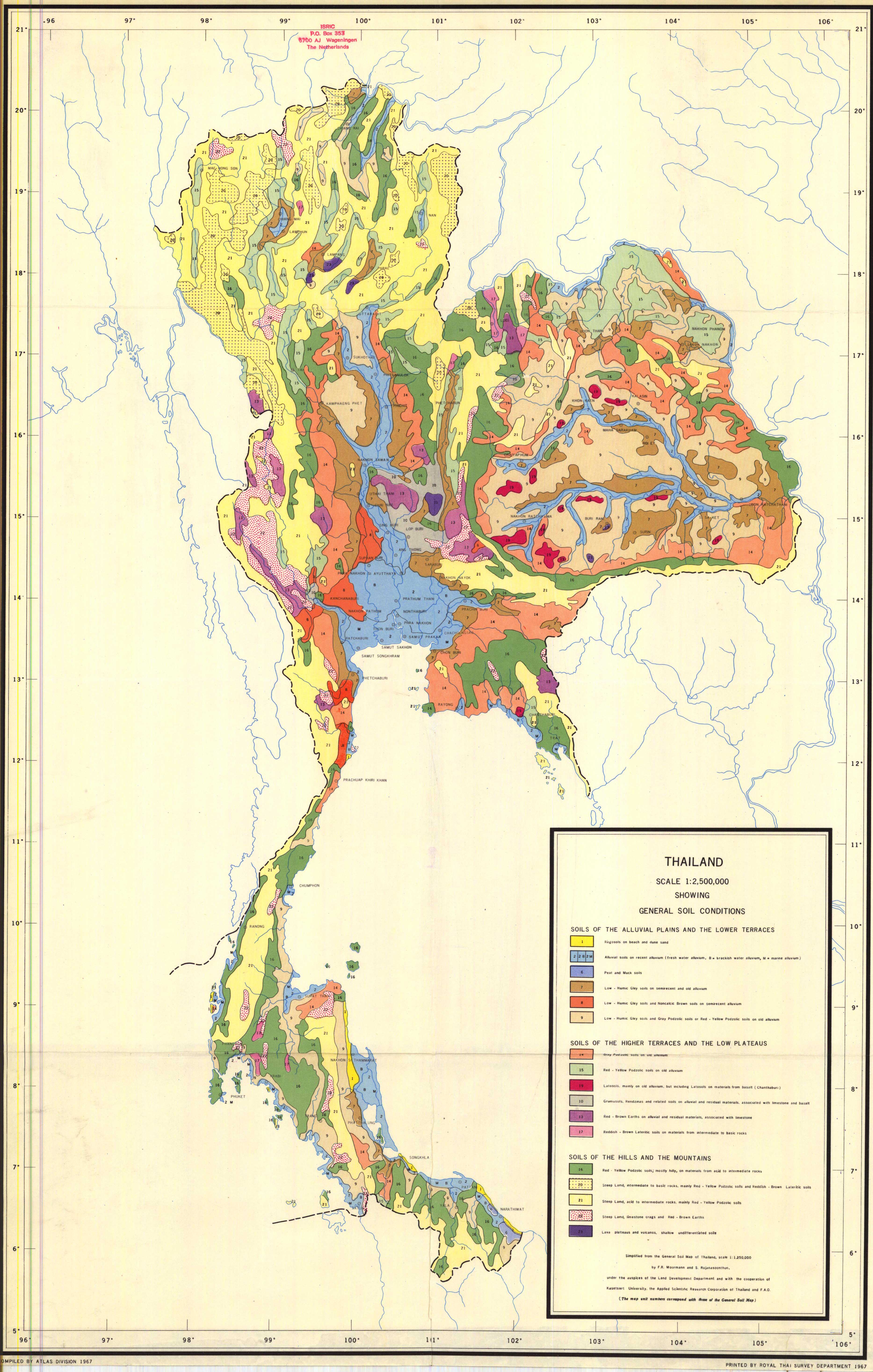
- Red-Yellow Podzolic soil (Ultisol) road surfaces in tropical/subtropical settings where iron-oxide-coated kaolinite produces field behaviour indistinguishable from Oxisol laterite; in regions such as Northern Thailand, Ultisols and lateritic Oxisols coexist on the same hillside and cannot be separated without laboratory analysis[17]
- Nitisol road surfaces where field behaviour and appearance are indistinguishable from laterite for mappers[5]
Explicit exclusions:
- Vertisol and black cotton soil: keep
surface=clay(correct mineralogical match; dry-season hardening is swelling/shrinking, not iron-oxide cementation)[7] - Intact ferricrete or calcrete duricrust outcrop: use
surface=rock[8] - Improved laterite roads where construction work has produced a stable surface: use
surface=compacted. Supporting basis: engineered surfaces use borrow-pit-selected laterite gravel with high nodule (pisolith) content, producing CBR values of 30–90, structurally distinct from fine-fraction-dominant natural laterite.[21][19] The intent is to preserve existing mapper practice: in Africa, major laterite highways are already taggedsurface=compactedand should remain so.surface=lateritetargets natural, unimproved, or minimally graded surfaces where wet-season plasticity is the defining behaviour. Where construction level is ambiguous, surface texture is the practical test: visible individual nodules or particles indicate engineered aggregate (surface=compactedwhen rolled); a smooth continuous fine-grained surface indicates natural laterite soil (surface=laterite). When uncertain,surface=lateriteis the safer default. - Natural soils that harden in dry season, including calcrete, gypcrete, silcrete, black cotton soil in dry season, desert pavement, and natural tracks compacted only by traffic: do not use
surface=compacted. Dry-season hardness is not evidence of engineering; these soils have no imported aggregate skeleton. Usesurface=dirtwhere you can confirm a natural soil road but cannot identify the material, orsurface=groundwhere the surface type is indeterminate. - Red sand and other loose non-cohesive red surfaces: use
surface=sandorsurface=gravelas appropriate
Compacted aggregate boundary: engineering detail
The key distinction between surface=laterite and surface=compacted on laterite-region roads is the construction method, not the material origin.
In-situ natural laterite tracks form without material selection: traffic compacts the natural soil profile in place. The surface is dominated by fine-grained laterite (fine particle fraction dominant), uniform from surface to cut bank, with no visible coarse aggregate skeleton.[19]
Engineered laterite roads use borrow-pit-selected laterite gravel with high pisolith (nodule) content:
- California Bearing Ratio (CBR) values of 30–90, versus roughly 5–15 for fine-fraction natural laterite
- Pisolith content >30–50%, providing an aggregate skeleton that maintains strength when wet
- Mechanically placed in layers and compacted, producing a bound surface distinct in behaviour from natural soil[21][19]
The Wet Mix Macadam (WMM) and Aggregate Base Course (ABC) construction standards used in engineered laterite road design use these CBR and particle-size specifications to separate subbase from subgrade; that same engineering boundary separates surface=compacted from surface=laterite in mapping practice.
Field indicator for mapper use: if visible individual pisoliths or angular rock fragments are embedded in the road surface, the material has been engineered. If the surface is smooth and continuous fine-grained with no visible aggregate skeleton, it is natural laterite soil.
USDA / FAO taxonomy mapping
| Soil type | USDA taxonomy | FAO/WRB taxonomy | Notes |
|---|---|---|---|
| Laterite (core scope) | Oxisols (highly weathered), Ultisols (less weathered) | Ferralsol, Plinthosol | Plinthosol covers soils with ironstone plinthite; Ferralsol is the broad Oxisol equivalent |
| Latosol (terra roxa) | Oxisols, Rhodic subgroup | Ferralsol (Rhodic) | Brazilian Latossolo classification; Rhodic indicates deep red colour from hematite |
| Nitisol | Alfisols or Ultisols (no direct USDA match) | Nitisol (WRB-only order) | Recognised in WRB but not in USDA taxonomy; behaviour matches laterite family for mapping purposes |
| Andosol (extended scope) | Andisols | Andosol | Volcanic ash parent material; dark colour; confirmed special case only |
| Vertisol (excluded) | Vertisols | Vertisol | Same order in both systems; clay-mineral dominant; correctly remains surface=clay
|
| Applied laterite aggregate (excluded) | None (applied material) | None (applied material) | surface=compacted or surface=gravel depending on state
|
| Rocky duricrust (excluded) | None (duricrust, not a soil order) | Plinthosol (ferricrete), Calcisol (calcrete) | surface=rock when intact; surface=compacted or surface=gravel when crushed and applied
|
Field identification criteria
The following criteria apply to the proposed surface=laterite scope (Approach C: iron-oxide-rich tropical soil family). All three criteria should be evaluated together; no single criterion is sufficient on its own.
Colour criterion
Colour is the fastest visual pre-check but is non-diagnostic alone and is unreliable when the surface is wet.
- Red, orange, reddish-brown: primary diagnostic colour, most common case. Strongly diagnostic when combined with cohesion and tropical geography. The colour usually persists in cut banks and rut walls.
- Dry-season lightening: the same laterite road can look much lighter in prolonged dry conditions, including orange-light beige at the surface, especially where fine dust coats the road. Use fresh ruts, cut banks, and wet patches to confirm the underlying red matrix.
- Dark brown to black: within scope in volcanic zones only (andosol). When colour is dark, cohesion and wet behaviour are the primary identifiers. Confirm volcanic geology and humid tropical zone before applying the tag.
- Grey, white, pale soils: generally excluded. Uniform white, cream, or light-grey profiles usually indicate calcium carbonate, silica, or kaolin dominance. Light orange-beige surface dust alone does not exclude laterite if subsurface evidence is red and cohesive.
- Colour when wet: non-diagnostic. All five in-scope soil types turn brown-grey to near-black when fully saturated. Do not use wet-state colour to include or exclude a surface.
Cohesion criterion
Press a boot or stick into the surface. In-situ natural laterite soil is cohesive: it does not shift freely underfoot when dry, and it deforms plastically (smooth-walled ruts, no crumbling) when wet. Applied aggregate and rock surfaces fail this test.
- Dry state: does not shift freely underfoot. Surface is firm or hard.
- Wet state: plastic deformation, smooth-walled ruts, strongly adhesive. A vehicle that sinks does not find gravel fragments providing resistance.
- Surfaces that provide progressive grip loss when wet (coarse fragments felt through the tyre or boot) are more likely applied aggregate: use
surface=compacted.
Geographic criterion
The iron-oxide-rich soil family is confined to tropical and subtropical zones (broadly 25°N–25°S, with extensions to ~30° in high-rainfall subtropical regions). Reddish cohesive soils outside this zone are almost certainly not laterite or related soils.
- Andosol is restricted to volcanic arc zones: Java, Sumatra, Philippines, Central America, Cameroon, Japan.
- Laterite and nitisol are absent from arid zones regardless of latitude.
- A red cohesive road in a temperate or arid climate is more likely an iron-oxide-stained clay or a calcrete/ferricrete outcrop: verify geology before tagging.
Three-criterion decision tree
- Is the road in a tropical or subtropical zone? If no: do not use
surface=laterite. - Is the surface cohesive when dry (does not shift freely)? If no:
surface=sand,surface=gravel, orsurface=rockdepending on material. - Is the surface plastic when wet, with smooth-walled ruts and strong adhesion? If no (progressive grip loss, coarse fragments visible):
surface=compacted. - Is the colour red, orange, or reddish-brown? If yes: strong indication. If dry-season surface is orange-light beige, confirm red cohesive matrix in ruts or cut banks. If colour is dark brown to black: confirm volcanic zone before proceeding.
- If all applicable criteria are met: use
surface=laterite.
Boundary cases and exclusions
Not all visually similar roads qualify under the criteria above. The cases below are either geologically unrelated or represent forms of laterite that behave differently on the road surface. Two field tests together provide the clearest disambiguation: cohesion when dry (does not shift freely underfoot) and plastic deformation when wet. A surface that fails either test does not qualify.
- Nodular / aggregate laterite (pisolithic laterite, quarried laterite gravel): Geologically the same Oxisol/Ferralsol as fine-matrix laterite, but iron oxide particles are cemented into stable macro-aggregates (pisoliths). Behaves like gravel when wet: progressive grip loss rather than plastic deformation. Visually nearly identical to fine-matrix laterite when dry; close inspection reveals rounded pea-to-marble-sized nodules in the surface. The wet-season behaviour is the clearest field test: if the surface provides progressive traction when wet rather than becoming a plastic mass, it is the nodular form. Correctly tagged
surface=gravelorsurface=compactedwhen quarried and laid as road base. In Thailand this distinction maps onto ดินลูกรัง (din luk rang, nodular) vs ดินแดง (din daeng, fine-matrix). Does not qualify under the proposed criteria because it is not plastic when wet. - Red sand (Australia, American Southwest): iron oxide coating on quartz or sandstone-derived sand grains. Loose, non-cohesive, shifts freely. Correctly tagged
surface=sand. Colour can be identical to laterite; geography and cohesion are the decisive indicators. - Iron-stained rock roads (Central Asia, mountain regions): colour from iron oxide in sedimentary or metamorphic bedrock. Outside tropical zone. Loose or compacted crushed rock, not cohesive soil. Correctly tagged
surface=gravelorsurface=rock. - Red clay from iron-oxide impurities: some clay soils are reddish from trace iron oxide as a minor impurity. These remain
surface=clay, as the reddish tint is incidental and the mineralogy is clay-mineral-dominant. Distinguishable from laterite by lower colour saturation and the absence of strong red-orange throughout cut banks. - Caliche / calcrete (arid and semi-arid zones): calcium-carbonate-cemented soil or rock crust. Occurs in arid climates, not humid tropical zones. Hard and brittle when dry rather than plastic when wet. Not a clay-textured road soil.
-

-
 Utah (BLM), USA: visually similar colour to laterite, iron oxide coating on sandstone-derived sand grains, but loose, non-cohesive, arid climate. Colour alone is not a sufficient field indicator. Photo: Jeremy T. Dyer, BLM Utah.

.jpg)
Applied laterite aggregate
Applied laterite aggregate is quarried and applied material, not naturally formed soil. It consists of cohesive iron-oxide-rich fines mixed with coarse laterite gravel, pisoliths, or rock fragments that have been excavated from a borrow pit and spread on a road surface, with or without mechanical compaction.
The key distinction from surface=laterite is observable in the field: natural laterite soil is a continuous cohesive matrix, uniform from the surface down to the cut bank. Applied aggregate shows a visible mixture of fine cohesive material and coarse fragments, often with rounded pisoliths or angular rock chips embedded in the surface.
Tagging guidance:
- Any mix of cohesive fines and coarse laterite gravel or rock fragments that has been applied and compacted, with fines visibly filling voids and the surface stable underfoot: use
surface=compacted. - The
surface=gravelwiki explicitly warns against using it for compacted surfaces; usesurface=compactedfor compacted applied aggregate. - Use
surface=rockfor intact rock-hard duricrust that a track crosses as an outcrop. - Do not use
surface=lateritefor applied aggregate;surface=lateriteis reserved for naturally formed laterite soil.
Regional examples: din lukrang (Thailand, nodular laterite aggregate), murram gravel (East Africa), koffieklip crushed (southern Africa). The tagging of din lukrang is left to mapper judgment based on observable surface condition: if the surface is clearly applied aggregate, surface=compacted is the correct tag; if it is natural red cohesive soil, surface=laterite applies.
Rocky duricrusts (ferricrete and calcrete)
Rocky duricrusts are cemented rock-hard crusts formed within the soil profile. They are not cohesive soils and do not become plastic when wet. Two types are relevant to tropical and subtropical road mapping:
- Ferricrete (koffieklip intact, laterite hardpan): iron oxides cement the soil profile into a hard rock-like layer. Found in tropical and subtropical zones. When a track crosses an intact ferricrete outcrop, it behaves as rock: no ruts, no seasonal degradation. Correctly tagged
surface=rock. - Calcrete (caliche, hardpan in arid zones): calcium carbonate cements the soil profile. Found in arid and semi-arid zones, not in humid tropical areas. White to cream colour. Behaves as rock. Correctly tagged
surface=rock.
Global tagging rule:
- Intact duricrust as road surface outcrop:
surface=rock - Crushed or broken duricrust applied as road aggregate:
surface=compactedwhen compacted,surface=gravelwhen loose - Do not use
surface=lateritefor duricrusts; the cementation prevents plastic behaviour.
Note on koffieklip: the name is used in southern Africa for both intact ferricrete outcrop (correctly surface=rock) and crushed ferricrete applied as road base (correctly surface=compacted). The name alone does not determine the tag; observable surface condition does.
Routing and rendering implications
surface=laterite is speed-sensitive at both seasonal extremes:
- Wet season: plastic, sticky, potentially impassable conditions with abrupt onset. On first wetting the road surface rapidly becomes near-frictionless before softening to full-depth plasticity, a hazard that can develop within minutes.[15] Affects pedestrians as well as vehicles.
- Peak dry season: heavy dust, reduced traction, low visibility on open roads and tracks.[18]
A higher default routing cost than surface=dirt is justified across the year, since challenging conditions are a known, predictable property of the material rather than random events.
For rendering, treat surface=laterite as equivalent to other unpaved natural surfaces. No special styling is needed beyond what renderers already apply to surface=dirt or similar values.
A note on tracktype=* and laterite: tracktype interpretation is not fully uniform in the community. Some mappers apply it based on surface firmness and composition; others base it on infrastructure development or maintenance level. For laterite roads, this creates a specific tension: a road that is firm and dust-dry in the dry season (grade2-like in feel) may reach grade4 or grade5 conditions in wet season. tracktype=grade3 is the most defensible default for natural laterite, as it does not imply the consistent firmness that grade2 carries. smoothness=* is often more useful than tracktype for laterite roads because it captures the observable condition at survey time without making an implicit claim about year-round passability.
Geographic gallery
Representative roads from regions where the tagging gap is most acute.
-
 Lead image of Key:surface. Tanzania (near Kilimanjaro), wet season. Most plausible identification: nitisol or laterite; andosol also possible in volcanic context.
 -
 Tanzania (Kitulo Plateau): black cotton soil (Vertisol), Southern Highlands.
 -
 Uganda: firm red road, dry season. Laterite or nitisol.
 -
 Benin: red-orange laterite piste.
 -
 DR Congo: deep red road. Laterite or nitisol.
 -
 Ethiopia: red road, dry season. Laterite or nitisol.
 -
 Laos: deep red-orange road. Laterite or latosol.
 -
 India (Kerala): wet-season laterite track.
 -
 Argentina (Misiones): basalt-derived latosol (tierra colorada).
 -
 French Guiana: red laterite road.
 -
 Cambodia: dry-season laterite road.
 -
 Thailand: dry-season laterite, appearing light beige-orange at the surface.


.jpg)
.jpg)


See also
- Proposal:Surface=laterite (main proposal)
- Proposal:Surface=laterite/Data
- Proposal:Surface=laterite/Community
- Tag:surface=clay
- Tag:surface=dirt
- Tag:surface=ground
- Tag:surface=compacted
- Tag:material=laterite
- Key:surface
- Wikipedia: Laterite
- Wikipedia: Ferralsol
- Wikipedia: Nitisol
- Wikipedia: Andosol
- Wikipedia: Vertisol
- Wikipedia: Terra roxa
- Wikipedia: Ferricrete
- Wikipedia: Clay mineral
References
- ↑ Tardy, Y. (1997). Petrology of Laterites and Tropical Soils. A.A. Balkema, Rotterdam. 408 p. ISBN 9054106786.
- ↑ 2.0 2.1 2.2 2.3 Wikipedia: Laterite
- ↑ 3.0 3.1 3.2 3.3 3.4 Wikipedia: USDA soil taxonomy
- ↑ 4.0 4.1 Wikipedia: Terra roxa
- ↑ 5.0 5.1 Wikipedia: Nitisol
- ↑ Wikipedia: Andosol
- ↑ 7.0 7.1 Wikipedia: Vertisol
- ↑ 8.0 8.1 Wikipedia: Ferricrete
- ↑ USDA: Soil Texture Classification
- ↑ Wikipedia: Clay mineral
- ↑ Wikipedia: Clay court
- ↑ Wikipedia: Laterite, Agriculture section
- ↑ Wikipedia: Clay. "Clay-size particles and clay minerals are not the same, despite a degree of overlap in their respective definitions."
- ↑ 14.0 14.1 14.2 14.3 Pinard, M.I., Netterberg, F., Paige-Green, P. (2014). Review of Specifications for the Use of Laterite in Road Pavements. AFCAP Contract AFCAP/GEN/124. Crown Agents / UKAID. (Table 2-3, citing Charman et al., 1988)
- ↑ 15.0 15.1 Gidigasu, M.D. (1974). "Identification of Problem Laterite Soils in Highway Engineering: A Review". Transportation Research Record 497, pp. 96–111. Transportation Research Board, Washington D.C.
- ↑ Wikipedia: Laterite, Building blocks section. "Upon exposure to air it gradually hardens as the moisture between the flat clay particles evaporates and the larger iron salts lock into a rigid lattice structure."
- ↑ 17.0 17.1 Thailand soil classification map, European Soil Data Centre (ESDAC), 2004
- ↑ 18.0 18.1 Wikipedia: Gravel road, "Laterite and murram roads" section. "laterite soils are used to build dirt roads." Also: "laterite, called murram in East Africa, varies considerably in the proportion of stones to earth and sand... Not all laterite and murram roads are therefore strictly gravel roads." Also notes: clay-containing laterite "becomes very slippery when wet" and "can become very hard, like sun-dried bricks" when dry. Cite error: Invalid
<ref>tag; name "wp-gravel-road" defined multiple times with different content - ↑ 19.0 19.1 19.2 19.3 Ministry of Transport and Public Works, Malawi (2013). Design Manual for Low Volume Sealed Roads. Roads Authority / AFCAP.
- ↑ 20.0 20.1 Thailand Department of Highways (1989). Standard No. DH-S 205/2532: Aggregate Subbase Material Specification. Bangkok: Department of Highways.
- ↑ 21.0 21.1 21.2 21.3 Zame, P.Z., Assomo, P.S. and Onwualu, J.N. (2017). "Assessment of Geotechnical Properties of Lateritic Gravels from South-Cameroon Road Network". International Journal of Geosciences, 8, 949–964.
- ↑ Thai SME Government Product Database: Din lukrang (ดินลูกรัง): definition, characteristics and uses. Defines din lukrang as soil containing more than 35% gravel or rock fragments by volume, used for road fill and sub-base construction.
- ↑ Din lukrang: characteristics, types and uses (Thai construction reference). Identifies three types: coarse-grained (for road compaction), fine-grained, and organic-mixed.
- ↑ Valorization of Lateritic Nodules in Concrete: State of the Art and Perspectives. RROIJ Open Access.