Proposal:Surface mine
| surface_mine | |
|---|---|
| Proposal status: | Abandoned (inactive) |
| Proposed by: | Myfanwy |
| Tagging: | man_made=surface_mine
|
| Statistics: |
|
| Draft started: | |
| Proposed on: | 2008-01-29 |
| RFC start: | 2008-01-29 |
Currently being used with:

Proposal
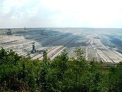
In my region there are some very large surface mines (up to 4000 hectares of area) which I would like to tag. See wikipedia:de:Tagebau and wikipedia:surface mining for details on such mines.
this proposal includes making landuse=quarry obsolete
Rationale
the previous proposal Proposed features/Mining had merit, but tried to address surface (opencast) mines and pit mines with the same tag. A separate tag proposal has been created for pit mines Proposed features/Mineshaft, and this one created to cover surface mines.
See also
tagging
Applies to:
- areas and nodes (for really small mines)
tag values
- tag=man_made value=surface_mine
- tag=resource value=coal|bauxite|stone (optional) - whatever they mine in that mine, e.g. lignite, stones (which could superseed quarry). This could be rendered in some way (different colors?), but I think it's mainly metadata for the time being. Initial key for resource has been started here Key:resource.
- tag=name value=...
- tag=operator value=...
Discussion
Actually I was a bit surprised that the former mining proposal wasn't clear about the top level tag, I now see man_made=surface_mine here. As someone noted in the former proposal, I also think landuse would make more sense here, giving the fact that these surface mines usually covers huge areas. Later we might even want to tag individual items like cranes, surveyor belts and such on this landuse - so landuse also makes sense to be a "collection of things" here. I see man_made as human build structures much smaller in size, like a gasometer or such. - Ulfl 23:36, 28 January 2008 (UTC)
- i thought this would come up. problems are: we shouldn't be demarcating items by their size, that's an incredibly vague way of doing things. if an item is large, it will be seen as large by the area of the land it covers. true, we may want to tag individual items - buildings, etc. - but that shouldn't change anything. for example, my university covers a huge area, and is made up of many different items (buildings, sports pitches, car garages, etc), but that sits ok as an amenity. ditto a hospital. if we're going to get into collections of things (a good idea, they should all be related), then relations may be the way to go. Myfanwy 23:53, 28 January 2008 (UTC)
- a broader response: is there any definition anywhere of what 'landuse' actually means (in the specific context of osm, obviously)? this discussion has come up a few times before, i think it would be simpler to define landuse once, and then refer back to it. Myfanwy 23:55, 28 January 2008 (UTC)
- don't use "key=man_made" but "key=landuse" and you got it :) --Cbm 13:25, 29 January 2008 (UTC)
- why landuse? i don't see it as that at all Myfanwy 18:14, 29 January 2008 (UTC)
- could we suspend any work on this, until the definition of landuse is finished? discussion is here: Talk:Key:landuse Myfanwy 02:03, 4 February 2008 (UTC)
- Whatever the outcome of the landuse discussion. There is already a definition for man_made it goes like:
- "A tag for identifying man made (artificial) structures and buildings added to the landscape."
- A hole in the ground of several square kilometers does not fit into that definition. --Cartinus 07:12, 9 February 2008 (UTC)
- that's a fair point, i had no idea there was an OSM definition for man_made Myfanwy 19:13, 18 February 2008 (UTC)
- I agree that landuse=surface_mine should be used. Further I propose to use surface_mine=coal|bauxite|stone|salt|Peat in stead of resource= as this is more consistent with how other things are tagged. --Skratz 12:02, 30 December 2008 (UTC)
- I don't see any difference with Proposed_features/Mining so this is useless --PhilippeP 06:57, 4 February 2008 (UTC)
- There are actually two fairly visible differences. One is the change from landuse= to man_made= discussed right above your comment. The other is the removal of the subsurface part of the other proposal, which is mentioned in the paragraph called "rationale" above. --Cartinus 07:12, 9 February 2008 (UTC)
- I can't see the advantage of this proposal. What's wrong with Proposed_features/Mining? It contains all needed tags (except "operator", but this can be added). I read no arguments in this proposal for not using [Proposed_features/Mining]]. Please explain why we shouldn't use it for surface mines S.A.L. 16:16, 1 December 2008 (UTC)
- How would this accommodate a large surface-mining district that contains a mix of active, former, and highly likely mines? Status of individual parcels and areas cannot be verified easily on the ground (few roads, government-mandated vegetation buffers along roads and surface streams, and private landholders who do not welcome mappers taking photos). So it must be inferred from imagery. Some formerly-mined parcels can be identified solidly, but an area shown as an active mine could now be mined-out, and some nearby unmined areas could now be undergoing mining, or have been mine-out after the image was made. Some of the former mines are being reused, most are not and may not be for a very long time. Old ones had minimal requirements for reclamation. EdH 8:31 p.m. 5 July 2009 (EDT)
Voting
is not open yet, proposed for 2008-02-19