Uploads by Harry Wood
Jump to navigation
Jump to search
This special page shows all uploaded files.
| Date | Name | Thumbnail | Size | Description | Versions |
|---|---|---|---|---|---|
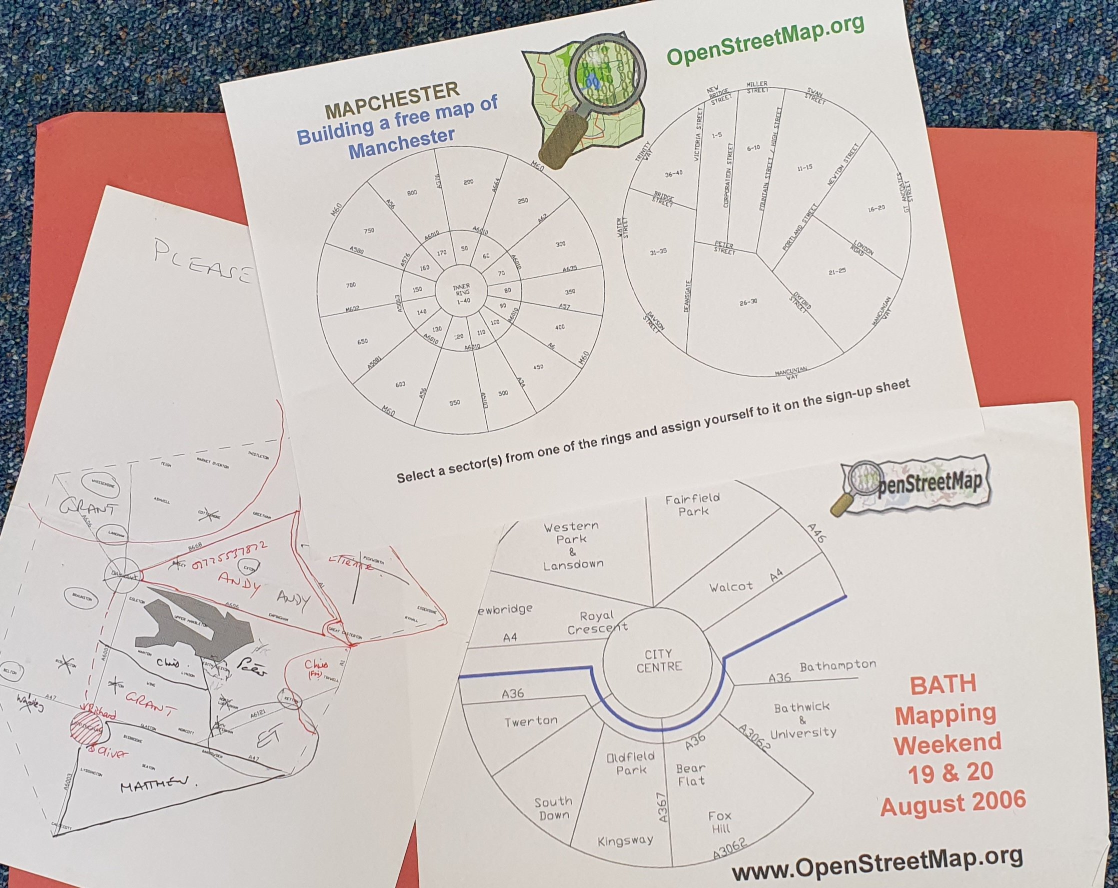
| 02:46, 27 March 2024 | Cake Diagram printout for Mapchester and Bath 2006.jpg (file) |  |
506 KB | {{Information | description=Cake Diagram printout for Mapchester and Bath mapping events in 2006 | source= | date= | author=Photo taken by User:Blackadder (of printouts by him) | other_versions= }} | 1 |
| 15:15, 2 January 2024 | MapATag screenshot.png (file) |  |
90 KB | {{Information | description=A screenshot of MapaTag (no longer exists). Image also featured on [http://sigdeletras.blogspot.com/2013/01/notas-sobre-gamificacion-y-mapas.html their blog] | source=https://www.flickr.com/photos/sigdeletras/9188308231/ | date=2nd July 2013 | author=SIGdeletras TIG y Patrimoni on flickr | other_versions= }} | 1 |
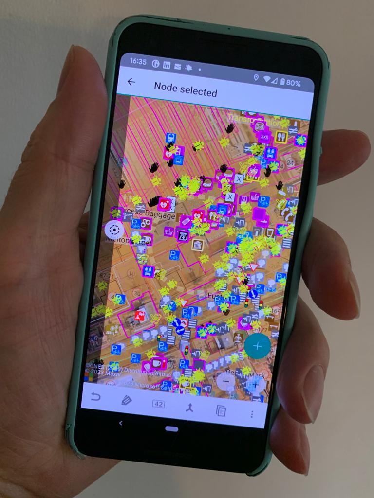
| 15:52, 19 September 2023 | Vespucci hand.jpg (file) |  |
98 KB | {{Information | description=A phone in a hand showing Vespucci | source= | date= | author=~~~~ | other_versions= }} | 1 |
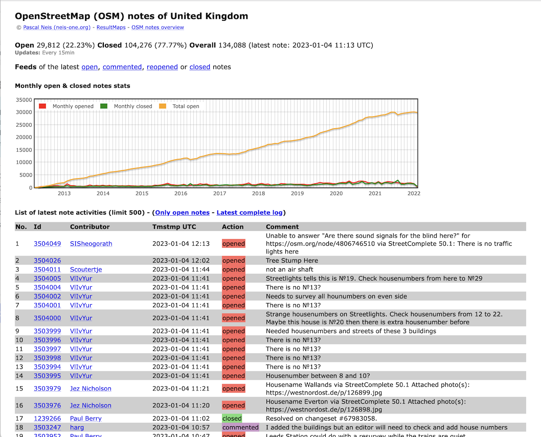
| 11:37, 4 January 2023 | Resultmaps.neis-one.org Notes in the UK.png (file) |  |
384 KB | {{Information | description=Screenshot of the neis-one.org notes overview of the UK on 4th January 2023 https://resultmaps.neis-one.org/osm-notes-country?c=United%20Kingdom | source=[https://resultmaps.neis-one.org/osm-notes-country?c=United%20Kingdom] | date=4th Jan 2023 | author=~~~ | other_versions= }} | 1 |
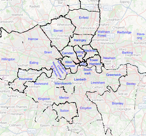
| 10:42, 29 September 2022 | London borough boundaries 2008.png (file) |  |
195 KB | Of course these days it's a bit more finished. I'm going to revert to a 2008 state because it's a more amusing historical artefact to use on the London borough boundaries page | 7 |
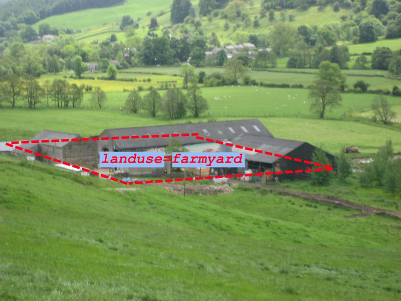
| 09:35, 30 November 2021 | Landuse=farmyard.jpg (file) |  |
127 KB | Illustration of landuse=farmyard as a modified version of my original File:Landuse=farmyard and landuse=farm.jpg | 1 |
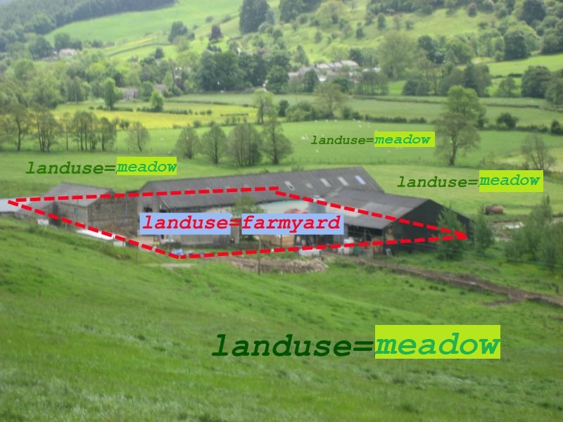
| 18:32, 29 November 2021 | Landuse=farmyard and landuse=meadow.jpg (file) |  |
106 KB | Image created by User:GoodClover on 23:30, 29 June 2021 originally overwriting File:Landuse=farmland.jpg, and as a (2nd) modified version of the original File:Landuse=farmyard.jpg and landuse=farm.jpg | 1 |
| 23:19, 7 May 2021 | F4map basic 3D buildings.png (file) |  |
248 KB | Screenshot of [https://demo.f4map.com/#lat=53.4800523&lon=-2.2420602&zoom=17&camera.theta=52.75&camera.phi=6.589 f4map.com showing a bit of central Manchester] | 1 |
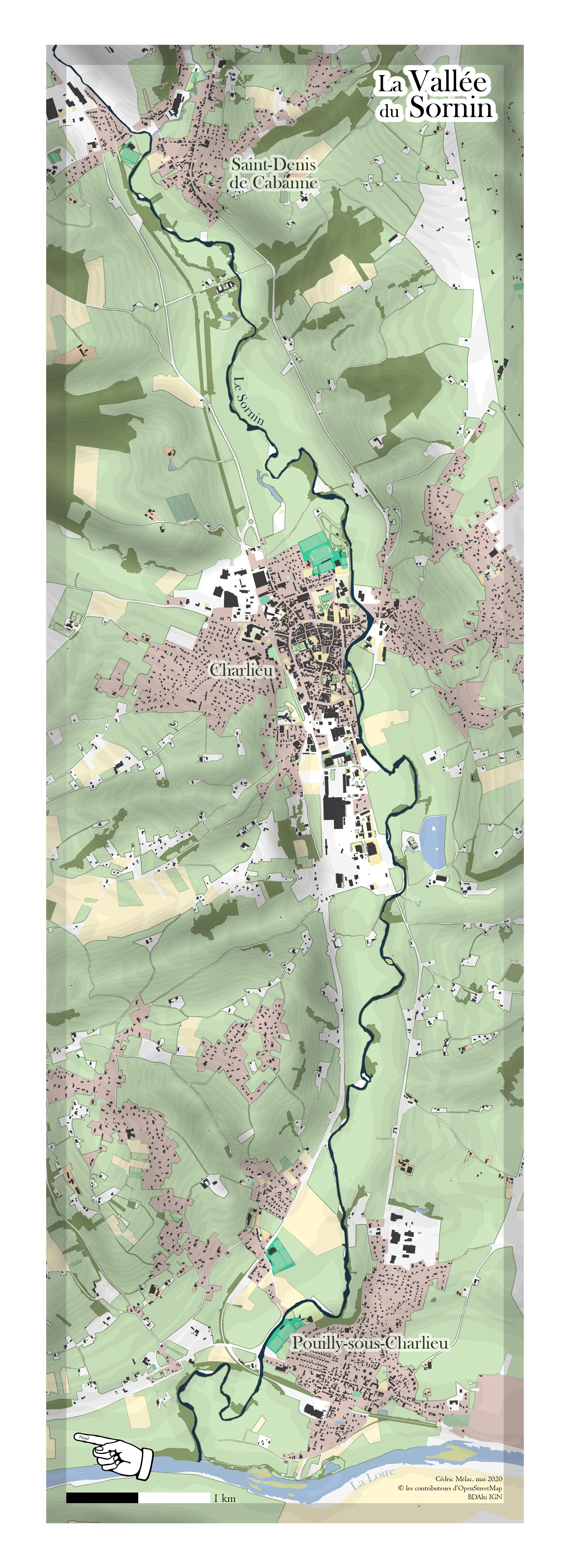
| 20:34, 8 May 2020 | La Vallee du Sornin.jpg (file) |  |
2.91 MB | La Vallee du Sornin by User:CapitaineMoustache Cedric Melac | 1 |
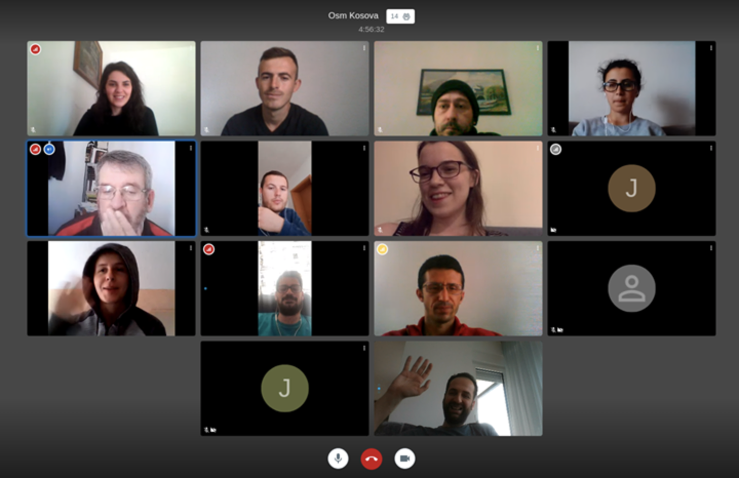
| 06:51, 6 April 2020 | OSM Kosovo online meet-up March 2020.png (file) |  |
962 KB | An OSM Kosovo online meet-up and mapathon to work on mapping of Kosovo's healthcare system | 1 |
| 00:22, 23 March 2020 | Hopitaux IdF petit.jpg (file) |  |
802 KB | All hospitals in Île-de-France. by User:JBacc | 1 |
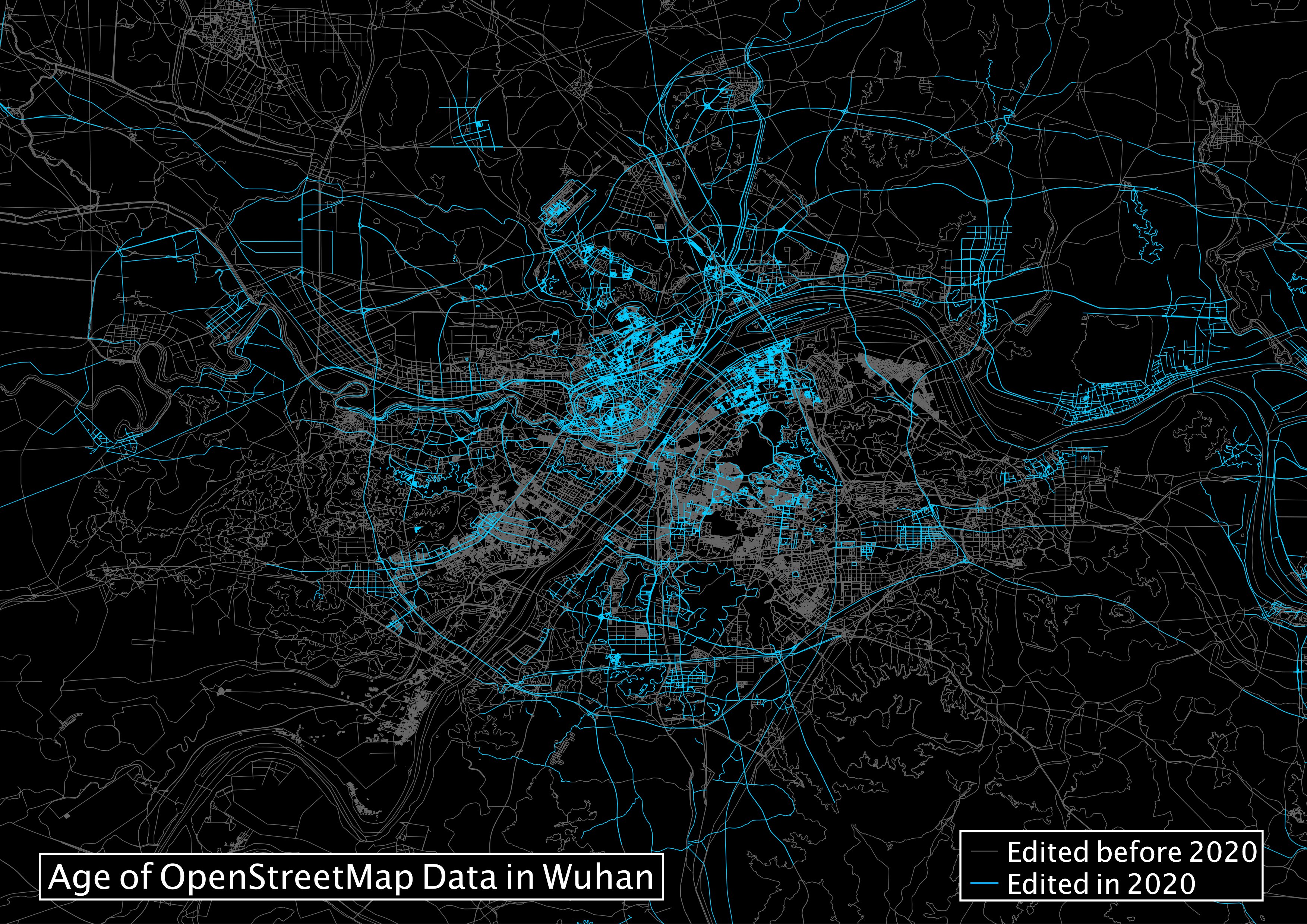
| 15:18, 4 March 2020 | OSM edits in Wuhan 2020.jpg (file) |  |
1.85 MB | OSM edits in Wuhan 2020. Rendering by Jeff Underwood https://twitter.com/jeffdefacto/status/1235066401745817600 | 1 |
| 13:55, 6 January 2020 | Road names in London OSMnx.jpg (file) |  |
447 KB | Distribution of Road/Street/Way/Drive/Avenue names in London by puntofisso https://twitter.com/puntofisso/status/1213135545121099777 | 1 |
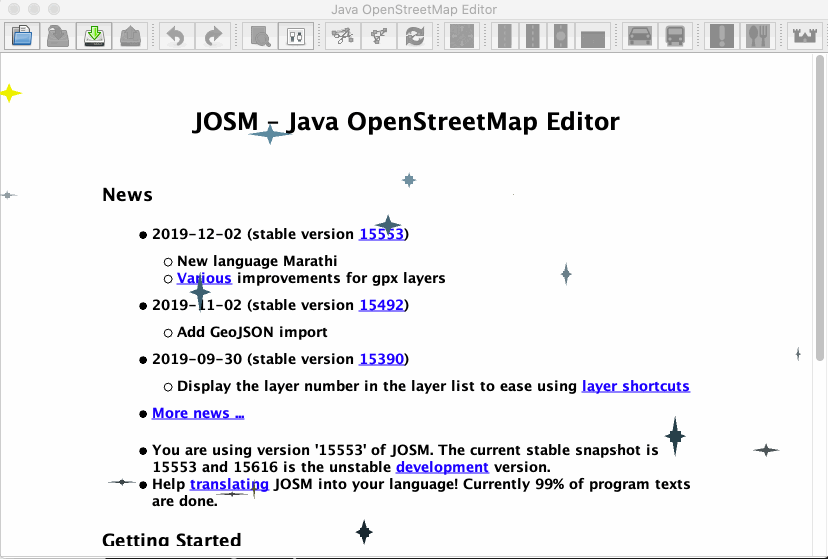
| 02:36, 27 December 2019 | JOSM christmassy sparkle.gif (file) |  |
354 KB | The JOSM startup screen over Christmas time 2019 | 1 |
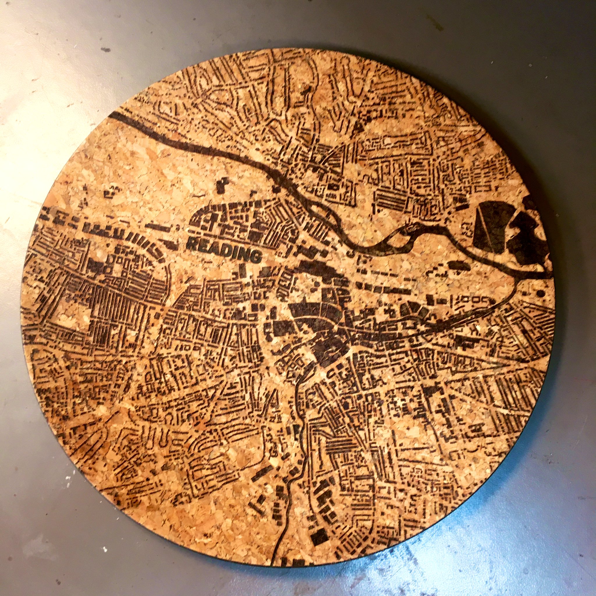
| 15:50, 2 December 2019 | Reading map etched cork tray.jpg (file) |  |
896 KB | A map of Reading (building & river data from OpenStreetMap) laser etched into a cork tray at the Reading hackspace: https://twitter.com/tone001/status/1199692466754146304 | 1 |
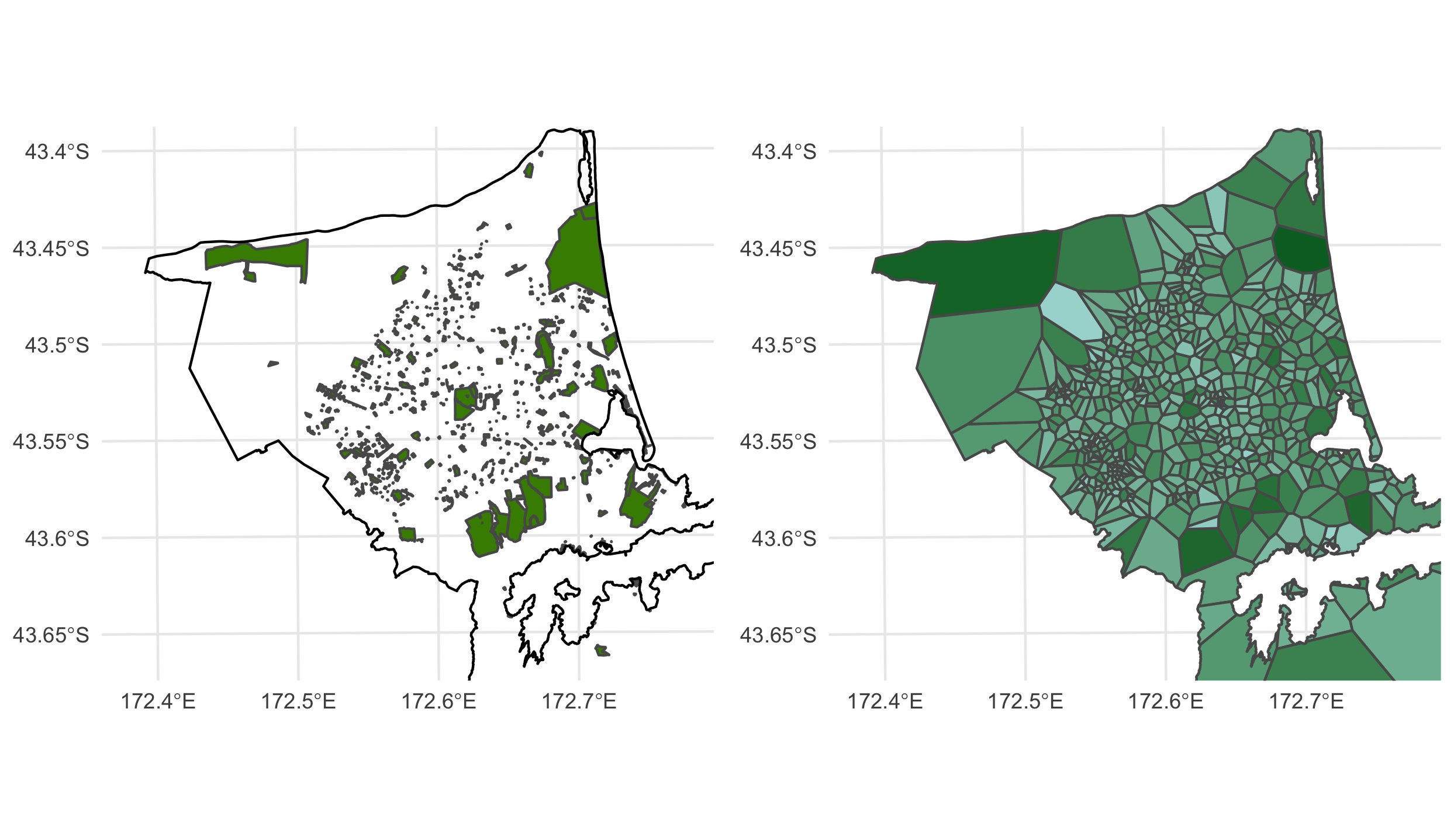
| 23:55, 24 November 2019 | Christchurch parks tessellation of polygons centroids.jpg (file) |  |
269 KB | Parks in Christchurch, New Zealand tessellation of polygons centroids (catchment) by Luis Apiolaza https://twitter.com/zentree/status/1192519217192423425 | 1 |
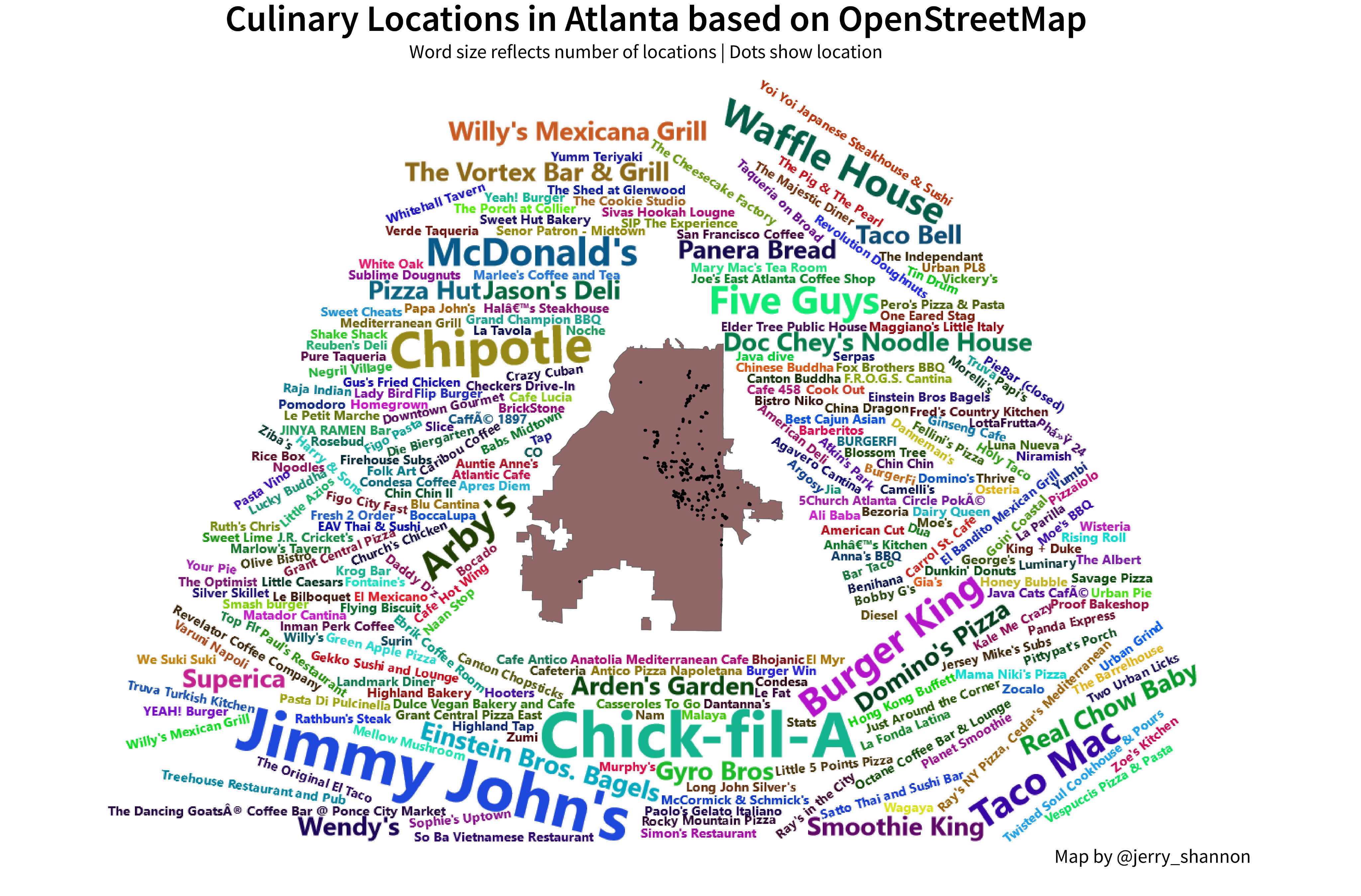
| 18:01, 17 November 2019 | Atlanta eateries wordcloud.jpg (file) |  |
1.3 MB | Atlanta eateries wordcloud by Jerry Shannon https://twitter.com/jerry_shannon/status/1195442656052047872 | 1 |
| 14:45, 9 November 2019 | Contributor lifespan.png (file) |  |
2.38 MB | Visualisation by Jennings Anderson https://www.openstreetmap.org/user/Jennings%20Anderson/diary/390743 | 1 |
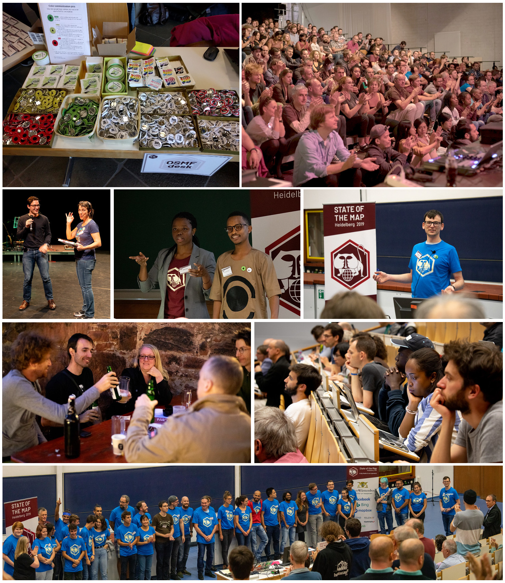
| 22:50, 30 September 2019 | SOTM 2019 montage.jpg (file) |  |
1.04 MB | State of the Map 2019 photos montage | 1 |
| 21:09, 17 September 2019 | Motorbike openstreetmap ipad.png (file) |  |
1.83 MB | App and photo by @EIosdev | 1 |
| 20:43, 17 September 2019 | SotM 2019 beer.jpg (file) |  |
640 KB | https://twitter.com/sotm/status/1173632376280363011 https://www.instagram.com/ruprecht_bier | 1 |
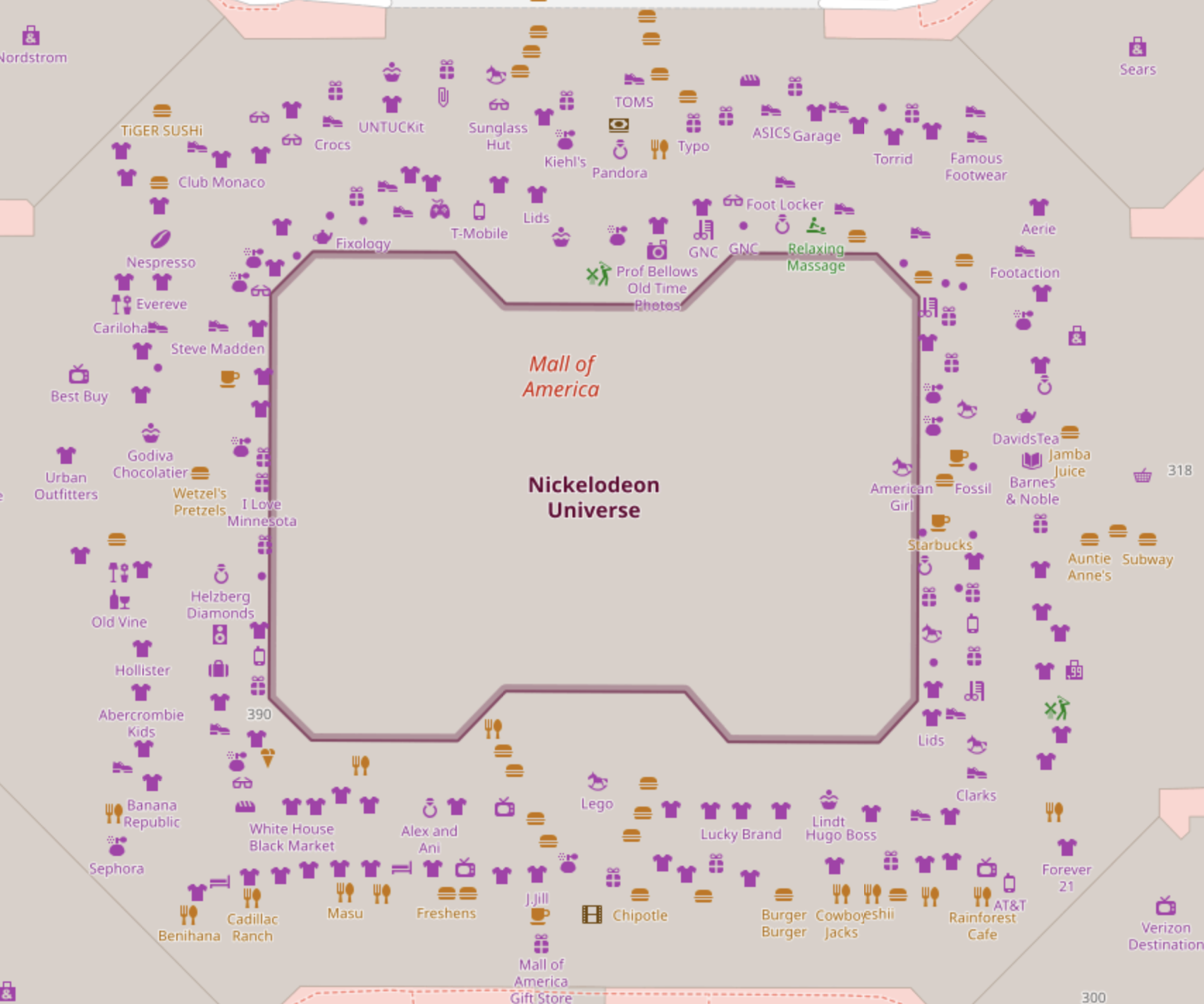
| 23:27, 14 September 2019 | Map of Mall of America Minnesota.png (file) |  |
758 KB | Screenshot of the map here: https://www.openstreetmap.org/#map=18/44.85466/-93.24250 At the Mall of America in Bloomington, Minnesota. | 1 |
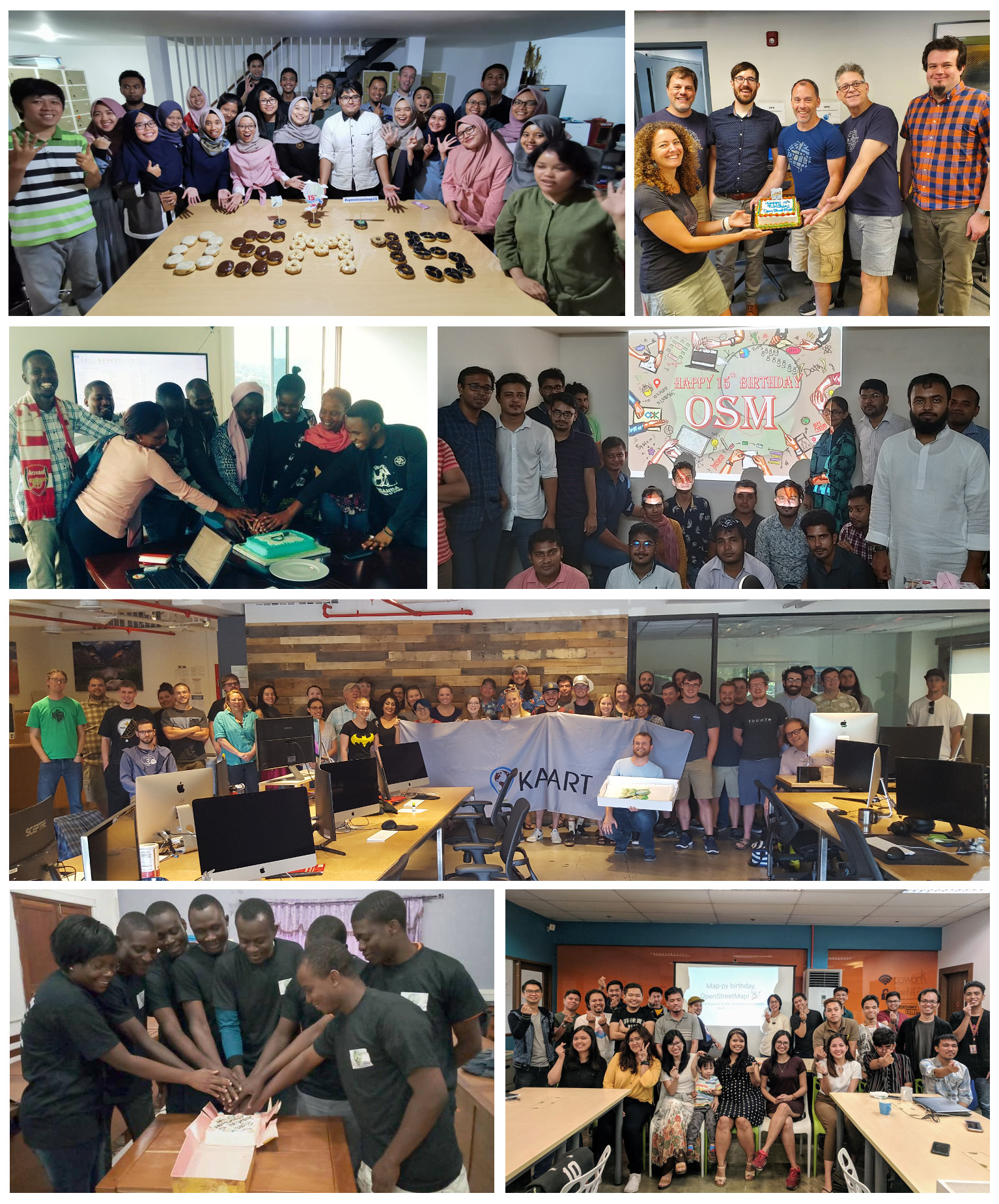
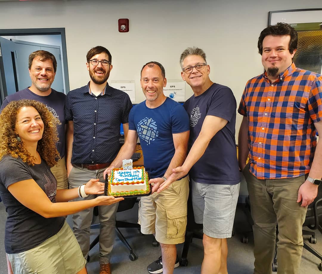
| 01:17, 29 August 2019 | 15th birthday group of groups.jpg (file) |  |
876 KB | Add Benin and Philippines | 3 |
| 00:47, 29 August 2019 | Benin 15th Birthday group.jpg (file) |  |
44 KB | 15th Birthday celebrations in Benin https://twitter.com/FAbiodoun/status/1160509279075491841 | 1 |
| 00:46, 29 August 2019 | Benin 15th Birthday cake.jpg (file) |  |
77 KB | 15th birthday cake in Benin https://twitter.com/FAbiodoun/status/1160509279075491841 | 1 |
| 20:42, 27 August 2019 | Indonesia 15th Birthday Group.jpg (file) |  |
130 KB | OSMID 15th birthday cake https://twitter.com/OSM_ID/status/1160830386248622081 | 1 |
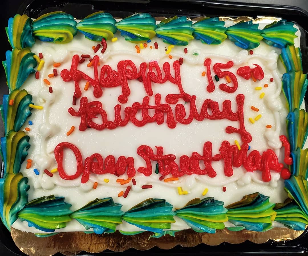
| 19:58, 27 August 2019 | SwissOSM 15th birthday cake.jpg (file) |  |
325 KB | 15th Birthday cake tweeted by SwissOSM https://twitter.com/SwissOSM/status/1161326745687134210 | 1 |
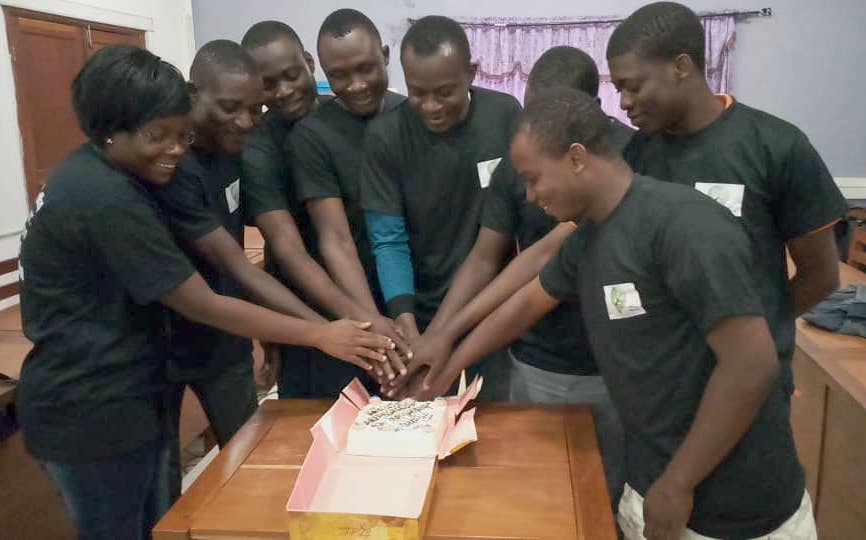
| 01:09, 23 August 2019 | 2019 Uganda cake group.jpg (file) |  |
54 KB | Map Uganda group with their OSM 15th birthday cake https://twitter.com/mapuganda/status/1160227827641389056 | 1 |
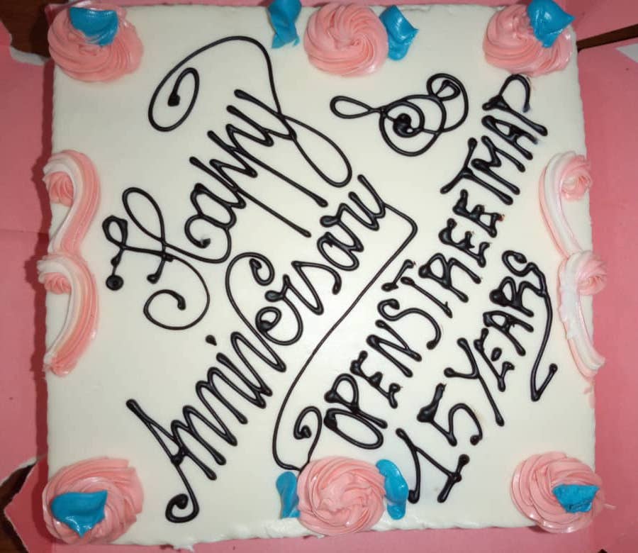
| 01:01, 23 August 2019 | 2019 Uganda cake.jpg (file) |  |
92 KB | 15th Birthday Cake by the MapUganda group https://twitter.com/mapuganda/status/1160227827641389056 | 1 |
| 14:06, 12 August 2019 | GWU 15th birthday cake group.jpg (file) |  |
122 KB | Folks from GWU with their cake. 15th birthday. | 1 |
| 14:01, 12 August 2019 | GWU 15th birthday cake.jpg (file) |  |
134 KB | Folks at George Washington University made this cake. Shared on twitter for upload here: https://twitter.com/sotmus/status/1160910525087305730 | 1 |
| 00:37, 5 August 2019 | Moved road mess.png (file) |  |
4.04 MB | A data mess occurring in London due to someone moving a bunch of roads several miles to the north [https://lists.openstreetmap.org/pipermail/talk-gb/2019-August/023327.html talk-gb mailing list discussion] | 1 |
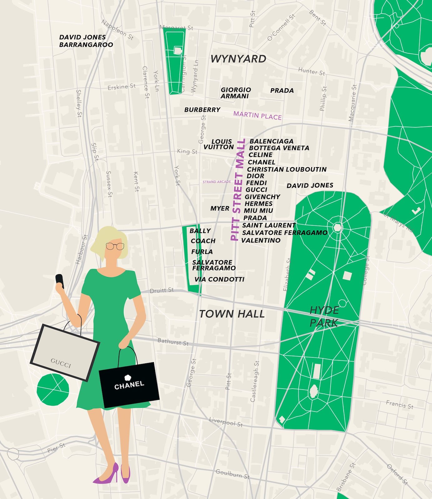
| 13:10, 2 August 2019 | Syndey shopping map.jpg (file) |  |
320 KB | "Where to shop in Sydney when you want to shop big" by Kate Volkano https://twitter.com/katevolkano/status/1157236226358829058 | 1 |
| 08:09, 29 July 2019 | Boho mapping event.jpg (file) |  |
377 KB | Building resilient communities in Bohol through OpenStreetMap. Carlo Felipe https://twitter.com/carlofelipe/status/1154299488451751936 | 1 |
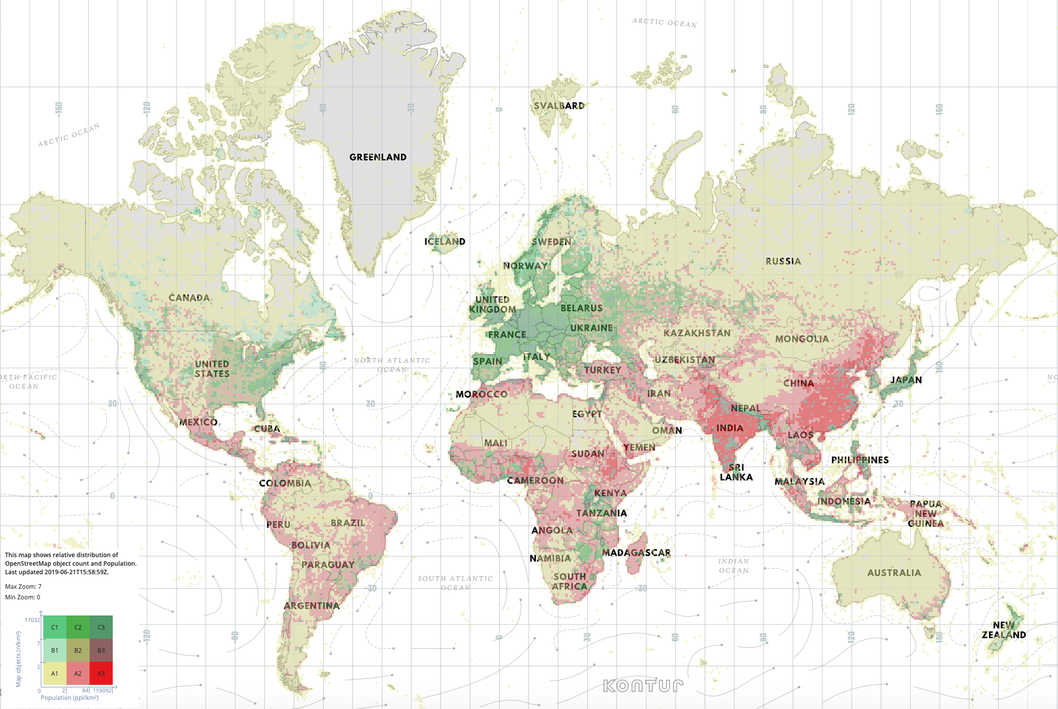
| 09:00, 25 June 2019 | Kontur population vs openstreetmap.png (file) |  |
937 KB | Kontur OpenStreetMap Coverage Map http://disaster.ninja/live | 1 |
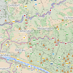
| 13:05, 6 June 2019 | Tile hikebike.png (file) |  |
31 KB | This style appears to have been updated at some point. Less white | 2 |
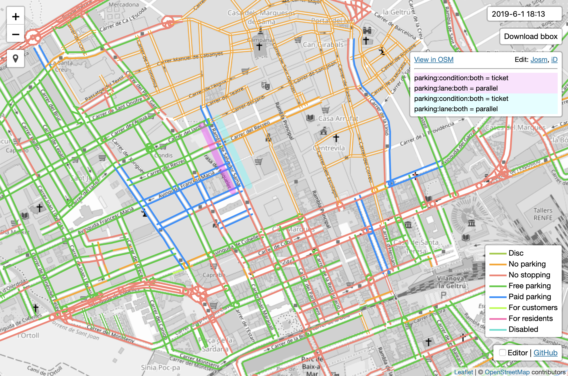
| 21:36, 4 June 2019 | Zlant parking lanes view.png (file) |  |
2.29 MB | https://zlant.github.io/parking-lanes/#16/41.2225/1.7246 | 1 |
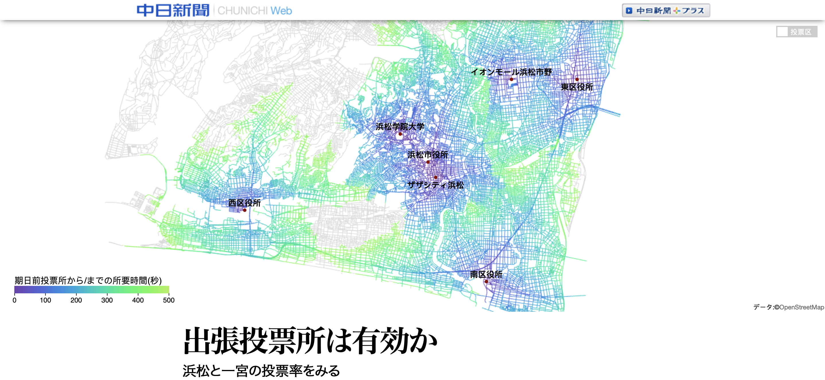
| 22:33, 2 June 2019 | Japan voting station travel times.png (file) |  |
2.42 MB | Animated dynamic map of Japan voting station travel times appear on [https://www.chunichi.co.jp/ee/feature/data/early_voting_stations.html this chunichi.co.jp article]. Created by songbogong who thanks the OpenStreetMap community here: https://twitte... | 1 |
| 08:48, 30 May 2019 | OSMF Board F2F 2019.jpg (file) |  |
145 KB | OSMF Board face-to-face meeting https://blog.openstreetmap.org/2019/05/28/osmf-board-face-to-face-meeting-2019/ Photograph by Allen Gunn | 1 |
| 15:27, 22 May 2019 | Sweden Lakes and Buildings.jpg (file) |  |
68 KB | "Sweden Lakes and Buildings" by Etienne Pauthenet. https://twitter.com/pauthenet/status/1022520673640620035 | 1 |
| 15:59, 14 May 2019 | Warma Zambia Mapathon 2019.jpg (file) |  |
150 KB | Hans van der Kwast [https://twitter.com/hansakwast/status/1127940889647697920 organised] a mapathon at [http://www.warma.org.zm Warma] Zambia, helping them learn OpenStreetMap while mapping Zambia for disaster preparedness and water/sanitation provisio... | 1 |
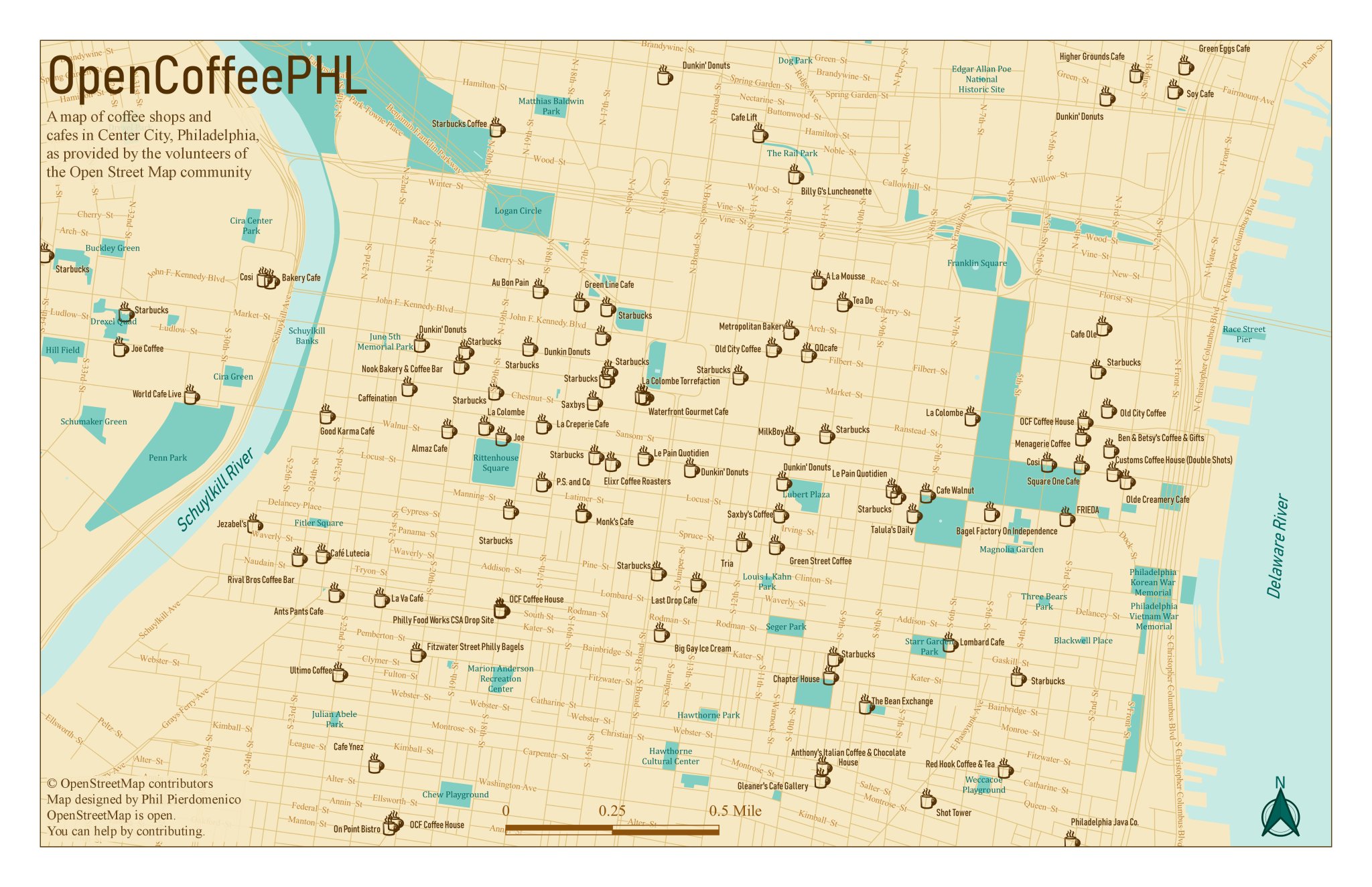
| 21:45, 26 April 2019 | OpenCoffeePHL map.jpg (file) |  |
436 KB | Map by Philip Pierdomenico https://twitter.com/PhilPierdo/status/1120145202684014593 | 1 |
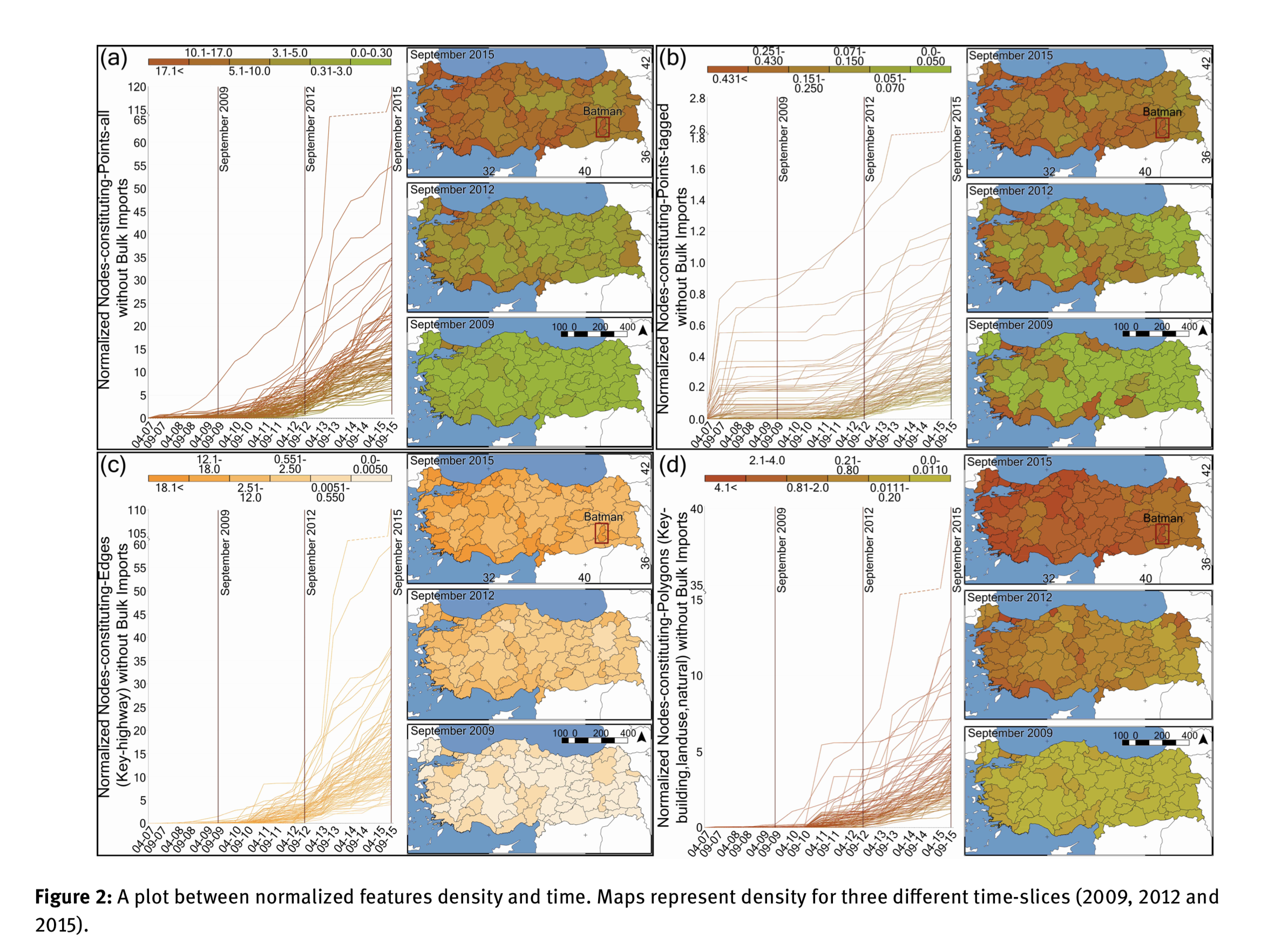
| 22:56, 21 April 2019 | Turkey time series analysis.png (file) |  |
2.7 MB | Growth of OpenStreetMap data density in Turkey, presented in [https://www.degruyter.com/view/j/geo.2019.11.issue-1/geo-2019-0012/geo-2019-0012.xml a paper of various time series spatial analyses] | 1 |
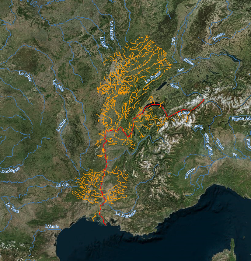
| 09:24, 20 April 2019 | Riverbasinmap com.png (file) |  |
1.39 MB | riverbasinmap.com - An interactive world map of rivers and river basins, showing the Rhone. [http://riverbasinmap.com/?base=3&labels=1&autozoom=1&extras=000000&type=b&id=r1075117#map=7/6.491/44.979] | 1 |
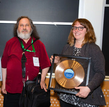
| 21:11, 31 March 2019 | Kate and RMS2.jpg (file) |  |
31 KB | Kate Chapman, holding the Free Software Foundation 2018 award for projects of social benefit, together with FSF founder and president Richard Stallman, who presented the award during LibrePlanet 2019. Copyright © 2019 Madi Muhlberg, CC-BY 4.0. Image... | 1 |
| 12:02, 25 March 2019 | Osm logo black circle.png (file) | 129 KB | The blackout logo relating to https://blog.openstreetmap.org/2019/03/21/the-eu-copyright-directive-threatens-openstreetmap/ | 1 | |
| 01:47, 19 March 2019 | Nottingham roof top solar panels.png (file) |  |
587 KB | Roof top solar panels in Nottingham Aspley Estate, shown on OpenInfraMap [https://openinframap.org/#14.48/52.97661/-1.20206] | 1 |
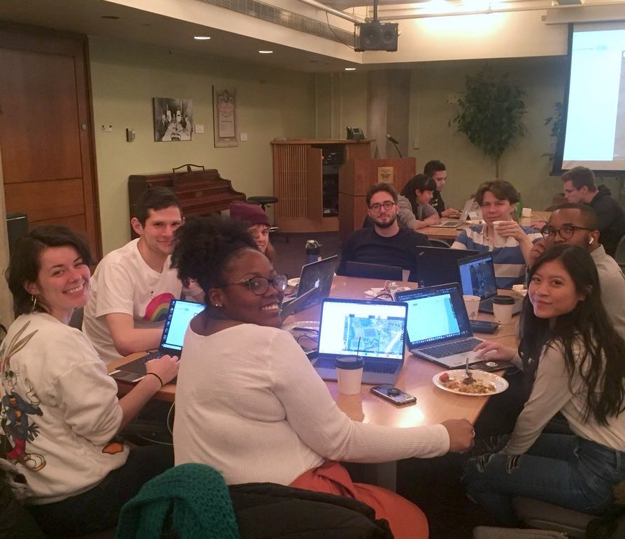
| 04:23, 7 March 2019 | Chicago Uni Tobler Society Mapathon 2019.jpg (file) |  |
112 KB | https://twitter.com/MaryniaKolak/status/1103475366293843969 | 1 |
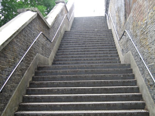
| 01:13, 25 February 2019 | Steps.jpg (file) |  |
91 KB | try to fix image rotation | 2 |
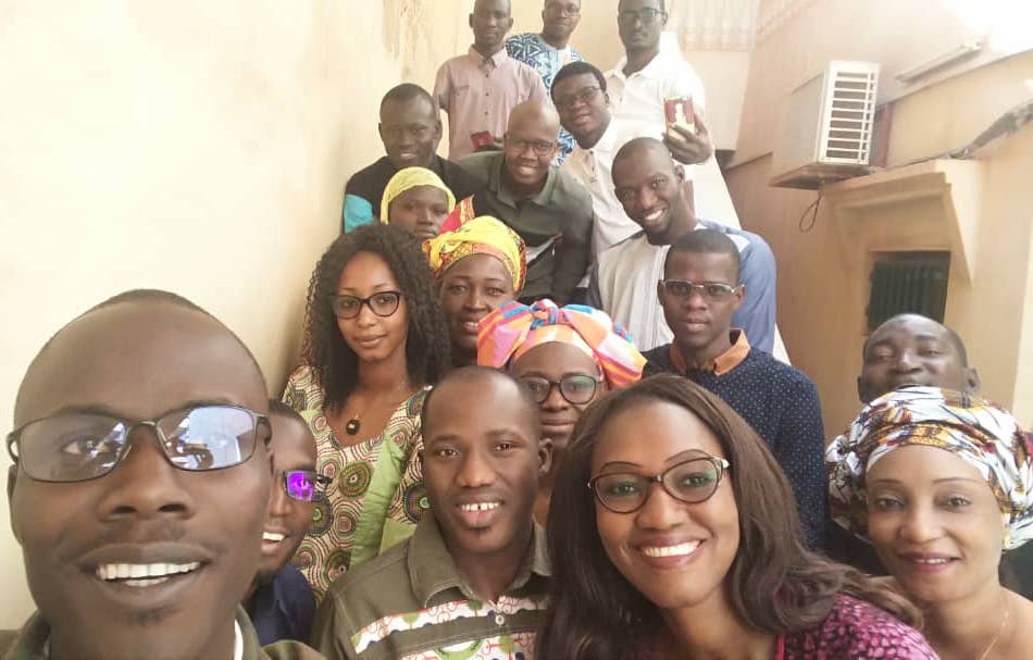
| 01:06, 19 February 2019 | Mali mappers.jpg (file) |  |
60 KB | Students in Mali https://twitter.com/OSM_Mali/status/1096443485111111681 | 1 |