Proposal:Milestones
|
The proposal Milestones was built without a vote and the tagging is widely established based on this proposal. The Feature Page for the proposal Milestones is located at Tag:highway=milestone. |
| Milestones | |
|---|---|
| Proposal status: | Proposals with undefined or invalid status (inactive) |
| Proposed by: | Ivansanchez |
| Tagging: | highway=milestone |
| Applies to: | node |
| Definition: | A stone or metal marker on the side of a road denoting the reference and distance travelled. |
| Statistics: |
|
| Draft started: | |
| Proposed on: | 2008-05-30 |
Proposed new tag: highway=milestone
Rationale
From http://en.wikipedia.org/wiki/Milestone :
- A milestone or kilometre sign is one of a series of numbered markers placed along a road or boundary at regular intervals, typically at the side of the road or in a median. Milestones are constructed both to reassure the traveller that the proper path is being followed and to indicate distance travelled, or the remaining distance to the desired destination. They are alternatively known as a mile marker, milepost, or mile post (sometimes abbreviated MP), notably in the United States.
Modern milestones are usually metal, and depending on the country may include the reference number of the road and the distance from the start of the road.
Applies to
Milestones, or similar signs, on the side of any way used for transportation.
Usage
For road milestones:
<tag k="highway" v="milestone"/>
For railroad milestones:
<tag k="railway" v="milestone"/>
For milestones including a reference number:
<tag k="highway" v="milestone"/>
<tag k="ref" v="M-509"/>
For milestones including the distance from the start of the road (AKA point kilométrique):
<tag k="highway" v="milestone"/>
<tag k="pk" v="35 km"/>
In any case, the milestone node must be part of the way it is referred to. (e.g. a highway milestone must be part of the way that is the road that the milestone refers to).
For double-carriage ways, either mark the milestone for each carriage (if available), or use extrapolation.
For single-carriage ways with two milestones (one at each side), use interpolation.
Tag Values
highway=milestone or railway=milestone are mandatory.
ref=* is optional, only to be used if the milestone actually has a reference number written on it.
pk=* is optional, only to be used if the milestone actually has a number being the distance from the beginning of the road/rail. The use of a distance unit (as km for kilometers or mi for miles, separated from the value by a space) is mandatory. Decimal numbers specified with points are allowed, e.g. <tag k="pk" v="35.0 km"/>, <tag k="pk" v="15.5 mi"/>
- requiring the unit goes against the general osm practice where metric is the assumed default, so free to omit units in that case. space should not be required, too --Richlv (talk) 02:29, 29 October 2013 (UTC)
Already used
[ dead link ]
Rendering
Only on highest zoom levels, in a similar way as motorway_junctions.
Comments
Please use the discussion page for comments.
Example of signs

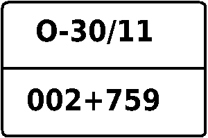
Brazil federal highway BR-101, pk=236

Voting
Voting has not started. Please comment the proposal.