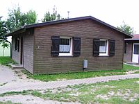
Tag:house=bungalow
Jump to navigation
Jump to search
 |
| Description |
|---|
| Simple single-storey house, sometimes with a second storey built into a sloped roof. |
| Group: buildings |
| Used on these elements |
| Requires |
| See also |
| Status: in use |
| Tools for this tag |
A simple single-storey house, sometimes with a second storey built into the roof.
See ![]() bungalow.
bungalow.
Most mappers prefer to map this a building=bungalow, which is used 1000 times more often as of December 2020. See this OSM tag history as a curve chart which shows the development of the usage numbers of the different tags in comparison.
Tagging levels
A bungalow has one above ground level tagged as building:levels=1.
If the bungalow also has a level in the roof, then roof:levels=1 can be used.
Examples
| Image | Description |
|---|---|

|
|

|
A coastal bungalow in Ireland. |

|
A bungalow in the United Kingdom. |