Tag:industrial=gas_storage
| Description |
|---|
| Underground natural gas storage |
| Group: industrial |
| Used on these elements |
| Requires |
| Useful combination |
|
| Status: in use |
| Tools for this tag |
|
Natural gas storage: Sub-surface facilities for storing natural gas for use at a later time. The facilities are usually hollowed-out salt domes, geological reservoirs (depleted oil or gas fields) or water-bearing sands (called aquifers) topped by an impermeable cap rock.
For above-ground facilities, use man_made=storage_tank + content=gas
How to map
Draw an area ![]() around the grounds of the gas processing plant or place a node
around the grounds of the gas processing plant or place a node ![]() at the centre of the grounds.
at the centre of the grounds.
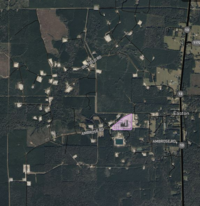
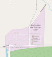
Mapping as an area is preferred, however, please do only tag the central area used for operations, don't create an area which includes every well! See the image in the infobox: Only the area marked purple should be tagged as industrial=gas_storage, even though the wells cover a much larger area.
Add
- landuse=industrial
- industrial=gas_storage
- gas_storage=depleted_field or gas_storage=salt_dome or gas_storage=aquifer
- name=*
- operator=*
- addr=*
Tagging the capacity
There are various metrics used within the industry.
- capacity:total=* maximum volume of natural gas that can be stored at the storage facility.
- capacity:base=* volume of gas that is intended as permanent inventory in a storage reservoir to maintain adequate pressure and deliverability rates throughout the withdrawal season.
- capacity:working=* total gas storage capacity minus the base gas.
- capacity:delivery=* measure of the amount of gas that can be delivered (withdrawn) from a storage facility on a daily basis.
Make sure to add the unit to avoid confusion.
Example
| Photo | Tagging | OSM Carto | Note |
|---|---|---|---|
|
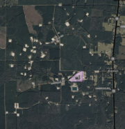
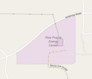
industrial=gas_storage gas_storage=salt_dome name=Pine Prairie Energy Center operator=Pine Prairie Energy Center, LLC capacity:base=18125040 Mcf capacity:delivery=3200000 Mcf capacity:total=71800000 Mcf capacity:working=56000000 Mcf start_date=2008 |
|
Example of a salt dome gas storage in Louisiana. Only tag the 'main operation area'. |
|
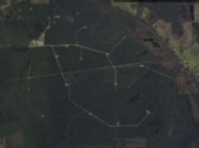
industrial=gas_storage gas_storage=depleted_field name=Washington Gas Storage Field operator=Transcontinental Gas Pipe Line Company, LLC capacity:base=45000098 Mcf capacity:delivery=790000 Mcf capacity:total=120000098 Mcf capacity:working=75000000 Mcf |
|
Example of a depleted field gas storage in Louisiana. Only tag the 'main operation area'. |
