uMap/Guide/Configure shape interaction (labels…)

Map level Default interaction options
Also for individual shapes
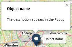
Information about a shape (marker, line, polygon) can be shown in various ways: labels, pop-ups, sidebar,.... This article is about the configuration of this information: what will be shown, how is it displayed and when is it displayed.

Configuration options are available on Map level (the default), on Layer level and for individual shapes. See structure.
Popup

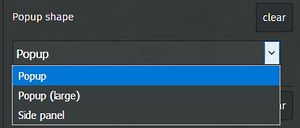
Popup shape
The dropdown has 3 options
- Popup: Default. Shape grows vertically for more text.
- Popup (Large): Wider than the default.
- Side panel: Suitable for much (formatted) text.
A scroll bar appears automagically if too much text must be shown.
All options may show a navigation icon ().
See Popup footer in the User Interface option of the Map.

Popup content style
The dropdown has 4 options. Effect shown in the picture below


Popup content template
The template to be used by the Popup can be specified on Map level and Layer level.
Variables are enclosed by braces ({name}). This field allows also standard text and formatted text.
Examples
Following code will produce a "JOSM" link to edit the clicked OSM object:
- [[http://127.0.0.1:8111/load_object?new_layer=true&objects={id}|Edit in JOSM]]
Label

Display label


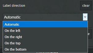
Label direction
Option Automatic enables a dynamic text positioning: the system may choose the best readable position of the label.
Labels are clickable
Click of a shape show the Popup. Click of the associated Label does nothing. Configuration of On here will show the Popup if the label is clicked.
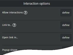
Allow interactions

Configuration of a polygon has extra option Allow interactions, values Off and On (default).
Help shows: If false, the polygon will act as a part of the underlying map..
Effect is that click a polygon no longer activates a link, shows no popup, hover shows no lable AND it is no longer possible to select the polygon graphically. (Use browse information).
Link a website
Configuration of a polygon has extra option to specify a link. Configuration of a link overrules the Popup configuration
Link to ...
Enter a full URL.

Open Link in
- new window
- iframe: In the current window. The Back button of the browser can be used to get back to the Map.
- parent window