uMap/Guide/Edit properties of layer objects
This article shows how properties of objects in a layer can be modified by means of a table editor. This is an efficient way for quick modification of all objects of a layer. The table editor allows also addition of new, self-defined properties.
Recipe:

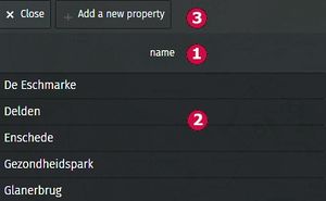
This shows a table. The columns are the properties that can be changed. Only simple text properties can be modified by the table editor.
- The default state shows a table with 1 column: name.
- Each object (marker, poyline, polygon) in the layer is shown in a row. Rows are sorted alphabetically by name. Click a cell to change the value. An updated sort is shown after saving the map and refresh browser content.
- Top left shows Add a new property to add properties for all objects of the layer.

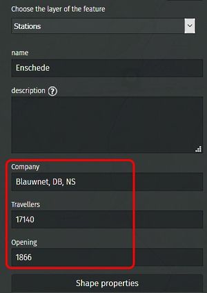
The size of the table grows by adding properties. New properties are added alphabetically. The example was created by adding Travellers, subsequently Company and lastly Opening.

Hover with the mouse over a property name reveals buttons.
- Left to remove a property
Delete this property on all the features - Right to change the name of the property
Rename this property on all the features

New properties will also be shown in the panel to modify an object. No need for the table editor to modify the new properties.