User:Stanton
| Babel user information | ||||||
|---|---|---|---|---|---|---|
| ||||||
| Users by language |

Mappers don't get lost - they just discover new areas to map.
Activities
- Mapping Milan
- on-the-ground mapping, mostly in the northwestern zones
- Public transport in Milan (in Italian)
- Piste mapping, mainly St. Anton am Arlberg
- Mapping any other place I go to
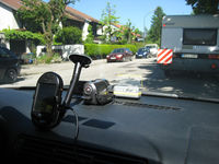
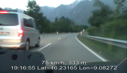
- Video mapping
- SRT module for Gpsbabel (hoping for the JOSM plugin to be ready soon, though)
- Navit development (currently inactive)
- Proposals:
- OSM Transport Map - a map of public transport routes, using a variation of the familiar Mapnik layout as a backdrop (currently working on PoC)
Equipment
Devices
- Mitac Mio 168RS
- Neo Freerunner, running Android (fixed the GPS timestamp bug, now it's usable for mapping)
- Geeksphone One (for recording tracks and for taking pictures when I don't have the Ixus with me)
- Canon Ixus 70 for still images
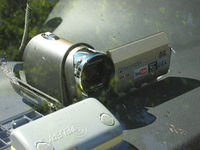
- Panasonic SDR-S26 for video
As far as I'm concerned, there is no real need for a dedicated GPS unit. Get a PDA or smart phone with a GPS receiver and the software of your choice (you might also be able to hack a sat-nav device) - this will give you the most flexibility, though that depends on the software. Storage space is not really an issue with these - the Mio and both my smartphones each have a 2 GB SD card (for the Mio this is the upper limit) and even after months of mapping without deleting a single GPS track, there was still plenty of space left on all of them.
Only caveat: quality of the built-in GPS can differ greatly. The Freerunner can take a long while to get a signal and may return erratic readings for a while after - but once it has stabilized, it has decent precision. The Mio (in my opinion) is slightly faster to get a signal and has good precision, only slightly below that of the Freerunner. The GeeksPhone, especially with a data connection and GPS assistance data available, gets a fix almost instantly but precision is rather shoddy - it is acceptable in open areas but degrades noticeably in the vicinity of obstacles.
Software
Tracking
- Navit (on Mio 168RS)
- NaviPOWM (on Mio 168RS, substitute for Navit)
- OSMtracker for Android (on Freerunner and Geeksphone)
- GPS Status for Android (gratis but non-free - I use it to display GPS time and to download GPS assistance data with my Geeksphone)
Altogether, I have not found the perfect tracking software yet. My dream would be:
- vector map display (for quick comparisons of what is mapped and what is not, basically a navigation system, except it does not need routing capabilities)
- ability to start/stop tracking (Navit doesn't allow it, the other two do)
- ability to record waypoints (OSMtracker for Android does an excellent job at that, lacking in the other two)
- immediate writing to file - no in-memory caching of GPS output (NaviPOWM does a good job at that, Navit mostly does, OSMtracker used to be really bad at that but has improved - but once your device has crashed after an hour of mapping, you'll know how badly you need this)
- GPX output format (OK for Navit and older OSMtracker versions, later OSMtracker versions require an extra step to export tracks, manual conversion needed for NaviPOWM)
If I have some time on my hands and get Navit for WinCE to compile on Cygwin, I might hack up a version of Navit which finally makes my tracking dreams come true. I have capitulated and installed Ubuntu on my laptop and Navit compiles fine, right now I am adding tracking capabilities to it.
Analysis
- JOSM
- GPSBabel for any conversion (NMEA to GPX; video subtitles from tracks of either kind)
- VLC for video mapping (waiting for the JOSM plugin)