Featured images/Jan-Mar 2010
Jump to navigation
Jump to search


These are featured images, which have been identified as the best examples of OpenStreetMap mapping, or as useful illustrations of the OpenStreetMap project.
If you know another image of similar quality, you can nominate it on Featured image proposals.
| ← from January to March 2009 | ← from October to December 2009 | from April to June 2010 → | from January to March 2011 → |
Gallery of featured images, from January to March 2010
2010, week 1
2010, week 2
2010, week 3
2010, week 4
2010, week 5
2010, week 6

2010, week 7
2010, week 8
2010, week 9
2010, week 10
2010, week 11
2010, week 12
2010, week 13
Details and captions
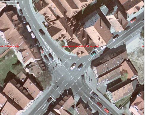
Week 1 (from Monday 4 January 2010 to Sunday 10 January 2010) [Edit]

- English : 15 cm high res aerial imagery with 0.5 m positional accuracy, of Lauf in Germany (map) donated by the local municipality. See DE:Luftbilder aus Lauf.
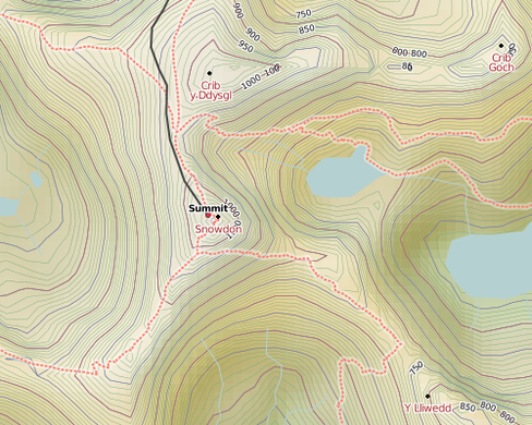
Week 2 (from Monday 11 January 2010 to Sunday 17 January 2010) [Edit]

- English : The cycle map now has hill-shading
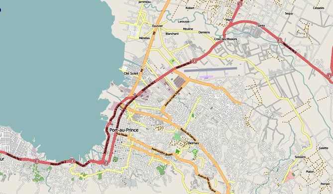
Week 3 (from Monday 18 January 2010 to Sunday 24 January 2010) [Edit]

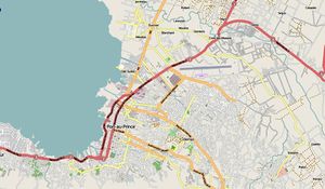
- English : Earthquake Response WikiProject Haiti.
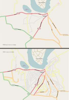
Week 4 (from Monday 25 January 2010 to Sunday 31 January 2010) [Edit]

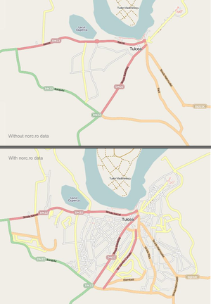
- English : Based on the second batch of tracks and panoramic images from norc.ro, the Romanian contributors organized Virtual Mapping Party Romania 2009 (still in progress). In the image you can see the progress in Tulcea after a few days work.
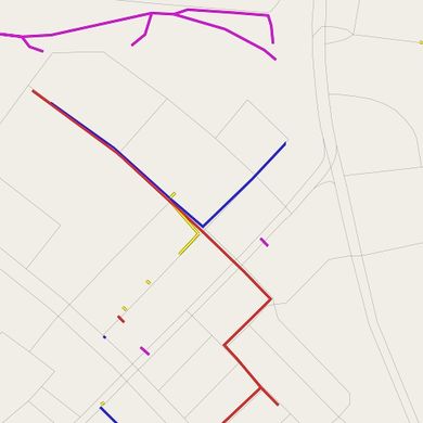
Week 5 (from Monday 1 February 2010 to Sunday 7 February 2010) [Edit]

- English : Nothing left to map? Try underground pipelines, deduced from manholes, wall markers and open pit construction work.
Week 6 (from Monday 8 February 2010 to Sunday 14 February 2010) [Edit]

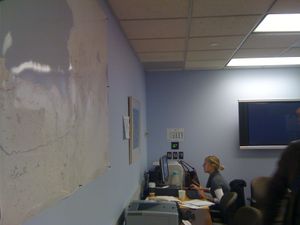
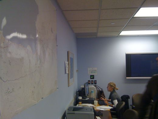
- English : Large printouts of OpenStreetMap on the walls of the World Banks Situation Room for the Haiti Earthquake response.[1] These maps are serving as the basic infrastructure information for response and rebuilding activities.
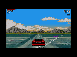
Week 7 (from Monday 15 February 2010 to Sunday 21 February 2010) [Edit]

- English : A JOSM plugin lets you record GPS traces by driving an early 90s sports car in WMS imagery land.
Week 8 (from Monday 22 February 2010 to Sunday 28 February 2010) [Edit]

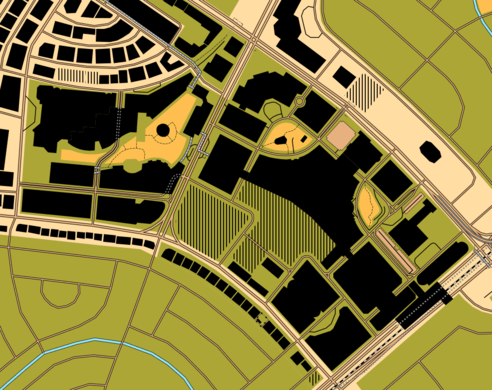
- English : OpenOrienteeringMap rendering of Ayala Center
Week 9 (from Monday 1 March 2010 to Sunday 7 March 2010) [Edit]

- English : mapgen.pl is a simple renderer written in Perl that can be used to create maps in SVG, PNG and PDF format.
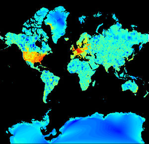
Week 10 (from Monday 8 March 2010 to Sunday 14 March 2010) [Edit]

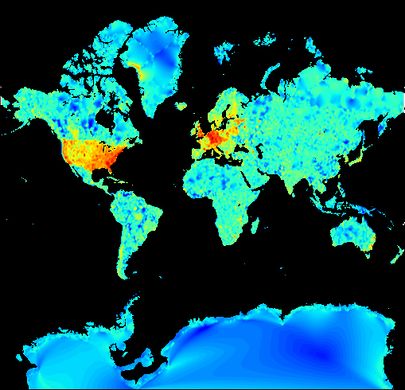
- English : Map detail throughout the world (red = more complex maps)
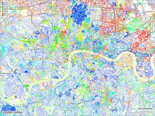
Week 11 (from Monday 15 March 2010 to Sunday 21 March 2010) [Edit]

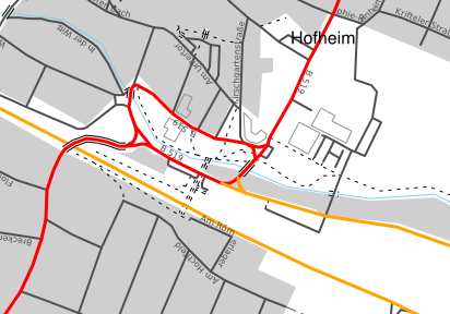
- English : Map showing parts of London that have been updated in the last year (from OSM Mapper)
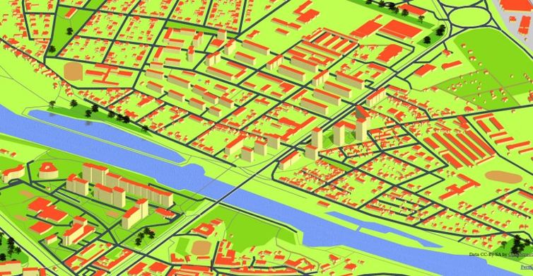
Week 12 (from Monday 22 March 2010 to Sunday 28 March 2010) [Edit]

- English : Isometric 3D Map of Czech Republic – screenshot of Kralupy nad Vltavou (see the same place by OSM Carto).
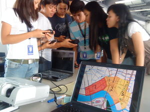
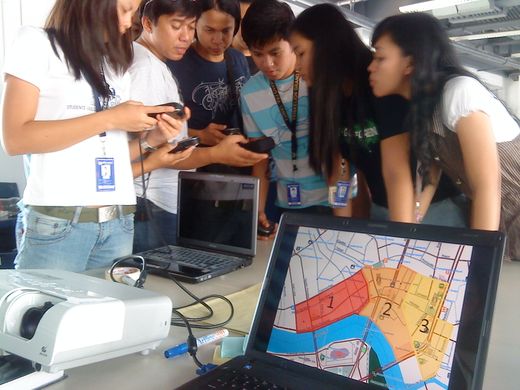
Week 13 (from Monday 29 March 2010 to Sunday 4 April 2010) [Edit]

- English : OpenStreetMap Workshop at FEATI University in Manila, Philippines. An OSMer is teaching geodetic engineering students how to operate the GPS units and the cake slices for the field mapping is in the foreground.