WikiProject Haiti/Earthquake map resources
- WikiProject revisions: Revisions to front page of WikiProject completed = everything consolidated into a single table or moved to different pages. --Ceyockey 16:34, 30 October 2011 (UTC)
- WikiProject revisions: Revisions are underway (slowly) to revise the WikiProject from crisis-response to mapping-as-usual mode. --Ceyockey 16:34, 30 October 2011 (UTC)
- On-the-ground: Fourth deploy write-up - 2010-09-08
- On-the-ground: HOT Mission 3 complete [1] - 2010-06-28
- Hot website launched with blog category 'Haiti' - 2010-05-??
 Search & rescue teams use OSM garmin data in Haiti |
 haiti.openstreetmap.nl shows our tagging of damaged buildings and camps |
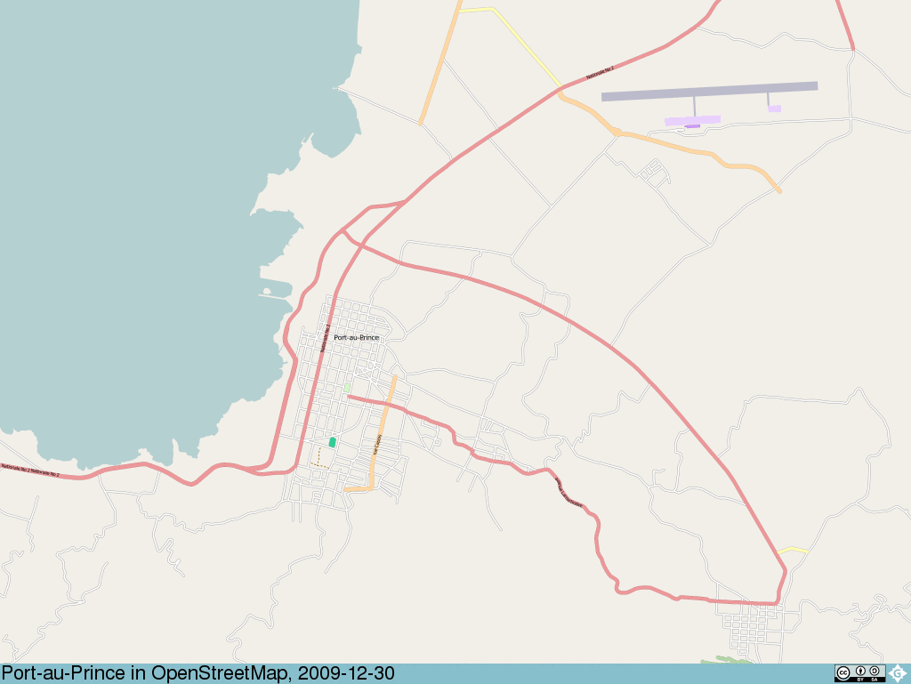
OpenStreetMap has fantastic map coverage of the worst hit cities of Port-Au-Prince and Carrefour, and the neighbouring countryside thanks to the Haiti earthquake response mapping project. Using the free data, OpenStreetMap developers and others around the web have created a set of earthquake map resources in addition to our basic online map.


Uses of OpenStreetMap data by crisis responders
People on-the-ground in Haiti (and related organisations) are using (or used) our maps :
- Thanks message from Colombian Mission in Haiti. (2010-02-10)
- "This is where OpenStreetMap is a godsend" in How to Deploy Long-Distance WiFi in Haiti (2010-02-10) by Inveneo, an NGO whose mission is connecting those who need it most, on how they were able to bring high-speed Internet access - critical communication capacity - to eleven relief agency locations with minimal equipment and installation time.
- On 13/01/2010 ITHACA and WFP published their damage assessment of Port-au-Prince using OSM road data.
- Special session on mapping the disaster during the Haiti Emergency at the GI4DM 2010 Conference See subpage GI4DM2010
- Special session on mapping the disaster during the Haiti Emergency at the GI4DM 2010 Conference
- OpenStreetMap renderings on Garmin GPS receivers by Colombian search and rescue operators - "Many thanks Freddy. Very timely maps of Haiti that sent me to the Garmin. I went down and installed the GPS in our search and rescue teams. OSM undoubtedly be a great help to our response teams, especially those going to move to rural areas." via ouɐɯnH (2010-01-15)
- Fairfax County Urban Search & Rescue Team Using Garmin downloads. Message of thanks.
- Unitar / UNOSAT use OpenStreetMap street data in their damage report
- "I'm told OSM is on the big monitors at SOUTHCOM." unofficial report can anyone confirm?
- On 18/91/2010 ITHACA and WFP released maps for Gressier, Jacmel and Leogane using "roads, places, natural elements and assessments" from OpenStreetMap.
- NOAA's Environmental Response Management Application ERMA
- The Food and Agriculture Organization (FAO) (http://www.fao.org/emergencies/country_information/list/latinamerica/haiti_earthquake/en/) uses OSM data in its interactive tool, the GIEWS Workstation (http://fenix.fao.org:8080/fenix-web/org.fao.fenix.web.modules.haiti.Haiti/Haiti.html?country=108)
- The Office for the Coordination of Humanitarian Affairs (UNOCHA) in the Haiti Earthquake 2010 page of its OneResponse web portal (http://oneresponse.info/Disasters/Haiti/Pages/default.aspx) lists the OSM Haiti Project WIki as a resource (Social Media Links category) for the responding community. "Basically it's the best source of transportation information that we have for Haiti" says Catherine from OCHA. video blog
- Secretary of State Hillary Clinton, Remarks on Internet Freedom "The technology community has set up interactive maps to help us identify needs and target resources"
- Kjeld Jensen, Red Cross (IFRC): "Hello guys, I just wanted to let you know that your work on improving the Haiti maps is really appreciated here. A few days ago I installed a version on my Garmin Oregon GPS and the result is impressive. It has already saved me and my driver from getting lost twice, and the alternative would have been long delays. In the coming days I will try to update our Red Cross relief GPS receivers with your map.
Again thanks a lot guys, we are really running fast here in Haiti trying to help the people here, and your work makes it easier. Keep up the good work!"
- Jihad Abdalla from UNICEF (http://groups.google.com/group/crisismappers/msg/54a9be63091dbab9): "Many thanks to all crisismappers for great contributions, you made my life much easier, since I'm one man show here...Million thanks."
Other earthquake related websites using our maps :
- Atlas compiled by the Center for Interdisciplinary Geospatial Information Technologies at Delta State University used street data from openstreetmap.org
- flickr.com - the massive photo sharing site switched to using OpenStreetMap in the area for geolocated photo displays.
- http://haiti.ushahidi.com/ - plotting "reports" from the ground in on a map and over time, with easy SMS and other input channels.
- MapAction (http://mapaction.org) use OpenStreetMap for some of the Haiti resources e.g.
- Information Management & Mine Action Programs (iMMAP) (http://www.immap.org/index.php) use OpenStreetMap data in some of the products of its Haiti response
- World bank printed a giant poster for their SitRoom
- OpenStreetMap data is being shipped on drives to the government of Haiti
There are many alternative renderings/map views too. (Often sites set up by OpenStreetMap people)
Mobile apps
There are plenty of mobile apps on various platforms which will display OpenStreetMap maps of Haiti. Notably useful for earthquake response:
- OffMaps - The most widely used of the OSM iPhone apps. This allows you to download Haiti maps while you have a connection, for use later offline.
- GaiaGPS [2] (App store) - a free version of the GaiaGPS app for the iPhone which gives users access to the disaster-specific imagery and renderings of Haiti.
- GPSMid - A J2ME app. Also listed below. Special customisations to help users work with the Haiti data.
But check out Software/Mobilephones to find an app for your platform. Think about how you will work with map data without a connection. "Stores map-data off-board" is probably a useful feature. Test out the app before you need it, and be aware of your battery limitations.
Extracts
| Platform | Description | Update Frequency | Provider | Link(s) |
|---|---|---|---|---|
| multiple downloads | Frequently updated downloads of haiti extracts in multiple formats: .osm, Shapefile, Garmin img | frequently | Geofabrik | http://labs.geofabrik.de/haiti/ |
| NaviPOWM | maps for NaviPOWM 0.2.4 | Last Updated May 27th | OSM User:StefanDausR | http://dev.openstreetmap.de/navipowmmaps/navipowm/ |
| Garmin | Maps and instructions for uploading to GPS devices | unspecified | CrisisCommons | http://haiti.crisiscommons.org/gps/ |
| GpsMid (for J2ME-enabled mobile devices) |
display collapses/damages, camp_sites, hospitals routing respects impassable=yes send SMS with lat/lon/comment |
N/A | GpsMid SourceForge Project | http://gpsmid.sourceforge.net/prebuild/ |
Printable and Static Maps
| Dimensions | Format | Description | Update Frequency | Provider | Link(s) |
|---|---|---|---|---|---|
| Large: ~15k x 10k pixels | PNG | Last update 1/26 | Geofabrik | http://labs.geofabrik.de/haiti/large-png-maps | |
| Largish: 6k x 3k pixels | PNG | Last update 1/18 | User:Harry Wood | http://harrywood.co.uk/maps/haiti/hi-res/ | |
| unspecified | PNG, SVGZ, PDF | Maps with street indexes Create map > Area selection mode : bounding box or enter the name of the city needs a valid relation:administrative, level 8 |
daily | MapOSMatic | http://www.maposmatic.org/ |
| unspecified | map of Port-au-Prince. To get a more detailed print or of another area it's easy to pan around the map and make a new one.</ref> useful for photocopying |
latest | Walking Papers | http://walking-papers.org |
Alternate Haiti Renders and Views
| Description | Update Frequency | Provider | Link(s) |
|---|---|---|---|
| Mapnik tile mirror specifically for Haiti. Custom rendering style showing damage + Imagery transparency. Also roads superimposed over sat pics. |
minutely | User:Ldp | haiti.openstreetmap.nl (down) transparent (down) |
| ArcGIS Tile Service only for ArcGIS 9.3 |
30 minutes | Open Solutions Group User:Springmeyer |
link not active for browser access: http://geocache.opensgi.net/haiti/arcgis/services |
| Google Earth OSM layer | 30 minutes | Google User:Springmeyer |
KML file download: http://geocache.opensgi.net/haiti/1.0.0/haiti/overlay.kml |
| WMS of OSM in WGS84 using Mapnik Custom rendering style showing damage and camps (more soon) |
30 Minutes | User:Springmeyer | example request (down) |
| Hillshading Map Layers: Mapnik, OpenCycleMap, Osmarender, Hike&Bike style Includes Ldp's Damage layer and lit=* overlay |
unspecified | User:Colin_Marquardt | http://hikebikemap.de/?zoom=13&lat=18.55957&lon=-72.3416&layers=0000BTFFF |
| Transparent Map Google, Yahoo and OSM data with variable layer transparency |
unspecified | unspecified | http://sautter.com/map/?zoom=13&lat=18.55957&lon=-72.34126&layers=00B000TFFFFF |
| POI Map Select the points-of-interest to display |
unspecified | User:Plenz | lenz-online.de (does not show POIs) |
| Shows geotagged Flickr photos on OSM map (more than 5000 photos as of 19 Jan 2010) |
unspecified | MapPIN'on OSM | mappin.hp2.jp (down) See https://lists.openstreetmap.org/pipermail/talk/2010-January/047410.html for advanced uses |
| PhtoSM Shows geotagged Flickr photos on OSM map (no photos as of 17 Jan 2010) |
unspecified | unspecified | haiti.broadbox.de (down) |
| JRC Map Viewer with Haiti overlays (e.g. Points of Interest Port-au-Prince) |
unspecified | European Union | http://dma.jrc.it/map/ |
| OpenStreetBrowser | unspecified | User:Skunk | haiti.openstreetbrowser.org (down) alternate (down) |
| Google Earth OSM overlay | unspecified | MGMaps.com | OpenStreetMap - mapnik overlay: http://www.mediafire.com/file/zmyz20wzyat/maps_osm_m.kml... Simple instructions is just hide all other layers in google earth and just show this one. |
| GeoPDF of Haiti with OpenStreetMap + NASA ASTER + GeoEye imagery | unknown | unknown | Mississippi Delta State Maps (down) |
| Haiti Crisis Map | Telascience Hypercube map (down) (please be aware of the personal and corporate contributors which can be viewed by the "contributors" tab)
| ||
| OpenOrienteeringMap | unspecified (last update at time of writing, Jan 2010) | User:Ollie | View encompassing most of Haiti: oobrien.com/oom/uk.php (old) oomap.co.uk/global.php (new); zoom to see details. |
| Waterways network | hourly | User:Jocelyn / OSM France / CRANS | Tributaries relations (down) (based on this convention), with related map extract views (down) |
Routing and Other Services
- Open Route Service Haiti - Search and Routing - Updated hourly - http://openls.geog.uni-heidelberg.de/osm-haiti/
- from GIScience @ Uni Heidelberg
- now also supporting routing and geocoding in Dominican Republic
- now also supporting the UNOSAT data -> Please turn on the layer in the layerswitcher. A legend is on the left side near the "Avoid Areas" feature ... Click on "UNOSAT Layer Legend"
- now also supporting the http://haiti.openstreetmap.nl/ - Minutely updating mapnik tile mirror specifically for Haiti
- now also supporting OSM Layers showing impassable and barriers on streets from http://zvenzzon.mine.nu:81/map.html
- now also supporting GeoEye TileCache -> Please use the layerswitcher to change the map
- Port-au-Prince on the mapJumper access to more than 50 maps. Fill the list on the wiki : MapJumper. Ddrag the mJLite bookmarklet to your toolbar find it here and jump from map to map.
- https://www.geoint-online.net/community/HaitiCrisisResponse/DataServices/default.aspx - In support of the crisis in Haiti, the National Geospatial-Intelligence Agency is providing a website open to public.
- nominatim.openstreetmap.org/haiti - Search and Geocoding service specially for Haiti.
- updated hourly
- api documentation as: https://wiki.openstreetmap.org/wiki/nominatim (substitute https://nominatim.openstreetmap.org/haiti for https://nominatim.openstreetmap.org/
- http://projekte.eiops.de/osm-matrix/ TraceMatrix. A Tool to coordinate the tracework of the aerial images from GeoEye or DigitalGlobe. Zoom in and select what is already mapped in Openstreetmap.
- Accessing OpenStreetMap data within ArcGIS - OpenStreetMap data available with ArcGIS online, or via WMS services set up by ESRI.
- OSM-Emergencies (a web site available at ose.petschge.de) - Click on the map, and enter your message, for the World to see. (In this experimental phase, it can be used for any need that seems relevant. Test it with Haiti Symbolic Project: click on the purple line around the coast of Haiti.) (could automatically forward to Ushahidi in the near future.)
- Simple geocoding applications: http://dbsgeo.com/latlon/ http://gll.petschge.de/
- Animation of editing in PaP: http://labs.geofabrik.de/haiti/old-png-images-documenting-mapping-effort/port-au-prince-animation.gif
POI-Maps
Created by Lübeck. Send him an email if you need more special purpose maps.
Note: you can choose the base layer in these maps. Click on the + symbol in the upper right corner. In particular, the base layer haiti-best-wms-image is interesting because for any area in Haiti it shows the best available aerial or satellite imagery.
I did not update this maps ! --Lübeck 19:59, 14 March 2011 (UTC)
| Description | selection tags | Port-au-Prince | Haiti | Comment |
|---|---|---|---|---|
| Cemeteries | landuse=cemetery amenity=grave_yard |
Map | Map | |
| Education | amenity=school amenity=college amenity=university |
Map | Map | |
| Health Facilities | paho:id=* | Map | Map | Special purpose map for the health facilities imported from the PAHO master list. Different icons visualize different types of health facilities, see the key on the map and WikiProject_Haiti/Status/Hospitals#Rendering the rendering rules |
| Media | amenity=studio tower:type=communication |
Map | Map | Special purpose map for radio and tv studios imported from a master list maintained and provided by CartOMG. |
| Police | amenity=police | Map | Map |