File:Flag of Norway.svg
Jump to navigation
Jump to search

Size of this PNG preview of this SVG file: 512 × 372 pixels. Other resolutions: 320 × 233 pixels | 640 × 465 pixels | 1,024 × 744 pixels | 1,280 × 930 pixels.
Original file (SVG file, nominally 512 × 372 pixels, file size: 319 bytes)
This file and its description are from Wikimedia Commons.
Summary
| Description |
Беларуская: Сцяг Нарвегіі
Norsk bokmål: Norges flagg. Fargene tilsvarer omtrentlig Pantone 200 C (høyrødt) og 281 C (mørkeblått).
Norsk nynorsk: Det norske flagget
Davvisámegiella: Norgga leavga
Brezhoneg: Banniel Norvegia
Čeština: Vlajka Norska
Cymraeg: Baner Norwy
Dansk: Norges flag
Deutsch: Flagge Norwegens
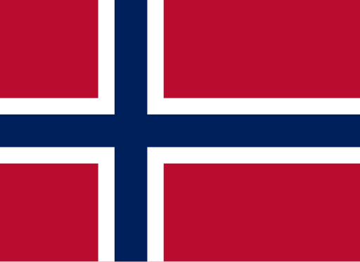
English: Flag of Norway. The colors approximately correspond to Pantone 200 C (deep red) and 281 C (dark blue).
Esperanto: Flago de Norvegio
Español: Bandera de Noruega
Føroyskt: Flagg Noregs
Français : Drapeau de la Norvège
Hrvatski: Zastava Norveške
Íslenska: Norski fáninn
Italiano: Bandiera della Norvegia
한국어: 노르웨이의 국기
Latina: Vexillum Norvegiae
Nederlands: Vlag van Noorwegen
Norrǿna: Þjóðfáni Noregs
Polski: Flaga Norwegii
Suomi: Norjan lippu
Svenska: Norges flagga
Tiếng Việt: Quốc kỳ Na Uy
Volapük: Stän Norgäna
العربية: علم النرويج |
||||||||
| Date | |||||||||
| Source | Own work | ||||||||
| Author | Gutten på Hemsen | ||||||||
| Flag colors |
| ||||||||
| SVG development | This flag was created with a text editor. | ||||||||
| Source code | SVG code<?xml version="1.0" encoding="UTF-8"?>
<svg xmlns="http://www.w3.org/2000/svg" version="1.1" viewBox="0 0 22 16">
<title>Flag of Norway</title>
<rect width="22" height="16" fill="#ba0c2f"/>
<path d="M0,8h22M8,0v16" stroke="#fff" stroke-width="4"/>
<path d="M0,8h22M8,0v16" stroke="#00205b" stroke-width="2"/>
</svg>
|

Licensing
| This image of simple geometry is ineligible for copyright and therefore in the public domain, because it consists entirely of information that is common property and contains no original authorship. |  |

|
This image shows a flag, a coat of arms, a seal or some other official insignia. The use of such symbols is restricted in many countries. These restrictions are independent of the copyright status. |
Dependent images
File history
Click on a date/time to view the file as it appeared at that time.
| Date/Time | Thumbnail | Dimensions | User | Comment | |
|---|---|---|---|---|---|
| current | 19:18, 20 February 2023 | | 512 × 372 (319 bytes) | wikimediacommons>Mdaniels5757 | per edit request // Editing SVG source code using c:User:Rillke/SVGedit.js |
File usage
More than 100 pages use this file. The following list shows the first 100 pages that use this file only. A full list is available.
- 3D Demo Areas
- Contributors
- Cs:Jednoduché 3D budovy
- Cs:Tag:route=train
- Default speed limits
- Et:Key:highway
- Eurasia
- Europe
- Hispanic community
- International highway classification equivalence
- Key:isced:level
- Key:maxbogieweight
- Key:payment:*
- Ko:Tag:highway=motorway
- Ko:Tag:highway=trunk
- List of OSM centric Telegram accounts
- List of territory based projects
- Matrix
- No:OpenStreetMap in the media
- Norway
- OSM tags for routing/Maxspeed
- OpenStreetMap for Government
- OpenStreetMap in the media/2009
- OpenStreetMap in the media/2013
- Past events 2019
- Pl:Schemat tagowania budynków 3D
- Press Contacts
- Previous Missing Maps parties
- Pt:Construções 3D simples
- Pt:Highway:International equivalence
- Simple 3D Buildings/Demo areas
- Sq:Key:highway
- Tag:boundary=administrative
- Tag:highway=motorway
- Tag:highway=primary
- Tag:highway=trunk
- Tag:motor vehicle=destination
- Tag:route=train
- WikiProject Metro systems
- Zh-hant:Tag:highway=motorway
- Zh-hant:Tag:highway=trunk
- User:Anderfo
- User:Dhrasmus
- User:Entur AS - Fredrik Edler
- User:Espenso
- User:FredrikEdler
- User:FredrikLindseth
- User:FredrikLindseth/Norwegian Mapping Projects
- User:Gnonthgol
- User:Gorm
- User:Hans Wurst
- User:Hauke-stieler
- User:Hugoren Martinako
- User:Ivansanchez/sandbox
- User:Kilt
- User:Messy Unicorn
- User:Olejorgenb
- User:Reitstoen
- User:Rumander
- User:SAJensen
- User:Skela
- User:Skippern
- User:Skippern/INT-1
- User:Skippern/World
- User:Sssandum
- User:Tractor
- User:Tyrfing
- User:Vibrog
- Template:Countries of Europe
- Template:ES:Regiones que hablan español
- Template:Highway:International equivalence
- Template:Spanish-speaking regions
- Template:Table:INT-1:C
- Template:Table:INT-1:D
- Template:Table:INT-1:E
- Template:Table:INT-1:F
- Template:Table:INT-1:N
- Template:Table:INT-1:P
- Template:Table:INT-1:Q
- Template:Table:INT-1:U
- Template:User Norway
- Template:User hails from europe
- Template:User hails from europe/doc
- DE:Simple 3D Buildings
- FR:3D Demo Areas
- FR:Contacts pour la presse
- FR:Highway:International equivalence
- FR:Key:admin level
- ES:3D Demo Areas
- ES:Comunidad hispana
- ES:Key:isced:level
- ES:Tag:route=train
- IT:Contributors
- IT:Key:highway
- RU:Key:highway
- RU:Key:maxbogieweight
- RU:Simple 3D Buildings/Demo areas
- RU:Простые 3D здания
- JA:Key:payment
- JA:協力者
View more links to this file.