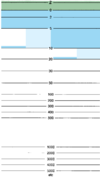
INT 1
#
|
Symbol
|
Description
|
OSM Tags
|
OSM Proposals
|
A: Chart Number, Title, Marginal Notes
|
|
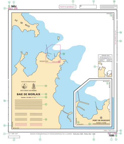
1: Chart number in National Chart Series
2: Chart number in international chart series (INT if any)
3: Cautionary note (if any) on WGS84 datum
4: Publication Note (imprint)
5: Copyright note
6: Edition note.
7: Small correction note
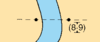
8: Dimensions of inner borders
9: Corner co-ordinates
10: Chart title
11: Explanatory notes on chart construction. To be read before using chart
12: Seals of issuer (national chart agency) and International Hydrographic Organization (IHO) to show that chart is an international one. Purely national charts mighthave only national seal. Reprints of charts from other national series must also hold seal of origin (third seal)
13: Scale of chart at stated latitude. The scale is precisely as stated only at the latitude quoted
14: Linear scale on large-scale charts
15: Linear border scale on large scale coastal charts. On smaller scales use latitude borders for sea miles.
16: Cautionary notes (if any). Information on particular features. to be read before using chart
17: Source Diagram (if any). The source diagram should be studied before using the chart in order to assess the reliability of the sources. Navigators should be cautious where surveys are inadequate.
18: Reference to a larger scale chart
19: References to an adjoining chart of similar scale
20: Instruction to refer to complimentary nautical publications
Note: a and b are references used only in some national series. In the example (french) a refers to the French Notices to Mariners weekly, and b to identificator of a latticed chart.
|
B: Positions, Distances, Directions, Compass
|
| B1
|
Lat
|
Latitude
|
|
Rendering aid, not tagged
|
| B2
|
Long
|
Longitude
|
|
Rendering aid, not tagged
|
| B3
|
|
International Meridian (Greenwich)
|
|
Rendering aid, not tagged
|
| B4
|
°
|
Degree(s)
|
|
Rendering aid, not tagged
|
| B5
|
´
|
Minute(s) of Arc
|
|
Rendering aid, not tagged
|
| B6
|
´´
|
Second(s) of Arc
|
|
Rendering aid, not tagged
|
| B7
|
PA
|
Position Approximate
|
|
Quality Assurance
|
| B8
|
PD
|
Position Doubtful
|
|
Quality Assurance
|
| B9
|
N
|
North
|
|
Rendering aid, not tagged
|
| B10
|
E
|
East
|
|
Rendering aid, not tagged
|
| B11
|
S
|
South
|
|
Rendering aid, not tagged
|
| B12
|
W
|
West
|
|
Rendering aid, not tagged
|
| B13
|
NE
|
North-East
|
|
Rendering aid, not tagged
|
| B14
|
SE
|
South-East
|
|
Rendering aid, not tagged
|
| B15
|
SW
|
South-West
|
|
Rendering aid, not tagged
|
| B16
|
NW
|
North-West
|
|
Rendering aid, not tagged
|
| B20
|

|
Triangulation Point
|
man_made=survey_point+type=triangulation
|
|
| B21
|

|
Observation Spot, as used by surveyors for determining a precise position by means of astronomical observation
|
man_made=survey_point+type=observation_spot
|
|
| B22
|

|
Fixed Point
|
man_made=survey_point+type=fixed_point
|
|
| B23
|

|
Benchmark, a visible reference point where height is precisely known to a particular datum
|
man_made=survey_point+type=benchmark
|
|
| B24
|
|
Boundary Mark
|
historic=boundary_stone
|
|
| B25.1
|

|
Distance Mark, without visible mark
|
river:waterway_distance=*
waterway=milestone + sign=no + kp=*
seamark:type=distance_mark + seamark:distance_mark:category=not_installed + seamark:distance_mark:distance=* + seamark:distance_mark:units=*
OpenSeaMap/Distance Marks
|
Proposed features/Milestones
|
| B25.2
|
|
Distance Mark, with visible mark
|
waterway=milestone + sign=yes + kp=*
seamark:type=distance_mark + seamark:distance_mark:category=board + seamark:distance_mark:distance=* + seamark:distance_mark:units=*
OpenSeaMap/Distance Marks
|
Proposed features/Milestones
|
| B30
|
  
|
Symbols in Plan
|
|
Rendering aid, not tagged
|
| B31
|
  
|
Symbols in Profile
|
|
Rendering aid, not tagged
|
| B32
|
  
|
Point Symbol (Accurate Position)
|
|
Rendering aid, not tagged
|
| B33
|

|
Point Symbol (Aproximate Position)
|
|
Rendering aid, not tagged
|
| B40
|
km
|
kilometer(s)
|
|
Rendering aid, not tagged
|
| B41
|
m
|
meter(s)
|
|
Rendering aid, not tagged
|
| B42
|
dm
|
decimeter(s)
|
|
Rendering aid, not tagged
|
| B43
|
cm
|
centimeter(s)
|
|
Rendering aid, not tagged
|
| B44
|
mm
|
milimeter(s)
|
|
Rendering aid, not tagged
|
| B45
|
n mile(s)
M
|
Nautical Miles
|
|
Rendering aid, not tagged
|
| B46
|
M
|
Cable (length)
|
|
Rendering aid, not tagged
|
| B47
|
ft
|
Foot/feet
|
|
Rendering aid, not tagged
|
| B48
|
fm., fms.
|
Fathom(s)
|
|
Rendering aid, not tagged
|
| B49
|
h
|
Hour
|
|
Rendering aid, not tagged
|
| B50
|
min
|
Minute(s) of Time
|
|
Rendering aid, not tagged
|
| B51
|
s
|
Seconds of Time
|
|
Rendering aid, not tagged
|
| B52
|
kn
|
Knot(s)
|
|
Rendering aid, not tagged
|
| B53
|
t
|
Ton(s)
|
|
Rendering aid, not tagged
|
| B54
|
cd
|
Candela
|
|
Rendering aid, not tagged
|
| B60
|
Var
|
Variation
|
|
Rendering aid, not tagged
|
| B61
|
Mag
|
magnetic
|
|
Rendering aid, not tagged
|
| B62
|
|
Bearing
|
|
Rendering aid, not tagged
|
| B63
|
|
true
|
|
Rendering aid, not tagged
|
| B64
|
decrg
|
decreasing
|
|
Rendering aid, not tagged
|
| B65
|
incrg
|
increasing
|
|
Rendering aid, not tagged
|
| B66
|
|
Annual change
|
|
Rendering aid, not tagged
|
| B67
|
|
Deviation
|
|
Rendering aid, not tagged
|
| B68.1
|

|
Note of Magnetic Variation in position
|
|
Rendering aid, not tagged
|
| B68.2
|
 
|
Note of Magnetic Variation out of position
|
|
Rendering aid, not tagged
|
| B70
|

|
Compass Rose, normal and smaller pattern
|
|
Rendering aid, not tagged
|
| B71
|

|
Isogonals, with notes such as: MAGNETIC VARIATION LINES ARE OF 2000
The magnetic variation is shown in degrees, followed by the letter E or W, as appropriate, at certain positions on the lines. The annual change is expressed in minutes with the letter E or W and is given in brackets, immediately following the variation.
|
|
This must be stored in a different database somehow
|
| B82.1
|

|
Local magnetic anomalies symbol in/near location
|
|
|
| B82.2
|

|
Local magnetic anomalies text with reference to note
|
|
|
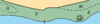
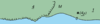
C: Natural Features
|
| C1
|

|
Surveyed Coastline
|
natural=coastline + coastline:survey_quality=complete
|
|
| C2
|

|
Inadequately Surveyed Coastline
|
natural=coastline + coastline:survey_quality=inadequate
|
|
| C3
|
|
Steep Coast, Cliffs
|
natural=cliff + natural=coastline
|
|
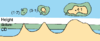
| C4
|

|
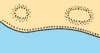
Hillocks
|
natural=coastline + SRTM details
|
SRTM data from external database
|
| C5
|

|
Flat Coast
|
natural=coastline
|
|
| C6
|
 
|
Sandy Coast
|
natural=beach with surface=sand?
|
|
| C7
|
|
Stony or Shingly shore
|
natural=beach with surface=gravel or surface=pebbles
|
|
| C8
|
|
Sandhills or Sand Dunes
|
natural=dune
|
|
| C10
|
|
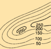
Contour lines
|
|
This is covered by SRTM data
|
| C11
|
|
Spot heights
|
|
This is covered by SRTM data
|
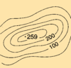
| C12
|

|
Contour lines aproximate
|
|
This is covered by SRTM data
|
| C13
|
|
Form lines
|
|
This is covered by SRTM data
|
| C14
|
|
The height of top of trees
|
|
|
| C20
|

|
River, Stream
|
waterway=river or waterway=stream
|
|
| C21
|
|
Intermittent rivers
|
waterway=river + seasonal=yes or intermittent=yes or water=intermittent
|
Proposed features/Intermittent river + Proposed_features/Water_cover
|
| C22
|

|
Rapids and waterfalls
|
waterway=waterfall, whitewater:rapid_grade=*
|
Proposed features/Waterfall WikiProject Whitewater Maps
|
| C23
|

|
Lakes
|
natural=water
|
|
| C24
|
|
Salt Pans
|
natural=wetland + wetland=saltmarsh or landuse=salt_pond
|
|
| C25
|
|
Glacier
|
natural=glacier
|
|
| C26
|
 
|
Lava flow
|
natural=lava
|
|
| C30
|
|
Woods in general
|
(landuse=forest or natural=wood with/without wood=* or wood=mixed) or (natural=tree with denotation=landmark and type=* and species=*)
|
|
| C31.1
|

|
Deciduous woods, broadleaf (usually seasonal)
|
wood=deciduous
|
Tree
|
| C31.2
|

|
Evergreen woods, evergreen broadleef
|
wood=evergreen
|
Talk:Key:wood, Tree
|
| C31.3
|

|
Conifer-woods, needle leaf
|
wood=coniferous
|
Tree
|
| C31.4
|
|
Palm
|
wood=palm
|
Talk:Key:wood, Tree
|
| C31.5
|

|
Nipa Palm
|
wood=nipa_palm
|
Talk:Key:wood
|
| C31.6
|

|
Casuarina
|
wood=casuarina
|
Talk:Key:wood
|
| C31.7
|

|
Filao
|
wood=filao
|
Talk:Key:wood
|
| C31.8
|

|
Eucalypt
|
wood=eucalypt
|
Talk:Key:wood Tree
|
| C32
|
|
Mangroves
|
natural=wetland + wetland=mangrove
|
Proposed features/Wetland areas
|
| C33
|
|
Marsh, Swamp, Salt marsh
|
natural=wetland + wetland=marsh
|
Proposed features/Wetland areas
|
 Ca Ca
|
|
Cliffy Coast
|
natural=cliff + natural=coastline
|
|
 Ca Ca
 Ck Ck
|

|
Park, Garden
|
leisure=garden
|
|
Cb
Cm
|
|
Spring
|
natural=spring
|
|
Cc
Cd
|
|
Grassland
|
landuse=grass or natural=grassland or natural=heath or landuse=meadow
|
|
Cd
Ce
|
|
Paddy field
|
landuse=farm + crop=rice
|
|
Ce
Ch
|
|
Coniferous woodland
|
natural=wood or landuse=forest + wood=coniferous
|
|
Cf
Cf
|
|
Bushes
|
natural=scrub
|
|
D: Cultural Features
|
| D1
|
 
|
Places and Built up areas
|
place=*
|
|
| D2
|
|
Scattered buildings
|
building=*
|
|
| D3
|
  
|
Places on medium scale charts
|
place=*
|
|
| D4
|
 
|
Inland villages
|
place=*
|
|
| D5
|

|
Scattered buildings
|
building=*
|
|
| D6
|
|
Landmark buildings
|
building=yes with some key features + landmark=*?
|
|
| D7
|
|
Street and Road Names
|
name=* on highway=*
|
|
| D8
|
  
|
Ruined Landmark
|
historic=ruins or ruins=yes
|
Proposed features/ruins
|
| D10
|

|
Motorway
|
highway=motorway or highway=trunk
|
|
| D11
|
 
|
Road
|
highway=primary
|
|
| D12
|
 
|
Tracks or Paths
|
highway=track or highway=path
|
|
| D13
|
|
Railway
|
railway=*
|
|
| D14
|
|
Cutting
|
cutting=yes
|
|
| D15
|
 
|
Embankment
|
embankment=yes
|
|
| D16
|

|
Tunnel
|
tunnel=yes
|
|
| D17
|

|
Airfield
|
aeroway=*
|
|
| D20
|
|
Vertical Clearance
|
On overhead object:maxheight:marine=*
On waterway under object:seamark:bridge:clearance_height=* / seamark:bridge:clearance_height_open=* / seamark:bridge:clearance_height_closed=* / seamark:cable_overhead:vertical_clearance_safe=*
|
|
| D21
|

|
Horizontal Clearance
|
On waterway under object: seamark:bridge:clearance_width=*
|
|
| D22
|

|
Fixed Bridge
|
bridge=yes/suspension/arch + seamark:type=bridge + seamark:bridge:category=*
|
|
| D23.1
|

|
Opening Bridge in general with vertical clearance
|
bridge=opening + maxheight:marine=* + seamark:bridge:clearance_height=*
|
|
| D23.2
|

|
Swing bridge with vertical clearance
|
bridge=swing+maxheight:marine=* + seamark:bridge:clearance_height=*
|
|
| D23.3
|

|
Lifting bridge with vertical clearance (open and closed)
|
bridge=lift+maxheight:marine=open;closed + seamark:bridge:clearance_height=* / seamark:bridge:clearance_height_open=* + seamark:bridge:clearance_height_closed=*
|
|
| D23.4
|

|
Bascule bridge with vertical clearance
|
bridge=bascule+maxheight:marine=* + seamark:bridge:clearance_height=*
|
|
| D23.5
|
 
|
Pontoon bridge
|
bridge=pontoon
|
|
| D23.6
|

|
Draw bridge
|
bridge=drawbridge
|
|
| D24
|

|
Transporter Bridge
|
bridge=transporter
|
|
| D25
|

|
Overhead transporter or telepheric
|
aerialway=*
|
|
| D26
|

|
Power Transmission Line
|
power=line + seamark:type=cable_overhead + seamark:cable_overhead:category=power + seamark:cable_overhead:vertical_clearance_safe=*
|
|
| D27
|

|
Telephones Line
|
lines=phone + seamark:type=cable_overhead + seamark:cable_overhead:category=telephone + seamark:cable_overhead:vertical_clearance_safe=*
|
|
| D28
|

|
Overhead pipeline
|
man_made=pipeline + maxheight:marine=* + seamark:type=pipeline_overhead
|
|
| D29
|
|
Pipeline on land
|
man_made=pipeline
|
|
| Da
|
|
Footbridge
|
bridge=* on highway=path, highway=footway or similar
|
|
| Da
|

|
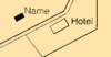
City, Town (Small Scale)
|
place=*
|
|
 Da Da
|

|
Tramway
|
railway=tram
|
|
| Db
|
|
Public building
|
building=public or building=civic or amenity=public_building
|
|
| Db
|

|
Helicopter landing site, Heliport
|
aeroway=helipad
|
|
| Dc
|
TS
|
Telegraph Office
|
signal_station=telegraph
|
|
| Dd
|
|
Causeway
|
highway=* with embankment=yes
|
|
| De
|
|
Bridge inland
|
bridge=*
|
|
| Df
|
|
Stadium
|
leisure=stadium
|
|
E: Landmarks
|
| E1
|

|
Examples of landmarks
|
seamark:type=landmark
|
|
| E2
|

|
Examples of conspicuous landmarks
|
seamark:type=landmark + seamark:landmark:conspicuity=conspicuous
|
User:Jongleur/MultiLevel Building Shapes
|
| E3.1
|

|
Sketches with position circle
|
seamark:type=landmark
|
User:Jongleur/MultiLevel Building Shapes
|
| E3.2
|

|
Sketches out of position
|
seamark:type=landmark
|
User:Jongleur/MultiLevel Building Shapes
|
| E4
|

|
Height from top of structure above height datum
|
ele=*
|
|
| E5
|

|
Height above physical ground level
|
height=*
|
|
| E10.1
|
   
|
Church
|
amenity=place_of_worship with religion=christian and building=church + seamark:type=landmark + seamark:landmark:function=church
|
|
| E10.2
|
 
|
Church with location of tower market with label Tr
|
amenity=place_of_worship with religion=christian and landmark=tower and building=church + seamark:type=landmark + seamark:landmark:category=tower + seamark:landmark:function=church
|
|
| E10.3
|
 
|
Church with location of spire market with label Sp
|
amenity=place_of_worship with religion=christian and landmark=spire and building=church + seamark:type=landmark + seamark:landmark:category=spire + seamark:landmark:function=church
|
|
| E10.4
|
 
|
Church with location of cupola market with label Cup
|
amenity=place_of_worship with religion=christian and landmark=dome and building=church + seamark:type=landmark + seamark:landmark:category=dome + seamark:landmark:function=church
|
|
| E11
|
 
|
Chapel
|
amenity=place_of_worship with religion=christian and building=chapel + seamark:type=landmark + seamark:landmark:function=chapel
|
|
| E12
|

|
Cross or Calvary
|
historic=wayside_cross or amenity=crucifix with landmark=cross + seamark:type=landmark + seamark:landmark:category=cross
|
Proposed_features/building
|
| E13
|
 
|
Temple
|
amenity=place_of_worship + religion=jewish + seamark:type=landmark + seamark:landmark:function=temple
|
|
| E14
|
 
|
Pagoda
|
amenity=place_of_worship with religion=taoist + seamark:type=landmark + seamark:landmark:function=pagoda
|
|
| E15
|

|
Shinto Shrine, Josshouse
|
amenity=place_of_worship with religion=shinto + seamark:type=landmark + seamark:landmark:function=shinto_shrine
|
|
| E16
|
 
|
Buddhist Temple
|
amenity=place_of_worship with religion=buddhist + seamark:type=landmark + seamark:landmark:function=buddhist_temple
|
|
| E17
|
 
|
Mosque
|
amenity=place_of_worship with religion=muslim + seamark:type=landmark + seamark:landmark:function=mosque
|
|
| E18
|
  
|
Marabout (shrine marking the burial place of a Moslem holy man, mainly confined to Northern Africa)
|
religion=muslim on building=* marking a tomb (historic=wayside_shrine?) + seamark:type=landmark + seamark:landmark:function=marabout
|
|
| E19
|
 
|
Cemeteries
|
landuse=cemetery with landmark=cemetery + seamark:type=landmark + seamark:landmark:category=cemetery
|
|
| E20
|

|
Towers in general
|
man_made=tower with landmark=tower + seamark:type=landmark + seamark:landmark:category=tower
|
|
| E21
|

|
Water Tower
|
man_made=water_tower + seamark:type=tank + seamark:tank:category=water_tower
|
|
| E22
|

|
Chimney
|
man_made=chimney with landmark=chimney + seamark:type=landmark + seamark:landmark:category=chimney
|
Proposed features/Chimney, Proposed features/chimney, Key:landmark
|
| E23
|

|
Flare
|
man_made=flare with landmark=flare_stack + seamark:type=landmark + seamark:landmark:category=flare_stack
|
Proposed features/marine-tagging
|
| E24
|

|
Monument
|
historic=monument with landmark=monument + seamark:type=landmark + seamark:landmark:category=monument / seamark:landmark:category=column / seamark:landmark:category=memorial / seamark:landmark:category=obelisk / seamark:landmark:category=statue
|
|
| E25.1
|

|
Windmill
|
man_made=windmill with landmark=windmill} + seamark:type=landmark + seamark:landmark:category=windmill
|
|
| E25.2
|

|
Ruined Windmill
|
man_made=windmill + ruins=yes with landmark=windmill} + seamark:type=landmark + seamark:landmark:category=windmill
|
Proposed features/ruins
|
| E26.1
|

|
Wind motor
|
power=generator with generator:source=wind and landmark=windmotor} + seamark:type=landmark + seamark:landmark:category=windmotor
|
Proposed_features/generator_rationalisation
|
| E26.2
|

|
Wind Farm
|
Area with several power=generator with generator:source=wind and landmark=windmotor} + seamark:type=landmark + seamark:landmark:category=windmotor
|
Proposed_features/generator_rationalisation
|
| E27
|

|
Flag pole
|
man_made=flagpole and landmark=flagpole} + seamark:type=landmark + seamark:landmark:category=flagstaff
|
Proposed features/flagpole
|
| E28
|
 
|
Radio or Television Mast
|
man_made=tower, tower:type=communication, tower:construction=freestanding} + seamark:type=landmark + seamark:landmark:category=mast
|
Proposed features/Communications tower
|
| E29
|

|
Radio or Television Tower
|
man_made=tower, tower:type=communication, tower:construction=lattice} + seamark:type=landmark + seamark:landmark:category=tower
|
Proposed features/Communications tower
|
| E30.1
|

|
Radar mast
|
man_made=mast with landmark=radar_scanner} + seamark:type=landmark + seamark:landmark:category=radar_scanner
|
|
| E30.2
|

|
Radar tower
|
man_made=tower with landmark=radar_scanner} + seamark:type=landmark + seamark:landmark:category=radar_scanner
|
|
| E30.3
|

|
Radar scanner
|
man_made=mast with landmark=radar_scanner} + seamark:type=landmark + seamark:landmark:category=radar_scanner
|
|
| E30.4
|

|
Radar dome, radome
|
man_made=tower + tower:construction=dome with landmark=radar_scanner} + seamark:type=landmark + seamark:landmark:category=radar_scanner
|
|
| E31
|

|
Dish Aerial
|
man_made=tower, tower:type=communication, tower:construction=dish with landmark=dish_aerial} + seamark:type=landmark + seamark:landmark:category=dish_aerial
|
Proposed features/Communications Transponder
|
| E32
|
 
|
Tanks
|
man_made=storage_tank
|
Proposed features/storage tank
|
| E33
|
 
|
Cylindrical Silos
|
man_made=silo
|
Proposed features/Silo
|
| E34.1
|

|
Fortified Structure
|
historic=fort historic=castle historic=archaeological_site
|
WikiProject Fortifications Proposed features/Building attributes
|
| E34.2
|
 
|
Castle, Fort, Blockhouse
|
historic=fort historic=castle historic=archaeological_site
|
WikiProject Fortifications Proposed features/Building attributes
|
| E34.3
|
 
|
Battery, Small fort
|
historic=fort historic=castle historic=archaeological_site
|
WikiProject Fortifications Proposed features/Building attributes
|
| E35.1
|
 
|
Quarry or Mine
|
landuse=quarry or man_made=mineshaft or man_made=adit
|
|
| E35.2
|

|
Quarry or Mine
|
landuse=quarry or man_made=mineshaft or man_made=adit
|
|
| E36
|

|
Quarry or Mine
|
landuse=quarry or man_made=mineshaft or man_made=adit
|
|
| Ea
|

|
Mast
|
man_made=mast} + seamark:type=landmark + seamark:landmark:category=mast
|
|
Ea
Ec
|

|
Any kind of station
|
man_made=tower + tower:type=communication} + seamark:type=landmark + seamark:landmark:category=tower
|
|
| Eb
|

|
Stadium
|
leisure=stadium
|
|
| Eb
|

|
Sandpit
|
landuse=quarry+resource=sand or resource=aggregate or resource=gravel
|
|
| Ed
|
|
Monastary, Convent
|
amenity=place_of_worship
|
|
F: Ports
|
| F1
|
|
A dyke, levee
|
man_made=dyke
|
|
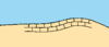
| F2.1
|

|
Seawall on large scale maps
|
barrier=wall + wall=seawall
|
|
| F2.2
|
|
Seawall on small scale maps
|
barrier=wall + wall=seawall
|
|
| F3
|

|
Causeway
|
highway=* with embankment=yes
|
|
| F4.1
|
  
|
Breakwater in general
|
man_made=breakwater
|
Proposed features/Breakwater
|
| F4.2
|

|
Breakwater loose boulders, tetrapods
|
man_made=breakwater
|
Proposed features/Breakwater
|
| F4.3
|

|
Breakwater slope of concrete or masonry
|
man_made=breakwater
|
Proposed features/Breakwater
|
| F5
|
|
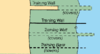
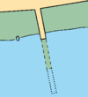
Training Wall
|
barrier=wall + wall=training_wall
|
|
| F6.#
|
|
Groyne
- always dry
- intertidal
- always underwater
|
man_made=groyne
|
Proposed features/Breakwater Harbour Proposed features/marine-tagging
|
| F10
|

|
Fishing Port
|
harbour=yes
|
Harbour
|
| F12
|

|
Mole
|
Combining man_made=breakwater and man_made=pier or man_made=jetty
|
Proposed features/marine-tagging OpenSeaMap Harbour
|
| F13
|


|
Quay or Wharf
|
man_made=pier or man_made=jetty
|
Proposed features/Jetties and piers
|
| F14
|


|
Pier, Jetty
|
man_made=pier
|
Proposed features/Jetties and piers
|
| F15
|

|
Pier, Prominade
|
man_made=pier
|
Proposed features/Jetties and piers
|
| F16
|

|
Pontoon
|
|
Harbour
|
| F17
|

|
Landing for boats
|
|
|
| F18
|
|
Steps, Landing Stairs
|
highway=steps
|
|
| F19
|

|
Number (or letter) of berth
|
ref=*
|
|
| F20
|

|
Dolphin
|
seamark:type=mooring + seamark:mooring:category=dolphin
|
Proposed features/marine-tagging OpenSeaMap Harbour
|
| F21
|

|
Deviation Dolphin
|
seamark:type=mooring + seamark:mooring:category=deviation_dolphin
|
Proposed features/marine-tagging OpenSeaMap Harbour
|
| F22
|

|
Minor Posts or Pillars
|
seamark:type=mooring + seamark:mooring:category=post or + seamark:mooring:category=pile
|
Proposed features/marine-tagging OpenSeaMap Harbour
|
| F23
|
   
|
Slipway or patent slip or ramp
|
leisure=slipway
|
|
| F24
|

|
Gridiron
|
|
Proposed features/marine-tagging OpenSeaMap Harbour
|
| F25
|

|
Dry dock
|
waterway=dock + dock=drydock
|
|
| F26
|
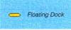
|
Floating Dock
|
waterway=dock + dock=floating
|
|
| F27
|

|
Wet dock or non-tidal basin
|
|
Proposed features/marine-tagging OpenSeaMap Harbour Proposed features/Port
|
| F28
|

|
Tidal basin
|
|
Proposed features/marine-tagging OpenSeaMap Harbour Proposed features/Port
|
| F29.1
|

|
Floating oil barrier
|
seamark:type=obstruction + seamark:obstruction:category=boom
|
|
| F29.2
|
|
Oil retaining barrier or high pressure pipe
|
|
|
| F30
|

|
Works on land
|
construction=*
|
|
| F31
|

|
Work at sea
|
construction=* + seamark:type=shoreline_construction + seamark:shoreline_construction:category=*
|
|
| F32
|


|
Work under construction
|
construction=*
|
|
| F33.1
|

|
Ruined Pier in general
|
historic=ruins or ruins=yes on man_made=pier
|
Proposed features/ruins
|
| F33.2
|


|
Ruined Pier partly submerged on high water
|
historic=ruins or ruins=yes on man_made=pier
|
Proposed features/ruins
|
| F34
|

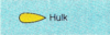
|
Hulk
|
seamark:type=hulk
|
|
| F40
|
|
Canal
|
waterway=canal
|
|
| F41.1
|
|
Lock on large scale charts
|
waterway=lock_gate
|
|
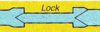
| F41.2
|
|
Lock on smaller scale charts
|
waterway=lock_gate
|
|
| F42
|
|
Caisson
|
waterway=lock_gate
|
|
| F43
|

|
Flood barrage
|
|
Proposed features/marine-tagging OpenSeaMap Harbour
|
| F44
|
|
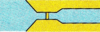
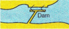
Dam
|
waterway=dam
|
|
| F50
|

|
RoRo Terminal
|
|
Proposed features/marine-tagging OpenSeaMap Harbour
|
| F51
|
|
Transit sheds and warehouses
|
building=warehouse
|
Proposed features/marine-tagging OpenSeaMap Harbour
|
| F52
|

|
Timber yard
|
storage_area=timber or landuse=utility or landuse=harbour
|
Proposed features/marine-tagging OpenSeaMap Harbour
|
| F53.1
|

|
Crane
|
man_made=crane
|
|
| F53.2
|

|
Crane
|
man_made=crane
|
|
| F53.3
|

|
Crane
|
man_made=crane
|
|
| F60
|

|
Harbour Master's Office
|
harbour=harbour_master and office=government / amenity=harbourmaster
|
Proposed features/marine-tagging OpenSeaMap Harbour
|
| F61
|

|
Customs Office
|
harbour=customs
|
Proposed features/marine-tagging OpenSeaMap Harbour
|
| F62.1
|
|
Health Officers office or Quarantine Office can be combined in a hospital, or a separate office.
|
office=administrative or office=government + type=quarantine, may be combined with amenity=hospital
|
Proposed features/marine-tagging OpenSeaMap Harbour
|
| F62.2
|


|
Hospital
|
amenity=hospital
|
|
| F63
|
 or PO or PO
|
Post Office
|
amenity=post_office
|
|
| Fa
|

|
Bollard
|
seamark:type=mooring + seamark:mooring:category=bollard
|
|
| Fa
|
|
Ditch with sloice
|
waterway=ditch with lock=*
|
|
| Fa
|

|
Calling point for VTS
|
seamark:type=calling-in_point
|
|
| Fb
|

|
Mooring ring
|
mooring=ring or seamark:type=mooring + seamark:mooring:category=wall
|
|
| Fc
|

|
Seawall
|
barrier=wall + wall=seawall
|
|
G: Topographic Terms
|
| As chapter G contains no symbols, chapter is omitted in this list
|
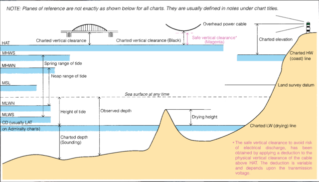
H: Tides, Currents
|
| H1
|
CD
|
Datum for Sounding Reduction
|
|
This information should be kept in a separate database
|
| H2
|
LAT
|
Lowest Astronomical Tide (LAT)
|
|
This information should be kept in a separate database
|
| H3
|
HAT
|
Highest Astronomical Tide (HAT)
|
|
This information should be kept in a separate database
|
| H4
|
MLW
|
Mean Low Water (MLW)
|
|
This information should be kept in a separate database
|
| H5
|
MHW
|
Mean High Water (MHW)
|
|
This information should be kept in a separate database
|
| H6
|
MSL
|
Mean Sea Level (MSL)
|
|
This information should be kept in a separate database
|
| H7
|
|
Land Survey Datum
|
|
This information should be kept in a separate database
|
| H8
|
MLWS
|
Mean Low Water Spring (MLWS)
|
|
This information should be kept in a separate database
|
| H9
|
MHWS
|
Mean High Water Spring (MHWS)
|
|
This information should be kept in a separate database
|
| H10
|
MLWN
|
Mean Low Water Neap (MLWN)
|
|
This information should be kept in a separate database
|
| H11
|
MHWN
|
Mean High Water Neap (MHWN)
|
|
This information should be kept in a separate database
|
| H12
|
MLLW
|
Mean Lower Low Water (MLLW)
|
|
This information should be kept in a separate database
|
| H13
|
MHHW
|
Mean Higher High Water (MHHW)
|
|
This information should be kept in a separate database
|
| H14
|
MHLW
|
Mean Higher Low Water (MHLW)
|
|
This information should be kept in a separate database
|
| H15
|
MLHW
|
Mean Lower High Water (MLHW)
|
|
This information should be kept in a separate database
|
| H16
|
Sp
|
Spring Tide (Sp)
|
|
This information should be kept in a separate database
|
| H17
|
Np
|
Neap Tide (Np)
|
|
This information should be kept in a separate database
|
| H20
|
References
|
| H30
|
Semi-Diurnal and Diurnal Tide Level

|
| H31
|
Tidal streams table

|
| H40
|

|
Tidal Stream Arrow
|
|
This information should be kept in a separate database
|
| H41
|

|
Tidal Stream Arrow
|
|
This information should be kept in a separate database
|
| H42
|

|
Non-tidal current in restricted waters
|
|
This information should be kept in a separate database
|
| H43
|

|
Non-tidal or ocean current in restricted waters
|
|
This information should be kept in a separate database
|
| H44
|

|
Overfalls, races, and tide rips
|
|
This information should be kept in a separate database
|
| H45
|

|
Eddie
|
|
This information should be kept in a separate database
|
| H46
|

|
Locations, often referred to as diamonds due to its shape, are locations of reference for tidal and current diagrams
|
|
This information should be kept in a separate database
|
| H47
|

|
Offshore positionfor which tidal levels are tabulated
|
|
This information should be kept in a separate database
|
| He
|

|
Wave Recorder
|
|
|
| Hf
|

|
Current meter
|
|
|
I: Depths
|
| I1
|
ED
|
Existence Doubtful
|
depth:source_quality=existence_doubtfull
|
|
| I2
|

|
Sounding Doubtful
|
depth:source_quality=sounding_doubtfull
|
|
| I3.1
|
Rep
|
Reported Dangers
|
depth:source_quality=reported
|
|
| I3.2
|
Rep (1977)
|
Reported Dangers with indication of last report
|
depth:source_quality=reported + depth:source_quality:reportyear=*
|
|
| I4
|
 
|
Reported Dangers with indication of last report
|
depth:source_quality=reported_not_confirmed
|
|
| I10
|
  
|
Numerical values of single point soundings
|
|
This should be handled by an external database, similar to SRTM data for heights at land.
|
| I11
|
     
|
Out of position soundings
|
|
This should be handled by an external database, similar to SRTM data for heights at land.
|
| I12
|

|
Least depth in narrow channel
|
|
This should be handled by an external database, similar to SRTM data for heights at land.
|
| I13
|

|
Non-bottom soundings
|
|
This is readings from echosounders where real seabed is deeper. Only way to survey the depth is by use of manual sounding.
|
| I14
|
 
|
Unreliable soundings
|
|
Quality of seabed, sediments of water, or special conditions of currents and tides might give wrong readings, or the source are old or inaccurate.
|
| I15
|
|
Drying height
|
water=tidal + height=*?
|
|
| I16
|

|
Natural water cause
|
|
|
| I20
|

|
Limit of dredged area
|
waterway=dredged_area seamark:type=dredged_area
|
|
| I21
|
|
Dredged depth
|
depth:dredged=* + waterway=dredged_area seamark:type=dredged_area
|
Proposed features/marine-tagging
|
| I22
|
|
Dredged depth not regularly maintained
|
depth:dredged=* + maintained=no + depth:dredged:year=* + waterway=dredged_area seamark:type=dredged_area
|
Proposed features/marine-tagging
|
| I23
|
|
Dredged depth regularly maintained
|
depth:dredged=* + maintained=yes + waterway=dredged_area seamark:type=dredged_area
|
Proposed features/marine-tagging
|
| I24
|

|
Swept Area
|
waterway=swept_area
|
Proposed features/marine-tagging
|
| I25
|
   
|
Area with note regarding depth survey
|
note:depth=*
|
|
| I30
|
|
Depth contours
|
|
This should be handled by an external database, similar to SRTM data for heights at land.
|
| I31
|

|
Approximate contours
|
|
This should be handled by an external database, similar to SRTM data for heights at land.
|
| Ic
|
unexam
|
Unexamined
|
|
|
J: Nature of Seabed
|
| J1
|
S
|
Seabed Surface of Sand
|
seabed_surface=sand /
seamark:type=seabed_area + seamark:seabed_area:surface=sand
|
|
| J2
|
M
|
Seabed Surface of Mud
|
seabed_surface=mud /
seamark:type=seabed_area + seamark:seabed_area:surface=mud
|
|
| J3
|
Cy
|
Seabed Surface of Clay
|
seabed_surface=clay /
seamark:type=seabed_area + seamark:seabed_area:surface=clay
|
|
| J4
|
Si
|
Seabed Surface of Silt
|
seabed_surface=silt /
seamark:type=seabed_area + seamark:seabed_area:surface=silt
|
|
| J5
|
St
|
Seabed Surface of Stones
|
seabed_surface=stones /
seamark:type=seabed_area + seamark:seabed_area:surface=stones
|
|
| J6
|
G
|
Seabed Surface of Gravel
|
seabed_surface=gravel /
seamark:type=seabed_area + seamark:seabed_area:surface=gravel
|
|
| J7
|
P
|
Seabed Surface of Pebbles
|
seabed_surface=pebbles /
seamark:type=seabed_area + seamark:seabed_area:surface=pebbles
|
|
| J8
|
Cb
|
Seabed Surface of Cobbles
|
seabed_surface=cobbles /
seamark:type=seabed_area + seamark:seabed_area:surface=cobbles
|
|
| J9.1
|
R
|
Seabed Surface of Rock or Rocky
|
seabed_surface=rocky /
seamark:type=seabed_area + seamark:seabed_area:surface=rocky
|
|
| J9.2
|
Bo
|
Seabed Surface of Boulders
|
seabed_surface=boulders /
seamark:type=seabed_area + seamark:seabed_area:surface=boulders
|
|
| J10
|
Co
|
Seabed Surface of Coral or Coraline Algea
|
seabed_surface=coral /
seamark:type=seabed_area + seamark:seabed_area:surface=coral
|
|
| J11
|
Sh
|
Seabed Surface of Shells
|
seabed_surface=shells /
seamark:type=seabed_area + seamark:seabed_area:surface=shells
|
|
| J12.1
|
S/M
|
Two Layer, e.g. Sand over Mud
|
seabed_surface:1=sand, seabed_surface:2=mud /
seamark:type=seabed_area + seamark:seabed_area:1:surface=sand + seamark:seabed_area:2:surface=mud
|
|
| J12.2
|
fS.M.Sh
|
Admixtures are shown behind the main consistuent of the deposit
|
seabed_surface:quality:1=coarse
|
|
| J13.1
|
Wd
|
Seabed Surface of Weed such as Kelp
|
seabed_surface=weed /
seamark:type=seabed_area + seamark:seabed_area:surface=weed
|
|
| J13.2
|

|
Kelp
|
seabed_surface=kelp /
seamark:type=seabed_area + seamark:seabed_area:surface=kelp
|
|
| J14
|

|
Sandwaves
|
seabed_surface=mobile_bottom /
seamark:type=seabed_area + seamark:seabed_area:surface=???
|
|
| J15
|

|
Springs in the Seabed
|
seabed_surface=spring_in_seabed /
seamark:type=seabed_area + seamark:seabed_area:surface=???
|
|
| J20
|
|
Intertidal areas of sand and mud with patches of stones and gravel
|
water=tidal + surface=*
|
Proposed_features/Water_cover
|
| J21
|
|
Intertidal areas of Rocky nature
|
water=tidal + surface=rocky
|
Proposed_features/Water_cover
|
| J22
|

|
Coral Reef or Foreshore
|
water=tidal + surface=coral
|
|
| J30
|
f
|
Quality of seabed is fine, only used in relation with Sand
|
seabed_surface:quality=fine
|
|
| J31
|
m
|
Quality of seabed is medium, only used in relation with Sand
|
seabed_surface:quality=medium
|
|
| J32
|
c
|
Quality of seabed is coarse, only used in relation with Sand
|
seabed_surface:quality=coarse
|
|
| J33
|
bk
|
Quality of seabed is broken
|
seabed_surface:quality=broken
|
|
| J34
|
sy
|
Quality of seabed is sticky
|
seabed_surface:quality=sticky
|
|
| J35
|
so
|
Quality of seabed is soft
|
seabed_surface:quality=soft
|
|
| J36
|
sf
|
Quality of seabed is stiff
|
seabed_surface:quality=stiff
|
|
| J37
|
v
|
Quality of seabed is volcanic
|
seabed_surface:quality=volcanic
|
|
| J38
|
ca
|
Quality of seabed is calcareous
|
seabed_surface:quality=calcareous
|
|
| J39
|
h
|
Quality of seabed is hard
|
seabed_surface:quality=hard
|
|
K: Rocks, Wrecks, Obstructions
|
| K1
|

|
Danger area
|
|
|
| K2
|

|
Depth of swept point
|
depth:swept=*
|
|
| K3
|

|
Submerged object with Safe Clearance mark
|
depth:clearance=*
|
|
| K10
|
|
Rocks or large boulders that do not cover
|
natural=rock + ele=*
|
|
| K11
|
|
Rocks or large boulders that cover and uncover
|
natural=rock + tidal=yes
seamark:type=rock+seamark:rock:water_level=covers
|
|
| K12
|
|
Rocks which are awash
|
natural=rock + depth=0
seamark:type=rock+seamark:rock:water_level=awash
|
|
| K13
|
|
Rocks that are always under water
|
natural=rock + depth=*
seamark:type=rock
|
|
| K14.1
|
|
Underwater rocks within corresponding depth area
|
natural=rock + depth=*
|
|
| K14.2
|
|
Underwater rocks outside corresponding depth area
|
natural=rock + depth=*
|
|
| K15
|

|
Underwater rocks of known depth not of danger to surface navigation
|
natural=rock + depth=*
|
|
| K16
|

|
Submerged coral reefs and pinnacles
|
natural=reef + depth=* or sub_sea=reef + depth=*
|
Proposed features/reef
|
| K17
|
 
|
Breakers
|
natural=breaker
|
|
| K20
|

|
Wreck completely above water with mast or funnel
|
historic=wreck + height=* or ele=* seamark:type=wreck
|
|
| K21
|

|
Wreck that covers and uncovers with mast or funnel
|
historic=wreck + tidal=yes seamark:type=wreck
|
|
| K22
|

|
Wreck with known depth
|
historic=wreck + depth=* seamark:type=wreck
|
|
| K23
|

|
Wreck with unknown depth
|
historic=wreck seamark:type=wreck
|
|
| K24
|

|
Stranded wreck
|
historic=wreck + stranded=yes? seamark:type=wreck
|
|
| K25
|
 
|
Wreck with only mast or funnel visible
|
historic=wreck seamark:type=wreck
|
|
| K26
|

|
Wreck where least known depth have been checked with sounding only
|
historic=wreck + depth=* + depth:verified=sounding seamark:type=wreck
|
|
| K27
|

|
Wreck that have been wire swept
|
historic=wreck depth:swept=yes seamark:type=wreck
|
|
| K28
|

|
Wreck with unknown depth considered to be potentially dangerous
|
historic=wreck + depth:dangerous=yes seamark:type=wreck
|
|
| K29
|

|
Wreck with unknown depth for which safe clearance cannot be estimated
|
historic=wreck + depth=* seamark:type=wreck
|
|
| K30
|

|
Wreck over which exact depth is unknown, but which is considered to have a safe clearance at the depth shown
|
seamark:type=wreck
|
|
| K31
|
 
|
Foul ground
|
seamark:type=obstruction + seamark:obstruction:category=foul_ground
|
|
| K40
|

|
Submerged Obstruction with unknown depth
|
seamark:type=obstruction + seamark:obstruction:category=foul_area
|
|
| K41
|

|
Submerged Obstruction with least known depth by sounding only
|
|
|
| K42
|

|
Submerged Obstruction wire swept or least known depth verified by divers (in combination with K2)
|
|
|
| K43.1
|
 
|
Stumps of Posts or Pillars
|
seamark:type=obstruction + seamark:obstruction:category=stump
landmark=pillar
|
|
| K43.2
|

|
Stumps of Posts or Pillars
|
seamark:type=obstruction + seamark:obstruction:category=stump
landmark=pillar
|
|
| K44.1
|
 
|
Fish Stakes
|
|
|
| K44.2
|

|
Fish Traps, Fish Lines, Tunny Nets
|
|
|
| K45
|

|
Fish Trap Area, Tunny Net Area
|
|
|
| K46.1
|

|
Fish havens or Fish reefs, artificial structures where fish can live protected, to breed.
|
seamark:type=obstruction + seamark:obstruction:category=fish_haven
|
|
| K46.2
|

|
Fish havens or Fish reefs, artificial structures where fish can live protected, to breed.
|
seamark:type=obstruction + seamark:obstruction:category=fish_haven
|
|
| K47
|

|
Shellfish beds with no obstruction
|
|
|
| K48.1
|

|
Marine farms
|
seamark:type=marine_farm
landuse=fishfarm or landuse=aquaculture
|
Proposed features/fishfarm Proposed features/Aquaculture
|
| K48.2
|
  
|
Marine farms
|
seamark:type=marine_farm
landuse=fishfarm or landuse=aquaculture
|
Proposed features/fishfarm Proposed features/Aquaculture
|
Kc
Kd
|
Discol
|
Discolored water
|
|
|
| Ke
|

|
Submerged wreck, depth unknown
|
historic=wreck seamark:type=wreck
|
|
| Kf
|

|
Navigation light on stranded wreck
|
historic=wreck + light=* seamark:type=wreck
|
|
L: Offshore Installations
|
| L1
|

|
Names of Oil and Gas fields
|
waterway=offshore_field + name=*
|
|
| L2
|

|
Platform with designation/name
|
man_made=offshore_platform + name=* seamark:type=platform
|
|
| L3
|

|
Safety Zone
|
|
|
| L4
|

|
Limit of Development Area
|
|
|
| L5.1
|

|
Wind Turbine
|
power=generator + power_source=wind
|
|
| L5.2
|

|
Wind Farm
|
area with power=generator + power_source=wind
|
|
| L10
|

|
Offshore platform
|
man_made=offshore_platform
|
|
| L11
|

|
Flare
|
man_made=flare+offshore=yes?
|
|
| L12
|

|
Single Point Mooring
|
mooring=spm or mooring=sbm
|
|
| L13
|

|
Observation/Research Platform with name
|
man_made=offshore_platform seamark:type=platform
|
|
| L14
|

|
Disused Platform
|
man_made=offshore_platform+disused=yes seamark:type=platform
|
|
| L15
|

|
Artificial Island
|
|
|
| L16
|

|
Monobuoy, Exposed Location Single Mooring Buoy
|
mooring=monobuoy
|
|
| L17
|

|
Floating Storage Unit or FPSO
|
man_made=floating_storage
|
|
| L18
|

|
Mooring Ground Tackle
|
|
|
| L20
|


|
Production well, with depth where known
|
man_made=petroleum_well + type=* + depth=*
|
|
| L21.1
|

|
Submerged wellhead: Suspended well, depth over wellhead unknown
|
man_made=petroleum_well
|
|
| L21.2
|

|
Submerged wellhead: Suspended well, with depth over wellhead
|
man_made=petroleum_well + depth=*
|
|
| L21.3
|

|
Submerged wellhead: Wellhead with height over bottom
|
man_made=petroleum_well + height=*
|
|
| L22
|

|
Cleared platform
|
|
|
| L23
|

|
Above water wellhead
|
man_made=petroleum_well
|
|
| L24
|

|
Underwater turbine
|
power=generator + power_source=?
|
|
| L30.1
|

|
Submarine Cable exact route of individual cable
|
man_made=submarine_cable seamark:type=cable_submarine
|
|
| L30.2
|

|
Submarine Cable Area
|
man_made=submarine_cable seamark:type=cable_submarine
|
|
| L31.1
|

|
Submarine Power Cable exact route of single cable
|
man_made=submarine_cable+power=line seamark:type=cable_submarine
|
|
| L31.2
|

|
Submarine Power Cable Area
|
man_made=submarine_cable+power=line seamark:type=cable_submarine
|
|
| L32
|

|
Disused submarine cables
|
man_made=submarine_cable+disused=yes seamark:type=cable_submarine
|
|
| L40.1
|

|
Submarine supply pipeline, label to indicate product should be shown
|
man_made=pipeline seamark:type=pipeline_submarine
|
|
| L40.2
|

|
Submarine supply pipeline area
|
man_made=pipeline? seamark:type=pipeline_submarine
|
|
| L41.1
|

|
Submarine outlet/intake pipeline
|
man_made=pipeline seamark:type=pipeline_submarine
|
|
| L41.2
|

|
Submarine outlet/intake pipeline area
|
man_made=pipeline seamark:type=pipeline_submarine
|
|
| L42
|

|
Buried pipelines of all sorts
|
man_made=pipeline seamark:type=pipeline_submarine
|
|
| L43
|


|
Diffuser
|
seamark:type=pipeline_submarine
|
|
| L44
|

|
Disused pipelines
|
man_made=pipeline + disused=yes seamark:type=pipeline_submarine
|
|
| Lc
|

|
SWOPS, Single Well Oil Production System. For substantial periods of time a loading tanker is positioned over the wellhead
|
|
|
| Ld
|

|
Underwater Installation; template, manifold
|
|
|
M: Tracks, Routes
|
| M1
|
|
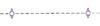
Leading Line
|
 type=leading_line type=leading_line  seamark:type=navigation_line seamark:type=navigation_line
|
|
| M2
|
|
Clearing Lines or Transits marking Isolated Dangers
|
|
|
| M3
|
|
Recommended Track where based on a system of fixed marks
|
seamark:type=recommended_track
|
|
| M4
|
|
Recommended Track where not based on a system of fixed marks
|
seamark:type=recommended_track
|
|
| M5.1
|
|
Oneway tracks and DW tracks based on a system of fixed marks
|
seamark:type=deepwater_route
|
|
| M5.2
|
|
Oneway tracks and DW tracks not based on a system of fixed marks
|
seamark:type=deepwater_route
|
|
| M6
|

|
Maximum authorized (or recommended) draught
|
maxdraught=* / draft=* / maxdraft=*
|
|
| M10
|
|
Arrow for direction of transit in TSS
|
seamark:type=separation_lane
|
|
| M11
|
|
Arrow for recomended direction of transit in TSS
|
seamark:type=separation_lane
|
|
| M12
|
|
Separation Line
|
seamark:type=separation_line
|
|
| M13
|

|
Separation Zone
|
seamark:type=separation_zone
|
|
| M14
|

|
Limit of Restricted Area
|
seamark:type=restricted_area
|
|
| M15
|

|
Limit of Routing Measures
|
seamark:type=separation_boundary
|
|
| M16
|

|
Danger Symbol
|
|
|
| M17
|

|
Archipelagic Sea Line (ASL)
|
|
|
| M18
|
|
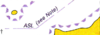
Fairway
|
seamark:type=fairway / seamark:type=separation_lane?
|
|
|
|
| M21
|
|
Roundabout in a TSS
|
seamark:type=separation_roundabout
|
|
| M22
|
|
Junction in a TSS
|
|
|
| M23
|
|
Crossing in a TSS
|
|
|
| M24
|
|
Precaution Area
|
|
|
| M30
|

|
Radar Surveillance Station
|
seamark:type=radar_station
|
|
| M31
|

|
Radar Range
|
seamark:type=radar_line
|
|
| M32.1
|

|
Radar Reference Line
|
seamark:type=radar_line
|
|
| M32.2
|

|
Radar Reference Line coinciding with a leading line
|
seamark:type=radar_line / seamark:type=navigation_line
|
|
| M40.1
|
|
Radio Reporting Point showing with direction of report and designation (if any)
|
seamark:type=calling-in_point
|
|
| M40.2
|
|
Radio Reporting Line
|
seamark:type=calling-in_point
|
|
| M50
|

|
Ferry Route
|
route=ferry
|
|
| M51
|

|
Cable Ferry Route
|
route=ferry
|
|
N: Areas, Limites
|
N1.1
N1.2
|
 
|
Non-restricted areas
|
|
|
| N2.1
|

|
Restriction Area such as speed limits, access restrictions, etc.
|
seamark:type=restricted_area
|
|
| N2.2
|

|
Entry Prohibited Area
|
seamark:type=restricted_area + seamark:restricted_area:restriction=no_entry
|
|
| N10
|

|
Reported Anchorages
|
seamark=anchorage seamark:type=anchorage
|
|
| N11.1
|

|
Designated Anchor Berth
|
seamark=anchorage seamark:type=anchorage
|
|
| N11.2
|

|
Designated Anchor Berth with limit
|
seamark=anchorage seamark:type=anchorage
|
|
| N12.1
|

|
Anchorage Area, defined limit
|
seamark=anchorage seamark:type=anchorage
|
|
| N12.2
|

|
Anchorage Area, numbered Anchorage
|
seamark=anchorage seamark:type=anchorage
|
|
| N12.3
|

|
Anchorage Area, named Anchorage
|
seamark=anchorage seamark:type=anchorage
|
|
| N12.4
|

|
Anchorage Area, deep Water Anchorage
|
seamark=anchorage seamark:type=anchorage
|
|
| N12.5
|

|
Anchorage Area, tanker Anchorage
|
seamark=anchorage seamark:type=anchorage
|
|
| N12.6
|

|
Anchorage Area, for periods up to 24h
|
seamark=anchorage seamark:type=anchorage
|
|
| N12.7
|

|
Anchorage Area, explosives
|
seamark=anchorage seamark:type=anchorage
|
|
| N12.8
|

|
Anchorage Area, quarantine Anchorage
|
seamark=anchorage seamark:type=anchorage
|
|
| N12.9
|

|
Anchorage Area, reserved Anchorage
|
seamark=anchorage seamark:type=anchorage
|
|
| N13
|

|
Seaplane operation area
|
seamark:type=seaplane_landing_area
|
|
| N14
|

|
Seaplane anchorage
|
seamark=anchorage seamark:type=anchorage
|
|
| N20
|

|
Areas in which Anchorage is prohibited
|
seamark:type=restricted_area + seamark:restricted_area:restriction=no_anchoring
|
|
| N21
|

|
Area where Fishing is prohibited
|
seamark:type=restricted_area + seamark:restricted_area:restriction=no_fishing
|
|
| N22
|
           
|
Bird Sanctuary, Seal Sanctuary, Nature Reserve, National Park, Marine Sanctuary or Marine Reserve. Can also be PSSA (Particularly Sensitive Sea Area)
|
boundary=national_park or boundary=protected_area
|
|
| N23.1
|

|
Explosives Dumping Ground
|
|
|
| N23.2
|

|
Explosives Dumping Ground (disused)
|
|
|
| N24
|

|
Dumping Ground for Harmful Substances
|
|
|
| N25
|

|
Degaussing Range
|
|
|
| N26
|

|
Historic Wreck
|
|
|
| N27
|

|
Maximum Speed
|
maxspeed=* seamark:type=restricted_area + seamark:restricted_area:restriction=restricted_speed
|
|
| N30
|

|
Limit of Firing danger area
|
seamark:type=restricted_area + seamark:restricted_area:category=military
|
|
| N31
|

|
Other Naval Practice Area
|
seamark:type=restricted_area + seamark:restricted_area:category=military
|
|
| N32
|

|
Limit of Mine laying or counter-measures/clearance practice area
|
seamark:type=restricted_area + seamark:restricted_area:category=military
|
|
| N33
|

|
Submarine Practice Area
|
seamark:type=restricted_area + seamark:restricted_area:category=military
|
|
| N34
|

|
Mine field
|
seamark:type=restricted_area + seamark:restricted_area:category=military
|
|
| N40
|
 
|
International boundaries on land
|
boundary=administrative + admin_level=2 in two boundary relations, one for each country
|
Proposed features/Maritime borders
|
| N41
|
 
|
International maritime boundaries
|
boundary=administrative + admin_level=2 maritime=yes + border_type=territorial should be part of the same relation as the land border
|
Proposed features/Maritime borders
|
| N42
|

|
Baseline
|
boundary=maritime + border_type=baseline
|
Proposed features/Maritime borders
|
| N43
|
 
|
Territorial Sea
|
boundary=maritime + border_type=territorial?
|
Proposed features/Maritime borders
|
| N44
|

|
Contiguous Zone
|
boundary=maritime + border_type=contiguous
|
Proposed features/Maritime borders
|
| N45
|

|
Fishery Zone
|
boundary=maritime + border_type=fishery?
|
Proposed features/Maritime borders
|
| N46
|

|
Continental Shelf
|
natural=continental_shelf?
|
|
| N47
|
 
|
Exclusive Economic Zone
|
boundary=maritime + border_type=eez seamark:type=exclusive_economic_zone
|
Proposed features/Maritime borders
|
| N48
|

|
Customs Limit
|
|
|
| N49
|

|
Defined Harbour Limits
|
boundary=maritime + border_type=harbour_limits?
|
Harbour
|
| N60.1
|
 
|
Limit of Fast Ice, Ice Front (with date)
|
|
|
| N60.2
|
 
|
Limit of Sea Ice, Pack Ice (with date)
|
|
|
| N61
|

|
Log Pond
|
|
|
| N62.1
|

|
Spoil Ground
|
seamark:type=restricted_area + seamark:restricted_area:category=foul_ground
|
|
| N62.2
|

|
Spoil Ground, disused
|
seamark:type=restricted_area + seamark:restricted_area:category=foul_ground + disused=yes
|
|
| N63
|

|
Dredging Area
|
waterway=dredged_area seamark:type=dredged_area
|
|
| N64
|

|
Cargo Transhipment Area
|
|
|
| N65
|

|
Incineration Area
|
|
|
| Na
|
|
Seabed Operations Dangerous/Prohibited
|
|
|
| Na
|
|
Danger Area
|
|
|
| Nb
|

|
Limit of iceberg
|
|
|
Nb
Nb
|

|
Diving Prohibited
|
seamark:type=restricted_area + seamark:restricted_area:restriction=no_diving
|
|
| Nc
|
|
Embankment area
|
|
|
| Nc
|

|
Maximum speed limit
|
maxspeed=*
|
|
| Nd
|
|
District or province limit
|
boundary=administrative + admin_level=4
|
|
| Nd
|

|
Bottom chain
|
|
|
O: Hydrographic Terms
|
| As chapter O contains no symbols, chapter is omitted in this list
|
P: Lights
|
| P1
|


|
Major Light, Minor Light, Light, Lighthouse
|
seamark:light:colour=* seamark:type=light_minor / seamark:type=light_major
|
Proposed features/marine-tagging
OpenSeaMap/Lights Data Model
|
| P2
|

|
Lighted Offshore Platforms
|
seamark:light:colour=* seamark:type=platform
|
Proposed features/marine-tagging
|
| P3
|

|
Lighted Beacon Tower
|
seamark:light:colour=*
|
Proposed features/marine-tagging
|
| P4
|


|
Lighted Beacon
|
seamark:light:colour=*
|
Proposed features/marine-tagging
|
| P5
|

|
Buoyant Beacon, Resilient Beacon
|
seamark:light:colour=*
|
Proposed features/marine-tagging
|
| P6
|


|
Major Floating Light (light vessel, major light float, LANBY)
|
seamark:type=light_vessel or seamark:type=light_float with seamark:light:colour=*
|
Proposed features/marine-tagging
|
| P10.#
|
|
Class of Light
- Fixed (constant light)
- Occulting (total duration of light longer than duration of darkness)
- Isophase (duration of light and darkness equal)
- Flashing (total duration of light shorter than duration of darkness)
- Long-flashing (flash 2s or longer)
- Quick (repetition rate of 50 to 79 - usually either 50 or 60 - flashes per minute)
- Continuous Quick
- Group Quick
- Interrupted Quick
- Very Quick (repetition rate of 80 to 159 - usually either 100 or 120 - flashes per minute)
- Continuous Very Quick
- Group Very Quick
- Interrupted Very Quick
- Ultra Quick (repetition rate of 160 or more - usually either 240 or 300 - flasher per minute)
- Continuous Ultra Quick
- Interrupted Ultra Quick
- Morse Code
- Alternating
|
|
Proposed features/marine-tagging
|
| P11.#
|

|
Color of Light
- White
- Red
- Green
- Blue
- Violet
- Yellow
- Orange
- Amber
|
seamark:light:colour=*
|
Proposed features/marine-tagging
|
| P12
|
|
Periods
|
seamark:light:period=*
|
Proposed features/marine-tagging
|
| P13
|
|
Elevation of Light in meters
|
seamark:light:height=*
|
Proposed features/marine-tagging
|
| P14
|
|
Nominal Range in Nautical Miles
|
seamark:light:range=*
|
Proposed features/marine-tagging
|
| P15
|
|
Position
- Horizontal (hor)
- Vertical (vert)
|
seamark:light:category=*
|
Proposed features/marine-tagging
|
| P16
|
|
Full light Description
|
Composition of all seamark:light:*=*
|
Proposed features/marine-tagging
|
| P20.1
|
|
Leading Lights with leading line (firm line is track to follow) and arcs of visibility
|
seamark:light:category=directional type=leading_light or part of seamark:type=navigation_line
|
Proposed features/marine-tagging
|
| P20.2
|

|
Leading Lights (≠ : any two objects in line)
|
seamark:light:category=directional
|
Proposed features/marine-tagging
|
| P20.3
|


|
Leading Lights leading lights in small scale charts
|
seamark:light:category=directional
|
Proposed features/marine-tagging
|
| P21
|
|
Light in line marking the sides of a channel
|
seamark:light:category=directional?
|
Proposed features/marine-tagging
|
| P22
|
|
Rear or Upper light
|
seamark:light:category=upper or seamark:light:category=rear
|
Proposed features/marine-tagging
|
| P23
|
|
Front or Lower light
|
seamark:light:category=front or seamark:light:category=lower
|
Proposed features/marine-tagging
|
| P30.1
|

|
Direction Lights with narrow sector and course to be followed
|
seamark:light:category=directional
|
Proposed features/marine-tagging
|
| P30.2
|
|
Direction Lights with course to be followed
|
seamark:light:category=directional
|
Proposed features/marine-tagging
|
| P30.3
|
|
Direction Lights with narrow fairway sector flanked by light sectors of different characters
|
seamark:light:category=directional
|
Proposed features/marine-tagging
|
| P30.4
|
|
Direction Lights with narrow fairway sector flanked by light sectors of different characters on many color maps
|
seamark:light:category=directional
|
Proposed features/marine-tagging
|
| P31
|

|
Moire Effect Light (day and night)
Arrows show when course alteration needed
|
seamark:light:category=moire
|
Proposed features/marine-tagging
|
| P40.1
|
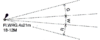
|
Sector Light on Standard Charts
|
seamark:light:*:sector_start=* and seamark:light:*:sector_end=*
|
Proposed features/marine-tagging
|
| P40.2
|
|
Sector Light on Many Color Charts
|
seamark:light:*:sector_start=* and seamark:light:*:sector_end=*
|
Proposed features/marine-tagging
|
| P41.1
|
|
Sector Light, the white sector marks sides of the fairway on Standard Charts
|
seamark:light:*:sector_start=* and seamark:light:*:sector_end=*
|
Proposed features/marine-tagging
|
| P41.2
|
|
Sector Light, the white sector marks sides of the fairway on Many Color Charts
|
seamark:light:*:sector_start=* and seamark:light:*:sector_end=*
|
Proposed features/marine-tagging
|
| P42
|

|
Main Light visible all around with subsidiary light seen over danger
|
separate node with seamark:light:category=subsidiary
|
Proposed features/marine-tagging
|
| P43
|
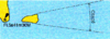
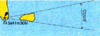
|
All-around light with obscured sector
|
seamark:light:colour=* + seamark:light:visibility=part_obscured
|
Proposed features/marine-tagging
|
| P44
|
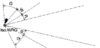
|
Light with arc of visibility deliberately restricted
|
seamark:light:*:sector_start=* and seamark:light:*:sector_end=* (exclude restricted sector on purpose)
|
Proposed features/marine-tagging
|
| P45
|
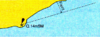
|
Light with faint sector
|
seamark:light:visibility=unintensified
|
Proposed features/marine-tagging
|
| P46
|
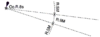
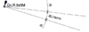
|
Light with intensified sector
|
seamark:light:visibility=intensified
|
Proposed features/marine-tagging
|
| P50
|
|
Lights Exhibited only when needed
|
seamark:light:exhibition=on_demand
|
Proposed features/marine-tagging
|
| P51
|
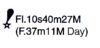
|
Daytime lights (charted only where character shown by day differs from that shown at night)
|
seamark:light:exhibition=day
|
Proposed features/marine-tagging
|
| P52
|
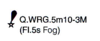
|
Fog Light (exhibited only in fog, or when character changes in fog)
|
seamark:light:exhibition=fog
|
Proposed features/marine-tagging
|
| P53
|

|
Unwatched (Unmanned) light with no standby or emergency arrangements
|
seamark:light:status=unreliable
|
Proposed features/marine-tagging
|
| P54
|
(temp)
|
Temporary
|
seamark:light:status=temporary
|
Proposed features/marine-tagging
|
| P55
|
(exting)
|
Extinguished
|
seamark:light:status=extinguished / disused=*
|
Proposed features/marine-tagging
|
| P60
|
|
Aero Light
|
seamark:light:category=aero
|
Proposed features/marine-tagging
|
| P61.1
|
|
Air Obstruction Light, High Intensity
|
seamark:light:category=air_obstruction
seamark:light:visibility=intensified
seamark:light:visibility can be omitted if unknown
|
Proposed features/marine-tagging
|
| P61.2
|
|
Air Obstruction Light, Low Intensity
|
seamark:light:category=air_obstruction
seamark:light:visibility=unintensified
seamark:light:visibility can be omitted if unknown
|
Proposed features/marine-tagging
|
| P62
|
|
Fog Detector Light
|
seamark:light:category=fog_detector
|
Proposed features/marine-tagging
|
| P63
|

|
Floodlight, Floodlighting of a structure
|
seamark:light:category=floodlight
|
Proposed features/marine-tagging
|
| P64
|

|
Strip lights
|
seamark:light:category=striplight
|
Proposed features/marine-tagging
|
| P65
|
|
Private light other than one exhibited occasionally
|
seamark:light:status=private
|
Proposed features/marine-tagging
|
| Pa
|

|
Alternating Light on Many Color Charts
|
seamark:light:character=Al
|
|
| Pa
|
|
Navigational Lights on Landmarks or Other Structures
|
seamark:light:colour=*
|
|
| Pb
|
|
Lights located outside the chart
|
seamark:light:colour=*
|
|
| Pc
|

|
Light with unintensified sector
|
seamark:light:colour=*
|
|
| Pd
|
(sync) or (sync)
|
Synchronized or Sequential
|
|
|
Q: Buoys, Beacons
|
| Q1
|

|
Position of Buoy
|
seamark:type=buoy_lateral or seamark:type=buoy_cardinal or seamark:type=buoy_isolated_danger or seamark:type=buoy_safe_water or seamark:type=buoy_special_purpose
|
Proposed features/marine-tagging OpenSeaMap/Buoy Data Model
|
| Q2
|

|
Green or Black (symbol filled black)
|
seamark:buoy_lateral:colour=green or seamark:buoy_special_purpose:colour=black
|
Proposed features/marine-tagging
|
| Q3
|

|
Single Color other than Green or Black
|
seamark:buoy_lateral:colour=* / seamark:buoy_cardinal:colour=* / seamark:buoy_isolated_danger:colour=black;red;black / seamark:buoy_safe_water:colour=red;white / seamark:buoy_special_purpose:colour=* with any other value than green or black
|
Proposed features/marine-tagging
|
| Q4
|

|
Multiple Color in Horizontal bands
|
seamark:buoy_lateral:colour_pattern=horizontal / seamark:buoy_cardinal:colour_pattern=horizontal / seamark:buoy_isolated_danger:colour_pattern=horizontal / seamark:buoy_special_purpose:colour_pattern=horizontal
|
Proposed features/marine-tagging
|
| Q5
|

|
Multiple Color in Vertical or Diagonal bands
|
seamark:buoy_safe_water:colour_pattern=vertical / seamark:buoy_special_purpose:colour_pattern=vertical / seamark:buoy_special_purpose:colour_pattern=diagonal
|
Proposed features/marine-tagging
|
| Q6
|
Refl
|
Retroreflecting material
|
retroreflecting=yes / seamark:reflectivity=* / seamark:buoy_lateral:reflectivity=* / seamark:buoy_cardinal:reflectivity=* / seamark:buoy_isolated_danger:reflectivity=* / seamark:buoy_safe_water:reflectivity=* / seamark:buoy_special_purpose:reflectivity=*
|
Proposed features/marine-tagging
|
| Q7
|

|
Light marks on standard charts
|
seamark:light:colour=*
|
Proposed features/marine-tagging
|
| Q8
|

|
Light marks on multi colored charts
|
seamark:light:colour=* or sector information
|
Proposed features/marine-tagging
|
| Q9
|

|
IALA System Buoy Topmark
|
seamark:topmark:colour=* and seamark:topmark:shape=*
|
Proposed features/marine-tagging Proposed features/marine-tagging/topmark
|
| Q10
|
 
|
Beacon with topmark, color, Radar reflector, and designation
|
seamark:type=beacon_lateral + seamark:beacon_lateral:colour=red + seamark:radar_reflector=yes + seamark:topmark:colour=red + seamark:topmark:shape=cylinder + seamark:name=* + seamark:beacon_lateral:system=* + seamark:beacon_lateral:category=*
|
Proposed features/marine-tagging
|
| Q11
|
 
|
Buoy with topmark, color, Radar reflector, and designation
|
seamark:type=buoy_lateral + seamark:buoy_lateral:colour=* + seamark:buoy_lateral:shape=conical + seamark:buoy_lateral:system=* + seamark:buoy_lateral:category=* + seamark:radar_reflector=yes + seamark:topmark:colour=green + seamark:topmark:shape=cone, point up + seamark:name=*
|
Proposed features/marine-tagging
|
| Q20
|

|
shape of buoy - conical
|
seamark:buoy_lateral:shape=conical / seamark:buoy_cardinal:shape=conical / seamark:buoy_isolated_danger:shape=conical / seamark:buoy_safe_water:shape=conical / seamark:buoy_special_purpose:shape=conical
|
Proposed features/marine-tagging
|
| Q21
|

|
shape of buoy - cylindrical
|
seamark:buoy_lateral:shape=can / seamark:buoy_cardinal:shape=can / seamark:buoy_isolated_danger:shape=can / seamark:buoy_safe_water:shape=can / seamark:buoy_special_purpose:shape=can
|
Proposed features/marine-tagging
|
| Q22
|

|
shape of buoy - spherical
|
seamark:buoy_lateral:shape=spherical / seamark:buoy_cardinal:shape=spherical / seamark:buoy_isolated_danger:shape=spherical / seamark:buoy_safe_water:shape=spherical / seamark:buoy_special_purpose:shape=spherical
|
Proposed features/marine-tagging
|
| Q23
|

|
shape of buoy - pillar
|
seamark:buoy_lateral:shape=pillar / seamark:buoy_cardinal:shape=pillar / seamark:buoy_isolated_danger:shape=pillar / seamark:buoy_safe_water:shape=pillar / seamark:buoy_special_purpose:shape=pillar
|
Proposed features/marine-tagging
|
| Q24
|

|
shape of buoy - spar
|
seamark:buoy_lateral:shape=spar / seamark:buoy_cardinal:shape=spar / seamark:buoy_isolated_danger:shape=spar / seamark:buoy_safe_water:shape=spar / seamark:buoy_special_purpose:shape=spar
|
Proposed features/marine-tagging
|
| Q25
|

|
shape of buoy - barrel
|
seamark:buoy_special_purpose:shape=barrel
|
Proposed features/marine-tagging
|
| Q26
|

|
shape of buoy - superbuoy
|
seamark:buoy_special_purpose:shape=super-buoy
|
Proposed features/marine-tagging
|
| Q30
|

|
Light float as part of IALA System
|
seamark:type=light_float
|
Proposed features/marine-tagging
|
| Q31
|

|
Light float (unmanned light vessel) not part of IALA System
|
seamark:type=light_float
|
Proposed features/marine-tagging
|
| Q40
|


|
Mooring Buoys
|
seamark:type=mooring + seamark:mooring:category=buoy
|
Proposed features/marine-tagging
|
| Q41
|

|
Mooring Buoys with light
|
seamark:type=mooring + seamark:mooring:category=buoy + seamark:light:colour=*
|
Proposed features/marine-tagging
|
| Q42
|

|
Mooring trots
|
seamark:type=mooring
|
Proposed features/marine-tagging
|
| Q43
|

|
Mooring Buoy with telegraphic or telephonic cabel
|
seamark:type=mooring + seamark:mooring:category=buoy + amenity=telephone
|
Proposed features/marine-tagging
|
| Q44
|

|
Numerous Moorings
|
seamark:type=mooring + seamark:mooring:category=buoy
|
Proposed features/marine-tagging
|
| Q50
|

|
Firing Danger Area
|
seamark:type=buoy_special_purpose + seamark:topmark:shape=x-shape
|
Proposed features/marine-tagging
|
| Q51
|

|
Target
|
seamark:type=buoy_special_purpose + seamark:topmark:shape=x-shape + seamark:name=Target
|
Proposed features/marine-tagging
|
| Q52
|

|
Marker Ship
|
seamark:type=buoy_special_purpose + seamark:topmark:shape=x-shape + seamark:name=Marker ship
|
Proposed features/marine-tagging
|
| Q53
|

|
Barge
|
seamark:type=buoy_special_purpose + seamark:topmark:shape=x-shape + seamark:name=Barge
|
Proposed features/marine-tagging
|
| Q54
|

|
Degaussing Range
|
seamark:type=buoy_special_purpose + seamark:topmark:shape=x-shape
|
Proposed features/marine-tagging
|
| Q55
|

|
Buoy marking cable
|
seamark:type=buoy_special_purpose + seamark:topmark:shape=x-shape
|
Proposed features/marine-tagging
|
| Q56
|

|
Spoil Ground
|
seamark:type=buoy_special_purpose + seamark:topmark:shape=x-shape
|
Proposed features/marine-tagging
|
| Q57
|

|
Buoy marking outfalls
|
seamark:type=buoy_special_purpose + seamark:topmark:shape=x-shape
|
Proposed features/marine-tagging
|
| Q58
|

|
ODAS-buoy (Ocean Data Acquisition System) Data Collection buoy of superbuoy size
|
seamark:type=buoy_special_purpose + seamark:buoy_special_purpose:category=odas + seamark:buoy_special_purpose:shape=super-buoy
|
Proposed features/marine-tagging
|
| Q59
|

|
Buoy marking wave recorder or current meter
|
seamark:type=buoy_special_purpose + seamark:topmark:shape=x-shape
|
Proposed features/marine-tagging
|
| Q60
|
|
Seaplane anchorage buoy
|
seamark:type=buoy_special_purpose
|
Proposed features/marine-tagging
|
| Q61
|
|
Buoy marking traffic separation scheme
|
|
Proposed features/marine-tagging
|
| Q62
|

|
Buoy marking recreation zone
|
seamark:type=buoy_special_purpose
|
Proposed features/marine-tagging
|
| Q70
|

|
Buoy privately maintained
|
|
Proposed features/marine-tagging
|
| Q71
|
 
|
Temporary buoy
|
|
Proposed features/marine-tagging
|
| Q80
|


|
Beacon in general
|
man_made=beacon or seamark=beacon or landmark=beacon or airmark=beacon - seamark:type=beacon_lateral / seamark:type=beacon_cardinal / seamark:type=beacon_isolated_danger / seamark:type=beacon_safe_water / seamark:type=beacon_special_purpose
|
OpenSeaMap/Beacon Data Model, Proposed features/day beacon, Proposed features/marine-tagging, Marine navigation, Proposed features/aeroway obstacle, Proposed features/Airports
|
| Q81
|

|
Beacon with color, no distinctive topmark
|
seamark:beacon_lateral:colour=* / seamark:beacon_cardinal:colour=* / seamark:beacon_isolated_danger:colour=black;red;black / seamark:beacon_safe_water:colour=red;white / seamark:beacon_special_purpose:colour=*
|
Proposed features/marine-tagging
|
| Q82
|

|
Beacon with color and topmarks
|
As Q80 and Q81 + seamark:topmark:colour=* + seamark:topmark:shape=*
|
Proposed features/marine-tagging
|
| Q83
|
 
|
Beacon on submerged rock (topmarks as appropriate)
|
As Q80 on K13
|
Proposed features/marine-tagging
|
| Q90
|

|
Pole
|
seamark:beacon_lateral:shape=pole / seamark:beacon_special_purpose:shape=pole
|
Proposed features/marine-tagging
|
| Q91
|

|
Perch
|
seamark:beacon_lateral:shape=perch
|
Proposed features/marine-tagging
|
| Q92
|
|
Withy
|
seamark:beacon_lateral:shape=withy
|
Proposed features/marine-tagging
|
| Q100
|

|
Cairns
|
man_made=cairn + landmark=cairn / seamark:beacon_special_purpose:shape=cairn
|
Proposed features/Cairn, Openseamap/Beacon Data Model, Proposed features/marine-tagging, Proposed features/sea mark
|
| Q101
|

|
Colored or White marks
|
seamark:type=daymark + seamark:daymark:colour=* + seamark:daymark:shape=*
|
Proposed features/marine-tagging
|
| Q102.1
|


|
Coloured topmark (color known or unknown) with function of a beacon
|
seamark:topmark:colour=*
|
Proposed features/marine-tagging
|
| Q102.2
|

|
Painted boards with functions of leading beacons
|
seamark:topmark:shape=board
|
Proposed features/marine-tagging
|
| Q110
|

|
Beacon Tower
|
seamark:beacon_lateral:shape=tower / seamark:beacon_cardinal:shape=tower / seamark:beacon_isolated_danger:shape=tower / seamark:beacon_safe_water:shape=tower / seamark:beacon_special_purpose:shape=tower
|
Proposed features/marine-tagging
|
| Q111
|

|
Lattice Beacon
|
seamark:beacon_lateral:shape=tower / seamark:beacon_cardinal:shape=tower / seamark:beacon_isolated_danger:shape=tower / seamark:beacon_safe_water:shape=tower / seamark:beacon_special_purpose:shape=tower
|
Proposed features/marine-tagging
|
| Q120
|

|
Leading beacons
|
seamark:type=navigation_line
|
Proposed features/marine-tagging
|
| Q121
|

|
Beacons marking a clearing line
|
seamark:type=navigation_line
|
Proposed features/marine-tagging
|
| Q122
|
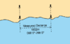
|
Beacons marking measured distances with quoted bearings
|
|
Proposed features/marine-tagging
|
| Q123
|

|
Cable Landing Beacon
|
seamark:beacon_special_purpose:category=cable
|
Proposed features/marine-tagging
|
| Q124
|
 
|
Refuge Beacon
|
|
Proposed features/marine-tagging
|
| Q125
|
|
Firing Practice area Beacons
|
seamark:beacon_special_purpose:category=warning
|
Proposed features/marine-tagging
|
| Q126
|
NB

|
Notice Board
|
seamark:beacon_special_purpose:category=notice
|
Proposed features/marine-tagging
|
| Q130.1
|
Lateral Marks are generally for well defined channels. There are two international buoyage regions - A and B - where Lateral marks differ
seamark:type=buoy_lateral + seamark:buoy_lateral:colour=red/green + seamark:buoy_lateral:shape=* + seamark:topmark:colour=red/green + seamark:topmark:shape=cylinder/cone, point up + seamark:buoy_lateral:system=iala-a/iala-b + seamark:buoy_lateral:category=* + seamark:light:colour=red/green
seamark:type=beacon_lateral + seamark:beacon_lateral:colour=red/green + (seamark:beacon_lateral:shape=*) + seamark:topmark:colour=red/green + seamark:topmark:shape=cylinder/cone, point up + seamark:beacon_lateral:system=iala-a/iala-b + seamark:beacon_lateral:category=* + seamark:light:colour=red/green
|
| Q130.2
|
|
Signal for direction of buoyage
|
| Q130.3
|
Cardinal Marks indicating navigable water to the named side of the mark. Cardinal marks have the same meaning in Region A and B.
seamark:type=buoy_cardinal + seamark:buoy_cardinal:category=north/east/south/west + seamark:buoy_cardinal:shape=* + seamark:topmark:colour=black seamark:topmark:shape=* + seamark:light:colour=white + seamark:buoy_cardinal:colour_pattern=horizontal + seamark:buoy_cardinal:colour=*
seamark:type=beacon_cardinal + seamark:beacon_cardinal:category=north/east/south/west + seamark:beacon_cardinal:shape=* + seamark:topmark:colour=black seamark:topmark:shape=* + seamark:light:colour=white + seamark:beacon_cardinal:colour_pattern=horizontal + seamark:beacon_cardinal:colour=*
Note: Cardinal marks always have topmarks, and always have the same colour combinations. Light characteristics can vary some (Fl, Q, VQ or UQ), but group combinations are always the same. Cardinal marks might be lit or unlit.
|
| Q130.4
|
Isolated Danger Marks, stationed over dangers with navigable water around them.
seamark:type=buoy_isolated_danger + seamark:buoy_isolated_danger:shape=* + seamark:buoy_isolated_danger:colour=black;red;black + seamark:buoy_isolated_danger:colour_pattern=horizontal + seamark:topmark:shape=2 spheres + seamark:topmark:colour=black + seamark:light:colour=*
seamark:type=beacon_isolated_danger + seamark:beacon_isolated_danger:shape=* + seamark:beacon_isolated_danger:colour=black;red;black + seamark:beacon_isolated_danger:colour_pattern=horizontal + seamark:topmark:shape=2 spheres + seamark:topmark:colour=black + seamark:light:colour=white
|
| Q130.5
|
Safe Water Marks, such as mid-channel and landfall marks
seamark:type=buoy_safe_water + seamark:buoy_safe_water:colour=red;white + seamark:buoy_safe_water:colour_pattern=vertical + seamark:topmark:shape=sphere + seamark:topmark:colour=red + seamark:light:colour=white
seamark:type=beacon_safe_water + seamark:beacon_safe_water:colour=red;white + seamark:beacon_safe_water:colour_pattern=vertical + seamark:topmark:shape=sphere + seamark:topmark:colour=red + seamark:light:colour=white
|
| Q130.6
|
Special Marks, not primarily to assist navigation but to indicate special features
seamark:type=buoy_special_purpose + seamark:buoy_special_purpose:shape=* + seamark:buoy_special_purpose:colour=yellow + seamark:buoy_special_purpose:category=* + seamark:topmark:shape=x-shape + seamark:topmark:colour=* + seamark:light:colour=*
seamark:type=beacon_special_purpose + seamark:beacon_special_purpose:shape=* + seamark:beacon_special_purpose:colour=yellow + seamark:beacon_special_purpose:category=* + seamark:topmark:shape=x-shape + seamark:topmark:colour=* + seamark:light:colour=*
|
|
|
Emergency wreck buoy [1] (fr)
is under consideration by IALA to be implemented, but currently under testing (thus no INT-1 code).
Its purpose is to mark temporary dangers to navigation, such as new ship wrecks in high density traffic areas. The need of a special mark like this was highlighted after the Tricolor accident in English channel, where even if marked with not less than 5 Cardinal buoys, and guarded by a dedicated guard vessel, no less than 3 other ships collided with the semi-submersed wreck.
seamark:type=buoy_special_purpose + seamark:buoy_special_purpose:colour=yellow;blue + seamark:buoy_special_purpose:colour_pattern=vertical + seamark:name=* + seamark:topmark:colour=yellow + seamark:topmark:shape=upright-cross
seamark:light:colour=yellow;blue + seamark:light:character=Al
|
| Qa
|

|
Distance to rand of channel border
|
|
|
| Qa/Qb/Qc
|
|
national symbols for beacons, daymarks non-IALA
|
seamark:type=beacon_special_purpose
|
|
| Qd
|

|
Racing mark
|
seamark:buoy_special_purpose:category=racing
|
|
| Qe
|
|
Beacon that does not conform with the IALA system
|
|
|
R: Fog Signals
|
| R1
|

|
Audible Fog Signal
|
seamark:fog_signal=yes
|
Proposed features/marine-tagging
|
| R10
|
Explos
|
Explosive
|
seamark:fog_signal:category=explosive
|
Proposed features/marine-tagging
|
| R11
|
Dia
|
Diaphone
|
seamark:fog_signal:category=diaphone
|
Proposed features/marine-tagging
|
| R12
|
Siren
|
Siren
|
seamark:fog_signal:category=siren
|
Proposed features/marine-tagging
|
| R13
|
Horn
|
Horn
|
seamark:fog_signal:category=horn
|
Proposed features/marine-tagging
|
| R14
|
Bell
|
Bell
|
seamark:fog_signal:category=bell
|
Proposed features/marine-tagging
|
| R15
|
Whis
|
Whistle
|
seamark:fog_signal:category=whistle
|
Proposed features/marine-tagging
|
| R16
|
Gong
|
Gong
|
seamark:fog_signal:category=gong
|
Proposed features/marine-tagging
|
| R20
|

|
Siren at a lighthouse, giving a long blast followed by a short one (N), repeated every 60 second
|
man_made=lighthouse + seamark:type=light_major + seamark:fog_signal:category=siren + seamark:fog_signal:group=N + seamark:fog_signal:period=60
|
Proposed features/marine-tagging
|
| R21
|

|
Wave-actuated bell buoy
|
seamark:type=buoy_cardinal + seamark:fog_signal:category=bell + seamark:fog_signal:status=wave_activated
|
Proposed features/marine-tagging
|
| R22
|

|
Light buoy with a horn giving a single blast every 15 seconds
|
seamark:type=buoy_cardinal + seamark:fog_signal:category=horn + seamark:fog_signal:period=15
|
Proposed features/marine-tagging
|
| Ra
|
|
Fog Gun
|
seamark:fog_signal:category=gun
|
Proposed features/marine-tagging
|
S: Electronic Position-Fixing Systems
|
| S1
|

|
Coast radar station, providing range and bearing service on request
|
amenity=coast_radar_station? seamark:type=radar_station
|
|
| S2
|

|
Ramark, radar beacon transmitting continuosly
|
seamark:radar_transponder:category=ramark
|
|
| S3.1
|

|
Radar transponder beacon, with morse identification, responding within the 3-cm(X)-band
|
seamark:radar_transponder:category=racon + seamark:radar_transponder:group=* + radar_transponder:band=X
|
|
| S3.2
|

|
Radar transponder beacon, with morse identification, responding with 10cm(S)-band with limit
|
seamark:radar_transponder:category=racon + seamark:radar_transponder:group=* + radar_transponder:band=S
|
|
| S3.3
|

|
Radar transponder beacon, with morse identification
|
seamark:radar_transponder:category=racon + seamark:radar_transponder:group=*
|
|
| S3.4
|
 
|
radar transponder beacon with seactor (of obscured) reception
|
seamark:radar_transponder:category=racon + seamark:radar_transponder:group=* + seamark:radar_transponder:sector_start=* + seamark:radar_transponder:sector_end=*
|
|
| S3.5
|
 
|
leading radar transponder beacons
|
radar_transponder=leading seamark:type=navigation_line
|
|
| S3.6
|
 
|
floating marks with radar transponder beacons
|
radar_transponder=*
|
|
| S4
|

|
radar reflector
|
seamark:radar_reflector=yes
|
|
| S5
|

|
Radar-conspicious feature
|
radar_conspicious=yes or seamark:conspicuity=conspicuous
|
|
| S10
|

|
Circular (non-directional) marine or aeromarine radiobeacon
|
radio_transponder:category=circular or seamark:radio_station:category=beacon_circular
|
|
| S11
|
 
|
directional radiobeacon
|
radio_transponder:category=directional or seamark:radio_station:category=beacon_directional
|
|
| S12
|

|
rotating-pattern radiobeacon
|
radio_transponder:category=rotating_pattern or seamark:radio_station:category=beacon_rotating
|
|
| S13
|

|
Consol beacon
|
radio_transponder:category=consol or seamark:radio_station:category=beacon_consol
|
|
| S14
|

|
radio direction-finding station
|
radio_transponder:category=direction_finding or seamark:radio_station:category=direction_finding
|
|
| S15
|

|
coast radio station providing QTG service
|
radio_transponder:category=coast_radio or seamark:radio_station:category=qtg_services
|
|
| S16
|

|
aeronautical radiobeacon
|
radio_transponder:category=aeronautical or seamark:radio_station:category=beacon_aero
|
|
| S17.1
|

|
Automatic Identification System transmitter
|
radio_transponder:AIS=yes
|
|
| S17.2
|
 
|
Automatic Identification System transmitter
|
radio_transponder:AIS=yes
|
|
| S50
|
WGS
WGS72
WGS84
|
World Geodetic System, 1972, 1984
|
|
This should not be tagged as all OSM data is WGS84
|
| S51
|

|
DGPS Correction Transmitter
|
man_made=monitoring_station with monitoring:gps=yes/no and/or monitoring:glonass=yes/no (future also monitoring:galileo=yes/no) and DGPS_correction=yes and radio_transponder:signal_frequency=283-325kHz or frequency=283-325kHz or seamark:radio_station:category=dgps
|
|
T: Services
|
| T1.1
|

|
Position of pilot boarding place
|
pilotage=boarding_point or seamark:type=pilot_boarding
|
Proposed features/marine-tagging
|
| T1.2
|

|
Position of pilot boarding place, Named
|
pilotage=boarding_point + name=* or seamark:type=pilot_boarding
|
Proposed features/marine-tagging
|
| T1.3
|

|
Position of pilot boarding place with Note
|
pilotage=boarding_point + note:pilotage=* or seamark:type=pilot_boarding
|
Proposed features/marine-tagging
|
| T1.4
|

|
Position of pilot boarding place, Reference
|
pilotage=boarding_point + ref=* + seamark:type=pilot_boarding
|
Proposed features/marine-tagging
|
| T2
|

|
Pilot Station with Pilot Lookout
|
building=yes or building=civic or building=office with office=administrative
|
Proposed features/marine-tagging
|
| T3
|

|
Pilot Office
|
building=yes or building=civic or building=office with office=administrative
|
Proposed features/marine-tagging
|
| T4
|

|
Port which is known for pilotage
|
pilotage=yes
|
Proposed features/marine-tagging
|
| T10
|
   
|
Coastguard Station
|
amenity=coast_guard or emergency=coast_guard
|
Proposed features/coast guard
|
| T11
|
   
|
Combined Coastguard and Rescue Station
|
amenity=coast_guard or emergency=coast_guard seamark:type=rescue_station
|
Proposed features/coast guard Proposed features/Emergency services
|
| T12
|

|
Rescue Station
|
emergency=water_rescue_station seamark:type=rescue_station
|
Proposed features/Emergency services
|
| T13
|
 
|
Lifeboat mooring
|
amenity=lifeboat_station or emergency=lifeboat_station seamark:type=rescue_station
|
Proposed features/Lifeboat
|
| T14
|
Ref
|
Refuge for shipwrecked mariners
|
emergency=marine_refuge?
|
Proposed features/marine-tagging
|
| T20
|

|
Signal Station
|
signal_station=yes or seamark:type=signal_station_traffic / seamark:type=signal_station_warning
|
Proposed features/marine-tagging
|
| T21
|

|
Signal Station showing International Port Traffic Signals
|
signal_station=international_port_traffic seamark:type=signal_station_traffic
|
Proposed features/marine-tagging
|
| T22
|

|
Traffic Signal Station
|
signal_station=traffic seamark:type=signal_station_traffic
|
Proposed features/marine-tagging
|
| T23
|

|
Port Control Signal Station
|
signal_station=control
|
Proposed features/marine-tagging
|
| T24
|

|
Lock, dock and berthing signals
|
signal_station=lock
|
Proposed features/marine-tagging
|
| T25.1
|

|
Bridge Signals
|
signal_station=bridge
|
Proposed features/marine-tagging
|
| T25.2
|

|
Bridge Signals including traffic signals
|
signal_station=bridge
|
Proposed features/marine-tagging
|
| T26
|

|
Distress Signal Station
|
signal_station=distress
|
Proposed features/marine-tagging
|
| T27
|

|
Telegraph Station
|
signal_station=telegraph
|
Proposed features/marine-tagging
|
| T28
|

|
Storm Signal Station
|
signal_station=storm seamark:type=signal_station_warning
|
Proposed features/marine-tagging
|
| T29
|

|
Weather Signal Station / Wind Signal Station
|
signal_station=weather seamark:type=signal_station_warning
|
Proposed features/marine-tagging
|
| T30
|

|
Ice Signal Station
|
signal_station=ice seamark:type=signal_station_warning
|
Proposed features/marine-tagging
|
| T31
|

|
Time Signal Station
|
signal_station=time
|
Proposed features/marine-tagging
|
| T32.1
|
 
|
Tide Scale
|
signal_station=tide_scale seamark:type=waterway_gauge
|
Proposed features/marine-tagging
|
| T32.2
|

|
automatically recording tide gauge
|
signal_station=tide_gauge seamark:type=waterway_gauge
|
Proposed features/marine-tagging
|
| T33
|

|
Tidal Signal Station
|
signal_station=tide seamark:type=waterway_gauge
|
Proposed features/marine-tagging
|
| T34
|
|
Tidal Stream Signal Station
|
signal_station=stream
|
Proposed features/marine-tagging
|
| T35
|

|
Danger Signal Station
|
signal_station=danger seamark:type=signal_station_warning
|
Proposed features/marine-tagging
|
| T36
|
|
Firing Practice Signal Station
|
signal_station=firing seamark:type=signal_station_warning
|
Proposed features/marine-tagging
|
| Ta
|

|
Emergency Telephone
|
emergency=phone
|
|
| Tb
|

|
Signal Mast
|
man_made=mast on signal_station=*
|
|
| Tc
|

|
Naval Signal Station
|
signal_station=* + military=*?
|
|
U: Small Craft (Leisure) Facilities
|
| U1.1
|

|
Marina
|
leisure=marina + harbour:category=marina or harbour=marina
seamark:type=harbour + seamark:harbour:category=marina + seamark:name=*
|
|
| U1.2
|

|
Yacht berth without facilities
|
man_made=pier
seamark:type=harbour + seamark:harbour:category=marina_no_facilities + seamark:name=*
|
|
| U2
|

|
Visitor's berth
|
man_made=pier seamark:type=berth
seamark:type=small_craft_facility + seamark:small_craft_facility:category=visitor_berth
|
|
| U3
|

|
Visitor's mooring
|
mooring=visitor or mooring=guest or seamark:type=mooring
seamark:type=small_craft_facility + seamark:small_craft_facility:category=visitors_mooring
|
Harbour
|
| U4
|

|
Yacht Club, Sailing Club
|
leisure=sailing_club or amenity=yacht_club
seamark:type=small_craft_facility + seamark:small_craft_facility:category=nautical_club
|
Proposed features/marine-tagging
|
| U5
|

|
Slipway
|
leisure=slipway and harbour=slipway|
seamark:type=small_craft_facility + seamark:small_craft_facility:category=slipway
|
|
| U6
|

|
Boat hoist
|
waterway=boat_lift
seamark:type=small_craft_facility + seamark:small_craft_facility:category=boat_hoist
|
|
| U7
|

|
Public Landing, Steps, Ladder
|
highway=steps
|
|
| U8
|

|
Sailmaker
|
craft=sailmaker
|
Proposed features/Craft Proposed features/marine-tagging
|
| U9
|

|
Boatyard
|
waterway=boatyard or seamark:small_craft_facility:category=boatyard
|
|
| U10
|

|
Public House, Inn
|
tourism=guest_house, tourism=hostel, amenity=pub
|
|
| U11
|

|
Restaurant
|
amenity=restaurant
|
|
| U12
|

|
Chandler
|
shop=chandler / shop=ship_chandler
seamark:type=small_craft_facility + seamark:small_craft_facility:category=chandler
|
Marine Mapping
|
| U13
|

|
Provisions
|
shop=supermarket, shop=convenience, shop=general, shop=greengrocer
|
|
| U14
|

|
Bank, Exchange Office
|
amenity=bank or amenity=bureau_de_change
|
|
| U15
|

|
Physician, Doctor
|
amenity=doctors
|
Proposed features/Doctor healthcare=* Proposed features/Healthcare 2.0
|
| U16
|

|
Pharmacy, Chemist
|
amenity=pharmacy or shop=chemist
|
|
| U17
|
  
|
Water Tap
|
amenity=drinking_water or waterway=water_point or man_made=water_well
seamark:type=small_craft_facility + seamark:small_craft_facility:category=water_tap
|
|
| U18
|
   
|
Fuel Station
|
amenity=fuel or harbour=fuel
seamark:type=small_craft_facility + seamark:small_craft_facility:category=fuel_station
|
|
| U19
|

|
Electricity
|
seamark:type=small_craft_facility + seamark:small_craft_facility:category=electricity
|
|
| U20
|

|
Bottle Gas
|
shop=gas
|
|
| U21
|

|
Showers
|
amenity=shower / amenity=public_bath
seamark:type=small_craft_facility + seamark:small_craft_facility:category=showers
|
|
| U22
|

|
Laundrette
|
shop=laundry or shop=dry_cleaning
seamark:type=small_craft_facility + seamark:small_craft_facility:category=laundrette
|
|
| U23
|
 
|
Public Toilet
|
amenity=toilets
seamark:type=small_craft_facility + seamark:small_craft_facility:category=toilets
|
|
| U24
|

|
Post Box
|
amenity=post_box
|
|
| U25
|

|
Public Telephone
|
amenity=telephone
|
|
| U26
|
  
|
Refuse Bin
|
amenity=waste_basket or amenity=recycling or amenity=waste_disposal or amenity=waste_transfer_station
|
|
| U27
|
 
|
Public Car Park
|
amenity=parking
|
|
| U28
|

|
Parking for boats and trailers
|
amenity=parking?
|
|
| U29
|
 
|
Caravan site
|
tourism=caravan_site
|
|
| U30
|
   
|
Camping Site
|
tourism=camp_site
|
|
| U31
|

|
Water Police
|
amenity=police + police=water_police
|
|
| U32
|
Marine Facilities

seamark:type=small_craft_facility + seamark:small_craft_facility:category=* + seamark:small_craft_facility:name=*
|
| Ua
|

|
Bathing Place
|
natural=beach/leisure=bathing_place
|
|
 Ua Ua
|

|
Picnic
|
leisure=picnic_table / leisure=picnic_site / leisure=picnic / leisure=bbq
|
|
| Ub
|

|
Bird Sanctuary
|
leisure=nature_reserve?
|
|
| Uc
|

|
Hotel
|
tourism=hotel
|
|
V: National Index of Abriviations
|
|
This section have no tags or references in it, and must be generated per language
|
W: International Index of Abriviations
|
|
This section have no tags or references in it
|
X: General Index
|
|
This section have no tags or references in it
|


