Map internationalization
OpenStreetMap defaults to the local or official language in each part of the world, but a significant number of places and features are also translated into other languages. In addition, multilingual names are available for features in many multilingual areas and some areas that use non-Latin scripts. Besides being localized themselves, OpenStreetMap-based software applications and frameworks often allow users to experience the map in their own language.
Websites
Websites in bold offer global, panlingual coverage.
| Website | Geographic scope | Languages | Notes |
|---|---|---|---|
| Cartes | Global | 1 (French) | |
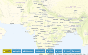
| Indic OpenstreetMap | Global | 13 (Indic languages) | |
| layers.openstreetmap.fr | Global | 3 (Basque, French, Occitan) | |
| Léarscáil na hÉireann | Ireland | 1 (Irish Gaelic) | |
| Mape furlane | Friuli-Venezia Giulia, Italy | 1 (Friulian) | |
| Open Camping Map | Global | 1 (English) | |
| OpenHistoricalMap | Global | 162 (living and extinct languages)[1] | Based on OpenHistoricalMap data, not OSM data. Limited to languages with five or more occurrences. Set desired language code in your preferences. |
| OpenHistoricalMap Embed | Global | 162 (living and extinct languages)[1] | Based on OpenHistoricalMap data, not OSM data. Limited to languages with 50 or more occurrences. Set desired language code in the URL e.g. ?language=sux. |
| Open Infrastructure Map | Global | 14[2] | |
| OpenSnowMap | Global | 1 (English) | |
| OpenStreetMap Americana | Global | All[3] | Local-language names in parentheses; falls back to Wikidata labels |
| OpenStreetMap Belgium TileServer | Belgium | 3 (French, Dutch, German) | |
| OpenStreetMap e brezhoneg | Europe | 1 (Breton) | |
| openstreetmap.by | Global | 4 (English, Russian, Belarusian – official and Taraškievica) | |
| OpenStreetMap en català | Global | 1 (Catalan) | |
| OpenStreetMap Deutschland | Global | 1 (German) | Local-language names on second line |
| osMap | Global | 10 | Transliteration and language fallbacks |
| Slovenski Eksonimi | Global | 1 (Slovene) | |
| Thailand maps | Southeast Asia | 1 (local language with romanization) | |
| TracesMap | Global | 21 | |
| VK Карты | Global | 1 (Russian) | |
| Wikimedia Maps | Global | 277[4] | Set desired language code in the URL e.g. ?lang=ja |
| WIWOSM | Global | 277[4] | |
| Žemėlapis | Lithuania | 1 (Lithuanian) |
-
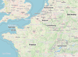 Europe with placenames in English by Tracestrack.
 -
 Europe with placenames in Japanese by Wikimedia.
 -
-
 OpenMapTiles on-the-fly language change
(Click the image for animation)


Applications
Developer resources
Software libraries:
Software demonstrations for developers:
Tutorials:
- User diary discusses on how to render non default names using "name:xx" tag in OSM-Carto
Tile servers
The following services provide raster or vector tiles that contain multilingual names:
| Service | Format | Languages | Notes |
|---|---|---|---|
| Geoapify | MVT | 57 | Tutorial describing how to change map language. |
| Mapbox | MVT, PNG, JPEG | 13[5] | Demo |
| MapTiler Cloud | MVT, PNG, JPEG | 55 | Demo |
| MapTiles API | PNG | 3 (English, French, Spanish) | |
| Nextzen | MVT | All[6] | |
| OpenFreeMap | MVT | 14[7] | |
| OpenHistoricalMap | MVT | 162[1] | Based on OpenHistoricalMap data, not OSM data |
| OpenMapTiles | MVT | 57 | Demo |
| OpenStreetMap U.S. Tile Service | MVT | All[3] | Showcased by OpenStreetMap Americana |
| Protomaps | PMTiles | 41[8] | Self-hosted option available |
| Slpy | MVT, PNG | 21 | Demo |
| Stadia Maps | MVT | 63[9] | |
| Tracestrack | PNG | 18 | Demo |
| Wikimedia Maps API | PNG | 277[4] | Demo; limited to Wikimedia affiliates |
Tile servers based on the Mapbox Vector Tile (MVT) format can be used with multiple client-side libraries, such as Mapbox GL and Tangram.
Projects of historical interest
The Frisian language map was probably the first example of OpenStreetMap Map Internationalization (2008) but seems to be broken now. See User:Lambertus#Frisian language map (Fryske kaart).
For his GSoC project Arindam Ghosh mainly worked on Website Internationalization Ideas 2008, but had some other thoughts on map Internationalization. See Talk:GSoC Applications 2008#I18n of OSM pages and map tiles.
User:Mikel experimented with rendering place names in Arabic.
Multilingual maps Wikipedia project was project kicked off in 2012 to set up rendering infrastructure for Wikipedia (Demo website: http://mlm.jochentopf.com/). Uses tiles hosted on tile.openstreetmap.de:8002 (currently offline).
Before it shut down, WMF-DE's toolserver.org used to have a tile server with a separate layer for each Wikipedia language edition. The replacement tileserver on the WMF Tools Labs only supported English and German. There was also a Multilingual country list (also offline due to toolserver.org shutdown), it has been supplanted by translated labels in Wikidata for each country or territory (and all other places) and querying them with its API.
OpenStreetMap India's homepage used to offer seven local languages.
Skobbler used to offer a Mapcreator raster tile service with a choice of seven languages.[10]
See also
- Other internationalization challenges.
- Map internationalization (India)
Notes and references
- ↑ Jump up to: 1.0 1.1 1.2 “vtiles_languages.json” (JSON). OpenHistoricalMap. 13 June 2025. Retrieved 13 June 2025.
- ↑ “layers.yml”. openinframap/openinframap. GitHub. 23 October 2024. lines 33–60.
- ↑ Jump up to: 3.0 3.1 “render_once.sh”. osmus/tileservice. GitHub. 22 January 2025. line 51.
- ↑ Jump up to: 4.0 4.1 4.2 Matazzoni, Joe (28 June 2018). “Interactive maps, now in your language”. Diff. Wikimedia Foundation. Retrieved 22 November 2024.
- ↑ “Mapbox Streets v8”. Mapbox Docs. Mapbox. 20 November 2024. Retrieved 23 November 2024.
- ↑ “Layers in Tilezen's vector tiles”. tilezen/vector-datasource. GitHub. 4 September 2023. Retrieved 23 November 2024.
- ↑ “Planetiler.java”. onthegomap/planetiler. GitHub. 10 August 2024. lines 105–109.
- ↑ “Basemap Localization”. Protomaps. 6 November 2024. Retrieved 22 November 2024.
- ↑ “Changing Place Labels to Another Language”. Stadia Maps Documentation. Stadia Maps. 26 February 2024. Retrieved 23 November 2024.
- ↑ “Mapcreator”. Skobbler GmbH. Archived from the original on 29 December 2016.