Night of the living maps/join
| Whats that? | Join | Start own | Promotion | Results |
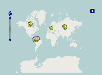
Ready for some action? Find a party location close to you at http://usergroups.openstreetmap.de. You can see a sample image below. Look for the Zombie-Heads and click on them for more Information. Be sure that "Night of the living map" is checked as an overlay (verify by clicking on the Plus-sign at the top right corner of the map).
Nothing in your area? Start your own party and invite your local mapping-community!
Freshly bitten? You are a Newbie?
New to OSM? The guys at the party will help you get in touch with mapping. What you need to bring to the party is:
- a Laptop
- a mouse (editing OSM with touchpads sucks)
When you get there you can start contributing as follows:
- Sign up on OpenStreetMap.org if you didn't already do so
- Get set up with one of our editors e.g. the JOSM Editor (http://josm.openstreetmap.de)
- Start it from the menu or doubleclick the .jar file
- Activate this plugins (F12 -> Plugins): building tools
- Download a certain area from the OSM DB, check the 'download gps tracks' feature
- Activate Bing layer: Backround -> Bing
- See if the imagery is well aligned to the existing data, otherwise add a displacement and ask for assistance
- Add nodes and ways as described in Video tutorials or Beginners' guide
- Upload your changes
- You are now a novice Mapper, see above what you can do in your area :)
Confused by all the new stuff?
If you'd like to learn some more tricks and tips, just ask around at the party or have a look at
Already rotting? You are a Maphead?
| Do's and Dont's | |
| Please read the Armchair Mapping Guidelines for more details | |
Ok, so we are bascialiy talking about tracing Bing (or other Aerial imagery) in the countryside near where you live, where currently the quality is quite bad. Things to do:
- Mark your area on a printed map (so you can avoid editing conflicts)
- Align streets (but please check the Bing offset in your area)
- Add missing streets
- Add buildings
- Add lakes, forests, towers,... everything that would help somebody who needs orientation
- Add landuse (making this place visible at lower zooms)
- Use Changeset comment '#notlm blablabla...' (we can use that later on for analyses and animations)
If you are not that sure if you have drawn something right, or you know Bing is outdated, add some OpenStreetBugs
Bonus task
Do you remember the areas you added content to? Then search (google, twitter, ...) for local contacts (government, educational, volunteer groups, ...) and encourage them to start adding local details. Offer them your help and point to OpenStreetBugs and Walking Papers as well. Now register for RSS feeds (see QA) and look when new users appear in your area.
Notes on armchair mapping
Tracing aerial imagery is a very easy way to contribute data to OSM, but there are disadvantages and problems with this style of mapping. Organizers must familiarise themselves with the armchair mapping page and particularly the Guidelines for event organisers