|
Dobrym sposobem, aby wziąć udział w projekcie OpenStreetMap jest załadowanie śladów z GPS, znanych również jako GPS traces. Zarejestrowany przez urządzenie GPS typowy ślad, to zapis lokalizacji co drugi lub każdy metr. Plik wynikowy będzie serią kropek, które pokazują drogę, po której się poruszałeś.
Te ślady mogą być dodawane jako podkład w edytowanej mapie w postaci cienkich linii lub małych punktów, a nastepnie mogą być wykorzystane w celu dodawania obiektów na mapie, podobnie jak przy użyciu zdjęć lotniczych.
Aby uzyskać więcej informacji na temat korzystania z urządzenia GPS i konwersji śladu do pliku GPX patrz Pl:Rejestrowanie śladów GPS i Pl:Załadowanie śladów GPS. Należy pamiętać, że załadowanie śladów GPS jest innym procesem niż edytowanie mapy, a także różni się od swobodnego importowania.
Jak przesłać ślad GPS
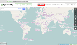 The GPS traces link, highlighted. It may be hidden behind a "More ▼" or a "☰" drop-down menu button if you use a small window width. |
- (optional) Convert your GPS trace to the GPX file format if your GPS device does not supply this format natively.
- Only GPS traces in the GPX file format can be uploaded to OpenStreetMap; multiple GPX files can also be submited if using a single zip (or tar/tar.gz) file.
- Files can easily be converted to this format using tools – see the convert GPS tracks.
- Select the "GPS traces" from the top main menu.
- Select "See your traces", or "upload a trace" directly
- If you are not already logged-in to the main OSM website, you will be asked to log in. If you don't have an account for the site, create an account first.
- (optional) Use the "Browse" button to select the GPX file on your local computer.
- (optional) Enter a Description and Tags of GPS trace. Help others understand how trace was recorded, there significant difference between car/hiking and bicycle traces.
- (optional) Select the privacy option visibility of GPS traces.
- If you do not want your GPS trace to be seen by anybody else, stop here and do not upload. (If you have already uploaded it, then in "See your traces" you can still edit/delete it.)
- Click Upload. The file will be uploaded to the OSM server, where it will join the queue of files ("PENDING" next to it) to be inserted into the database.
|
Co stanie się z moim plikiem po jego przesłaniu?
Your GPX file is parsed by the OSM server and points are extracted and inserted into the database. Note that this operation can be delayed. Requests go into a queue on the server, and occasionally there is a backlog. Once completed however, you should be able to...
- See your trace among others, while editing, (and use it to draw map features over the top)
- In iD open editor drag map and press B (or select icon "Background settings") then check "OpenStreetMap GPS traces"
- In Potlatch 2 toggle 'Show GPS tracks' (use the icon, or press 'G')
- In JOSM on the download dialogue window, tick to fetch 'Raw GPS data'.
You will not see any streets drawn in over your tracks, until you (or somebody else) uses an editor to draw the streets as nodes and ways with tags, for more see Contribute map data.
Możesz pomóc OpenStreetMap przesyłając ślady i zdjęcia z Mapillary
- Główny artykuł: Mapillary/Data collection with Mapillary
Potrzebny będzie telefon z Androidem z GPS lub iPhone'em.
Zobacz też
Mapillary.
|
