RU:Apple iOS
iOS это операционная система для мобильных устройств Apple. Специально разработана для iPhone (прежнее название: iPhone OS), с тех пор она устанавливался на iPod Touch и iPad с таким же успехом. Она базируется на Mac OS X и является родной операционной системой для многих устройств Apple.
Различные iOS-устройства
Смотрите Apple
Просмотр карт OSM
Вы можете просматривать карты с помощью браузера мобильного устройства по адресу http://www.openstreetmap.org. Он использует специальные малоэкранные стили, однако могут быть проблемы с Slippy Map JavaScript кодом. Допускается просмотр карт OSM специальными приложениями, check out the following options, particularly the app's map display features.
Приложения
Общая информация
| Название | Screenshot | Display map | Navigate | Make track | Monitor | License | Price | Languages | Version | Description |
|---|---|---|---|---|---|---|---|---|---|---|
| <20MB, <512MB, <2GB Maps [1] | 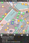
|
да | нет | нет | нет | nonfreeproprietary | nonfree1,59€ | EN | 2012-07-01 1.7.1 |
Offline maps and POIs for entire countries as well as selected cities. |
| 700 City Maps [2] | 
|
да | да | нет | нет | nonfreeproprietary | nonfree2.99$ for each city's map. | EN | 2012-06-02 2.01 |
|
| ArcGIS for iPhone [3] | 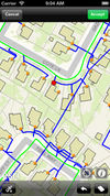
|
да | нет | нет | нет | nonfreeproprietary | free | EN | 2012-07-18 2.3.1 |
Shows just different maps |
| aSmartHUD NAVI MAP+ [4] | 
|
да | да | да | ?
|
nonfreeproprietary | nonfree1,99$ | 20 | 2012-05-02 1.5 |
vehicle digital dashboard, unified with in-car navigation system |
| B.iCycle [5] | 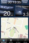
|
да | нет | да | да | nonfreeProprietary | nonfree9.99$ (iOS) $4 (android), | EN | 2013-04-03 4.0.1 |
MTB centered bike computer software |
| be-on-road [6] | 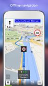
|
да | да | да | ?
|
nonfreeproprietary | nonfreeFree | DE; EN; CS; NL; FR; EL; HU; IT; PL; PT; RO; RU; SK; ES; TR; UK | 2013-11-13 3.9.26385 |
Offline multi-language voice navigation app with lane-guidance assistant. Data from OSM and propietary maps. |
| BikeCityGuide http://getfinn.com/ | 
|
да | да | да | нет | nonfreeproprietary | nonfree5Eur per city | EN,DE,FR | 2014-07-24 3.1 |
Designed for cyclists in urban areas incl. Insider tours. |
| Bluemapia [7] | 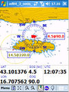
|
да | нет | нет | нет | nonfreeproprietary | free | EN | 2009-06-01 0.9.6 |
Marine mapping app for bluemappia.com |
| CartoType [8] | 
|
да | да | нет | нет | nonfreecommercial | ?
|
EN | 2013-07-17 2.9 |
portable library |
| City Maps 2Go [9] | 
|
да | нет | нет | нет | nonfreeproprietary | nonfreeiPhone: 2.99$ / 2.69€ Android: free | EN,DE,FR,IT,ES | 2013-07-17 4.5.7 |
City Maps 2Go |
| Cycle Hire [10] | 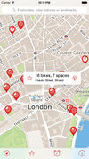
|
да | нет | нет | нет | ?
|
free | DE; EN; ... | 2012-05-12 4.1 |
Find Cycle Hire locations in London |
| directu [11] | 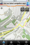
|
да | ?
|
?
|
?
|
nonfreeproprietary | free | EN | 2011-04-26 1.2.2 |
Offline map browsing with large OSM datasets (e.g. all of europe) |
| EasyMaps [12] | 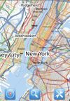
|
да | нет | нет | нет | nonfreeproprietary | free | EN | 2010-12-01 1.0.1 |
Just a offline static maps viewer |
| ForeverMap [13] | 
|
да | да | нет | нет | nonfreeproprietary | nonfreeiPhone: 1,59€, Android: 1,59€ (Free Android version available) | EN; DE; FR; SP; IT; RU | 2013-10-05 3.2 |
ForeverMap is an offline navigation app, providing address/POI search and route calculation |
| Gaia GPS [14] | 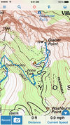
|
да | да | да | да | nonfreeproprietary | nonfree19.99$ iOS / $9.99 Android | EN | 2012-07-05 6.4 |
hiking focused logger |
| Galileo Offline Maps [15] | File:Galileo Offline Maps main.png | да | да | да | да | nonfreeproprietary | nonfreefreemium | EN, NL, DE, IT, JP, RU, ES, ZH | 2017-10-18 3.7.3 |
Fast and easy-to-use vector maps with offline search based on OpenStreetMap data. |
| GeoGuide 3D Worldwide Maps and Tracks [16] | 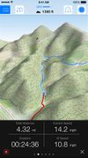
|
да | нет | да | да | nonfreeproprietary | nonfree2.99$ | EN; DE | 2013-04-06 3.1 |
3D Worldwide Maps and Tracks, Allows to download maps for offline use (topo and street) |
| Go Map!! | 
|
да | да | нет | нет | nonfreeproprietary | ?
|
En | 2014-10-03 1.2.1 |
Easy to use iPhone/iPad editor for OSM with support for adding POIs, editing ways, offline support, undo-redo, and more. |
| GPS Kit [17] | 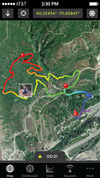
|
да | да | да | да | nonfreeproprietary | nonfree9,99$ | EN | 2013-02-25 6.5 |
|
| GPS Tuner [18] | 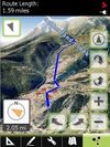
|
да | да | да | да | nonfreeproprietary | nonfree$6.99 / free | EN | 2012-05-31 1.0.10 |
Google Earth like 3D Navi with DEM |
| GPS-Tracks [19] | 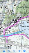
|
да | да | да | да | nonfreeproprietary | free | EN; DE; FR; IT | 2012-01-26 1.61 (iPhone); 1.52 (Windows Mobile); 1.30 (Android) |
|
| GPSies [20] | 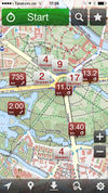
|
нет | нет | да | да | nonfreeproprietary | free | 7 | 2011-07-14 2.0 |
|
| Guide Me [21] | ?
|
да | ?
|
?
|
?
|
?
|
DE | 2011-10-24 ?
|
Navigation for blind persons | |
| Hoursome | 
|
нет | нет | нет | нет | nonfreeproprietary | free | EN; DE | 2013-12-05 1.0 |
Display and edit opening hours |
| iLOE [22] | 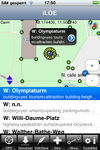
|
да | нет | нет | нет | nonfreeproprietary | nonfree0.99$ | EN | 2011-06-30 1.9.4 |
iPhone editor for the advanced user |
| iLOS [23] | 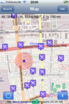
|
да | нет | нет | нет | nonfreeproprietary | nonfree1.99$ | EN | 2010-12-07 1.1 |
OSM Map and POI finder |
| kMaps [24] | 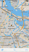
|
да | нет | нет | нет | nonfreeproprietary | nonfreeFree | EN | 2014-10-16 1.1.18 |
Free offline maps, covering the entire world |
| komoot iPhone App [25] | 
|
да | да | да | да | nonfreefreemium | ?
|
DE; EN | 2013-08-07 5.2 |
free usage in a small region, larger/different regions can be bought |
| Layar Reality Browser | да | нет | нет | нет | nonfreeproprietary | free | EN | ? 4.0.4 |
Augmented Reality browser mixes camera image with virtual reality | |
| Leisure [26] | 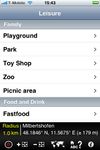
|
да | да | нет | нет | nonfreeproprietary | nonfree0.99 | DE; EN; FR | 2010-12-15 2.3 |
|
| Locations Tagger [27] | 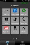
|
нет | нет | да | нет | nonfreeproprietary | free | EN | 2012-02-23 1.2 |
|
| Looking4Cache [28] | 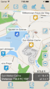
|
да | нет | нет | нет | nonfreefree;proprietary | nonfreefree;8,99$ | DE; EN | 2013-08-15 1.3 |
Geocaching App with a lot of functions. Including vector maps for complete offline caching. |
| MapOut [29] | 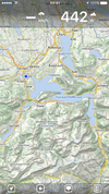
|
да | нет | да | да | nonfreeproprietary | nonfree4.49€ | EN; DE | 2014-03-26 2.2.2 |
Offline map covering the whole world, OpenGL vector rendering |
| mAPP [30] | 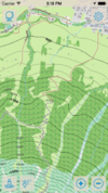
|
да | нет | да | да | nonfreeproprietary | nonfreeInApp Purchases | DE; EN | 2014-01-14 1.0 |
Offline topo vector maps for iPhone and iPad |
| MapQuest4Mobile | 
|
да | ?
|
?
|
?
|
nonfreeproprietary | free | EN | 2011-02-16 1.0b |
|
| MAPS.ME [31] | 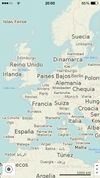
|
да | нет | нет | нет | nonfreeproprietary | nonfreeFree/$4.99 for Pro | EN; RU; CS; DE; ES; FR; IT; JA; KO; NL; UK; ZH-HANT; PL; PT; HU; TH; ZH-HANS; AR; DA; TR | ? 3.0.2 |
Offline maps of all countries, fast renderer, offline search, whole planet fits to 12Gb |
| MapTap [32] | 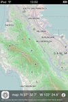
|
?
|
?
|
?
|
?
|
nonfreeproprietary | nonfree5€ | EN | 2010-04-19 1.5 |
|
| Mapzen POI Collector [33] | 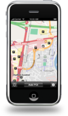
|
да | нет | нет | нет | nonfreeproprietary | free | EN | 2010-12-19 1.2.5 |
Easy to use app to map just POIs |
| Memphis [34] | ?
|
?
|
?
|
?
|
LGPL | free | EN | 2010-06-07 0.2.3 |
map rendering application and library | |
| MotionX-GPS [35] | 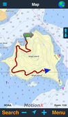
|
да | да | да | да | nonfreeproprietary | nonfree1.99$, 1.79€ | EN | 2013-08-20 21.1 |
|
| NavFree [36] | 
|
да | да | нет | нет | nonfreeproprietary | nonfreeFor Android is free. For iOS the first country is free, then €2.69. | EN; ES; DA; DE; FR; SW; IT and others | ? 1.9.8.8675 |
Free satnav app. Maps available: Andorra, Argentina, Australia, Austria, Benelux (Belgium, Netherlands, Luxembourg), Brazil, Canada, Croatia, Czech Republic, Denmark, Estonia, Finland, France, Germany, Hungary, India, Ireland, Italy, Latvia, Lithuania, Mexico, Monaco, Netherlands, New Zealand, Norway, Poland, Portugal, Slovakia, Slovenia, South Africa, Spain, Sweden, Switzerland, UK. |
| Navigon Urban [37] | 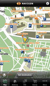
|
да | да | нет | ?
|
nonfreeproprietary | nonfree4.49€ | DE; EN | 2013-02-20 1.2.0 |
Offline router esp. for pedestrians/cyclists |
| Naviki [38] | 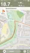
|
да | нет | да | нет | nonfreeproprietary | free | DE | 2011-02-24 1.5 |
Only Germany supported |
| Navit [39] | 
|
да | да | да | да | GPLv2 | free | 43 | 2013-01-13 0.2.0 |
Most popular OpenSource Car navigation tool; maps (offline-"custom"), vector-rendered |
| Navitel [40] | 
|
да | да | да | нет | nonfreeproprietary | nonfree17€ | EN; RU | 2011-06-10 5.0.0.1620 |
Popular in Russia |
| OffMaps 2 [41] | 
|
да | нет | нет | нет | nonfreeproprietary | nonfree1,59€ | DE,EN | 2011-03-01 1.05 |
Offline maps and POIs for selected destinations around the world. Combines OSM map with Wikipedia Articles. |
| OMaps [42] | 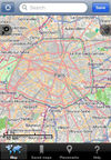
|
да | нет | нет | нет | nonfreeproprietary | nonfree1,99$ | EN | 2010-06-12 1.3.3 |
|
| Open Car InfoTainmenT system [43] | 
|
да | нет | да | нет | GPL | free | EN | 2008-06-12 0.1.0-rc1 |
Navi as part of an car infotainment system |
| OpenMaps [44] | 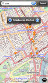
|
да | да | нет | нет | nonfreeproprietary | nonfree2,39€ , free | EN | 2011-10-12 4.5.4 |
Share & comment on OSM places via Twitter |
| OpenSeaMap [45] | 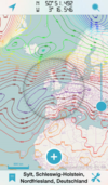
|
да | нет | нет | да | nonfreeproprietary | ?
|
DE,EN,FR | 2013-08-10 2.1 |
App for searching and offline caching |
| OsmPad [46] | 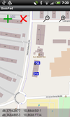
|
да | нет | нет | нет | ?
|
free | EN; DE | 2012-04-19 1.0 |
Utility to gather house numbers for OpenStreetMap |
| OsmSharp [47] | 
|
?
|
?
|
?
|
?
|
GPLv3 | free | EN | 2013-04-06 3.1 |
OSM routing and optimisation library. |
| OSMTrack [48] | 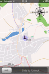
|
да | нет | да | да | nonfreeproprietary | nonfree0,99$ | EN, DE, FR | 2011-12-22 3.0.3 |
Easy to use tracking app with offline, user-updateable vector map and direct upload to OpenStreetMap |
| Path Tracker [49] | да | нет | да | нет | nonfreeproprietary | nonfree1,99$ | EN | 2008-09-27 1.4.2 |
||
| Pocket Earth Offline Maps & Travel Guides [50] | 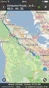
|
да | да | да | нет | nonfreeproprietary | nonfree0.99$ | EN,DE,FR,ES,NL,RU,CS | 2014-09-06 2.3 |
OpenGL powered Offline Maps (OSM) and Travel Guides (wikivoyage) with Wikipedia Articles, GPS Track Recording, Online Routing, and other advanced features and customization |
| POI+ [http://App Store] | 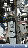
|
да | нет | нет | нет | GNU GPLv3 | free | EN; CA; JA; DE:PL | 2013-06-04 1.6.1 |
Simple iOS app for adding and editing a POI |
| Pushpin OSM [51] | 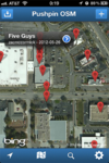
|
да | нет | нет | нет | nonfreeproprietary | free | EN | 2012-12-06 1.1 |
Simple POI editor. |
| Roadee [52] | 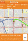
|
да | нет | нет | нет | nonfreeproprietary | nonfree1,99$ | EN | 2009-10-21 1.2 |
|
| RoadMap [53] | 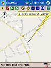
|
да | да | да | нет | GPL | free | EN | 2009-02-02 1.2.1 |
|
| Seewetter Pro [54] | 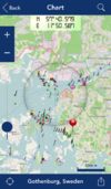
|
да | нет | нет | нет | nonfreeproprietary | nonfree€5.99 | DE | 2012-01-21 2.1 |
App for searching and offline caching |
| Skobbler GPS Navigation [55] | 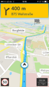
|
да | да | нет | нет | nonfreeproprietary | nonfreeAndroid: €1.00, free Version available (no offline maps); iOS: €1.79 | EN; DA; NL; FR; DE; HU; IT; PO; RO; RU; ES; SV; TR | 2014-09-11 6.0 |
Online and offline worldwide turn-by-turn navigation. Includes pedestrian and cyclist route planner, TripAdvisor, Foursquare and speed camera warning integration. |
| Terra Map GPS [56] | 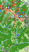
|
да | да | да | да | nonfreeproprietary | nonfree2.99$;4.99$ | DE; EN; IT; FR; ES | ? 2.3 |
Amazingly clear map rendering, nice UI, import of KMZ, KML, GPX files. |
| The Map [57] | 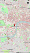
|
да | нет | нет | да | nonfreeproprietary | nonfree1,99£ | EN | 2011-10-13 3.0.1 |
Offline Viewer for lots of countries. |
| Track'n Trail [58] | 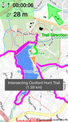
|
да | нет | да | нет | nonfreeproprietary | nonfree0.99$ | DE; EN; FR | 2010-09-28 1.0.1 |
Direct upload to openstreetmap.org |
| Trails [59] | да | нет | да | да | nonfreeproprietary | nonfree3,99$ | DE; EN | 2013-11-11 6.00 |
||
| TripGo [60] | 
|
да | нет | нет | нет | nonfreeproprietary | ?
|
EN | 2014-08-29 4.0.1 |
Calendar-aware trip planner with real-time transport suggestions |
| True Offline Maps 2.0 [61] | 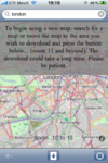
|
да | нет | да | нет | nonfreeproprietary | nonfree4.99$ | EN | ?
|
|
| UK TravelOptions [62] | 
|
да | нет | нет | нет | nonfreeproprietary | free | EN | 2011-01-06 ?
|
Vector map viewing with tilting/spinning 3D buildings & transport data of London. |
| Vectorial Map [63] | 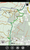
|
да | нет | да | нет | nonfreeproprietary | nonfreedepends on platform | EN | 2014-03-15 1.0 |
Vectorial Map is map viewer and track logger for Mapsforge offline vector maps (*.map) with support for custom XML styles like provided by OpenAndroMaps.org. It is based on a platform independent custom render engine. |
| VectorMaps GB [64] | 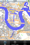
|
да | нет | нет | нет | nonfreeproprietary | nonfree£1.19 | EN | 2012-06-20 1.5 |
Vector Maps viewer for England, Wales, Scotland |
| ViewRanger GPS [65] | да | ?
|
да | ?
|
nonfreeproprietary | nonfreefree (purchases available) | EN,DE | 2011-04-14 ?
|
proprietary outdoors-oriented map app for mobile phones, OSM & cycle & piste maps | |
| VoxTrek Navigation GPS [66] | 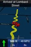
|
да | да | ?
|
?
|
nonfreeproprietary | nonfree2,99$ | 20 | 2010-07-12 2.1 |
Navigation for blind users |
| Wikimap [67] | 
|
да | нет | нет | нет | nonfreeproprietary | nonfree2,99$ | EN | 2010-08-09 1.6 |
Displays POIs of alimni.net |
| Wisepilot [68] | 
|
да | да | нет | нет | nonfreeproprietary | nonfree€1.79 monthly | EN; DE; ES; FR; SV; and much more | 2014-04-03 5.0.2 |
online turn-by-turn navigation |
| World Maps Offline [69] | 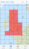
|
да | нет | нет | нет | nonfreeproprietary | nonfree0.99$;0.69£;0.79€ | EN | ? 1.9.0 |
World Maps Offline lets you select map areas and save them to your iPhone, iPod Touch or iPad for browsing without an internet connection. |
This table in the past was generated automatically by a bot. Learn more.
Map display features
| Name | Shows map as vector | Shows map as bitmap | Stores map-data on-board | Stores map-data off-board (downloads from internet) | Rotate map | 3D view |
|---|---|---|---|---|---|---|
| <20MB, <512MB, <2GB Maps | да | нет | да | нет | да | нет |
| 700 City Maps | нет | да | да | нет | да | нет |
| ArcGIS for iPhone | нет | да | нет | да | ?
|
нет |
| aSmartHUD NAVI MAP+ | да | нет | да | нет | да | да |
| B.iCycle | нет | да | да (cache) | да | ?
|
нет |
| be-on-road | да | нет | да | нет | да | да |
| BikeCityGuide | да | нет | да | нет | да | нет |
| Bluemapia | да | да | да | да | да | нет |
| CartoType | да | да | да | да | да | да |
| City Maps 2Go | да | да | да | нет | нет | нет |
| Cycle Hire | ?
|
?
|
?
|
?
|
?
|
нет |
| directu | ?
|
?
|
?
|
?
|
?
|
?
|
| EasyMaps | нет | да | да | да | ?
|
нет |
| ForeverMap | да | нет | да | нет | да | нет |
| Gaia GPS | нет | да | да (cache) | да | да | нет |
| Galileo Offline Maps | да | да | да | да | да | нет |
| GeoGuide 3D Worldwide Maps and Tracks | ?
|
?
|
да (cache) | да | нет | да |
| Go Map!! | да | да | да | да | нет | нет |
| GPS Kit | нет | да | нет | да | ?
|
нет |
| GPS Tuner | да | да | да | да | да | да |
| GPS-Tracks | нет | да | да (cache) | да | да | нет |
| iLOE | нет | да | да (cache) | нет | нет | нет |
| iLOS | нет | да | да (cache) | нет | нет | нет |
| kMaps | да | нет | да | нет | нет | нет |
| komoot iPhone App | нет | да | да (cache) | да | да | нет |
| Layar Reality Browser | да | нет | нет | да | да | да |
| Leisure | нет | да | нет | да | нет | нет |
| Looking4Cache | да | да | да | да | да | нет |
| MapOut | да | нет | да | нет | да | нет |
| mAPP | да | нет | да | да | да | нет |
| MapQuest4Mobile | нет | да | нет | да | ?
|
нет |
| MAPS.ME | да | нет | да | нет | да | нет |
| Mapzen POI Collector | ?
|
?
|
?
|
?
|
?
|
?
|
| MotionX-GPS | нет | да | да (cache) | да | да | нет |
| NavFree | да | нет | да (cache) | нет | да | да |
| Navigon Urban | да | нет | да | нет | да | да |
| Naviki | ?
|
?
|
?
|
?
|
?
|
?
|
| Navit | да | нет | да | нет | да | да |
| Navitel | да | нет | да | нет | да | да |
| OffMaps 2 | да | нет | да | нет | да | нет |
| OMaps | нет | да | да (cache) | да | ?
|
нет |
| Open Car InfoTainmenT system | да | нет | да | нет | ?
|
нет |
| OpenMaps | нет | да | да (cache) | да | ?
|
нет |
| OpenSeaMap | нет | да | да | да | нет | нет |
| OsmPad | нет | да | да | да | нет | нет |
| OSMTrack | да | да | да | нет | да | нет |
| Path Tracker | нет | да | нет | да | нет | нет |
| Pocket Earth Offline Maps & Travel Guides | да | нет | да | нет | да | нет |
| POI+ | ?
|
?
|
?
|
?
|
?
|
?
|
| Pushpin OSM | нет | да | нет | да | нет | нет |
| Roadee | нет | да | да | да | ?
|
нет |
| RoadMap | да | нет | да | нет | да | да |
| Seewetter Pro | нет | да | да | да | нет | нет |
| Skobbler GPS Navigation | да | нет | да | да | да | да |
| Terra Map GPS | да | нет | да | нет | да | нет |
| The Map | да | нет | да | нет | нет | нет |
| Track'n Trail | ?
|
?
|
?
|
?
|
?
|
нет |
| Trails | нет | да | да (cache) | да | ?
|
нет |
| TripGo | да | нет | да (cache) | да | нет | нет |
| True Offline Maps 2.0 | нет | да | да | нет | да | нет |
| UK TravelOptions | да | нет | да (cache) | да | да | да |
| Vectorial Map | да | да | да | да | нет | нет |
| VectorMaps GB | да | нет | да | нет | ?
|
нет |
| ViewRanger GPS | нет | нет | нет | нет | ? | ? |
| VoxTrek Navigation GPS | нет | да | да | да | да | да |
| Wikimap | нет | да | да (cache) | да | ?
|
нет |
| Wisepilot | да | да | нет | да | да | да |
| World Maps Offline | нет | да | да | да | нет | нет |
This table in the past was generated automatically by a bot. Learn more.
| Name | Navigate to point | Find location | Find nearby POIs | Navigate along predefined route | Create route manually | Calculate route | Calculate route without internet | Car routing | Bike routing | Foot routing | Turn restrictions | Navigation with voice | Keep on road | Works without GPS |
|---|---|---|---|---|---|---|---|---|---|---|---|---|---|---|
| 700 City Maps | да | да | нет | ?
|
?
|
?
|
?
|
нет | нет | нет | нет | ?
|
?
|
?
|
| aSmartHUD NAVI MAP+ | да | ?
|
нет | ?
|
?
|
?
|
?
|
да | нет | нет | ?
|
нет | нет | ?
|
| be-on-road | да | да | да | ?
|
?
|
да | да | да | нет | да | да | да | yes;no | да |
| BikeCityGuide | да | да | да | ?
|
?
|
да | да | нет | да | нет | ?
|
да | ?
|
?
|
| CartoType | да | да | да | да | ?
|
да | да | да | да | да | да | ?
|
да | да |
| ForeverMap | да | да | да | нет | ?
|
да | ?
|
да | да | да | ?
|
нет | нет | нет |
| Gaia GPS | да | да | ?
|
нет | ?
|
нет | нет | нет | нет | нет | нет | ?
|
?
|
?
|
| Go Map!! | ?
|
?
|
?
|
?
|
?
|
?
|
?
|
?
|
?
|
?
|
?
|
?
|
?
|
?
|
| GPS Kit | да | ?
|
?
|
?
|
?
|
?
|
?
|
нет | нет | нет | нет | ?
|
?
|
?
|
| GPS Tuner | ?
|
?
|
?
|
?
|
?
|
?
|
?
|
да | да | да | ?
|
?
|
?
|
?
|
| GPS-Tracks | да | да | да | нет | ?
|
нет | нет | нет | нет | нет | нет | ?
|
нет | да |
| Guide Me | ?
|
?
|
?
|
?
|
?
|
?
|
?
|
?
|
?
|
?
|
?
|
да | ?
|
?
|
| komoot iPhone App | да | да | да | ?
|
?
|
?
|
?
|
нет | да | да | нет | да | да | да |
| Leisure | да | да | да | ?
|
?
|
?
|
?
|
нет | нет | нет | нет | нет | нет | нет |
| MotionX-GPS | да | нет | нет | ?
|
?
|
?
|
?
|
нет | нет | нет | нет | ?
|
yes;no | нет |
| NavFree | ?
|
?
|
?
|
?
|
?
|
?
|
?
|
?
|
?
|
?
|
?
|
?
|
?
|
?
|
| Navigon Urban | да | да | да | ?
|
?
|
?
|
?
|
нет | да | да | нет | да | нет | ?
|
| Navit | да | да | да | нет | ?
|
да | да | да | нет | да | да | да | да | нет |
| Navitel | да | да | да | нет | ?
|
да | да | да | да | да | да | да | да | да |
| OpenMaps | да | да | да | ?
|
?
|
?
|
?
|
да | да | да | да | ?
|
?
|
?
|
| Pocket Earth Offline Maps & Travel Guides | да | да | да | ?
|
?
|
да | нет | ?
|
?
|
?
|
нет | нет | нет | да |
| RoadMap | да | да | нет | ?
|
?
|
?
|
?
|
?
|
?
|
?
|
нет | нет | ?
|
да |
| Skobbler GPS Navigation | да | да | да | ?
|
?
|
да | да | да | да | да | да | да | да | нет |
| Terra Map GPS | да | нет | нет | да | ?
|
нет | нет | нет | да | да | нет | нет | нет | да |
| VoxTrek Navigation GPS | да | ?
|
?
|
?
|
?
|
?
|
?
|
да | нет | нет | ?
|
да | ?
|
?
|
| Wisepilot | да | да | да | ?
|
?
|
?
|
?
|
да | нет | да | да | да | ?
|
нет |
This table in the past was generated automatically by a bot. Learn more.
Track making features
| Name | Customizable log interval | GPX format | KML format | NMEA format | All formats | Geo-tagged notes | Geo-tagged photos | Geo-tagged audio | Fast POI buttons |
|---|---|---|---|---|---|---|---|---|---|
| aSmartHUD NAVI MAP+ | ?
|
?
|
?
|
?
|
?
|
?
|
?
|
?
|
?
|
| B.iCycle | нет | да | да | нет | gpx;kml | ?
|
?
|
?
|
нет |
| be-on-road | ?
|
?
|
?
|
?
|
?
|
?
|
?
|
?
|
?
|
| BikeCityGuide | ?
|
?
|
?
|
?
|
?
|
?
|
?
|
?
|
?
|
| Gaia GPS | ?
|
?
|
?
|
?
|
?
|
?
|
?
|
?
|
?
|
| Galileo Offline Maps | да | да | да | нет | gpx, kml, csv | нет | нет | нет | ?
|
| GeoGuide 3D Worldwide Maps and Tracks | да | да | нет | нет | gpx | ?
|
?
|
?
|
?
|
| GPS Kit | ?
|
да | да | нет | gpx;kml | нет | да | нет | ?
|
| GPS Tuner | ?
|
?
|
?
|
?
|
?
|
?
|
?
|
?
|
?
|
| GPS-Tracks | нет | да | нет | нет | gpx | нет | да | нет | да |
| GPSies | ?
|
да | нет | нет | gpx | ?
|
?
|
?
|
?
|
| komoot iPhone App | ;no | да | нет | нет | gpx | да | да | нет | да |
| Locations Tagger | ?
|
да | нет | нет | gpx | да | нет | нет | да |
| MapOut | нет | да | нет | нет | gpx | нет | нет | нет | нет |
| mAPP | да | да | нет | нет | gpx | да | нет | нет | да |
| MotionX-GPS | ?
|
да | да | нет | gpx;kml | ?
|
?
|
?
|
?
|
| Naviki | ?
|
?
|
?
|
?
|
?
|
?
|
?
|
?
|
?
|
| Navit | ?
|
да | нет | да | bin, garmin, gpx, nmea | ?
|
?
|
?
|
?
|
| Navitel | да | да | нет | нет | gpx | ?
|
?
|
?
|
?
|
| Open Car InfoTainmenT system | ?
|
?
|
?
|
?
|
?
|
?
|
?
|
?
|
?
|
| OSMTrack | ?
|
да | нет | нет | gpx | ?
|
?
|
?
|
нет |
| Path Tracker | ?
|
?
|
?
|
?
|
?
|
?
|
?
|
?
|
?
|
| Pocket Earth Offline Maps & Travel Guides | ?
|
?
|
?
|
?
|
?
|
?
|
?
|
?
|
?
|
| RoadMap | ?
|
?
|
?
|
?
|
?
|
?
|
?
|
?
|
?
|
| Terra Map GPS | нет | нет | нет | нет | png | да | да | нет | да |
| Track'n Trail | да | да | нет | нет | gpx | да | нет | нет | да |
| Trails | yes;no | да | нет | нет | gpx | нет | нет | нет | ?
|
| True Offline Maps 2.0 | ?
|
?
|
?
|
?
|
?
|
?
|
?
|
?
|
да |
| Vectorial Map | да | да | да | нет | jpg;png;gpx;kml;kmz | да | нет | нет | да |
| ViewRanger GPS | ? | нет | нет | нет | ? | нет | нет | нет | ? |
This table in the past was generated automatically by a bot. Learn more.
Monitoring features
| Name | Show current track | Open existing track | Altitude diagram | Show DOP value | Satellite view | Show live NMEA data | Send current position via SMS | Upload current position |
|---|---|---|---|---|---|---|---|---|
| B.iCycle | да | yes? | да | нет | нет | нет | нет | да |
| Gaia GPS | ?
|
?
|
?
|
?
|
?
|
?
|
?
|
?
|
| Galileo Offline Maps | да | да | ?
|
?
|
?
|
?
|
?
|
?
|
| GeoGuide 3D Worldwide Maps and Tracks | да | да | да | ?
|
?
|
?
|
?
|
?
|
| GPS Kit | да | да | да | да | нет | нет | ?
|
?
|
| GPS Tuner | ?
|
?
|
?
|
?
|
?
|
?
|
?
|
?
|
| GPS-Tracks | да | да | нет | да | нет | нет | нет | нет |
| GPSies | да | да | ?
|
?
|
?
|
нет | ?
|
?
|
| komoot iPhone App | да | да | да | нет | нет | нет | да | да |
| MapOut | да | да | да | нет | нет | нет | нет | нет |
| mAPP | да | да | нет | нет | нет | нет | нет | нет |
| MotionX-GPS | да | ?
|
да | ?
|
?
|
нет | ?
|
?
|
| Navit | да | ?
|
нет | да | нет | нет | нет | нет |
| OpenSeaMap | ?
|
нет | нет | да | нет | нет | ?
|
?
|
| OSMTrack | да | да | нет | да | нет | нет | нет | нет |
| Terra Map GPS | да | да | нет | да | нет | нет | да | нет |
| The Map | нет | да | нет | нет | нет | нет | ?
|
?
|
| Trails | да | да | да | ?
|
?
|
нет | нет | нет |
This table in the past was generated automatically by a bot. Learn more.
OpenStreetMap editing features
| Name | Add POIs | Edit / Delete POIs | Edit arbitrary tags of existing OSM objects | Edit geometries | Support imagery offset DB | Upload to OSM |
|---|---|---|---|---|---|---|
| Bluemapia | да | ?
|
?
|
?
|
?
|
да |
| Go Map!! | да | да | да | да | ?
|
да |
| iLOE | да | да | да | нет | ?
|
да |
| Mapzen POI Collector | да | да | да | нет | ?
|
да |
| OpenMaps | да | да | да | нет | ?
|
да |
| POI+ | да | да | да | нет | ?
|
да |
| Pushpin OSM | да | да | да | нет | ?
|
да |
This table in the past was generated automatically by a bot. Learn more.
Standalone Sites
- johnmckerrell.com/map/ created by John McKerrell with the MultiMap Open API that also shows OSM tiles
- iphone.opencyclemap.org A slippy map through the mobile safari web browser
- Touchscreen-optimized slippy map for the iPhone: osm.planetschmidt.de
- opentouchmap.org OpenTouchMap is a slippy map with basic gesture-capabilities using TouchMapLight. Also supports displaying your current location using the geolocation api and allows to set permalinks.
Libraries that help iPhone developers use OSM maps
- route-me [70] is an open-source library used in a number of iPhone applications to display OSM maps.
- MapQuest iOS Maps API ([71]) - For displaying maps and also routing and geocoding using MapQuest Open services (OSM)
- The CloudMade iPhone Maps Library is an open-source library that provides high-level access to CloudMade's OSM-based map tiles with different sizes and different styles.
- John McKerrell has ported the routing algorithm from gosmore to run on the iPhone and has successfully generated basic routes. More complicated routes crash the iPhone at the moment.
- OSM in Apple MapKit - How to use Apple MapKit and put OSM on top of it as overlay. It has limitations, but you can convert very easily from Google maps this way.
- The MapBox iOS SDK is an open source Cocoa-based library for iOS developers to adapt OSM, as well as any other kind of data, into custom maps while behaving just like Apple's MapKit.
Accessibility
- [72] Apple publishes Accessibility Guide.
Please use! See also:OSM for the blind
Earlier experiments
- native Cocoa based editor [73]
- Back in 2007 Mikel Maron hacked a jailbroken iPhone to use OSM tiles in the built in Map.
- (And from the comments of that blog entry, another similar attempt) no osm-layer available at the moment
- Another proof of concept slippy map for iPhone, changed from Google to OSM after a nastygram
- By breaking a map up into square sections the preview thumbnail acts like a (very) basic slippy-map
Related Apps
- iFreeThePostcode, an iPhone client for the Free the Postcode project from UK (source code available).
- RoqyBT, 8???, a jailbreak app that make bluetooth connection to an external GPS. Official apps (osm related & others) can use a better GPS than the internal one.
Potential topics
- Important: Tile usage policy
- Audio mapping with iPhone
- Photo Mapping with iPhone
- Navigation for the blind
Misc
- Category:IPhone Users - iPhone users on this wiki
- Category:IPad Users - iPad users on this wiki
