Category:Mapillary
Jump to navigation
Jump to search
- Main article: Mapillary
Pages related to the Mapillary service for geotagged photos.
See the category at Wikimedia Commons about Mapillary for more media on this topic (which can also be embedded in this wiki).
Subcategories
This category has the following 4 subcategories, out of 4 total.
Pages in category "Mapillary"
The following 13 pages are in this category, out of 13 total.
Media in category "Mapillary"
The following 7 files are in this category, out of 7 total.
-

-
 Mapillary at AVG.jpg 4,288 × 2,848; 2.09 MB
-
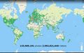 Mapillary coverage 04 05 2017.jpg 1,521 × 961; 303 KB
-
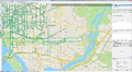 Mapillary plugin bug.png 2,560 × 1,400; 3.42 MB
-
 Mapillary Ranking.png 841 × 740; 216 KB
-
 Mapillary website coverage 2015 01 26.png 786 × 591; 201 KB
-
 Mapillarystart.png 466 × 409; 212 KB


