Featured images/Oct-Dec 2010
(Redirected from Featured Images/Oct-Dec 2010)

These are featured images, which have been identified as the best examples of OpenStreetMap mapping, or as useful illustrations of the OpenStreetMap project.
If you know another image of similar quality, you can nominate it on Featured image proposals.
| ← from October to December 2009 | ← from July to September 2010 | from January to March 2011 → | from October to December 2011 → |
Gallery of featured images, from October to December 2010
-
 2010, week 40
 -
 2010, week 41
 -
 2010, week 42
 -
 2010, week 43
 -
 2010, week 44
 -
 2010, week 45
 -
 2010, week 46
 -
 2010, week 47
 -
 2010, week 48
 -
 2010, week 49
 -
 2010, week 50
 -
 2010, week 51
 -
 2010, week 52
Details and captions
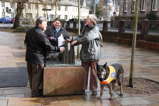
Week 40 (from Monday 4 October 2010 to Sunday 10 October 2010) [Edit]

- English : Mapping Party in Marburg, Germany: Blind and seeing mappers discover a tactile model of Elisabethkirche with accessible GPS devices.
Week 41 (from Monday 11 October 2010 to Sunday 17 October 2010) [Edit]

- English : Великие Луки Mapping Weekend banner: "We've come from different cities of Russia and Belarus to create the best map of Velikiye Luki in the world"
Week 42 (from Monday 18 October 2010 to Sunday 24 October 2010) [Edit]

- English : One year after the French land cover import, 69% of the country is informed in land cover [1]
Week 43 (from Monday 25 October 2010 to Sunday 31 October 2010) [Edit]

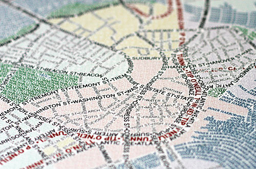
- English : Typographic maps manually traced from OSM data
Week 44 (from Monday 1 November 2010 to Sunday 7 November 2010) [Edit]

- English : Kite photography from up to 650 m / 2000 ft altitude (and a flying OSM advert) – some early results. Photographer: "Imagery will hopefully be served as tiles / WMS for use in editors"
Week 45 (from Monday 8 November 2010 to Sunday 14 November 2010) [Edit]

- English : The Nike Grid game is using OSM maps for London (with some help from Stamen and OSM attribution)
Week 46 (from Monday 15 November 2010 to Sunday 21 November 2010) [Edit]

- English : OSM maps used for political campaigning (Toronto)
Week 47 (from Monday 22 November 2010 to Sunday 28 November 2010) [Edit]

- English : OSM maps in German, Norwegian and French editions of Wikipedia. (Example – select "Kart/carte" next to coordinates)
Week 48 (from Monday 29 November 2010 to Sunday 5 December 2010) [Edit]

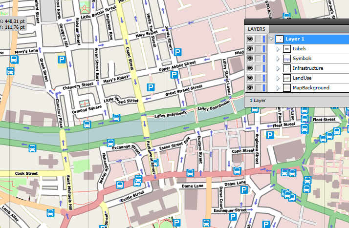
- English : Viewing a map of Dublin City Centre in Adobe Illustrator - SVG file was produced by latest release of Maperitive
Week 49 (from Monday 6 December 2010 to Sunday 12 December 2010) [Edit]

- English : Animation of 2 hours' tracing of Bing imagery with JOSM. (Street names added from addr: nodes)
Week 50 (from Monday 13 December 2010 to Sunday 19 December 2010) [Edit]

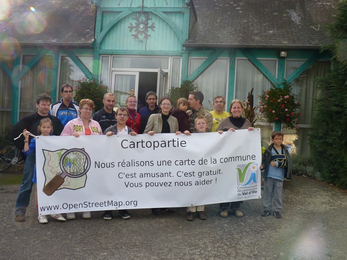
- English : A great day mapping for residents of Montreuil-le-Gast ([2]) (Brittany, France). The first time for many of us, but ultimately a great success! To be continued...
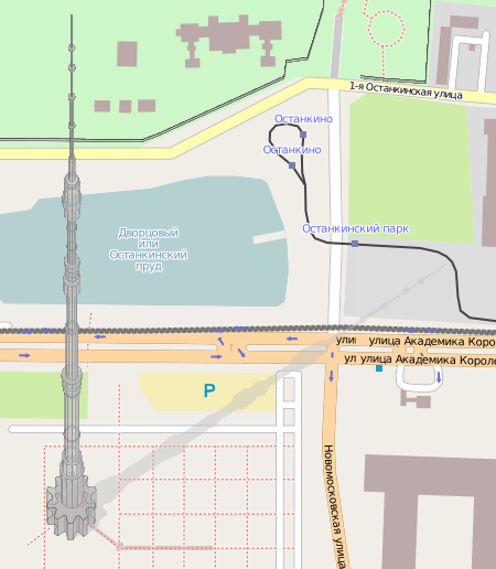
Week 51 (from Monday 20 December 2010 to Sunday 26 December 2010) [Edit]

- English : Komяpa has found a way to render 3D buildings. Famous Ostankino tower (drawn by Hind) looks very real! Some more.
Week 52 (from Monday 27 December 2010 to Sunday 2 January 2011) [Edit]

- English : The accessibility map of Castelfiorentino, Italy was made in the participatory process “Free Access for all”. Printable version, based on OSM data, can be downloaded for free.