File:Dublin ga.png
Jump to navigation
Jump to search


No higher resolution available.
Dublin_ga.png (548 × 521 pixels, file size: 184 KB, MIME type: image/png)
Licensing
![]()
![]()
![]()
This screenshot contains OpenStreetMap Carto rendering.
The OpenStreetMap Carto map style is made available under the Creative Commons CC-0 1.0 Universal Public Domain Dedication.
- Attribution to the map data:
![]()
Contains map data © OpenStreetMap contributors, made available under the terms of the Creative Commons Attribution-ShareAlike 2.0 (CC-BY-SA-2.0).
This is a Featured image, which means that it has been identified as one of the best examples of OpenStreetMap mapping, or that it provides a useful illustration of the OpenStreetMap project. If you know another image of similar quality, you can nominate it on Featured image proposals.
Front-page image for week 34 of 2009 (17–23 Aug.).
- Image descriptions
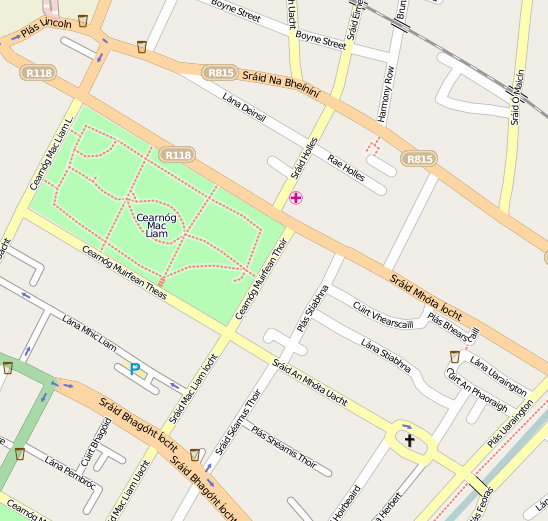
- Deutsch : OpenStreetMap auf Irisch ansehen (Parks in Baile Átha Cliath auf Ævar Arnfjörð Bjarmasons experimenteller Wikipedia-Karte), oder in anderen Sprachen.
- English : View the map in Irish (parks in Baile Átha Cliath being shown on Ævar Arnfjörð Bjarmason's experimental wikipedia rendering), or some other language.
- español : Ahora se puede ver el mapa en irlandés (gaélico) (se muestran los parques de Baile Átha Cliath gracias al renderizador experimental para la wikipedia hecho por Ævar Arnfjörð Bjarmason), o en cualquier otro idioma.
- français : Les toponymes en irlandais (rendu expérimental de Ævar Arnfjörð Bjarmason), ou dans d'autres langues.
- hrvatski : Pogledajte kartu na Irskom (parkovi u Baile Átha Cliath su prikazani kao Ævar Arnfjörð Bjarmason's na eksperimentalnom rendereru), ili za neki drugi jezik.
- italiano : Visualizza la mappa in irlandese (i parchi di Baile Átha Cliath mostrati nel rendering sperimentale per Wikipedia di Ævar Arnfjörð Bjarmason) o in altre lingue tra cui l'italiano.
- magyar : Nézd meg a térképet ír nyelven (dublini parkok láthatók Ævar Arnfjörð Bjarmason kísérleti wikipédia renderelésén), vagy néhány más nyelven.
- Nederlands : Bekijk de kaart in het Iers (parken in Baile Átha Cliath die worden getoond op de experimentele Wikipedia rendering van Ævar Arnfjörð Bjarmason's), of een andere taal, zoals het Nederlands.
- polski : OpenStreetMap po irlandzku (parki w Baile Átha Cliath są widoczne na eksperymentalnej warstwie dla Wikipedii, przygotowanej przez Ævar Arnfjörð Bjarmason) lub w innych językach.
- português : Veja o mapa em Irlandês (parques em Baile Átha Cliath mostrados na renderização experimental para a Wikipedia de Ævar Arnfjörð Bjarmason), ou em outras línguas.
- suomi : Karttaa voi selata myös iirin kielisillä nimillä (Baile Átha Cliath -puisto Ævar Arnfjörð Bjarmasonin testipalvelussa), tai muillakin kielillä.
File history
Click on a date/time to view the file as it appeared at that time.
| Date/Time | Thumbnail | Dimensions | User | Comment | |
|---|---|---|---|---|---|
| current | 15:02, 25 July 2009 | | 548 × 521 (184 KB) | Ojw (talk | contribs) |
You cannot overwrite this file.