JA:OSM Online Browsing
インターネットに接続している場合、地図を見るためのいくつかの方法があります。紙の地図と同じように、同じ領域を含む異なった地図を選ぶことが出来ます。選択は、それを必要とする目的(ハイキング、自転車旅行、観光旅行)や、描画方法に対する個人的な好みに依存します。ここで一覧表示しているオプションは異なった情報に着目しているかもしれませんが、ある点では共通です。すなわち、OpenStreetMapプロジェクトの自由な地図情報をベースとしていると言うことです。
いろいろな地図の形式
OpenStreetMapは、地図情報を使って種々の異なった方法で表現します。これに着目するため、以下ではWebベースの地図に対してOpenStreetMapの異なった描画スタイルをいくつか示しています。
| 名前, Webページ | 地図情報の範囲 | 説明 | 自由でオープンなライセンスにおけるスタイルシートが有効かどうか | 画像 |
|---|---|---|---|---|
| Hike & Bike Map [1] | 全世界 | 丘の立体視、輪郭とルートシンボルを伴う、ハイキングとツーリング用のスリーピーマップ | yes see | 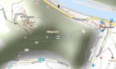
|
| Information Freeway | 全世界 | Tiles@homeからのタイルによるスリーピーマップ | yes | |
| OpenCycleMap [2] | 全世界 | 傾斜、丘の輪郭、ツーリング用のルート、バイク駐輪場とfryupをする喫茶店 | no | 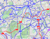
|
| OpenPisteMap [3] | スキー滑降コースとリフトを強調したスリーピーマップ | yesYes | ||
| OpenSeaMap [4] | 自由な海図 港, マリーナ, 灯台, 航路標識等 |
yes | 
| |
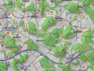
| OSMC Reit- und Wanderkarte [5] | ドイツ、オーストリアとスイス | 陰を付けた丘と、Nopによるハイキングコースのサインがある、ツーリングおよびハイキング用地図 | ? |
|
| TopOSM [6] [7] | アメリカのマサチューセッツ州とコロラド州 | OSMデータによる地形図 Lars Ahlzen。現在開発作業中である。 | yesSee link | 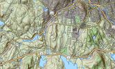
|
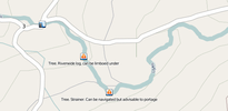
| Whitewater Maps [8] |
カヌーをこぐ人と筏に乗る人が使う急流地図。どこで入ったり出たりするか、どこが急流か、こぎ手によって使われる名前と、危険地点がどこかを表示する。|| align=center style='background-color:#6f3;'| yes see wiki-link. || | |||
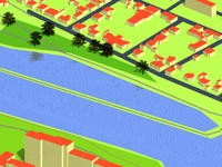
| Isometric 3D Map | チェコ共和国 | チェコ共和国の等尺性3D地図 (OpenKýblMap) | ? |
|
| ÖPNV-Karte | 欧州 | ドイツの中の公共輸送手段(PSV)のルートを表示する地図。 | ? |
Web ブラウザ
地図を見るための最も一般的な方法は、webブラウザを使うことです。リンクまたはURLをクリックすると地図が表示されます。
online "slippy map" はOSM地図を見るための標準的な方法です。
- It loads maps as required when you move around.
- Provide the name of the requested location and it will look it up for you.
- By clicking the + in the right top corner of the map you can choose a different rendering (including one adding extra info for cyclists).
- It provides a direct link to edit the map (login required).
- It lets you export the map to an image that you can save.
代替
- The OpenCycleMap or http://www.opencyclemap.org adds a layer showing information useful to cyclists.
- The Benelux Hiking map adds a layer showing information useful to hikers. Region is limited to the Netherlands and Belgium.
- The information Freeway has a "slippy map" using tiles@home data. It is possible to update the tile for an area by zooming to level 12 and ctrl-clicking. The tile is then generated and the new tile is available within the hour.
- Freemap is an alternative method to display OSM data, using a similar JavaScript interface.
- Yet another approach is Osmabrowser, which provides an interactive online front end to Osmarender, as well as PNG rendering using Freemap. This is not "slippy" but is useful if you want to display a static map of, say, a town. In early stages of development.
ブラウザ拡張
Making an OpenStreetMap handler for Operator documents the process of creating a new handler for the geo microformat for the Operator extension for Firefox.
OpenStreetMap Finder is a Firefox extension for the Mozilla Firefox web browser.
osm.js is a plugin for handling the geo microformat for the Operator extension for Firefox.
アプリケーション
- OSM-3D (we need an english tranlation of this wiki page!) is a project of University of Bonn to display OSM data in 3D by combining with SRTM DEM (powerful computer needed!). Link:www.OSM-3D.org
- MetaCarta Labs have created an add-on for NASA WorldWind and online map viewer.
