KaporSKAddress
Kapor
Kapor (sometimes referred to as kapor2) is a portal of Slovak cadastral office. The main website (in Slovak and English language) is located at www.katasterportal.sk/kapor.
It contains information about:
- parcels registered in Slovak Cadastre - including information such as building (if present), its conscription number, number of floors etc
- real estates (including the type of land and its predominant use (roughly equivalent to
landuse=*)
There is an ongoing import of building (polygons): WikiProject_Slovakia/Sources#Cadastral_map which is - as of June 2015 - near completion.

Slovak community is preparing a semi-automatic import of the available data to OSM. See below.
As the data are specific to Slovak Republic the discussion and information about project are on the Slovak version of this page.
We will try to translate the most important parts to this page when we reach the agreement here as well.
License for data
The data are freely available to anyone by law as they were created by government agency using tax payers' money. There are no copyrights on the data. This has been confirmed by Head of Cadastral Office in 2009: http://wiki.freemap.sk/KatasterPortal (Slovak).
Slovak Address Import
Slovak Cadastre does not contain information about street numbers (addr:streetnumber) which are used as a part of Cs:WikiProjekt Česko/Systém adres, this information has been however retrieved from municipalities of towns and cities as a separate activity effort. The information are still being cleaned and prepared for automated jobs.
Due to the fact that for villages/smaller town only utilizing conscription numbers (addr:conscriptionnumber) we do not need these data, we will split the import into two phases:
- import of conscription numbers only (data from Cadastral office)
- import of street and conscription numbers (data from Cadastral Office and municipalities combined)
Conscription numbers import
Scope
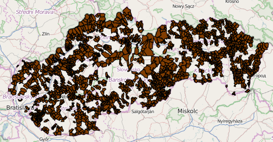
The plan is to import conscription numbers of all cadastral areas one by one (with tracking and manual check prior to import - similarly to http://ruian.poloha.net/czaddr/). Not all villages/cadastral areas are available (digitized) at this moment (the process is ongoing), this should not matter too much as missing cadastral areas can be imported later.
The areas containing only conscription numbers (w/o street numbers) were identified using the following approach:
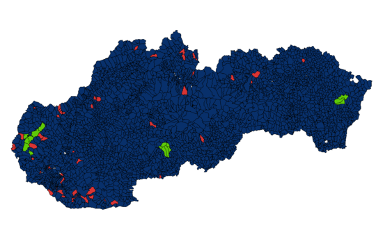
- if more than 5 % of its residents had a slash in their addresses (common separator between street and conscription numbers) it is assumed that street numbers are in use in that area and hence is excluded from further processing
- remaining areas were checked in current OSM data - if an element with addr:streetnumber is found within their boundaries, they are excluded as well.
This list will be constantly refined based on user inputs.

Description of input data
The following data is available:
- location (polygon) and names of parcels within cadastral area (there is approx 3500 areas in Slovakia)
- where available: list of conscription numbers on buildings residing on a specific parcel
Quality of the data as observed by long-term mappers is "quite good" or "(addresses) fitting exactly". Quality can be slightly improved by removing duplicate points (per cadastral area).
Data has been imported to Postgis for easier manipulation and running spatial queries.
Import principles
- conscription numbers already present in OSM will be skipped (won't be imported)
- conscription numbers will only be placed on top of buildings which are already present in OSM
- if a building already is tagged with addr:conscriptionnumber, it will be ignored
- address tags will be placed onto existing closed ways (buildings), where multiple addresses are found, there will be nodes with duplicate location generated and it will be up to individual to resolve these situations
- all data will be reviewed by individuals in JOSM prior to upload
Mapping of features to tags
- conscription number -> addr:conscriptionnumber
- conscription number -> addr:housenumber (this will be a copy of addr:conscriptionnumber as per Czech address system)
- name of town/village to which the address belongs -> addr:place (this will be added by an individual responsible for the import of an area)
- source of data -> source:conscriptionnumber=kapor2
Data preparation/cleanup
- although not a necessity, it would be useful to have as many buildings in OSM as possible, since no address will be generated/imported if a building is missing (import can be rerun later to fill in gaps) . currently more than 98 % cadastral areas have majority of buildings imported
- despite the fact community agreed on using Cs:WikiProjekt Česko/Systém adres there are still areas where Karlsruhe_Schema is used meaning instead of addr:conscriptionnumber and/or addr:streetnumber you only get addr:housenumber. these cases need to be reviewed and resolved (values copied to respective tags)
- data from cadastre - parcel polygons + conscription numbers (end of 2014) has been imported to Postgis
Data transformation
- import current address data from OSM to a local Postgis DB
- filter out cadastral areas containing addr:streetnumber - this will be handled in next stage
- skip conscription numbers already present in OSM
- import building polygons from OSM to a local Postgis DB
- run Postgis spatial query combining computed center of building with conscription number from a related parcel resulting in a osm change file (one per cadastral area) - only nonambiguous addresses will be exported as osc, two or more addresses per parcel will be placed into separate csv files
Data merge workflow
- a list of affected cadastral areas will be uploaded to a project dedicated website: http://addrtool.osm.margus.sk/ - individuals will be able to register their interest in any of cadastral areas, they will then receive auxiliary files and merge the data with OSM in JOSM. in case of conflicts, it is advised to not resolve them but instead report it and wait for an update.
Example
Example output for one cadastral area (Temeš) with real numbers replaced with random values is located at https://freeshell.de/~jose1711/skruian/.
History
- June 12th: coarse plan of import presented on country-specific mailing list (osm_sk@googlegroups.com)
- June 21st: evaluation of votes determining the fate of the import. Results: community in general supports the import, minor concerns were dismissed, nobody objected the import as such.
- June 21st: presented on imports talk list
- July 22nd: first changeset uploaded under dedicated user account: (32807772)
Import of street numbers and conscription numbers
Scope
The plan is to import conscription numbers and related street numbers of all cadastral areas one by one (with tracking and manual check prior to import - similarly to http://ruian.poloha.net/czaddr/). Not all villages/cadastral areas are available (digitized) at this moment (the process is ongoing), this should not matter too much as missing cadastral areas can be imported later. Furthermore, not all municipalities provided tables containing assignment street name - conscription number - street number for various reasons hence those will be excluded from import (permanent addresses of residents could provide the needed information to some extent but this options has not been explored in detail).
Progress
There is an ongoing process of data preparation and clean up of data provided by municipalities. ETA: september 2015.
Progress in this phase is expected once conscription numbers import is in full swing.