Key:abandoned:building
_(12488907894).jpg) |
| Description |
|---|
| A building which has been abandoned and is no longer functional due to serious damage to roof or walls, but which is still visible in the landscape. |
| Group: lifecycle |
| Used on these elements |
| See also |
| Status: in use |
| Tools for this tag |
|
![]()
The abandoned:building=* is used by some mappers to map a building which has fallen into serious disrepair and is not habitable or usable, and which could only be put back into safe operation with expensive effort, such as completely rebuilding the roof or walls. Such buildings will still have some physical form reflective of their former use visible in the landscape, but may be missing parts of the roof or wall and therefore cannot be inhabited.
For buildings which are disused, but could still be usable with minor repairs, see the key disused=yes instead.
Dispute
Some mappers feel that a building, abandoned or not, is still a building (large visible object), so it should be mapped with building=* and if one wants to mark that it's abandoned, they should add abandoned=yes. Also note that there is some overlap between disused:*=*, abandoned:*=* and ruins:*=*. There seem to be no clear consensus yet (as evidenced by continually growing usage of abandoned:building=*). See Talk page for more information.
How to map
Add the tag abandoned:building=yes to an area around the remaining walls, for an abandoned building which is partially or significanlty ruined, when the specific type of building is no longer possible to determine, or not known. Or you may use a node when the shape of the abandoned former building is not clear.
- More specific values such as abandoned:building=house, abandoned:building=barn or abandoned:building=bunker may be added when this is still clear.
Rendering
Note that some renderers (most notably OpenStreetMap Carto) will currently not show abandoned:building=* on the map at all, while other renderers (like OsmAnd or Jawg) will show it in special style (dashed lines).
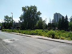
Gallery


Related alternatives
removed:building=yes, to prevent armchair mappers to re-adding the building from most recent aerial imagery where it is still visible. (otherwise, do not map at all)
.jpg)
.jpg)


See also
- building=ruins
- building=construction
- demolished:building=*
- disused:building=*
- Lifecycle prefix
- Comparison of life cycle concepts
- disused=yes + building=* for a building which is not currently used
- building=*
- abandoned=*
- shop=vacant