Key:dirtbike:scale
 |
| Description |
|---|
| A classification scheme for the difficulty of trails for off-road motorcycles. |
| Group: properties |
| Used on these elements |
| Requires |
|
|
| Useful combination |
|
| See also |
| Status: in use |
| Tools for this tag |
| This an experimental tag. Feedback is welcome to refine the scale descriptions and sample images. Please contribute suggestions on the Discussion page. |
Rationale
Provide a classification scheme for mapping the difficulty of trails suitable for off-road motorcycles, known as dirt bikes.
It's important to note that this scale specifically addresses trail conditions. The physical characteristics and examples provided for each scale level should help riders determine whether a trail is suitable for their skill level and the type of bike they are using.
To enhance the verifiability and precision of the scale due to its subjective nature, it is recommended to include additional tags such as smoothness=*, surface=*, tracktype=*, incline=*, and width=*.
Applies to
- single tracks:
highway=path - double tracks:
highway=track - unpaved roads: any alternative highway classifications featuring unpaved surfaces
How to map
This tag should be assigned to a way. You can either assign a specific dirtbike:scale=* value to the entire way or divide the way into segments with individual values.
The scale ranges from 0 to 5. Unlike mtb:scale=* (and like mtb:scale:uphill=*), values should be chosen based on the typical conditions encountered when riding uphill.
Additionally,
dirtbike:scale=?can be used to indicate that a specific route is known to be suitable for dirt bikes, although the exact difficulty scale is not known.
Values
| Value | Description | Examples |
|---|---|---|
0
|
Well-maintained gravel or compacted roads.
|
 
|
1
|
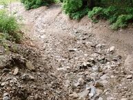
Ungraded tracks with navigable small obstacles.
|
 
|
2
|
Rough tracks with moderate obstacles and slopes
|
 
|
3
|
Challenging trails with large obstacles and steep slopes
|
 
|
4
|
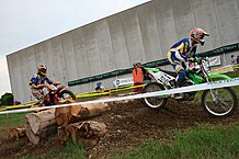
Hard Enduro trails with rugged terrain
|
 
|
5
|
Extreme Enduro trails with unforgiving terrain
|
 
|
Third-party Support
Renderers
| Tool | Support | Status | Link | Last update |
|---|---|---|---|---|
| OsmAnd | Custom Rendering | Enabled | https://github.com/osmandapp/OsmAnd-resources/pull/829#event-6708993295 | May 2022 |
| OsmAnd | Route Overlay | Pending | https://github.com/osmandapp/OsmAnd/issues/18756#issuecomment-2053672139 | Apr 2024 |
Possible tagging mistakes
motorcycle=no
The tag motorcycle=no specifies that it is legally prohibited to ride on a particular path. However, it is sometimes mistakenly used to suggest that a path is unsuitable or hazardous for riding. This constitutes a tagging mistake and should be corrected by using dirtbike:scale=*. On the other hand, roads that are legally off-limits for riding should not carry the dirtbike:scale=* tag.