Key:waste_basket
Jump to navigation
Jump to search
| Description |
|---|
| The presence of waste basket at/in a facility |
| Group: waste processing |
| Used on these elements |
| Useful combination |
| See also |
| Status: in use |
| Tools for this tag |
|
There exists a more popular bin=* tag with the same meaning, please use that instead.
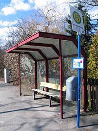
waste_basket=* was used to indicate the presence of a waste basket at a facility like bench=*, shelter=*, public_transport=platform, tourism=camp_pitch. As of 2024 the bin=* much more common in the OpenStreetMap database.
See also
- bin=* – more common tag with the same meaning
- amenity=waste_basket – separately mapped waste basket on single node
