Potlatch 1

- About
- Potlatch 1 was a Flash-based OpenStreetMap editor, which could still be reached from the 'Edit' tab of the main site until October 2012. To discourage use it was removed from the edit tab by then, but you could still access Potlatch 1 by manually editing the URL.
- Impact on OpenStreetMap
- Potlatch 1 was the default editor for many years. The main reason for many mappers to access Potlatch 1 was the unique functionality to undelete ways (zoom in as much as possible and hit the button "u" to query the server for deleted ways in the current area).
- Reason for being historic
- Its immediate successor was Potlatch 2. Due to deprecation of Adobe Flash, both Potlatch 1 and Potlatch 2 no longer function and have been replaced by Potlatch 3.
| Potlatch 1 | ||||||||||||||||||||||||||||||||||||||||||||||||||||||||||||||
|---|---|---|---|---|---|---|---|---|---|---|---|---|---|---|---|---|---|---|---|---|---|---|---|---|---|---|---|---|---|---|---|---|---|---|---|---|---|---|---|---|---|---|---|---|---|---|---|---|---|---|---|---|---|---|---|---|---|---|---|---|---|---|
| Author: | Richard Fairhurst | |||||||||||||||||||||||||||||||||||||||||||||||||||||||||||||
| License: | PD | |||||||||||||||||||||||||||||||||||||||||||||||||||||||||||||
| Platform: | Web | |||||||||||||||||||||||||||||||||||||||||||||||||||||||||||||
| Status: | Broken | |||||||||||||||||||||||||||||||||||||||||||||||||||||||||||||
| Version: | 1.4 (2010-12-24) | |||||||||||||||||||||||||||||||||||||||||||||||||||||||||||||
| Languages: | German and English
| |||||||||||||||||||||||||||||||||||||||||||||||||||||||||||||
| Website: | https://www.openstreetmap.org/edit?editor=potlatch | |||||||||||||||||||||||||||||||||||||||||||||||||||||||||||||
| Source code: | https://svn.openstreetmap.org/applications/editors/potlatch/ | |||||||||||||||||||||||||||||||||||||||||||||||||||||||||||||
| Programming language: | ActionScript
| |||||||||||||||||||||||||||||||||||||||||||||||||||||||||||||
| ||||||||||||||||||||||||||||||||||||||||||||||||||||||||||||||
|
A brief introduction to using Potlatch 1. Once you're comfortable with it, you can also learn some keyboard shortcuts. | |
|
See Potlatch 1 in action with this tutorial video (find more here). | |
|
Answers to frequently asked questions. | |
|
Tips, tricks and the latest news about Potlatch. | |
|
How Potlatch 1 works, how you can change it, and recent changes. | |
|
Leave a comment about improvements you'd like to see, and find out about future plans. |
The Potlatch Screen
If you click on the edit tab, typically you will enter Potlatch 2. To enter this older version, Potlatch 1, click the arrow next to the 'Edit' tab, select Potlatch 2, and replace editor=potlatch2 with editor=potlatch in the URL.
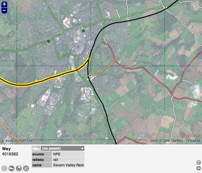
Choose 'Edit with save' if you would like to make edits and then save them (most people use this) Choose 'Live edit mode' for saving immediately as you go along. Now you will see the Potlatch screen and typically you might see Yahoo! aerial photography and, possibly, some mapped roads. At the bottom are some grey icons that are mapping tools and colored icons used to "tag" nodes on a map. More about that later.
You can zoom in and out using the plus "+" and minus "-" signs at the upper left of the image.
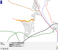
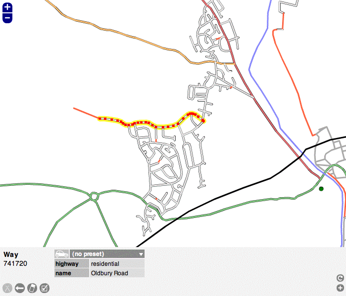
Carefully click on a "way" (a road, path or area) or a "node" (a specific spot), and it will be highlighted. Click anywhere else on the map to unhighlight it. In the example screen the highlighted road is outlined in yellow. When you highlight something, notice that the colored icons at the bottom of the screen are replaced by a kind of grid of light and dark grey boxes. You can see that these boxes contain information about the map item that you have highlighted. IMPORTANT: Look over the information but do not change anything yet until you have learned more about Potlatch.
This area at the bottom of the screen, called the Edit Panel, shows vital data about each "way" and "node" on the screen. This data is called "tags." Soon you will be adding your own "tags," but for now you need to become familiar with all the elements in the screen before you start editing.
Below the screenshot of Potlatch is a version of the Edit Panel with numbers on each element.
--1 and 2: When you select an item, this tells its basic type and its number in the OSM database
--3 through 9: These are basic tools that you will use to edit the map
--10: Template: In this case, the word "template" refers to a broad category of tags, such as "highway." "tourist" or "amenity."
--11: Relations: This refers to how each element is related to a larger road system. This is not always present on U.S. areas.
--12: Object tag: There are 7 "tags" or "object tags" in this example screen shot, starting with "highway." This element also introduces the terms "key" and "value." A "key" is a category of tags, such as "sport" or "railway." A "value" is a specific tag. For example, "highway" can be a key and "residential" is the value, or "sport" is the key and "tennis" is the value. Using multiple keys and values you can build up data for each item on the map.
--13: Delete tags: Use with caution because it does not ask you to confirm
--14: Copy tags: A handy tool for when you are making a lot of repetitive edits
--15: Open relation editor: In some cases a node or way may be part of a larger entity. For example, Historic Route 66 sometimes follows routes that today have different names or numbers. You can create a relation of the current way to the historic route. See "Relations" for other examples.
--16: Add a tag: If you need more tags to describe a way or node fully
--17: Help: a link to the Potlatch help page
--17.5?: Find Tag: A recent and welcome addition to Potlatch that provides a list of possible tags, if you are not sure which tag is right. Type in a possible tag, for example, "national park," and it provides a long list of acceptable tags for parks.
--18: Advanced menu: More editing tools. Read the Wiki for each before using them.
--19: Edit mode: Usually it is green and says "editing offline." This is the only mode a beginner should use. Make your edits, the click the next button, "Save."
--20: Save (not displayed when live edit mode): Saves changes you have made. Like anything else, the best method is to save often.
--21: Scroll bar for tags: This appears if you have added so many tags that the bottom Edit Panel is full, not likely, nor recommended, for a beginner.
After you are familiar with the screen, proceed to the Potlatch Primer [1] for the next steps.
Typical screen with Yahoo! Aerial Imagery:
Edit Panel:

|
1: Type of the selected element, |
12: Object tag (displayed 7 here, but it has more): a) key, b) value, |
Sometimes Yahoo! imagery is not available, so you will see only mapped items
Without Yahoo! Aerial Imagery:
Why Potlatch? (and why not?)
NOTE: The below is old text from before the release of Potlatch 2 (P2). All of that applies to P2.
Potlatch is intended as an easy-to-learn editing environment for drawing ways and adding metadata to existing ways. It is the best way for new members to start contributing to OSM, particularly in locations where there is good aerial photography. A clear, uncluttered user interface is paramount for newer users, and the Potlatch layout draws on the familiar conventions of the existing Slippy Map.
It's not intended for power users (who are already excellently served by JOSM and Merkaartor), people who want the speed of a desktop client, or those who don't like Flash. Nonetheless, since Potlatch, Merkaartor, and JOSM are developed separately, some innovations do make their way into Potlatch first, ranging from the simple (remove a node from one way alone) to the complex (editing history). An increasing number of experienced OSMers use Potlatch as a supplement to JOSM for instant editing, and a few use it as their principal editor.
As a very rough rule of thumb, Potlatch is easier for quick edits, and better for edits which range over a wide area (e.g. cycle routes). JOSM is better for heavy-duty editing in a concentrated area (e.g. housing estates) and offers facilities for audio and photo surveying. But everyone will have their own preferences.
Using Potlatch 1
Note: Since deprecation of Adobe Flash, neither Potlatch 1 nor Potlatch 2 is available via the OSM website. The text below is retained for historical reference but is no longer in effect.
Since the launch of Potlatch 2 there is (nearly) no reason to use Potlatch 1(.4) and, in fact, it is not recommended to use it -- except by advanced users who need to restore deleted ways or revert changes to ways in a given area. P1 is still the only handy tool to do that.
To access P1 user needs to add "&editor=potlatch" to the end of the editing URL. Again, don't use P1 except for reverting or undeleting ways!


