RU:Картографирование в зданиях
(Redirected from RU:Indoor Mapping)
Эта страница предназначена для собрания всех идей, касающихся изображения внутренних помещений зданий и т. п. на картах.
Случаи использования
- Схемы зданий: университеты, музеи, станции ж/д или метро, торговые центры и т. д..
- OSM для слепых - наглядные карты для людей с ослабленным зрением, нуждающимся в пешеходных картах и дополнительных указателях.
- Автомобильные проезды в многоярусных автостоянках.
Инструменты
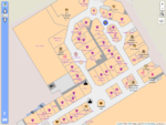
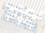
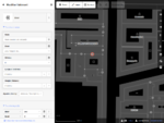
| Скриншот | Название | Разработчик | Лицензия | Последняя версия | Дата релиза | Сайт |
|---|---|---|---|---|---|---|

|
OpenLevelUp | PanierAvide | AGPL 3 | v3.0 alpha | ? | https://openlevelup.net/ |

|
OpenStationMap | Roland Wagner, Roland Olbricht | ? | ? | ? | https://www.openstationmap.org/ |

|
OsmInEdit | PanierAvide | ISC | v1.0.0 | 2019-09-19 | https://osminedit.pavie.info/ |
| ? | ? | ? | ? | ? | https://clement-lagrange.github.io/osmtools-indoor/ | |
| ? | ? | ? | ? | ? | https://sisinflab.poliba.it/polibaindoor/#lat=41.10829&lon=16.88020&z=18 | |

|
indoor= | François de Metz | BSD | 0.2.0 | 2020-11-24 | https://indoorequal.org/ |
| mapbox-gl-indoor | mapbox-gl-indoor | MIT | 0.0.4-rc1 | 2020-05-27 | https://github.com/mapbox-gl-indoor/mapbox-gl-indoor | |

|
openindoor.io | openindoor.io | AGPL 3 | v1.0 beta | 2020-07-04 | https://www.openindoor.io/ |
Устаревшие проекты
| Скриншот | Название | Разработчик | Лицензия | Последняя версия | Дата релиза | Note | |
|---|---|---|---|---|---|---|---|

|
ID-indoor | PanierAvide | ISC | ? | ? | https://projets.pavie.info/id-indoor/ | Replaced with OsmInEdit |
Тэгирование
Используемые тэги
indoor=yes- показывает, что данный объект находится внутри здания или под навесом.- mandatory has to be discussed --Saerdnaer 16:48, 28 March 2011 (BST)
level=n(optional, but recommended) - тэг показывает как этаж/ярус обозначается в реальности.- <n> - обычно целое число из одной-двух цифр, но может встречаться комбинация из цифр и букв (e.g. A,B,C,1,2,3).
- в любом случае <n> должен быть восходящим, увеличивающимся (по направлению к небу).
- в некоторых странах этажность считается начиная с нуля (0), в некоторых с первого этажа (1) (или A).
- иногда этажи обозначают дробным числом (e.g. level=2.5) в качестве "промежуточных этажей" (например, лестничные пролёты).
room=yes- описание на соответствующей странице
Номера квартир и имена указывают в тегах ref=* и name=*.
Предложенные (неутверждённые) тэги
- level – много предложений о схемах описания этажности
room=*- номера/названия помещений- room:class - тип комнатного помещения типа туалета, учительской, офиса, и т. д.
- room:capacity - число лиц, на которое помещение расчитано - вроде посадочных мест.
- building - отношения для зданий
Маршрутизация
- Показатель высоты GPS-устройств может использоваться для определения этажа многоярусной парковки, на которой припаркован автомобиль.
Устройства / Технологии
- Высокочувствительный GPS-приёмник
- Шагомер
- Компас
- Датчик ускорения
- Тахометр (подсчёт оборотов колеса автомобиля)
- Counting the number of floor tiles
- RFID
- WLAN
- Блютус
Проекты
Таблица сравнения проектов
| Название | Описание | Дата возникновения | Видео | Платформа, язык программирования | Лицензия | Формат данных внутренних помещений | Поддержка геопозиционирования |
|---|---|---|---|---|---|---|---|
| Geopard | end-of-studies project being developed by IT engineering students | 2008? | Video | Server: Linux+OSM(C,Java,BASH); Client: Android+J2MEOpenLayers; Editor:JOSM(Java) | GPL | .osm with indoor-specific "features" | Wifi, GPS (no Wifi-GPS transition implemented) |
| Absysseo | 2010 | больше не доступен | Server: No server; Client: J2ME/MIDP/C#/iOS/Android; Editor:.J2SE | коммерческая | proprietary supporting indoor/outdoor, buildings, floors and smart navigation | Any | |
| FootPath | infrastructureless indoor navigation on OSM data for smart phones | 2010 | Video | Client: Android; Editor: JOSM | GPL | .osm with indoor features | PDR (with sequence alignment) |
| Autonomie | 2010 | Navigation demonstration | Server: Apache Sling JCR; Client: iOS+Android; Editor: JOSM | - | .osm with indoor features | PDR, Wifi, GPS |
Отображение внутренних помещений на карте
- OpenLevelUp : http://github.pavie.info/openlevelup/
- http://ba.andreas-hubel.de/webapp/ карты с поддержкой уровней на основе OSM данных от Kothic JS
- Bing'овские карты многоэтажных торговых центров
- Ещё один рендер, альфа-версия: http://dotevo.geowebhost.pl/osmpoi/# от marek kleciak
mapping
- Richard Atterer's Leadme project A spare time project by Richard Atterer for home made indoor mapping .
- Indoor mapping with a kinect
location
- FootPath, infrastructureless indoor navigation on OSM data for smart phones (Android) at COMSYS, RWTH Aachen University video
- DLR Indoor Navigation Getting location via acceleration sensors. Nice Videos
commercial
- Absysseo. This french start-up located in Sophia-Antipolis, France provides a complete development kit allowing mobile developer to create LBS Indoor applications. This kit is composed of a Map Studio (map creation) running on PC and of a SW library(runtime) providing advanced cartography services and LBS functions. Available for several mobiles platforms (iPhone, Android, .Net C#, Java J2SE, Java J2ME), the client solution (runtime) is interfaceable with any indoor geopostioning solution. The map format is proprietary ; the solution ships with an SDK : the SmartIndoorTM Development Kit. Absysseo provides also news, information on the indoor location technology and indoor LBS usage on the blog [1]
- Senionlab providing an iOS library for navigation and positioning based on the sensors available on the mobile device (GPS, Wifi, three-axis gyro, accelerometer, digital-compass). Sensor fusion is done by a particle filter.
not clearly attributable/misc
- JA.net Investigations in Location Awareness see Capter B2. Interactive Maps mentioning Openstreetmap use for indoor mapping on a university campus.
- Open Floor Plan Display. (at Carnegie Mellon University) present at the Indoor Location and Floor Plan Standards forum(announcement) => end of forum page. A new indoor file format named IndoorML is introduced there.
- Ways4All (German) Research project to design an overall system for barrier-free indoor and outdoor navigation, including the communication with public transportation and public infrastructure, but no software available. News article
- IndoorWPS A WiFi-based, Crowd-Sourced Indoor Positioning System Development wiki
- NavCMU An open-source androit application for indoor navigation on the Carnegie Mellon’s campus
data formats/models
- CityGML very complex but standardised data model for land surveyors on top of gml/xml CityGML is a common information model for the representation of 3D urban objects. It defines the classes and relations for the most relevant topographic objects in cities and regional models with respect to their geometrical, topological, semantical and appearance properties. Included are generalization hierarchies between thematic classes, aggregations, relations between objects, and spatial properties. These thematic information go beyond graphic exchange formats and allow to employ virtual 3D city models for sophisticated analysis tasks in different application domains like simulations, urban data mining, facility management, and thematic inquiries.
- IFC building data model for architects and civil engineers
- wikipedia:Building_Information_Modeling
- http://www.buildingsmart.de/
- Nice lecture about integrating IFC in CityGML: Recording Slides (PDF)
Примеры по местности
Локации с разметкой внутренних помещений
Германия
Бавария
- Мюнхен
- TUM Mathematics/Computer Science Department: http://www.openstreetmap.org/?lat=48.262437&lon=11.667689&zoom=18
- Marienplatz: http://www.openstreetmap.org/?lat=48.1374683976173&lon=11.5761378407478&zoom=18
- Karlsplatz (Stachus): http://www.openstreetmap.org/?lat=48.13948&lon=11.566149&zoom=18
- Hauptbahnhof: http://www.openstreetmap.org/?lat=48.141162&lon=11.56094&zoom=18
Берлин
- Berlin
- bcc Berliner Congress Center http://www.openstreetmap.org/?lat=52.520765&lon=13.416662&zoom=18
North Rhine-Westphalia
- Aachen
- RWTH Computer Science Center Hörn: http://www.openstreetmap.org/?lat=50.778845&lon=6.060025&zoom=18&layers=M
- RWTH UMIC Research Center: http://www.openstreetmap.org/?lat=50.778834&lon=6.065266&zoom=18&layers=M
Филиппины
- Los Baños, Laguna
- University of the Philippines Los Baños (various buildings) http://www.openstreetmap.org/?lat=14.16534&lon=121.24303&zoom=17
- San Pablo City, Laguna
- SM City San Pablo http://www.openstreetmap.org/?lat=14.071238&lon=121.30207&zoom=18
Франция
Изер
Украина
Луганская область
- Северодонецк
- Торговый центр "Джазз" http://www.openstreetmap.org/?lat=48.944006&lon=38.493187&zoom=18&layers=M
Обсуждения
- в русском разделе OpenStreetMap Forum: