Exit Info
Populating Exit Sign Information
Methods
There are two methods to assign exit sign information into OpenStreetMap as described below:
1)The collective node and way method - the exit sign information is stored on both nodes and ways as follows:
| key | value |
|---|---|
| ref | <junction/exit number> |
| name | <exit name> |
| key | value |
|---|---|
| highway | *_link |
| oneway | yes |
| destination | <toward location> |
| destination:ref (proposed) | <branch route number> |
| destination:ref:to (proposed) | <toward route number> |
| destination:street (proposed) | <branch road name> |
| destination:street:to (proposed) | <toward road name> |
| junction:ref | <junction/exit number> (Optional: populate when a ramp splits and has different exit numbers – such as 51A and 51B |
| maxspeed:advisory | <safe exit speed> (Optional: populate when there is an advisory speed posted on ramp) |
| destination:symbol (proposed) | <motorist services> (Optional: populate when there are motorist services located at exit) |
2) The node only method - all of the exit sign information is stored on a node as follows:
| key | value |
|---|---|
| ref | <junction/exit number> |
| name | <exit name> |
| exit_to | <branch route number/road name> and/or <toward route number/road name> and/or <toward location> |
Preferred Method
The preferred approach is the 1st method – the collective node and way method for the following reasons:
- It can handle complex interchanges. Especially in the US where an exit ramp can split multiple times such as 3A-B-C
- Associating the exit sign information with the *_link way improves route guidance
- Germany has widely populated the ref and destination of the *_link way with junction/exit sign information
Attribute Definitions
| Node Term | Explanation |
|---|---|
| <junction/exit number> | The junction/exit number from the exit sign. Examples: 236, 11A, 51A-B |
| <exit name> | The exit name form the exit sign - this is not typical for most exits. Example from Pennsylvania Turnpike in the US: Gettysburg Pike |
| Way Term | Explanation |
|---|---|
| <toward location> | The location(typically a city) that the exit/ramp/slip road will head toward |
| <branch route number> | The route number that the exit/ramp/slip road will branch onto |
| <toward route number> | The route number that the exit/ramp/slip road will head toward |
| <branch road name> | The road name that the exit/ramp/slip road will branch onto |
| <toward road name> | The road name that the exit/ramp/slip road will head toward |
| <junction/exit number> | Populate when a exit/ramp/slip road splits at a common node and has different junction/exit numbers Example: 51A (the node <junction/exit number> will have 51A-B) |
| <safe exit speed> | Populate when a exit/ramp/slip road has an advisory speed sign |
| <motorist services> | Populate when the exit/ramp/slip road has access to services motorist need |
Examples
US Examples
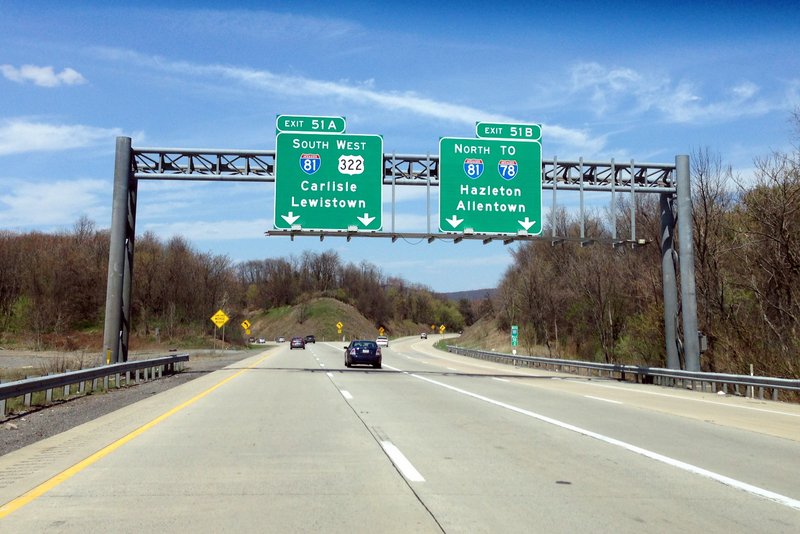
A/B Split Example
The above exit sign information shall be added to OpenStreetMap as follows:
| key | value |
|---|---|
| highway | motorway_junction |
| ref | 51A;51B |
| key | value |
|---|---|
| highway | motorway_link |
| oneway | yes |
| destination | Carlisle;Lewistown |
| destination:ref | I 81 South;US 322 West |
| junction:ref | 51A |
| key | value |
|---|---|
| highway | motorway_link |
| oneway | yes |
| destination | Hazleton;Allentown |
| destination:ref | I 81 North |
| destination:ref:to | I 78 |
| junction:ref | 51B |
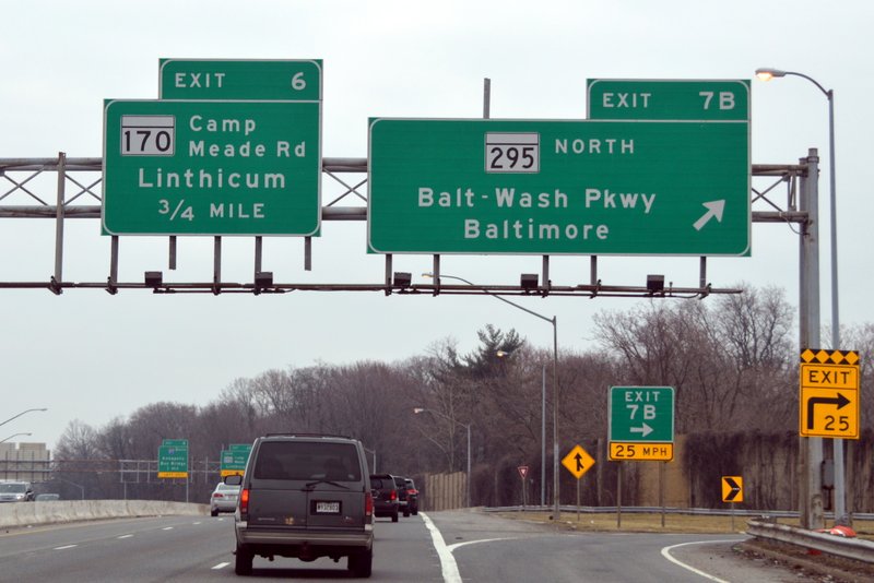
Road name Example
The above exit sign information shall be added to OpenStreetMap as follows:
| key | value |
|---|---|
| highway | motorway_junction |
| ref | 7B |
| key | value |
|---|---|
| highway | motorway_link |
| oneway | yes |
| destination | Baltimore |
| destination:ref | MD 295 North |
| destination:street | Baltimore-Washington Parkway |
| maxspeed:advisory | 25 mph |
At the next exit, tag ref=6 on the node and destination=Linthicum destination:ref=MD 170 destination:street=Camp Meade Road on the motorway_link way.
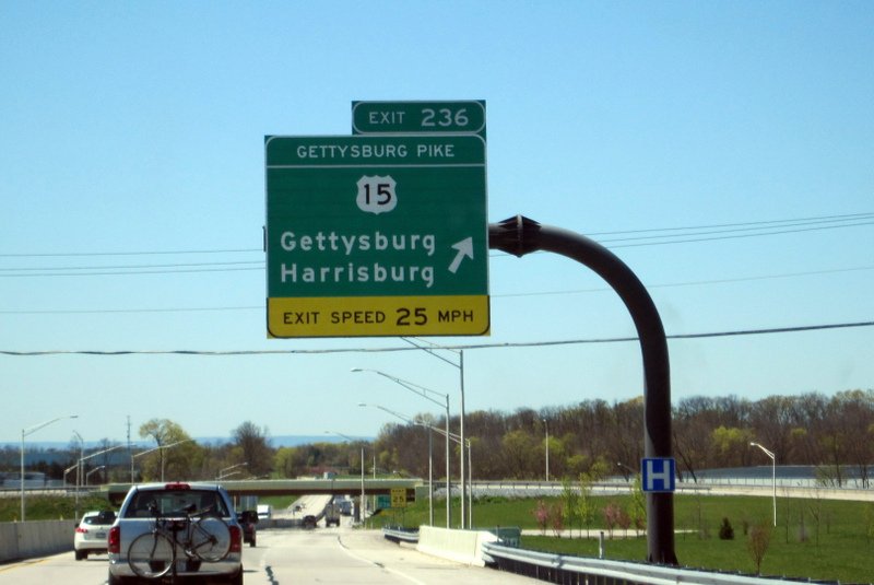
Exit name Example
Exit names are usually found on toll roads. On guide signs, exit names look similar to road names. The above exit sign information shall be added to OpenStreetMap as follows:
| key | value |
|---|---|
| highway | motorway_junction |
| ref | 236 |
| name | Gettysburg Pike |
| key | value |
|---|---|
| highway | motorway_link |
| oneway | yes |
| destination | Gettysburg;Harrisburg |
| destination:ref | US 15 |
| maxspeed:advisory | 25 mph |
| destination:symbol | hospital |
Issues
US Issues
Off Ramp/On Ramp Way Split
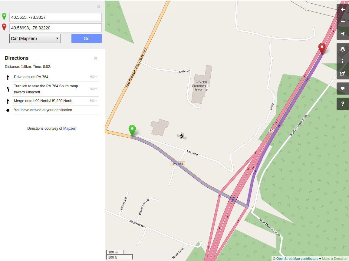
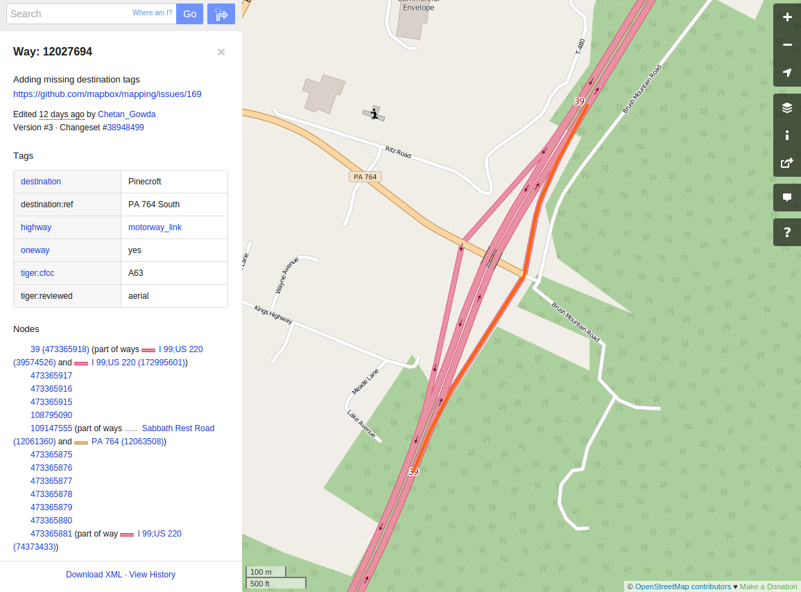
When adding interchange information to ways - please review the relationship of the interchange sign information and the connected ways. Sometimes a way will need to be split between an off ramp and an on ramp. Here is an example of when interchange information was added to a way that was both an off ramp and an on ramp:
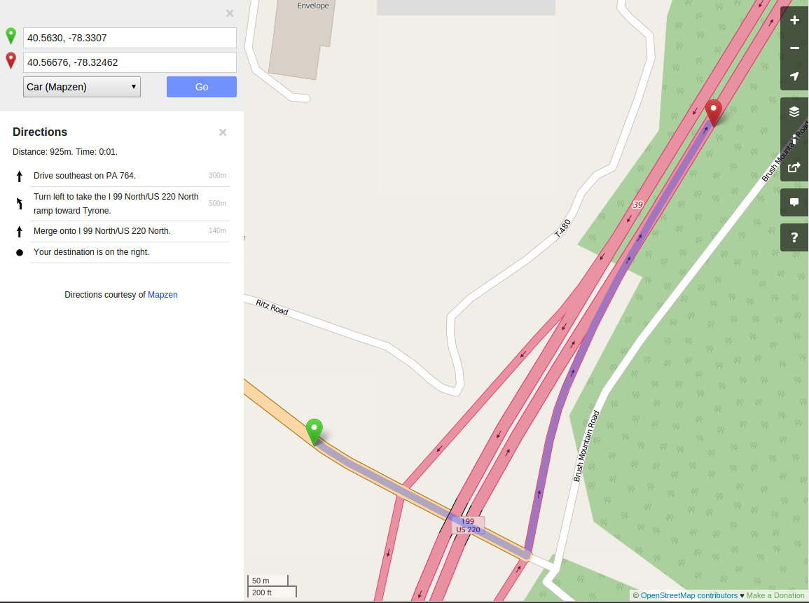
Thus, leading to the following invalid on ramp directions:
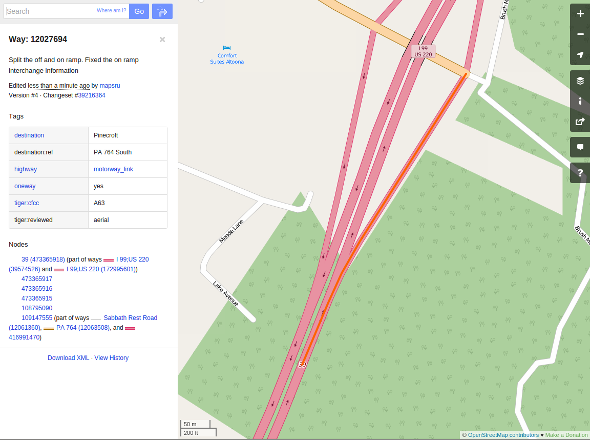
The above way was split - here is the updated off ramp way:
Here is the updated on ramp with the proper interchange information ( destination and destination:ref):
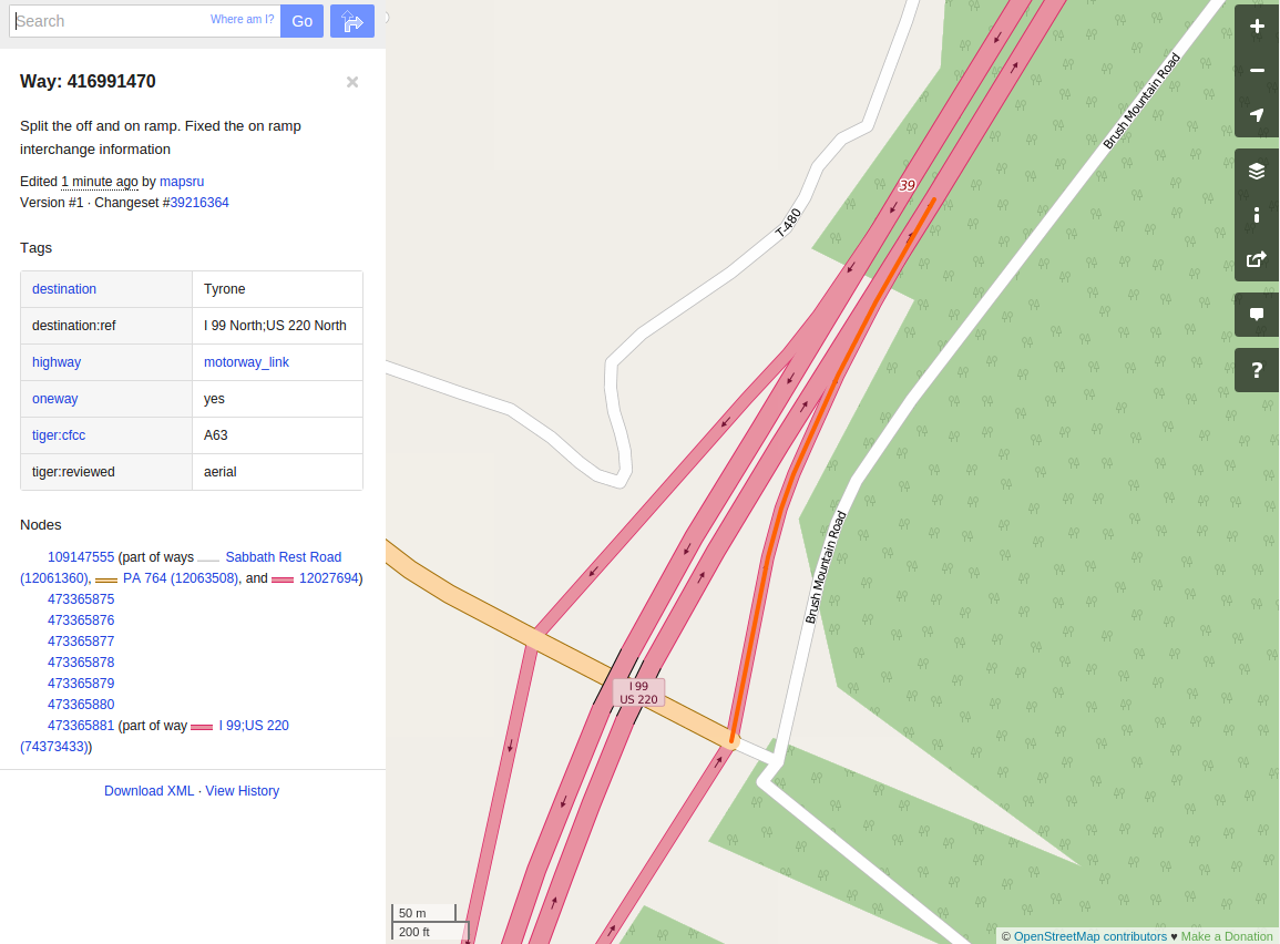
The on ramp instruction will now be: Turn left to take the I 99 North/US 220 North ramp toward Tyrone.
