Strava
Strava (Strava on Wikipedia) is a website and mobile app (for Android and for iOS) used to track athletic activity via GPS. Its headquarters are located in San Francisco, California, USA.
Most popular activities tracked are cycling, running and hiking. The Strava dataset contains 13 trillion latitude/longitude points from over 1 billion activities with a total distance of 27 billion km.[1] The heatmap shows the last two years and is updated monthly.[2]
Use of OpenStreetMap
Strava is introducing use of OpenStreetMap gradually, replacing Google Maps. They are using a "terrain" style rendered and hosted by Mapbox.
- Static maps (the small thumbnail map images) both on the web and within the mobile apps have used OpenStreetMap since early 2014.
- Slippy maps on the web have switched from Google Maps to OpenStreetMap mid 2015. Slippy maps in the Android and iPhone apps are not switched yet, the 2019-10 announcement was only about the static snapshots.
- Routing, and the "route builder" is based off OSM data.
There is also the strava-map-switcher browser extension that extends the Strava website with more detailed and/or recent maps (Mapy.cz, Freemap Slovakia, MTB map Europe, …).
Global Heatmap

Strava's Global Heatmap website: https://www.strava.com/heatmap/
Data Permission - Allowed for tracing!
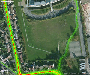
OpenStreetMap users have permission (reconfirmed in November 2019) to use Strava heatmap data for tracing into OSM only. For all other non-personal uses, including tracing into other datasets, please contact Strava Metro.
The data is available on a purchasable license basis, so it is great that Strava allows the data to be used free of charge for the purposes of improving OpenStreetMap (similar agreements exist with aerial imagery providers). Please be aware that this is a great tool to find missing paths, but that the presence of heatmap lines does not necessarily mean that access on that location is legal for the general public. Also the type of activity for some Strava tracks might be incorrectly specified (e.g., cycling tracks over large bodies of non-frozen water).
Global Heatmap in High Resolution
Global Heatmap in High Resolution is available to registered users of Strava. Thus, you first have to create a Strava account.
In JOSM, a TMS layer of Strava high-resolution heatmap can be added in the Imagery menu as follows:
tms[3,15]:https://heatmap-external-{switch:a,b,c}.strava.com/tiles-auth/ACTIVITY/COLOR/{zoom}/{x}/{y}.png?Key-Pair-Id=MYVALUE&Policy=MYVALUE&Signature=MYVALUE
In iD, you can use the following link as a custom background:
https://heatmap-external-{switch:a,b,c}.strava.com/tiles-auth/ACTIVITY/COLOR/{zoom}/{x}/{y}.png?Key-Pair-Id=MYVALUE&Policy=MYVALUE&Signature=MYVALUE
After logging in to https://www.strava.com/heatmap/ using a browser, you then have to retrieve and replace the MYVALUE items with appropriate cookie values for the following:
- CloudFront-Key-Pair-Id
- CloudFront-Policy
- CloudFront-Signature
To get these values: On Firefox, press ⇧ Shift+F9. On Chrome, paste this in your URL bar: chrome://settings/cookies/detail?site=strava.com, or click on the padlock icon in the URL bar while at https://www.strava.com/heatmap/ and take the values from Cookies.
Replace also the elements ACTIVITY and COLOR with the available options:
- ACTIVITY:
- run
- ride
- winter
- water
- all
- COLOR:
- blue
- bluered
- purple
- hot
- gray
The cookies will expire in approximately one week. After that, you need to repeat the whole process in order to keep using the high resolution Strava Heatmaps in your editor.
If you have a question regarding editing with the heatmap, please ask OSM community at for example help.openstreetmap.org (search for old, similar questions before). If you run into technical issues with these addresses (e.g. server/DNS error), please mail maps -at- strava.com.
Browser Extension
There is a browser extension that simplifies the process of getting the high-resolution heatmap TMS URL. It is available as a Firefox Addon or a Chrome Extension, and the source code is on Github.
If you are using Tampermonkey script manager, a script is offered to generate the heatmap URL.
Global Heatmap in Low Resolution
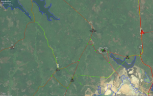
Strava heatmap in low resolution is not sufficiently detailed to be used for tracing into OSM. It might indicate where to find missing roads or cycle tracks.
In JOSM, the Strava Global Heatmap (Low Resolution) has been added to the JOSM imagery list, and can be activated through the preferences. Here are the strava entries on JOSM's internal list for reference.
For iD editor, you could paste the URLs into the "custom" entry (only one possible at a time) of the background settings. To find out the correct URLs, see the part between <url> and </url> on the JOSM list and append ?px=256 at the end. Examples:
https://heatmap-external-{switch:a,b,c}.strava.com/tiles/ride/bluered/{zoom}/{x}/{y}.png?px=256https://heatmap-external-{switch:a,b,c}.strava.com/tiles-auth/ride/hot/{zoom}/{x}/{y}.png?px=256
Strava Slide
Strava Slide iD fork gives access to GPS tracks and provides a clever tool (Slide add-on) to iteratively refine a way geometry and optimize its alignment with the GPS heat data.
Routing Error Reports
Routing errors reported by Strava users can be viewed on a slippy map that has OpenStreetMap as a base layer. This could be used as a "check list" for mappers to investigate potential problems and correct them based on usual sources (like checking the location on-the-ground). http://labs.strava.com/routing-errors/
API
Strava have an API. Most of the information available relates to a specific user or their friends and so requires login through a Strava account. http://strava.github.io/api/
See also
- Gpslib.ru - active since 2007; more functional counterpart, allows you to download traces with timestamps
- http://labs.strava.com/
- http://labs.strava.com/slide/slide-SOTM-2014.pdf
- http://stateofthemap.us/session/slide/
References
- ↑ “Strava Labs”. Retrieved 2021-11-28.
- ↑ "Heatmap Updates". Strava. Retrieved 2022-01-20.
