Tag:route=canoe
 |
| Description |
|---|
| Signed route for canoes, kayaks, or other paddle craft |
| Group: routes |
| Used on these elements |
| Requires |
| Useful combination |
| Status: in use |
| Tools for this tag |
Signed route for canoeists, kayakers and other paddlers. In OSM canoe=* is the general term for all these paddlers, also see access=*.
How to map
Canoeing routes are mapped in relations ![]() of type
of type type=route.
Tags used in combination
type=routemandatoryroute=canoemandatorynetwork=*optionalname=*- Nameref=*- Short identifier for route (max 5 characters)operator=*- Operatordistance=*- Distance in kmroundtrip=yes- Circular routedescription=*- Description of the routecolour=*- Colour of path symbols, especially when these are distinctive for the routesymbol=*- Human readable description of the path symbolsosmc:symbol=*- Machine readable description of the path symbols (used by the maps listed below)wiki:symbol=*- filename of symbol in the OSM wiki
Members
Canoe routes can include waterways, untagged lines showing the approximate path in a pond or lake, and overland paths known as portages. Order matters; make sure members are sorted so they can be followed in order from beginning to end.
Roles
Most of the time, elements will be added with an empty role. For recreational route relations, a basic functional role set has been approved, see https://wiki.openstreetmap.org/wiki/Proposed_features/Recreational_route_relation_roles The approved roles are: main, alternative, approach, excursion, and connection. When no role is set, main is assumed. The roles are applicable to way members and relation members. Note that in relations containing ways with the directional roles backward and forward, the functional roles should not be used. As yet, there is no approved way to assign multiple roles to one element. In such cases, you can create a child relation for the variant and add it as a member with the appropriate role.
Junction network
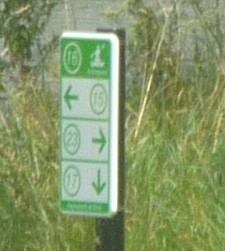
A junction network consists of numbered junctions of which the numbers are signposted on the routes in between. For more explanation about this method of mapping, see Cycle_routes#Tagging_Cycle_Route_Networks.
The junction number is tagged using the tags rpn_ref=* and network:type=node_network on a node ![]() . This junction is mapped at the actual intersection where the routes meet, not on a signpost next to the road.
. This junction is mapped at the actual intersection where the routes meet, not on a signpost next to the road.
The routes in between the junctions are mapped as relations ![]() of type
of type type=route. All ways in the route are added to the relation, preferably from the lower to the higher junction number. The following tags could be included:
type=routemandatoryroute=canoemandatorynetwork=rpnmandatorynetwork:type=node_networkmandatoryref=*- Numbers of both junctions in ascending order, connected by a dash
All junctions and route relations in a network can be added to a network relation. This is a relation ![]() of type
of type type=network. The following tags could be included:
type=networkmandatorynetwork=rpnmandatorynetwork:type=node_networkmandatoryname=*- Nameoperator=*- Operator
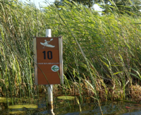
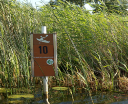
Local canoeing routes (not being a junction network) in complex water area's often also have numbered signposts along the way for orientation purposes. These nodes can be tagged with lpn_ref=*.
In some networks 'empty junction nodes' exist. It is preferred to tag these nodes with the letter 'o', which resembles an empty circle. An example of such node can be found on the route=motorboat page.
Overlap with motorboat routes
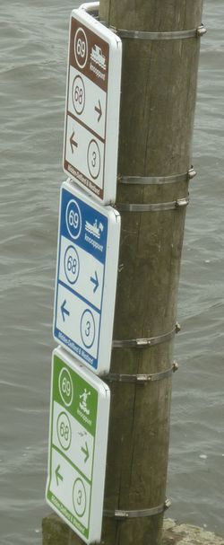
In some networks canoe routes overlap with motorboat routes. They may share network junctions or entire routes. An example is shown in Example 2 with brown and blue routes for motorboats and green routes for canoes.
As these networks are exceptions and canoe=* and motorboat=* are viewed as different modes of transports in Openstreetmap, is has been decided to use different route relations for canoes and motorboats. Secondary tags like colour=*, symbol=* and comment=* can be used on both relations to describe the exact situation.
A disadvantage of this method is the situation in which two relations with the same tag ref=* and the same route can be seen in the editors. This is an easy way to make mistakes. For a clear distinction the text 'canoe' can be added to the ref-tag, separated from the actual ref-tag by a semicolon separator, like ref=10-11; canoe.
Examples
| Picture | Tagging |
|---|---|

|
On the node On the relation
|

|
On the node On the relation
The motorboat routes (brown and blue together, since they are both motorboats in the sense of OSM and brown is a subset of blue) are mapped separately from the canoeing network, using |

|
Local route (not a junction network); on the node
|
Rendering
route=canoe is not rendered by the default map layers on Openstreetmap.org. Maps that render the tags include:
- Canoe routes on Openkaart.net
- Canoe Map on Knooppuntnet.nl
- OpenStreetBrowser Paddling There is also a development repository.
- OsmAnd issue #16105 requests they support the canoe key as they currently support the whitewater key.