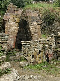
Tag:megalith_type=well
Jump to navigation
Jump to search
| Description |
|---|
| Nuragic holy well. |
| Group: historic |
| Used on these elements |
| Requires |
| Useful combination |
|
| See also |
| Status: in use |
| Tools for this tag |
|
The ![]() nuragic holy well is a typical Sardinian hypogean structure designed, during the Bronze Age, to the worship of the waters. Scattered throughout the island, along the Giants' grave and the megaron temples, they testify the deep religiosity of the Nuragic populations.
nuragic holy well is a typical Sardinian hypogean structure designed, during the Bronze Age, to the worship of the waters. Scattered throughout the island, along the Giants' grave and the megaron temples, they testify the deep religiosity of the Nuragic populations.
How to map
Set a node ![]() or draw as an area
or draw as an area ![]() along the outline and add:
along the outline and add:
Tags used in combination
- wikipedia=* - a link to Wikipedia's article
- wikidata=* - an ID of the specific Wikidata item
- historic:period=bronze-age - Bronze Age
- tourism=attraction - if the megalith is a tourist attraction.
- heritage=* - holy well is registered by an official heritage organisation.
See also
- megalith_type=dolmen - Dolmen - single-chamber megalithic tomb
- megalith_type=tholos - beehive megalithic tomb
- megalith_type=menhir - large upright standing stone
- megalith_type=alignment - stone row or stone alignment
- megalith_type=stone_circle - stone circle
- megalith_type=passage_grave - Passage grave
- megalith_type=nuraghe - ancient megalithic edifice found in Sardinia
- megalith_type=chamber - only fragments of the grave are visible and the type can no longer be identified
Tools
- JOSM Preset: Archaeology_in_Sardinia
