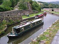
Tag:usage=transportation
Jump to navigation
Jump to search
| Description |
|---|
| Specifies that a canal is used for transportation by ships, boats or canoes |
| Group: waterways |
| Used on these elements |
| Useful combination |
| Status: in use |
| Tools for this tag |
|
The tag usage=transportation is added to a waterway=canal to specify that it is used to by boats or ships as a means of transportation.
How to map
Draw a way and add the tags waterway=canal + usage=transportation. Consider adding the width=* in meters
Also consider adding tags which specify legal access for boats and ships such as:
