Featured images/Jan-Mar 2013
Jump to navigation
Jump to search


These are featured images, which have been identified as the best examples of OpenStreetMap mapping, or as useful illustrations of the OpenStreetMap project.
If you know another image of similar quality, you can nominate it on Featured image proposals.
| ← from January to March 2012 | ← from October to December 2012 | from April to June 2013 → | from January to March 2014 → |
Gallery of featured images, from January to March 2013
2013, week 1
2013, week 2
2013, week 3
2013, week 4

2013, week 5

2013, week 6
2013, week 7

2013, week 8
2013, week 9
2013, week 10

2013, week 11
2013, week 12

2013, week 13
Details and captions
Week 1 (from Monday 31 December 2012 to Sunday 6 January 2013) [Edit]

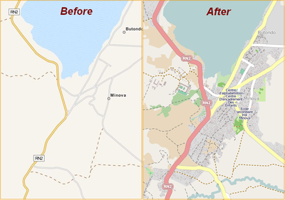
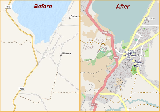
- English : Minova and Bweremana in DRC were mapped in a few days. This and other humanitarian mapping are being coordinated using the OSM Tasking Manager.
Week 2 (from Monday 7 January 2013 to Sunday 13 January 2013) [Edit]

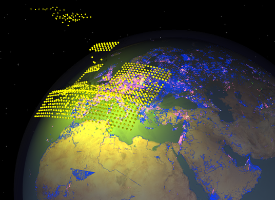
- English : Frame from the video "Year of edits 2012". This year's video features yellow and green effects for the redaction bot processing, and license changeover.
Week 3 (from Monday 14 January 2013 to Sunday 20 January 2013) [Edit]

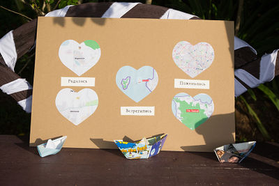
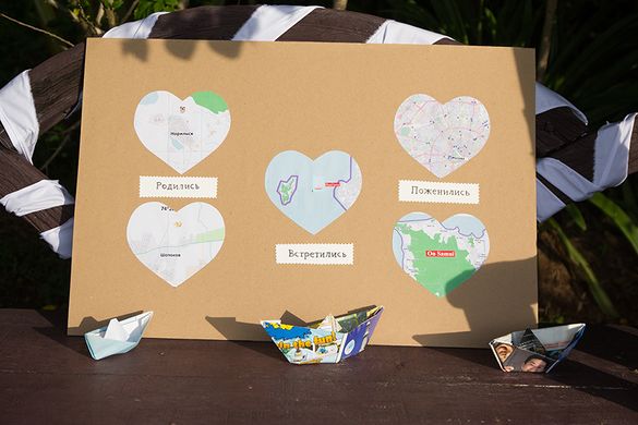
- English : OpenStreetMap wedding decorations! At the wedding of User:Vlish he featured this poster showing where he and his wife were born, where they met, and where they married.
Week 4 (from Monday 21 January 2013 to Sunday 27 January 2013) [Edit]

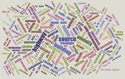
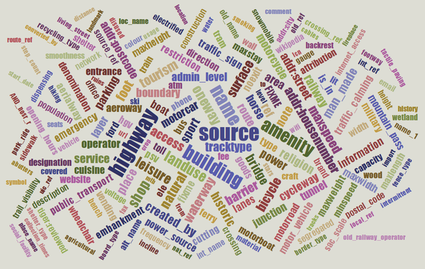
- English : Taginfo shows what tags are used in the OSM database.
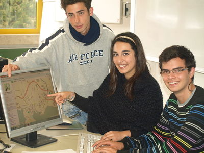
Week 5 (from Monday 28 January 2013 to Sunday 3 February 2013) [Edit]

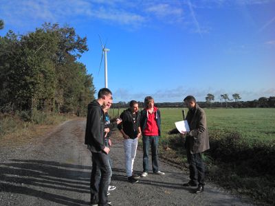
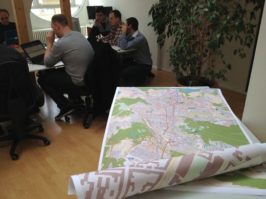
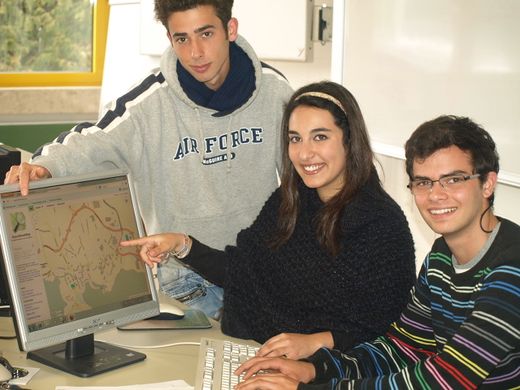
- English : French mapping company GéoBretagne use OpenStreetMap and are working with high schools to contribute data to the project. Here we see teachers and students mapping the exact coordinates of Lauzach wind turbines and their access roads.
Week 6 (from Monday 4 February 2013 to Sunday 10 February 2013) [Edit]

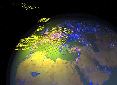
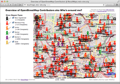
- English : The Overview of OpenStreetMap Contributors map by Pascal Neis is a great new way to discover active contributors in an area.
Week 7 (from Monday 11 February 2013 to Sunday 17 February 2013) [Edit]

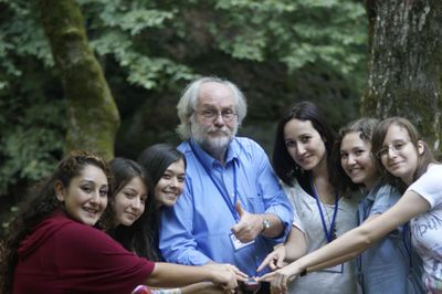
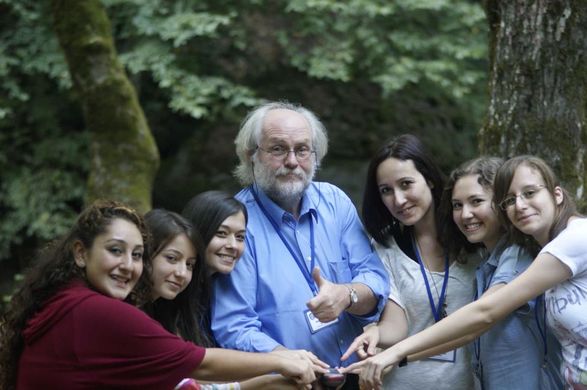
- English : Life Long Learning Mapping Project : Şeyma, Kader, Neslihan,(teachers: Manfred, Miray) Simge, Özge, Our project aims to tackle the issue of gender-stereotyping. Students from Karacabey, Turkey, learning how to use a tracking device (Garmin) to improve OSM in Turkey.
Week 8 (from Monday 18 February 2013 to Sunday 24 February 2013) [Edit]

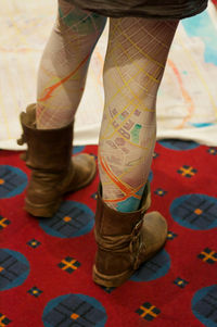
- English : OpenStreetMap leggings. A prototype on show at State Of The Map U.S. 2012 of a new product from softcities.net
Week 9 (from Monday 25 February 2013 to Sunday 3 March 2013) [Edit]

- English : A stack of prints at the Karlsruhe Hack Weekend in February 2013, where 18 mappers from all over Europe spent two days at the Geofabrik office, working together on OpenStreetMap projects.
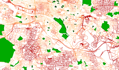
Week 10 (from Monday 4 March 2013 to Sunday 10 March 2013) [Edit]

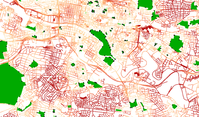
- English : Map showing distance from parks in Glasgow, using openstreetmap data and GRASS/QGIS network analysis. Dark red means further away from a park.
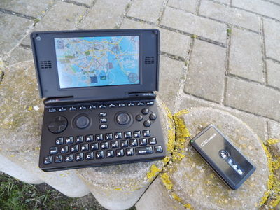
Week 11 (from Monday 11 March 2013 to Sunday 17 March 2013) [Edit]

- English : OpenStreetMap with Navit running on the OpenPandora gaming handheld. Open everything!
Week 12 (from Monday 18 March 2013 to Sunday 24 March 2013) [Edit]

- English : Students from Azores Islands, Portugal, visiting Germany on a training course in JOSM and QA Editor as part of the Life Long Learning Mapping Project
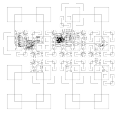
Week 13 (from Monday 25 March 2013 to Sunday 31 March 2013) [Edit]

- English : This curious map of the world, shows the result of dividing the OpenStreetMap dataset into quarters until each of these vector tiles is less than 32MB in size. An experiment by Eric Fischer (details)