RU:Key:kerb
Вы можете закончить перевод.
Если вы знаете английский, то можете помочь нам, переведя часть оригинальной статьи. Общие сведения о переводе статей на русский язык можно найти здесь.
| Описание |
|---|
| Used to indicate height and thus accessibility of a kerb. |
| Группа: дороги |
| Используется на элементах |
| Полезные сочетания |
| Статус: де-факто |
| Инструменты |
|
Бордюр (американский curb) — это край, где дорога соединяется с тротуаром. Поскольку это точки перехода между различными поверхностями и/или возвышениями, расположение бордюров имеет важное значение для пешеходов, велосипедистов и особенно для людей с ограниченной подвижностью (например, в инвалидных колясках).
Ключ — kerb=*, и он используется в узле highway=footway, highway=cycleway или highway=path в месте расположения бордюра (на краю улицы).
Примечание. По соглашению OSM для большинства тегов использует термины британского английского языка, а не североамериканского английского. Поэтому kerb, а не curb.
Теггирование
Отметьте точку ![]() на highway=footway, highway=cycleway или highway=path в том месте, где он пересекает бордюр, используя kerb=* и одно из значений ниже.
на highway=footway, highway=cycleway или highway=path в том месте, где он пересекает бордюр, используя kerb=* и одно из значений ниже.
Если бордюр одинаков с обеих сторон перекрестка и расположение реальных бордюров неясно (например, из-за отсутствия изображений с высоким разрешением), вместо этого к узлу highway=crossing иногда добавляется kerb=*. Это жертвует точностью ради простоты.
Возможные значения kerb=* показаны в таблице ниже. Указанные здесь высоты являются лишь ориентировочными; выбор того или иного значения должен зависеть исключительно от функциональных соображений. Другими словами, при выборе значения лучше учитывать доступность инвалидных колясок, чем конкретную высоту бордюра.
Эти документированные значения подразумевают wheelchair=yes или wheelchair=no; это означает, что вы можете пренебречь wheelchair=*, если только его значение не отличается от подразумеваемого значения ниже.
| Значение | Стандартная высота | Подразумевает | Стандартное использование | Описание | Пример |
|---|---|---|---|---|---|
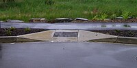
flush |
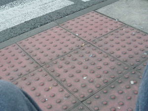
~0 cm | wheelchair=yes | Crossings & driveways | Similarly to lowered, except the level transition is unlikely to be apparent, to blind users, by tactile sensation.
It is important to map tactile paving at these locations. |
|
lowered |
~3 cm | wheelchair=yes | Crossings & driveways | Lowered kerbs are often found at crossing and driveways. They help ensure the crossing can be used by wheelchair users and allow access to drives.
Some names for objects that fall into this category include driveway apron, curb cut (U.S.), curb ramp, dropped kerb (UK), pram ramp, and kerb ramp (Australia). Use this as a replacement for sloped_curb=yes or both. |
|
no |
— | wheelchair=yes | No kerb is present. This can be useful to make it clear there is no kerb present — because there used to be a kerb, or a kerb would otherwise be expected (e.g., because it looks like one might be present judging from aerial photography). | ||
raised |
>3 cm | wheelchair=no† | Bus stops & older kerbs | High kerb. Height results in noticeable trouble for wheelchair and bicycles trying to pass it. In many places it falls foul of modern norms for crossings. Typical at bus stops to provide at-level access on and off buses.
At least in the US, this is also the most common kerb at footway crossings before recent accessibility regulations came into existence. Note that the primary feature of Kassel kerbs, used at bus stops, is contouring to alleviate tyre rubbing when buses stop (not having a raised level), which is not specifically mapped. †: When used on pedestrian paths it implies wheelchair=no (and may be used to increase the cost of travelling over this kerb by bicycle). This value can also be added to the highway=bus_stop node or platform node/way — in that case it would not imply wheelchair=no. |
|
rolled |
— | wheelchair=no | Residential streets | Rolled kerbs still provide a gutter for water while being traversable by large wheeled vehicles, such as cars and bicycles, but not wheelchairs. They are generally used in lightly trafficked areas, such as planned residential areas, being insufficient for commercial or industrial roads.
Do not confuse with kerb=lowered, which are traversable by wheelchairs. |
|
yes |
any | wheelchair=no‡ | Some sort of kerb is present, but it can't or hasn't yet been determined whether it is raised, lowered, flush, etc. This may be useful when mapping via aerial imagery (prior to field survey) or if the exact type of kerb can't be recalled.
‡: Cautious routers could consider this to mean wheelchair=no, so whenever possible this value should not be used other than on a temporary basis. |
Kerb height
If the exact height of the kerb is known this can be marked using kerb:height=*. Measurements of height and width are specified in metres by default (i.e., when the unit is omitted); state the unit used in the tag if you want to use centimetres or inches instead.
Some examples:
- 0.12 – a 12 cm high kerb, noted in metres.
- 4 cm – a 4 cm high kerb.
- 6" – a 6 inch high kerb.
Examples
| Type | Tagging |
|---|---|
| This shows a raised kerb at the tram stop, a lowered next to it at the crossing, and a regular one closest to the viewer. | |
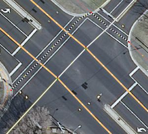
| Red nodes are tagged with kerb=lowered, crossing ways are marked with highway=footway and footway=crossing, crossing nodes are tagged with highway=crossing and crossing=traffic_signals. | |
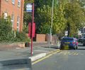
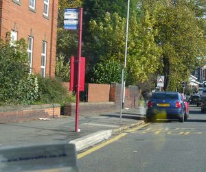
| Add to either the bus stop or the platform kerb=raised. It is assumed the kerb tag refers to the edge between the road and the platform. If you wish to explicitly map, tag the actual kerb as a way on the platform area. | |
| Use kerb=lowered on the nodes of the footway at the locations of the kerbs. Assuming both sides of the crossing are the same this could be added to the crossing node. | |
| Use kerb=flush and tactile_paving=yes on the nodes of the footway at the locations of the kerbs. Assuming both sides of the crossing are the same this could be added to the crossing node. |
Похожие теги
Узел kerb=* также можно пометить с помощью tactile_paving=*, чтобы помочь людям с нарушениями зрения, и это особенно важно для узлов kerb=flush.
Editing with JOSM
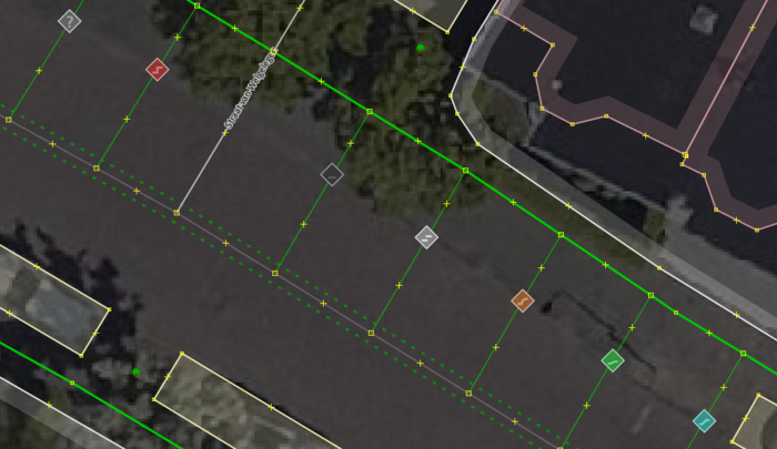
In JOSM the Map Paint Style Sidewalks and footways (with knobs on) can be used to visualize kerb=* when used on nodes ![]() :
:
See also
- Barrier
- Wheelchair
- Tactile paving
- Proposed features/Traffic island
- Proposed features/sloped curb
- Proposed features/right left
- Relations/Proposed/Area
External links
- Wikipedia articles on kerb, and curb cut
- FHWA: Designing Sidewalks and Trails for Access, Chapter 7. Curb Ramps - From the US Federal Highways Administration, more than you could ever want to know about curb ramps. Other chapters from this guide might also be useful.
