|
Upload GPS trace (also called "GPS tracks") is used to support editing OSM and means to upload your own GPS traces (collected by using your GPS device) to the OSM server. Uploading GPS tracks is a different process than editing the map (see below for more info on the difference), and is also different from bulk imports.
Instead of uploading there is also another possibility to use your GPS tracks only for your own editing: All of our main editor programs support displaying GPX files from your local storage without uploading them.
How to upload a GPS trace
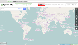 The GPS traces link, highlighted. It may be hidden behind a "More ▼" or a "☰" drop-down menu button if you use a small window width. |
- (optional) Convert your GPS trace to the GPX file format if your GPS device does not supply this format natively.
- Only GPS traces in the GPX file format can be uploaded to OpenStreetMap; multiple GPX files can also be submited if using a single zip (or tar/tar.gz) file.
- Files can easily be converted to this format using tools – see the convert GPS tracks.
- Select the "GPS traces" from the top main menu.
- Select "See your traces", or "upload a trace" directly
- If you are not already logged-in to the main OSM website, you will be asked to log in. If you don't have an account for the site, create an account first.
- (optional) Use the "Browse" button to select the GPX file on your local computer.
- (optional) Enter a Description and Tags of GPS trace. Help others understand how trace was recorded, there significant difference between car/hiking and bicycle traces.
- (optional) Select the privacy option visibility of GPS traces.
- If you do not want your GPS trace to be seen by anybody else, stop here and do not upload. (If you have already uploaded it, then in "See your traces" you can still edit/delete it.)
- Click Upload. The file will be uploaded to the OSM server, where it will join the queue of files ("PENDING" next to it) to be inserted into the database.
|
Troubleshooting
I have uploaded a GPS trace but nothing has happened on the map
When you upload a GPX file the points are extracted and inserted into the database. We do not however automatically create streets, paths or other map features based on your uploaded files. To add map features you (or somebody else) can use an editor to draw them using the GPS traces as a guide by viewing them as a background layer. (For more information see: Q:Why aren't my GPS traces shown on the maps? or Q:How are uploaded traces (GPX files) from my GPS device used in the OpenStreetMap editing process?)
How can I view my uploaded traces?
Once your GPX file has been uploaded to the database, you will be able to:
- See your trace listed on the GPS traces tab of the website
- Edit the map using your trace as a background (press edit beside any trace)
- Please see the documentation of the OSM editor which you are using for how to use GPS traces. Just some hints:
- See your trace among all the others, while editing an area
- In iD it will soon be integrated into the gps layer which can be enabled in Overlay settings.
- In Potlatch 2 toggle 'GPS' (use the button, or press 'g')
- In JOSM on the download dialogue window, select Raw GPS data under Data sources and Types.
- Use the API to fetch your trace among others within given bounding box
Note: Your have to upload your gpx trace as a public trace to be able to see it directly in the iD editor. Otherwise, You have to download it and check "Local GPX file" checkbox in Map Data section.
What are GPX file tags?
- Note: Tagging traces is completely separate from tagging OSM data itself. Yes, we use confusing names in openstreetmap.org!
When uploading GPX files, tags provide a simple way to describe your GPS traces. They make your GPX file findable with a single word and allow you to group the trace alongside other similar traces. For example, all the traces tagged 'Melbourne' are listed at www.openstreetmap.org/traces/tag/Melbourne. Please note that tags are case-sensitive - so Melbourne and melbourne may supply different results.
Each file can have many tags, and you can enter as many as you like with commas (",") between them. Usually the tags are the names of countries, cities and other places your trace concerns.
My uploaded trace has "PENDING" next to it. Why?
The trace is waiting for processing and insertion into the gps trace database. This usually takes less than 15 Minutes. At busy times (especially weekends), there can indeed be a wait before your trace is added to the database. You don't need to wait for this to start mapping, however:
- If you're using iD just drag'n'drop the gpx file onto the editor area.
- If you're using Potlatch, find the 'edit' link to the right of your track (in the GPS traces listing), and click this - not the usual Edit tab at the top.
- If you're using JOSM or another offline editor, just load the track from your hard drive.
Why do I get bad signal / traces in city centres / near big metal buildings?
For a GPS to work and achieve some accuracy it needs to receive at least four satellite signals. Often when in city centres there are many tall buildings that can block these signals and stop the GPS from being able to work out where it is. There may also be multi-path effects from the material making up the buildings around you, whereby signals bounce off them so the receiver actually thinks it is somewhere in the buildings around. Another factor that can affect this is the number and position of satellites that can be seen at the time of logging; trying the route on another day or a different time of day may give better results.
See also: Accuracy of GPS data.
Applications supporting direct upload of GPS traces
Software developers may be interested in the documentation for the GPX upload API.
The following applications support direct upload to OpenStreetMap:
- Android
- GPS Logger for Android is an Android application.
- OSMtracker (Android) will acquire, log and upload GPS data as GPX tracks.
- OruxMaps is an Android application.
- Locus Map is a Android mobile application.
- OsmAnd is the all-in-one app, with tracking and direct upload. Open Source app
- SuperCycle - Bike Computer Record and map bicycle rides, direct upload of GPS trace.
- OSMGpxUploader (outdated?) Upload GPX tracks directly or from other android Apps such as Google My tracks or OI File Manager, AndExplorer, etc
- Vespucci, the Android OSM editor, has a built-in track recording and uploading feature.
- StreetComplete allows you to record and upload tracks, and include a note and photos.
- Israel Hiking Map allows you to record and upload tracks, and include points of interests with name, description and a photo.
- iOS
- Go_Map!! is a fully featured iOS and macOS app.
- SuperCycle - Bike Computer Record and map bicycle rides, direct upload of GPS trace.
- Israel Hiking Map allows you to record and upload tracks, and include points of interests with name, description and a photo.
- Desktop
- JOSM is the java-editor for Openstreetmap. For uploading the GPS traces the DirectUpload plugin is needed. You may need to try switching from Basic Authentication to OAuth (on linux, at least) to get this to work.
- Viking is a desktop-based GPS data editor and analyzer.
| GPS related articles |
|---|
| | Main | GPS with good internal links, GNSS. Another formats: NMEA, FIT (Garmin), | | | GPX tracks: create | List of GPS trace file formats, GPX, Why not GPX?, GPX viewer and recorder (Windows™ only), OpenGpxTracker (iOS™ only), Gps Event Sync, GPX extractor, OsmAnd, MAPS.ME, GpsMid (J2ME), Gpsd | | | GPX tracks: convert | | | | GPX tracks: upload | | | | Visualise | | | | Hardware (receivers) | | | | Accuracy | | | | Other | |
|
|
