Utah
| V・T・E |
| latitude: 39.25, longitude: -111.75 |
| Browse map of Utah 39°15′00.00″ N, 111°45′00.00″ W |
| Edit map |
|
External links:
|
| Use this template for your locality |
Utah is a state in the United States at latitude 39°15′00.00″ North, longitude 111°45′00.00″ West.
| Local user group | |
| OpenStreetMap Utah | |
| Meetings | |
| When: | Monthly |
|---|---|
| Where: | Woodbine Food Hall (map) |
| Mailing list | |
| no mailing list | |
| Website | |
| [1] | |
| Image | |

| |
Community
We're fortunate to have a very active community in Utah! Our social events are currently in the Salt Lake City, Utah area. We aim to meet once a month with a mix of social events and outdoor mapping activities. Join the OpenStreetMap-Utah meetup group where we announce events.
- Follow on Mastodon:
 @utah@en.osm.town
- There's a #local-utah channel on the OSM US Slack.
- Add your name top the Utah/Active Mappers in Utah list!
Events
- Next event: To be determined
- Utah/Past Events
- A reusable addressing activity, part of:
State of the Map U.S. 2024
State of the Map U.S. 2024 will be held in Salt Lake City on June 6-8! Check out the OpenStreetMap US website for updates.
Projects
These are some mapping projects that could use your help. If you have a project of your own that you would like help with or that you think is worth mentioning here, please add it.
There is also an OpenStreetMap Utah project on MapRoulette where Utah-specific mapping tasks are published: https://maproulette.org/browse/projects/39484. If you have questions about this project or have an idea for a challenge to include, contact ![]() mvexel (on osm, edits, contrib, heatmap, chngset com.)
mvexel (on osm, edits, contrib, heatmap, chngset com.)
| Project Name | Description | Point of Contact |
|---|---|---|
| OSM US Trails Initiative | Initial focus of this initiative is Utah! See Organised Editing/Activities/Trails Stewardship Initiative/Resources/Utah for a list of handy resources while mapping. | |
| UTA stops | Mapping UTA stops/platforms and amenities around them. Important now are entering public_transport=stop_position (as a node on the rail) and public_transport=platforms on TRAX Red and Blue light_rail lines. The relations are emerging as fully v2 (not there yet, call them "partial"), but without all well-tagged stops and platforms, these relations remain "lines under construction." Map your train ride! | |
| UTA route relations | UTA route relations, see Utah/Transit for bus routes and Utah/Railroads for passenger train route links/data (with "status colors" in tables). | |
| Cycle Networks | United_States/Bicycle_Networks is an international/national/state-regional/local overview of bicycle routing "around here" (North America). It is often simpler to tag "infrastructure first" (tags like cycleway=lane or bicycle=yes on ways) and then complete route=bicycle relations with those elements as members of the route. Entering proposed routes can be sensitive; strive to meet a "high bar standard" of actual or nearly-actual route if you enter proposed routes. (Serious proposals, well-mapped, known funding...these are all a good start). Routes under construction, too: know they are funded, construction is scheduled and/or underway, signage plans, etc. before tagging these. Construction really means "construction." | |
| Utah/UtahBuildingsImport | Utah/UtahBuildingsImport is a project to import Utah building and address data. Currently it is only active in Salt Lake City, but help in other areas is welcome. | |
| Cache Valley Addresses Import | Importing addresses to Cache Valley (Logan area) - Slow-moving but still active. | |
| GNIS hamlets | There are a lot of 'hamlets' that need clean up: Salt Lake County / Utah County / Davis County. | |
| OSM for the Blind | There is a blind OSM user in Salt Lake City, 84101, who would appreciate if anybody could add some information of special interest, see OSM for the blind for details. |
Organized Edits and Automated Cleanup
Past projects
| Project Name | Description | Point of Contact |
|---|---|---|
| TIGER import clean up | Clean up unimproved rural roads from TIGER import. There is a MapRoulette project that breaks down the issues per county: https://maproulette.org/admin/project/39560 | |
| Building Footprints | Building footprint data was imported from AGRC data in 2018/9. See Utah/UtahBuildingsImport | |
| Clean up street names | See: User:Kevina/Salt Lake Grid Cleanup Script. 2010 | |
| GNIS hamlet deletion | mass-deletion of a bunch of GNIS "hamlets" in the Salt Lake area in the mid-2010s. Many remain. | |
| UTA bus stops | added bus stops for the entire UTA service area manually. Technically not an import or automated edit, since each stop was manually reviewed, compared with existing data, and aligned with latest imagery. Others have since started an effort to add these stops to the bus route relations. |
Mapping Conventions Specific To Utah
Road naming and classification
Utah has numbered and named streets. The way street names and addresses are signposted and written requires some local conventions: Utah/Naming Conventions. These have been discussed with local community members and are applicable to Salt Lake as they are elsewhere in Utah
Individual users have spent significant time and effort discussing and agreeing on the major roads classification. Of course you are free to change road classifications, but please look at any relevant changeset comments. We are always open to new opinions. Past efforts include User:Kevina/Salt Lake City Highway Classification.
Data Sources
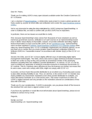
The state has made a wide range of GIS data available through its UGRC Data Portal. The license for most of the datasets is Creative Commons Attribution 4.0 International (CC BY 4.0), but the UGRC office has signed a waiver so we can use those datasets to improve OSM.
Aerial Imagery
High resolution aerial imagery sources are available from AGRC, but most of them require a license agreement. It is unlikely any of these layers can legally be used to improve OSM.
Access Map
https://publiclands.utah.gov/accessmap360/
From the website: "Utah’s Access Map 360° web application highlights roads that provide access to Utah’s public lands (primarily those managed by the BLM). The Access Map brings together a single operational dashboard combining maps, geographic information systems (GIS), and 360° geo-immersive panoramic video to facilitate the exploration and discovery of Utah’s public lands. Use this tool to explore your public lands, plan routes for your next adventure, and safely discover new places."
The data is published by the State of Utah’s Public Lands Policy Coordinating Office and is in the public domain.
