EuYoutH OSM/Portmarnock
European YoutHumanitarian OpenStreetMap - euYoutH OSM
Our school
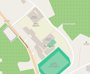
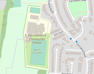
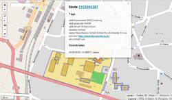
Portmarnock Community School is a public secondary school situated in Portmarnock, in the Fingal area of Dublin, to the northern side of the City of Dublin. The school has 940 students. It was built by The Department of Education and Science in 1979; the area was fast growing and had a number of feeder primary schools.
The school is located in an area with a high demand for housing and is therefore experiencing a population growth, which means that the physical buildings of the school are being expanded. The population of the local area is complex, with a wave of aging and older people, migrants, and a new wave of commencing families. The school caters for pupils in surrounding urban areas who are attracted to the community ethos, and track record of academic, sporting/cultural and philanthropic achievement.
The school hosts an area specific Non-Governmental Organisation - Action Ireland Trust. The Trust has the objective of bringing Portmarnock’s Philanthropic and Social Capital to bear on a twinned school community in Maseru, Lesotho, Africa. The modus operandi of the trust and the school is to seek partnerships with a variety of persons and organisations in the area who can participate in a development effort in Lesotho.
More here on the school's website
Our school in OSM
- See below ... browse map
-
 Spain browse map
 -
 Romania browse map
 -
 Ireland browse map
 -
 Portugal browse map
 -
 Germany browse map


Activities
Twitter, Facebook

- teach #OpenStreetMap and #Mapilliary to #euYoutH_OSM students
- Action Ireland Trust launches, "The Strategic Spatial Plan for Lesotho".
Project Stations - Mobilities
Deutschland: Kick-off in Saarburg
 As international educators were impressed by the two maps of the earthquake area in Haiti 2010, which Severin Menard showed in a live presentation from Paris. The two maps show what OpenStreetMap activists can achieve in just 28 days. |
The regional newspaper "Trierischer Volksfreund" reports on the meeting with the headline A map that can save lives |
Ireland, Portmarnock
Time table
Portmarnock from 25.03. to 29.03.2019

Activities
Report about mapping in Lesotho
| Description
After visiting the school and having lunch together, the pupils of the Portmarnock Community School (https://www.portmarnockcommunityschool.ie/) report on their mapping activities in Lesotho/South Africa. |
|


pLesotho.
The Editor JOSM
| Description
After the outdoor activity around Malahide Castle and the associated gardens, the collected data is processed with JOSM. |
| Internet |
| Students evaluate data on the computer
|


First Mapathon
| Description
Students map with data from Lesotho. The collected data were provided by the school in Portmarnock. |
| Pictures
|

„Mapping“ with MapSwipe
| Description
Students identify buildings in Ethiopia and Chad with the smartphone app 'MapSwipe. In Ethiopia, the aim is to find buildings endangered by flooding as a result of climate change (preliminary stage to mapping in JOSM, well suited for beginners). In Chad, the buildings and residential areas are to be identified in order to show the international aid organisations where vaccinations must be carried out before epidemics can break out. Translated with www.DeepL.com/Translator |
| Internet
Internet: https://mapswipe.org/ App for Android: https://play.google.com/store/apps/details?id=org.missingmaps.mapswipe&hl=de App for iOS: https://itunes.apple.com/us/app/mapswipe/id1133855392 |
|
Pupils identifying buildings with the help of MapSwipe
|


The Tasking Manager - the tool for distributed mapping
| Description
Tasking managers are in place to provide the best possible support to international aid organisations both preventively and in acute crisis situations. There, the crisis areas to be mapped are sorted according to urgency. After selecting a crisis area, more detailed information is displayed together with a very specific task. | ||||||||
Internet
There are a large number ofTasking-Managers https://wiki.openstreetmap.org/wiki/Tasking_Manager#Operational_installations_of_the_Tasking_Manager Learn OSM is a good address for beginners https://learnosm.org/en/ video instructions can be found on https://osm.earth/learn | ||||||||
More on Twitter
Portugal: Angra do HeroísmoTimetableAngra do Heroísmo from 24.06. to 30.06.2019
Welcome by the Portuguese hostsFor better orientation, the Portuguese welcomed us with an information brochure about Terceira Island, the school, and identity cards for all participants.
ActivitiesAzores Regional Civil Protection and Fire Services Agency (SRPCBA)“
From the presentation and discussions between the pupils and representatives of the SRPCBA, it emerged that information about fire hydrants, assembly points and schools in disaster situations is important. From this, the SuS derived the task of checking the fire hydrants in OpenstreetMap and, if necessary, supplementing and documenting the data. Measures from visit of SRPCBAUsing Overpass turbo (http://overpass-turbo.eu), a web-based data collection tool for OpenStreetMap, the pupils have carried out a query for Angra do Heroísmo using fire hydrants as an example.
The result reveals that only three fire hydrants (yellow circles in map) in Angra do Heroísmo are included in the map of OpenStreetMap. With the help of field papers. (http://fieldpapers.org/) Angra do Heroísmo was divided into a total of 12 areas.
In each area, internationally staffed teams of students and teachers used the OSMTracker app (https://wiki.openstreetmap.org/wiki/DE:OSMTracker_(Android)) to collect the locations of the fire hydrants.
Tagging in OSM
After all data has been entered, the new OSM map looks as follows:
Geological information about the Azores/Terceira
Drone-Mapping
The georeferenced images taken with the drone cannot easily be used for mapping in JOSM. The images still have to be rectified with special software. Further information can be found here: https://wiki.openstreetmap.org/wiki/DE:Projekt_Drohnen-Mapping_in_Landshut
OpenStreetCamWith OpenStreetCam, georeferenced images can be collected in chronological order at street level. To capture the images you can use an app for Android/iOS or a camera that is able to capture georeferenced images. With the collected images the maps of OpenStreetMap can be improved or spaces before and after a natural event can be compared and documented.
Internet: OpenStreetCam: https://openstreetcam.org/map/@38.721679775156424,-27.17674255371094,12z Google Play: https://play.google.com/store/apps/details?id=com.telenav.streetview&hl=en_US App Store: https://apps.apple.com/de/app/openstreetcam/id1089548849 Deutschland: SOTM in HeidelbergRumänien: Râmnicu VâlceaSpanien: A Guarda |


![more information Twitter https://twitter.com/euYoutH_OSM]](/wiki/File:Twitter_euYoutH_OSM.png)


