Fa:Applications of OpenStreetMap
این صفحه مرور کلی بر چگونگی استفاده از OpenStreetMap تاکنون تمرکز دارد. اگر در جستجوی دستورالعملهای OpenStreetMap توسط خودتان هستید لطفاً استفاده از OpenStreetMap را ببینید.

The core of OpenStreetMap is a collection of map data which can be used for many different purposes. You can get a first idea browsing the world map on the main page of OpenStreetMap. While browsing, try the Layers button on the right to view different map formats. It illustrates how OpenStreetMaps's data can be used in diverse manners.
Because everybody can use OpenStreetMap's data with very few restrictions, many different third party services are built on OpenStreetMap's data. Much of the value of OpenStreetMap lies in this variety of services. Each one serves you different information, and each one does so in a different way. There is much more information available through these services which you can't see on the OpenStreetMap world map.
Further, though we only talked about 'map data', OpenStreetMap is used for other purposes than maps, too.
نقشه


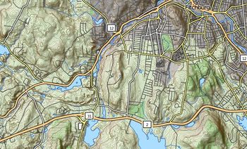
Many people get to know OpenStreetMap through its world map. People can easily integrate this map on their website, with the possibility to add their own features. Wikipedia does so, and many other people too. Further, OpenStreetMap provides the raw map data to create customized maps from the scratch. Numerous third party online maps are based on OpenStreetMap data. You can also use maps without internet connection on desktop computers or mobile devices such as smartphones or even the Play Station Portable. There are tools and online services helping to create high resolution paper maps.
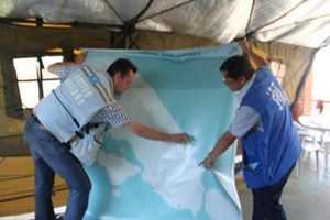
Maps can be used in very different ways. With OpenStreetMap, people get artistic or help on humanitarian activity. Within the OpenStreetMap Community, people focus on mapping a variety of particular topics, from accessibility to Special Populations. Third party services provide maps specialised on accessibility (wheelchair, blind, ...), on sports (hiking, biking, canoeing, skiing, ...), on History and many more. List of OSM based Services tries to give a comprehensive collection.
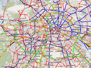
Many projects continuously improve their maps. Since they are all limited by the available information in the OpenStreetMap data collection, contributing map data is a good way to support them. ÖPNVkarte, a free public transport map, is a good example. The picture on the right shows the well mapped public transport system of Berlin. You can visit the project's page to discover regions of the world with less public transport information available in the OpenStreetMap data collection.
نقشههای 3D
- مقالهٔ اصلی: 3D
The third dimension is a growing topic at OSM. It's already possible to add detailed buildings and a lot of minor objects, which results in a 'feeling like home'.
مسیریابی
- مقالهٔ اصلی: Routing

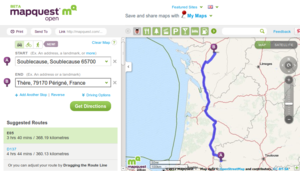
Many different routing services (see also this list of routing services) are built on OpenStreetMap data, not only for cars. Based on OpenStreetMap, you can find your way in wheelchair, on bike or horse, during your next hike, using public transport, ...
The Look and Listen Map provides an online map and routing service for blind, visually impaired and sighted persons. While still in a development status, the project already won some prizes.
نرمافزارهای GIS
- مقالهٔ اصلی: نرمافزار GIS
نرمافزارهای GIS زیادی اختصاصی، با کد بسته و کاملاً گران هستند. اغلب آنها با دادهها در قالب اختصاصی خودشان عمل میکنند. برعکس، دادههای OpenStreetMap آزاد هستند. برای رسیدن به این همکاری متقابل، ابزارهای تبدیل داده از/به داده OpenStreetMap زیادی شامل پشتیبانی از قالبهای رایج ESRI Shapefiles و قالب PostGIS وجود دارد، We try to document any special interoperability with OpenStreetMap for each GIS software. Try a search with the form on the top right of this page for your particular GIS software, or browse our GIS software category (use Category:Software as long as the previous doesn't exist). There is also open source GIS software working together with OpenStreetMap.
آموزش

- مقالهٔ اصلی: آموزش
OpenStreetMap در آموزش در مدارس، دانشگاهها و کالجها و در طیف وسیعی از رشتهها استفاده میشود. برخی پروژهها درگیر دادههای حال حاضر OpenStreetMap هستند در حالی برخی دیگر منتج به دادههای اضافه دیگری در مجموعه داده OpenStreetMap میشوند. پروژه OpenStreetMap در آموزش جغرافیا، ریاضی اکولوژی، برنامهریزیهای اجتماعی و تکنولوژی کاربرد دارد.
تحقیقات
- مقالهٔ اصلی: Research
از دادههای OpenStreetMap در سراسر دنیا جهت امور تحقیقاتی استفاده میشود.