File:2015 Nepal Earthquake USGS map.png
Jump to navigation
Jump to search

No higher resolution available.
2015_Nepal_Earthquake_USGS_map.png (683 × 405 pixels, file size: 616 KB, MIME type: image/png)
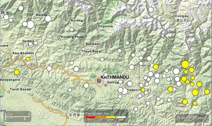
2015 Nepal earthquake. A map of earthquake epicentre and aftershock locations from USGS
This is actually on an OpenStreetMap (MapQuest Open) base map (The site is seemingly lacking the required credit)
MapQuest style license: MIT License (see also {{MIT}})
| Contains map data © OpenStreetMap contributors, made available under the terms of the Open Database License (ODbL).
The ODbL does not require any particular license for maps produced from ODbL data, produced maps may be subject also to other licences. |
File history
Click on a date/time to view the file as it appeared at that time.
| Date/Time | Thumbnail | Dimensions | User | Comment | |
|---|---|---|---|---|---|
| current | 14:04, 17 May 2015 | | 683 × 405 (616 KB) | PierZen (talk | contribs) | Updating to show more recent aftershocks over the last week. |
| 10:31, 12 May 2015 | 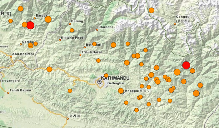 | 701 × 410 (580 KB) | Harry Wood (talk | contribs) | updating to reflect todays quake, plus some more recent aftershocks. Screenshot of [http://earthquake.usgs.gov/earthquakes/map/#%7B%22feed%22%3A%2230day_m45%22%2C%22search%22%3Anull%2C%22listFormat%22%3A%22default%22%2C%22sort%22%3A%22newest%22%2C%22ba... | |
| 12:25, 25 April 2015 | 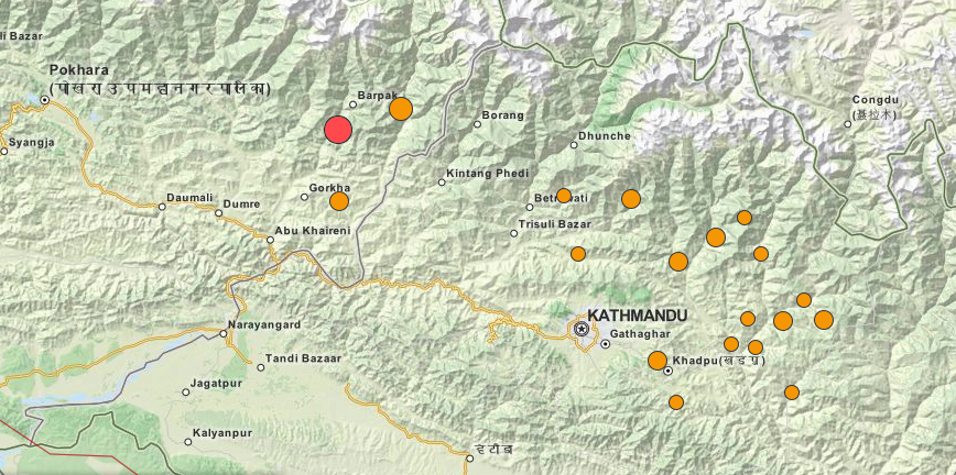 | 868 × 432 (757 KB) | Harry Wood (talk | contribs) | A [http://earthquake.usgs.gov/earthquakes/map/#%7B%22feed%22%3A%221day_m25%22%2C%22search%22%3Anull%2C%22listFormat%22%3A%22default%22%2C%22sort%22%3A%22newest%22%2C%22basemap%22%3A%22street%22%2C%22autoUpdate%22%3Atrue%2C%22restrictListToMap%22%3Atrue... |
You cannot overwrite this file.
File usage
The following 11 pages use this file: