Zh-hant:2015 Nepal earthquake
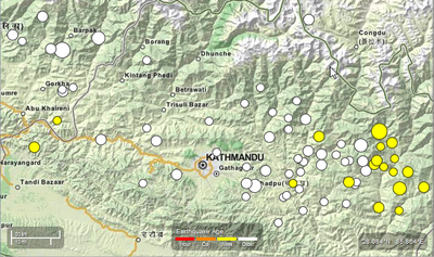
2015尼泊爾地震 (Wikipedia) 規模 7.8 級, 發生在當地時間四月二十五日星期六上午十一點五十六分, 震央位於尼泊爾 Lamjung 東南東方約 29 公里 (18 英哩) Kathmandu 西北方約 81 公里 (50 英哩) 處, 根據 USGS, 確切 震央位置 為 28.147°N 84.708°E.
災情
世界古蹟遺址網站上列的 Kathmandu Durbar Square 因為這個大地震已成為廢墟。

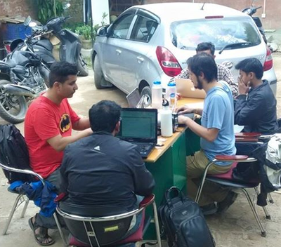
任何人都可以參閱並且下載自由開放街圖的網路地圖,規劃路徑, 並且可以在手機平台上使用。對尼泊爾大地震這樣的災難, 來自世界各地的志工可以貢獻心力快速地將衛星圖的資料數位化, 幫助被派到當地救災的人道團體。
我們的目的在參與人道救援, 透過迅速地提供詳細確切的地圖 (包含街道網絡, 鄉鎮, 建築物等等)來幫助人道團體。 這可以幫助人道救援團體有效率地搜尋到災民, 運送救援物資和救災服務到偏遠地區。
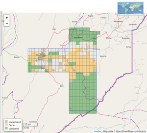
- 我們使用 OSM Tasking Manager 溝通協調志工的製圖過程。
- 志工貢獻的溝通協調
- 參閱「人道救援製圖組」(HOT) 電子郵件通訊錄上的討論
- Live #hot IRC Channel discussions with the Support Team (Use a nickname and type at the bottom of the screen to discuss with others.)
溝通協調
Pierre Béland from abroad (GMT-4)
Nama Raj Budhathoki and Kathmandu Living lab colleagues (GMT+5:45)
email contact: activation@hotosm.org
開放街圖的伺服器, 編輯器和編製地理資料的工具讓人道社群可以自由地的使用。開放街圖社群對人道救援的貢獻是有目共睹的, 開放街圖人道救援製圖組 (The Humanitarian OpenStreetMap Team)成了開放街圖社群和人道救援組織間的一道橋。我們和許多國際組織有合作關係, 我們負責提供並且改良地圖以便國際組織佈署在地的救援和應對災難和支援當地社群團體。

地圖與資料服務
關於「開放街圖」
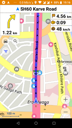
「開放街圖」 提供隨時可以更新的網路地圖和地理資料庫, 很多網路地圖都是從「開放街圖」發展出來的,包括 譬如像是 OSRM 這樣的導航工具。工具和服務可以讓地理資訊系統的專家摘取資料, Garmin GPS 路徑規劃的資料, 智慧型手機和其他可相容的設備所用的 GPS 導航資料的下載。因為有了開放式資訊, 只要連上了網路, 就可以定期同步更新社群所貢獻的資料。大量下載開放街圖資料也可以方便離線時使用。另外, 有必要的話, 也可以用來印製紙本地圖。
瀏覽 Activation Area 看看目前所有的資料。可以從螢幕右方點選不同的地圖形式, 包括獨特的人道街圖。雖然有一些資料還沒被繪製編成網路地圖, 還是可以從資料庫下載輸出做其他用途使用 (見以下有關「輸出」的那一段).
紙本地圖
大張海報尺寸的地圖和信紙尺寸的可客製的紙張地圖可以從以下網站印製:
- FieldPapers 有格子座標的紙本地圖, 實地勘查或是一般導航都很好用
- MapOSMatic 有格子座標、街道目錄和景點的大張的紙本地圖, 可以供指揮中心和醫院等機構使用
- Kathmandu Living Labs Quake Maps 重要都市地圖, 是可印製的 PDF 版本
輸出開放街圖的資料
常見更新
| OSM Format | ShapeFiles for GIS softwares | Offline Navigation on Small Devices | |
|---|---|---|---|
| Daily updates (osm contributor) | .pbf | Shapefile(Esri) 13 Thematic Layers |
.obf OSMAnd GPS Garmin IMG |
| 30 minutes updates by geofabrik see download directory |
.pbf | Shapefile(Esri) | |
| 30 minutes update Thematic layers (roads, IDP camps, land use, amenities, place names) GFDRR Innovation Lab from geofabrik |
.pbf | Shapefile(Esri) | |
| Updated every few days by kleineisel.de routable, contains height contour lines (from SRTM data), the map design is similar to topo maps. |
GPS Garmin IMG | ||
| Hourly updates (osm contributor) | OSMand obf | ||
| Updated every two hours Mail | Garmin, Android, Garmin-Basecamp, QLandkarte |
暫時的 標籤資訊 (Taginfo) 範例 ![]() 顯示尼泊爾的標籤統計資料, 每 30 分鐘會從 Geofabrik 的摘錄更新一次 (如果 dns 伺服器 不更新的話, 用 http://178.62.129.19/ )
顯示尼泊爾的標籤統計資料, 每 30 分鐘會從 Geofabrik 的摘錄更新一次 (如果 dns 伺服器 不更新的話, 用 http://178.62.129.19/ )
關於多種開放街圖資料輸出的資料形式
- OSM.pbf: 這是壓縮的開放街圖檔案, 多種地理資訊系統都通用。
- Shapefile: 這種資料可以輸入到像Quantum GIS 或是 ESRI ArcGIS for Desktop的地理資訊系統的軟體裡。
- OSMAnd.OBF: OSMAnd / Android and iPhone Offline map and navigation
Note: launched 2015-04-19, the first iPhone version does not yet integrate all the functionalities of the Android version.- » Android File manager: Move the obf file from the download to the OSMAnd directory
- 學習開放街圖 OSMAnd 設定裝置的教學, 和離線地圖導航
- 如何使用聲控導航
- Kathmandu Living Labs 地震圖 OSMAnd 圖資輸出
- GPS.IMG: Garmin GPS 形式
- » 重寫 IMG 影像檔的檔名為 gmapsupp.img, 然後把 gmapsupp.img 移到 Garmin GPS 卡的檔案目錄
- 其他行動裝置: 見其他 行動裝置產品.
開放街圖的救援響應
有關目前活動的持續更新請見 開放街圖人道救援製圖組電子郵件通訊錄
協調和討論可能在人道救援製圖組的 IRC Channel (direct link) 或是 Mumble 伺服器
一般尼泊爾遠端製圖指南(en)可能對了解尼泊爾的當地狀況有用
任務管理專案 (Task Manager projects)
以下的專案已經在OSM 任務管理專案 (Tasking Manager)上了 :

| Job No. | Location | What to map | Imagery expiration | Task Mapping Status | Task Validation Status |
|---|---|---|---|---|---|
| Job 1018 (priority) | Surrounding the greater areas outside Kathmandu | 2nd pass for detailed mapping | N/A | 進展中 | 進展中 |
| Job 190 (priority) | Kathmandu Valley, includes more imagery | buildings only | N/A | 進展中 | 進展中 |
| Job 1006 | North of Narayangadh and east of Pokhara | Residential areas and buildings | N/A | 進展中 | 進展中 |
| Job 1009 | Gorkha | Residential areas and buildings | N/A | 已完成 | 進展中 |
| Job 1008 | Kathmandu | IDP Camps | N/A | 已完成 | 進展中 |
| Job 1010 | Banepa | IDP Camps | N/A | 已完成 | 進展中 |
| Job 1014 | Sindhupalchowk | heavily affected area, detailed mapping needed | N/A | 進展中 | 進展中 |
| Job 1015 | Dhunche Rasuwa | heavily affected area, detailed mapping needed | N/A | 已完成 | 已完成 |
| Job 1016 | Langtang Rasuwa | heavily affected area, detailed mapping needed | N/A | 已完成 | 已完成 |
| Job 994 | North of Kathmandu and remote mountain areas | roads only | N/A | 進展中 | 已存檔 |
| Job 995 | East of Kathmandu and remote mountain areas | roads only | N/A | 進展中 | 已存檔 |
| Job 1001 | West of Kathmandu and remote mountain areas | roads only | N/A | 已完成 | 已存檔 |
| Job 1002 | North West of Kathmandu - Manaslu Conservation Area | roads, villages, buildings | N/A | 已完成 | 已存檔 |
| Job 1004 | South West of Kathmandu | roads | N/A | 進展中 | 已存檔 |
| Job 1003 | North of Dunche, includes more imagery | detailed map | N/A | 已完成 | 已完成 |
這些專案列都列在 http://tasks.hotosm.org/
任務和影像涵蓋的範圍的概況請見 uMap
所有任務的概要統計資料請見 尼泊爾製圖進度 Dashboard 板
製圖蓋論
除了貢獻小規模圖磚製圖之外, 我們也可以做大規模的改良, 譬如說審查或是改善整體地圖資料的一致性, 但是, 這也最有可能產生多方同時編繪地圖的衝突 (edit conflicts), 所以, 請記得要經常儲存, 或是了解像災難發生時這種忙碌時刻你可能會遇到編繪衝突 (edit conflicts).
任何在地知識像是基礎設施, 建築物, 道路名稱, 任何你可以辨識的東西都很有幫助。
繪製道路是目前最優先的任務, 見尼泊爾道路網頁 for proposed road conventions or guidelines for road categorization is a good reference.
開放街圖是一個可以編繪的地圖, 所以, 如果有任何錯誤或是不完盡之處, 我們都可以改善 (新手上路指南)。任何你所有的在地知識, 或是如果你可以實地訪查 (得知街道名稱等等), 對製圖特別有用。
如果你有在地知識, 但是不知道如何編繪開放街圖, 還是對我們的救援有助益。 你可以和開放街圖社群分享你的在地知識, 用"Notes"這個功能標示有關地點, 建築物, 或是道路資訊, 所以資深有經驗的繪圖者可以把你提供的情資放到開放街圖的資料庫中。基本的"如何和我們的製圖者分享你的在地知識"的簡介請見:
影像和供參考的地圖
Pleiades, Airbus Space & Defense
2014-04-27 Pleiades 2014-11-29 and 2015-04-27 have been used for post-disster IDP camps identification in Kathmandu.
Imagery Requests
Fresh and archive satellite imagery is being requested through international activations charter and imagery providers. HOT has identified areas that need high resolution imagery for both base mapping and damage assessment. Areas requested are highlighted in bright blue on this map:
http://umap.openstreetmap.fr/en/map/hot-imagery-coordination_37804#9/28.0623/85.2251
Bing
Bing imagery coverage as of 2015-04-25 with TM #994 and #995 overlay. (coverage source TMS: http://ant.dev.openstreetmap.org/bingimageanalyzer/tile.php/{z}/{x}/{y}.png)
DigitalGlobe
Indian Space Research Organization
Cartosat-2 post-earthquake for Kathmandu imagery as of 2015-04-27.
Mapbox
For some of TM #1001 the Bing imagery may be cloudy or unavailable, MapBox has coverage, but not at all zoom levels.
Public domain topo maps
There are two sets of public domain topographic maps available which cover large portions of Nepal. Both sets are 1:250,000 scale, which means they are only really useful for adding place names, of which the maps list thousands. Before we manually copy in place names from these maps we will manually merge in the GNS place names for the area, which will cut down on some of the work. After that is done, we will create task manager jobs to go through and systematically enter all of the place names on these topographic maps.
| Layer | JOSM TMS Url | View |
|---|---|---|
| US Army Map Service (AMS) | tms[15]:http://mapwarper.net/layers/tile/345/{zoom}/{x}/{y}.png | View online |
其他資料
- USGS shakemap data (click on 'download')
- Humanitarian Data Exchange - Nepal Earthquake
- NGA GEOnet Names Server (GNS)
- High resolution Nepal weather
- Near real-time MODIS imagery
- World Pop 100M gridded population for Nepal - currently being updated
- Gridded Population of the World
- UNOCHA Nepal data-sets
- Freizeitkarte Nepal Topographic maps for Garmin and Android (with periodic updates)
- www.kleineisel.de Topographic OSM map for Garmin devices with contours
- Nepal Topo Maps 1:25,000 This site contains a bunch of topographic maps. They are copyrighted so we cannot use them without permission from the creators. The copyright is His Majesty's Government of Nepal, Survey Department. Please coordinate on the HOT mailing list before sending any requests to the org to avoid sending multiple requests.
其他資源
Nepal Earthquakes Reporting Site (Kanthmandu Living Labs Ushahidi)
Disaster OpenRouteService for Nepal including POI, damaged buildings etc. (GIScience HD)
新聞媒體報導
- 25-Apr-2015: Articles on ReliefWeb by Shadrock Roberts describing all the DH group efforts
- 27-Apr-2015: Laura Bliss - Another Way to Help Humanitarian Efforts in Nepal: Start Mapping - In: CityLab
- 27-Apr-2015: Gizmodo - Two Ways You Can Join Nepal's Earthquake Relief Effort From a Computer
- 27-Apr-2015: Hyperallergic.com - Open Source Maps Help Guide Nepalese Earthquake Relief
- 27-Apr-2015: 'People Want to Help' - Digital Volunteers Around the World Scour Nepal Data
- 28-Apr-2015: The News Minute - How a group of individuals from all over India are making maps to help rescue teams in Nepal
- 28-Apr-2015: Wired.co.uk - How Nepal's earthquake was mapped in 48 hours
- 28-Apr-2015: Adele Peters - One Way You Can Help Nepal Right Now: All You Need Is A Computer And A Little Time - In: Co.Exis
- 28-Apr-2015: Siddharta Mishra - How a group of individuals from all over India are making maps to help rescue teams in Nepal - In: The News Minute
已紀錄的使用案例
Map Visualizations
Online Maps
Routing tools
Disaster OpenRouteService for Nepal including POI, damaged buildings etc. (GIScience HD) http://www.openrouteservice.org/disaster-nepal (more info: http://giscienceblog.uni-hd.de/2015/04/28/disaster-openrouteservice-for-nepal/ )

