File:Löschteich.jpg
Jump to navigation
Jump to search


Size of this preview: 800 × 533 pixels. Other resolutions: 320 × 213 pixels | 640 × 427 pixels | 1,024 × 683 pixels | 1,280 × 854 pixels | 2,512 × 1,675 pixels.
Original file (2,512 × 1,675 pixels, file size: 2.07 MB, MIME type: image/jpeg)
This file and its description are from Wikimedia Commons.
| Description |
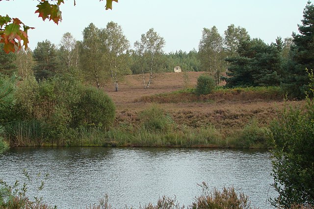
Deutsch: Löschteich zwischen Oldendorf und Eschede mit Gedenkstein im Hintergrund
English: Pond between Oldendorf and Eschede in north Germany with a memorial. The pond was used by fire services to pump water during the fire on the Lüneburg Heath in August 1975 |
| Date | |
| Source | Self-photographed |
| Author | Hajotthu 17:57, 20. Dez. 2007 (CET) |
| Camera location | | View this and other nearby images on: OpenStreetMap |
|---|
Licensing
Hajotthu at the German-language Wikipedia, the copyright holder of this work, hereby publishes it under the following license:

|
Permission is granted to copy, distribute and/or modify this document under the terms of the GNU Free Documentation License, Version 1.2 or any later version published by the Free Software Foundation; with no Invariant Sections, no Front-Cover Texts, and no Back-Cover Texts. A copy of the license is included in the section entitled GNU Free Documentation License. |
| This file is licensed under the Creative Commons Attribution-Share Alike 3.0 Unported license. | ||
| Attribution: Hajotthu | ||
| ||
| This licensing tag was added to this file as part of the GFDL licensing update. |
Original upload log
The original description page was here. All following user names refer to de.wikipedia.
- 2007-12-20 16:57 Hajotthu 2512×1675× (2173148 bytes) {{Information |Beschreibung = Löschteich zwischen Oldendorf und Eschede mit Gedenkstein im Hintergrund |Quelle = selbst fotografiert |Urheber = ~~~~ |Datum = 19. 09. 2007 |Genehmigung = |Andere Versionen = |Anmerkungen = }}
File history
Click on a date/time to view the file as it appeared at that time.
| Date/Time | Thumbnail | Dimensions | User | Comment | |
|---|---|---|---|---|---|
| current | 13:33, 24 December 2009 | | 2,512 × 1,675 (2.07 MB) | wikimediacommons>Bermicourt | {{Information |Description={{de|Löschteich zwischen Oldendorf und Eschede mit Gedenkstein im Hintergrund}} {{en|Pond between Oldendorf and Eschede in north Germany with a memorial. The pond was used by fire services to pump water during the fire on the L |
File usage
The following 36 pages use this file:
- Az:Map Features
- Cs:Map Features
- Da:Map Features
- El:Map Features
- Hu:Map Features
- Pl:Tag:emergency=fire water pond
- Pt:Key:emergency
- Pt:Map Features
- Uk:Emergency (facilities)
- Uk:Об'єкти мапи
- Zh-hant:Map Features
- Wiki:Files used by data items/3
- Template:Az:Map Features:emergency
- Template:Cs:Map Features:emergency
- Template:Da:Map Features:emergency
- Template:El:Map Features:emergency
- Template:FR:Map Features:emergency
- Template:Generic:Map Features:emergency
- Template:Hu:Map Features:emergency
- Template:IT:Map Features:emergency
- Template:JA:Map Features:emergency
- Template:NL:Generic:Map Features:emergency
- Template:NL:Map Features:emergency
- Template:Pl:Generic:Map Features:emergency
- Template:Pt:Map Features:emergency
- Template:RU:Map Features:emergency
- Template:Uk:Map Features:emergency
- Template:Zh-hant:Map Features:emergency
- FR:Éléments cartographiques
- IT:Map Features
- NL:Kaartelementen
- NL:Key:emergency
- RU:Key:emergency
- RU:Объекты карты
- JA:Key:emergency
- JA:Map Features