IT:Tag:natural=grassland
Jump to navigation
Jump to search
| Descrizione |
|---|
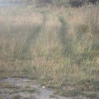
| Aree naturali in cui la vegetazione è dominata da erbe (Poaceae) e altre piante erbacee (non legnose) . |
| Rappresentazione in OSM Carto |

|
| Gruppo: natural |
| Applicabile agli elementi |
| Combinazioni utili |
| Vedi anche |
| Stato: approvato |
| Strumenti |
Questo articolo è una traduzione dall'articolo originale, ma il contenuto sembra essere disallineato con l'articolo di riferimento (solitamente la versione inglese, francese o tedesca). Se possibile aggiorna questa traduzione.
Aree naturali in cui la vegetazione è dominata da erbe (Poaceae) e altre piante erbacee (non legnose) . Esclude le zone coltivate e le zone umide.
Uso
Estensioni usate
- natural=grassland
- grassland=pampas — Prateria Naturale del sud sud America (principalmente Argentina)
- grassland=prairie — Prateria Naturale del centro nord America
- grassland=puszta — Prateria Naturale del centro Europa (principalmente Ungheria)
- grassland=savanna — Prateria Naturale del nord Africa
- grassland=steppe — Prateria Naturale del centro Eurasia
- grassland=veld — Prateria Naturale del sud Africa
Vedi Anche
- Proposed features/Grassland — la proposta originaria e votazione
- Vegetation — discussione generale sul tagging della vegetazione
- natural=scrub — natural vegetation dominated by shrubs (bush)
- natural=heath — natural vegetation dominated by dwarf shrubs
- natural=wetland with wetland=marsh — open wetlands where grasses grow in waterlogged soil (the distinction between grasslands and wetlands can be gradual)
- landuse=meadow — agricultural areas cultivated with grasses (or formerly cultivated and still growing mostly grasses)
- landuse=grass — usually ornamental areas covered with tended and mown grass (lawn)
