Key:stećak_necropolis
 |
| Description |
|---|
| To specify a site as a stećak necropolis - a large historic cemetery with elaborate stećak tombstone monuments. |
| Group: historic |
| Used on these elements |
| Requires |
| Useful combination |
| See also |
| Status: in use |
| Tools for this tag |
There are more than 60 thousand individual ![]() stećak tombstones in
stećak tombstones in ![]() Bosnia and Herzegovina, and another several thousands in border areas of neighboring countries. Stećak
Bosnia and Herzegovina, and another several thousands in border areas of neighboring countries. Stećak ![]() necropolis is a large historic cemetery with elaborate tombstone monuments. The term implies a separate burial site at a distance from a settlement.
necropolis is a large historic cemetery with elaborate tombstone monuments. The term implies a separate burial site at a distance from a settlement.
On initiative of the Commission to Preserve National Monuments of Bosnia and Herzegovina, stećaks are inscribed on the ![]() World Heritage List by
World Heritage List by ![]() UNESCO since 2016. More than 4,000 individual monoliths are selected, and grouped in necropolises at 28 locations, of which 22 in Bosnia and Herzegovina,[1] two in Croatia, three in Montenegro, and three in Serbia.
UNESCO since 2016. More than 4,000 individual monoliths are selected, and grouped in necropolises at 28 locations, of which 22 in Bosnia and Herzegovina,[1] two in Croatia, three in Montenegro, and three in Serbia.
Description
A stećak is a monumental gravestone slab or megalith, cut exclusively in Dinaric Karst limestone in variety of sizes and shapes which, however, followed ordered pattern, erected as a monument (tombstone) on top of the grave and mostly grouped in cemeteries or necropolises, but sometimes as tombstones for individual graves. At present there are more than 60 thousand individual ![]() stećak tombstones in
stećak tombstones in ![]() Bosnia and Herzegovina, and another several thousands in border areas of neighboring countries, mostly in necropolises comprised of few to few hundreds of individual stones. A stećak has been used as early as beginning of the 12th century to as late as mid to late 16th, in some cases early 17th century, for funerals or commemorative purposes.[2][3]
Bosnia and Herzegovina, and another several thousands in border areas of neighboring countries, mostly in necropolises comprised of few to few hundreds of individual stones. A stećak has been used as early as beginning of the 12th century to as late as mid to late 16th, in some cases early 17th century, for funerals or commemorative purposes.[2][3]
Stećaks that will later evolve into transitional variety of stećak-"nišan"s, a variety of stećak used in late medieval Bosnia by first converts to Islam after the Ottoman conquest of the Kingdom of Bosnia, could be mapped as stećak in combination with religious affiliation. Later still, these stećak-nišans will evolve into their final form as Muslim gravestones called nišan(s).[4]
How to map
Draw as an area ![]() along the necropolis outline a node
along the necropolis outline a node ![]() , use required tag
, use required tag historic=stećak and then stećak=stećak_necropolis. If consists of a significant individual stećaks draw those as an area inside necropolis area or set a node(s) ![]() . (
. (stećak=necropolis redirect here).
In addition, the following parameters should be given to describe the details of the object.
historic=stećakstećak:stećak_count="1,2,3,4,5,..."stećak:format="slab;gable;etc"- shapes of individual stećaksinscription=*religion=christianity;muslimdenomination=bosnian_church;orthodox;catholic- If more than one necropolis is in the close proximity use *
stećak:stećak_necropolis=*1, 2, 3, ...etc.
The following optional tags may also be useful on complement:
name=name- the name of the site, e.g. Radimlja
heritage=*- if the site is registered by an official heritage organisation,KONS in case of Bosnia; also UNESCO on selected necropolises.ref:kons=three- or four-digits number- both individual stećaks and stećak necropolises (graveyards/cemeteries) are listed as the National Monuments of Bosnia and Herzegovina byKONS and is be referenced by this numberkons:inscription_date=*- date of inscription by KONSref:whc=number- selected number of stećak necropolises is listed by UNESCO on the World Heritage List of protected monuments.
Tags to use in combination
wikidata=*- an ID of the specific Wikidata itemwikipedia=*- a link to Wikipedia's articlehistoric:civilization=*(or more precise subtags) - the civilization (culture) that originally created the feature, which usually isBosnian Church so suitable subtag is requiredtourism=*(tourism=attraction) - if it is a tourist attraction
See also
site_type=*- to further describe the type of the site - established tag, deprecated by wiki voting- key
historic=archaeological_sitespecifies an archaeological site;- tag
archaeological_site=necropolisspecifies an archaeological site as a necropolis.
- tag
Examples
-
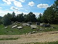
 Radimlja, Stolac
 -
 Grebnice, Radmilovića Dubrava, Baljći, Bileća
 -
 Kalufi in Krekovi, Nevesinje
 -
 Boljuni, Stolac
 -
 Kaursko Groblje, Dejičići

_24.jpg)

.jpg)

Rendering suggestions
 suggested by User:Santasa