Tag:highway=crossing: Difference between revisions
Harry Wood (talk | contribs) ("possible icon" is never a useful section IMO. In this case a diddy raster graphic. just clutters the page) |
Harry Wood (talk | contribs) (sync top description + "how to map", and "similar tags" sections) |
||
| Line 12: | Line 12: | ||
}} |
}} |
||
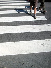
Pedestrians can cross a street here; e.g., zebra crossing |
|||
See {{Tag|crossing}} for usage. |
|||
== How to map == |
|||
To map a pedestrian crossing, place a node {{IconNode}} with the way representing the road, and set this highway=crossing tag on the node (not on the way). It's a good idea to further classify the crossing with the tag... |
|||
{{Tag|crossing}} which more accurately describes specific types of pedestrian crossings. More combination tags are described on the [[Key:crossing]] page. |
|||
{{Tag|footway|crossing}} and {{Tag|cycleway|crossing}} are sometimes used on ways which lead from a sidewalk to the crossing node (The node which has this highway=crossing tag) |
|||
==Similar tags== |
|||
{{Tag|railway|crossing}} used where a highway or footway crosses a railway. |
|||
==Rendering== |
==Rendering== |
||
| Line 23: | Line 35: | ||
==Routing== |
==Routing== |
||
Used by OsmAnd, a routing software, to signal and alert. |
Used by OsmAnd, a routing software, to signal and alert. |
||
==See Also== |
|||
This tag is for the node at the intersection of highways and footways. Footways themselves should use {{Tag|footway|crossing}}. |
|||
Planned to be used in [[Look and Listen Map]] as node and way! |
|||
{{RelatedTermList| {{RelatedTerm|interchange}} {{RelatedTerm|traverse}} {{RelatedTerm|junction}} {{RelatedTerm|intersection}} {{RelatedTerm|passage}} {{RelatedTerm|crossing}} {{RelatedTerm|cross walk}} {{RelatedTerm|crosswalk}} }} |
{{RelatedTermList| {{RelatedTerm|interchange}} {{RelatedTerm|traverse}} {{RelatedTerm|junction}} {{RelatedTerm|intersection}} {{RelatedTerm|passage}} {{RelatedTerm|crossing}} {{RelatedTerm|cross walk}} {{RelatedTerm|crosswalk}} }} |
||
Revision as of 04:09, 4 January 2016
| Description |
|---|
| Pedestrians can cross a street here - e.g. zebra crossing |
| Group: crossings |
| Used on these elements |
| Useful combination |
|
| Status: in use |
| Tools for this tag |
|
Pedestrians can cross a street here; e.g., zebra crossing
How to map
To map a pedestrian crossing, place a node ![]() with the way representing the road, and set this highway=crossing tag on the node (not on the way). It's a good idea to further classify the crossing with the tag...
with the way representing the road, and set this highway=crossing tag on the node (not on the way). It's a good idea to further classify the crossing with the tag...
crossing=* which more accurately describes specific types of pedestrian crossings. More combination tags are described on the Key:crossing page.
footway=crossing and cycleway=crossing are sometimes used on ways which lead from a sidewalk to the crossing node (The node which has this highway=crossing tag)
Similar tags
railway=crossing used where a highway or footway crosses a railway.
Rendering
Shows up in OSM2World and in OSM France.
Currently it is rendered as a yellow dot on OpenCycleMap.
It also is displayed in the JOSM Editor
Routing
Used by OsmAnd, a routing software, to signal and alert.
