State of the Map Asia 2016

State of the Map Asia 2016
State of the Map Asia 2016 is the second State of the Map Asia regional conference for Asia. The venue was the National Institute of Physics, UP Diliman, Quezon City, Metro Manila, Philippines in October 1-2 2016.

By the numbers:
- 2 days of presentations, workshops, and talks (punctuated by snacks and meals)
- 186 participants, from 21 countries (15 Asian states represented)
- Women made up 40 % of the attendees
- 80% of the total were between 15-34 years old, while 17% were between 35-54 years old
- 73% has edited an online map before the conference (OSM, Google Maps, etc.)
- 42% found out about the conference from social media
- 92% joined because of the program content
Code of Conduct
This was the first SotM Asia conference that formalized a Code of Conduct for all participants:
The State of the Map Asia 2016 team is dedicated to providing a harassment-free conference experience for everyone, regardless of gender, gender identity and expression, sexual orientation, disability, physical appearance, body size, race, age, or religion. We do not tolerate harassment of conference participants in any form. Sexual language and imagery is not appropriate for any conference venue, including talks.
Harassment includes verbal comments that reinforce social structures of domination related to gender, gender identity and expression, sexual orientation, disability, physical appearance, body size, race, age, religion; sexual images in public spaces; deliberate intimidation; stalking; following; harassing photography or recording; sustained disruption of talks or other events; inappropriate physical contact; and unwelcome sexual attention. Participants asked to stop any harassing behavior are expected to comply immediately.
Exhibitors or similar actors are also subject to the anti-harassment policy. In particular, exhibitors should not use sexualized images, activities, or other material. Booth staff (including volunteers) should not use sexualized clothing, or otherwise create a sexualized environment.
If a participant engages in harassing behavior, the conference organizers may take any action they deem appropriate, including warning the offender or expulsion from the conference with no refund. If you are being harassed, notice that someone else is being harassed, or have any other concerns that you are unable to satisfactorily resolve amongst the person(s) involved, please contact a member of conference team immediately. Escalation to, and incident reporting by a small subset of conference team leaders will ensure that repeat offenders do not go unnoticed.
The conference team will be happy to help participants contact venue security or local law enforcement, provide escorts, or otherwise assist those experiencing harassment to feel safe for the duration of the conference. We value your attendance.
We expect participants to follow these rules at all conference venues and conference-related social events.
Program
| Day | Time | Auditorium | Function Room |
|---|---|---|---|
| 1-Oct, Sat | 08:00 | Registration | |
| 08:45 | Session opening | ||
| 09:00 | Opening Keynote: Kate Chapman Chairperson, OpenStreetMap Foundation |
||
| 09:30 | State of the Country Talks - Part I Japan by Taichi Furuhashi India by Srividya Bharadwaj Taiwan by Jui-Lin Chen Indonesia by Adityo Dwijananto |
||
| 10:15 | Break | ||
| 10:30 | OSM for capacity building to strengthen disaster resilience Kuo-Yu “Slayer” Chuang, GeoThings |
COMET e-Jeepney and maps Fred Tinga, President, Global Electronic Transport | |
| 11:00 | Meet the supergirls from Marunda who utilize OSM to build their
community resilience map |
Making the map navigable Abhishek Saikia, Mapbox | |
| 11:30 | Development of a disaster-resilient campus land-use plan
of Bicol University using Open Source software |
The necessity and effectiveness of mapping
road incidents in policy-making and building better and safer roads in the Philippines | |
| 12:00 | Break | ||
| 13:00 | Keynote: Nama Budhathoki Executive Director, Kathmandu Living Labs |
||
| 14:00 | Project NOAH and OpenStreetMap: The role of science
and crowd-sourced mapping in DRR |
Mapillary: Street-level photos for richer map editing Edoardo Neerhut, Mapillary AB | |
| 14:00 | Mapping for flood exposure with OpenStreetMap
— the Sri Lanka experience |
Local knowledge is king – Maps.me Eugene Lisovsky, Maps.me | |
| 14:30 | Building a Data Team in the open Maning Sambale, Mapbox |
OSM, ODK and OMK, Oh my! Mapping and surveying in
Habitat for Humanity’s Nepali earthquake response | |
| 15:00 | Group Photo / Break | ||
| 15:15 | Map the Philippines initiative Celina Agaton, MapPH |
Improving map data through customer feedback Nikhil Prabhakar U, Mapbox | |
| 15:45 | Share local knowledge with Lowiki and OSM Pomin Wu, OSM Taiwan |
Run your own Taginfo instance Yogesh K S, OpenStreetMap India | |
| 16:15 | Validating the map Chethan H A, Mapbox |
Significance of Open Source in participatory
vulnerability mapping | |
| 16:45 | State of the Country Talks - Part II Sri Lanka by Srimal Priyantha Samansiri Philippines by Eugene Alvin Villar Nepal by Nama Budhathoki Indonesia by Adityo Dwijananto Bangladesh by Ahasanul Hoque |
||
| 17:30 | Closing, Day 1 | ||
| 18:00 | Commute to Social Event via GET/COMET E-jeepney | ||
| 2-Oct, Sun | 08:45 | It’s time to fly with your drone! Taichi Furuhashi, MAPconcierge |
Mapbox Studio workshop Srividya C, |
| 09:00 | Asia Resilience Forum
Moderator: Jun Amanto, BeGood Cafe | ||
| 10:00 | Act locally, change globally
Jun Amanto, BeGood Cafe | ||
| 10:15 | Break | ||
| 10:30 | Micro-satellites and UAVs: Challenges in
processing and distribution UP Department of Geodetic Engineering |
InaSAFE workshop
Adityo Dwijananto, HOT Indonesia | |
| 11:00 | Remote sensing, satellite, and UAV panel
Moderator: UP Department of Geodetic Engineering |
||
| 12:00 | Break | ||
| 13:00 | Keynote: Taichi Furuhashi
President, MAPconcierge |
||
| 13:30 | Local Chapters congress
Moderator: Maning Sambale, OpenStreetMap Philippines |
Mapillary workshop
Edoardo Neerhut, Mapillary AB | |
| 15:00 | Break | ||
| 15:15 | Lightning Talks
|
Mapathon and OpenStreetMap basics
Project NOAH | |
| 17:00 | Closing keynote: Dr. Mahar Lagmay, PhD
Executive Director, Project NOAH |
||
Collaborators
The conference was made possible with the support of numerous people, and organizations:
- Co-event partner - VISIONS Asia Resilience Forum
- Co-operation partner - BeGood Cafe and the Global Environment Fund (Japan)
- Sponsors - Mapbox, Mapillary
- Supporters - PHL Microsat, Department of Geodetic Engineering (UP Diliman), GET Philippines
- Organizer - OpenStreetMap Philippines led by messieurs Eugene Villar (@seav), Maning Sambale (@maning), and Win Olario (@GOwin)
The State of the Map Asia network's website is: stateofthemap.asia
Gallery
Some of the photos from the event.
-
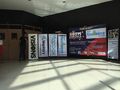 Lobby
Lobby -
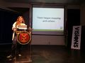 Opening Keynote
 -
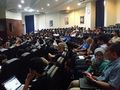 Attendees during plenary
 -
 "Slayer", presenter
 -
 Schadow1 Expeditions on mapping advocacy
 -
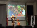
 Philippines - SotM, by Eugene
 -
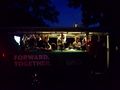 "Forward together" - Socials night commute, via GET E-jeepney
 -
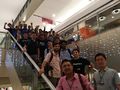 Socials night
 -
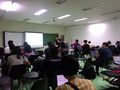 Inasafe Workshop
 -
 Mapillary workshop
 -
 Local chapters
 -
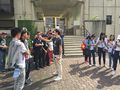
 Posing before the banners
 -
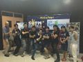
 So Long, and Thanks for All the Fish


