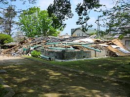
Tag:building=collapsed
Jump to navigation
Jump to search
 |
| Description |
|---|
Using this tag is discouraged, use demolished:building or building=ruins or delete object instead. |
| Rendering in OSM Carto |

|
| Group: buildings |
| Used on these elements |
| Status: deprecated |
| Tools for this tag |
building=collapsed is problematic for multiple reasons.
- Remains of a collapsed building are no longer a building and should be not tagged as
building=*. Delete the object representing no longer existing building or usedemolished:building=*if there is a significant risk that other mappers may mistakenly recreate it. building=*is used to tag the construction type, for examplebuilding=churchis for any building constructed as a church, no matter how it is used currently.building=collapsederases distinction between collapsed church, collapsed warehouse, collapsed barn and so on.
How to map no longer existing buildings?
OSM is not a place for mapping no longer existing things.
But sometimes recording that building is gone may be useful, for example to avoid remapping by armchair mappers using outdated aerial images. Consider retagging such objects as demolished:building=* if there is a significant risk that other mappers may mistakenly recreate it.
Once there is no risk of accidental recreation, such objects should be deleted.
See also
- Lifecycle_prefix to tag objects with a status such as disused, abandoned, demolished, historic, destroyed.
demolished:building=*for buildings which have been removed, with no traces leftruined:building=*for buildings are in ruin, but which are still useful for navigation and visible in the landscapedestroyed:building=*for buildings that were destroyed by an event other than intentional demolition, such as a natural disaster. Remains may still be present. Should be changed to demolished or deleted once removed from the field.
