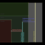
Tag:footway=link
Jump to navigation
Jump to search
| Description |
|---|
| A traversable path connecting other highways to enable routing. |
| Group: highways |
| Used on these elements |
| Requires |
| Implies |
| Useful combination |
|
| See also |
| Status: in use |
| Tools for this tag |
The footway=link tag is used to map a traversable path connecting other highways to enable routing between them.
Examples
| Illustration | Details |
|---|---|

|
Providing a routable path from an abruptly ending footway=sidewalk to an adjacent highway=residential.
|
Connecting a footway=access_aisle to a highway=service or service=parking_aisle.
|
Tags used in combination
surface=*lit=*wheelchair=*