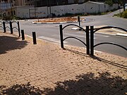
Tag:highway=footway
 |
| Description |
|---|
| A path mainly or exclusively for pedestrians. |
| Rendering in OSM Carto |

|
| Group: highways |
| Used on these elements |
| Implies |
| Useful combination |
|
| Status: de facto |
| Tools for this tag |
|
The tag highway=footway is used for mapping minor pathways which are used mainly or exclusively by pedestrians.
When to use
Footways tend to be constructed and either paved or with smooth surface (compacted, wood or similar). The elderly and small children and wheelchair users can use them with ease. They tend to be in urban settings. access=* is normally designated for pedestrians, which is often specified by street signs (or implied by local law).
- Paths kept mainly by people repeatedly walking on them, or those that are only minimally constructed, are usually tagged as
highway=path. Their surface might be uneven (typicallyground) and one might need to be physically fit and situationally aware to use them. They tend to be located outside of urban enviromnent. Hiking trails are a typical example andsac scale=*,trail_visibility=*,surface=*andaccess=*are useful. However, in some countries such as UK, this distinction does not hold and highway=footway can be used for these too. - For ways used mainly or exclusively by cyclists, use
highway=cycleway. - For ways used mainly or exclusively by horses, use
highway=bridleway. - For ways used mainly or exclusively for motorcycles, use
highway=path+motorcycle=yesormotorcycle=designated. - For ways closed to cars but open to motorcycles, cyclists, horses or other users without clear primary user, use
highway=pathwith appropriateaccess=*tags. - For wider pedestrianised streets, typically lined with shops or commercial buildings, use the
highway=pedestrian. - For ways designated for pedestrians, but which also allows bicycles, use either
highway=footwayandbicycle=yesorhighway=path,foot=designatedandbicycle=yes. - For roads for cars used to access land for mostly agricultural or forestry purposes, use
highway=track. - For sidewalks that span a road, see sidewalks.
How to map
Linear ways
To map a footway nothing else than a simple way is required. Add the highway=footway tag to it and add a name=* if appropriate.
Add access=* restriction tags if appropriate. See default access restrictions.
If the footway is associated with a road, then add the footway=sidewalk tag.
The way footway=* or highway=footway should join with another kind of way for routing purposes. For motivation, see Beginners Guide step 5, or Editing Standards and Conventions.
| Example photos | Example tracking | Referring tag | Comment |
|---|---|---|---|
 |
 |
Sidewalk referenced by the letter S on the image in the “Example tracking” column. + |
In case of footway not immediately adjacent to a highway=* and that is wide enough, for example in a park, consider highway=pedestrian.
|
 |
 |
Sidewalk referenced by the letter S on the image in the “Example tracking” column. + |
Reference B letter
|
 |
 |
Referenced by the letters S – C – C1 – C2 on the image in the “Example tracking” column. + |
Areas
There is no clear consensus on this topic – see the talk page for more information.
There are two main approaches to mapping the area of a highway=footway, and which to use is dependent upon the context of the area you're mapping. If you are mapping the area of a footway simply to describe the area it covers (e.g., rather than using width=*, perhaps because the width is variable) then it is recommended to use the area:highway=footway tag.
If, however, you are mapping the area of a footway because this provides non-linear routing —for example, large sidewalk areas— then you can map the area as highway=footway and area=yes. This tagging scheme is similar to the well-established highway=pedestrian + area=yes tagging scheme used when mapping pedestrian areas such as plazas and squares. While often there is a clear distinction between highway=footway and highway=pedestrian, it also might be region-specific or just unclear.
When mapping a highway area, the area should be connected via a node to at least one way. Some mappers chose to continue the way through the area, to enable routers to pick the most straightforward route through the area, but this way should still share nodes with the area (e.g., in the places where it enters and exists the area).
Tags used in combination
footway=*– type of a footway, e.g.:surface=*lit=*access=*tags, e.g.:bicycle=*
name=*– if it has a nameinformal=yes– additive tag to indicate a informal/unofficial footway
See also
- Path controversy gives explanation how this is different from / similar to
highway=path - UK public rights of way
- Guidelines for pedestrian navigation
- Proposal:One-way_for_pedestrians
highway=corridor– hallway inside a building
| ||||||||||||||||||||||||||||||